| Main | Births etc |
|---|
| Štúrovo Hungarian: Párkány German: Gockern Turkish: Ciğerdelen |
|||
|---|---|---|---|
| — Town — | |||
 |
|||
|
|||
 |
|||

Štúrovo |
|||

Štúrovo |
|||
| Coordinates: | |||
| Country | |||
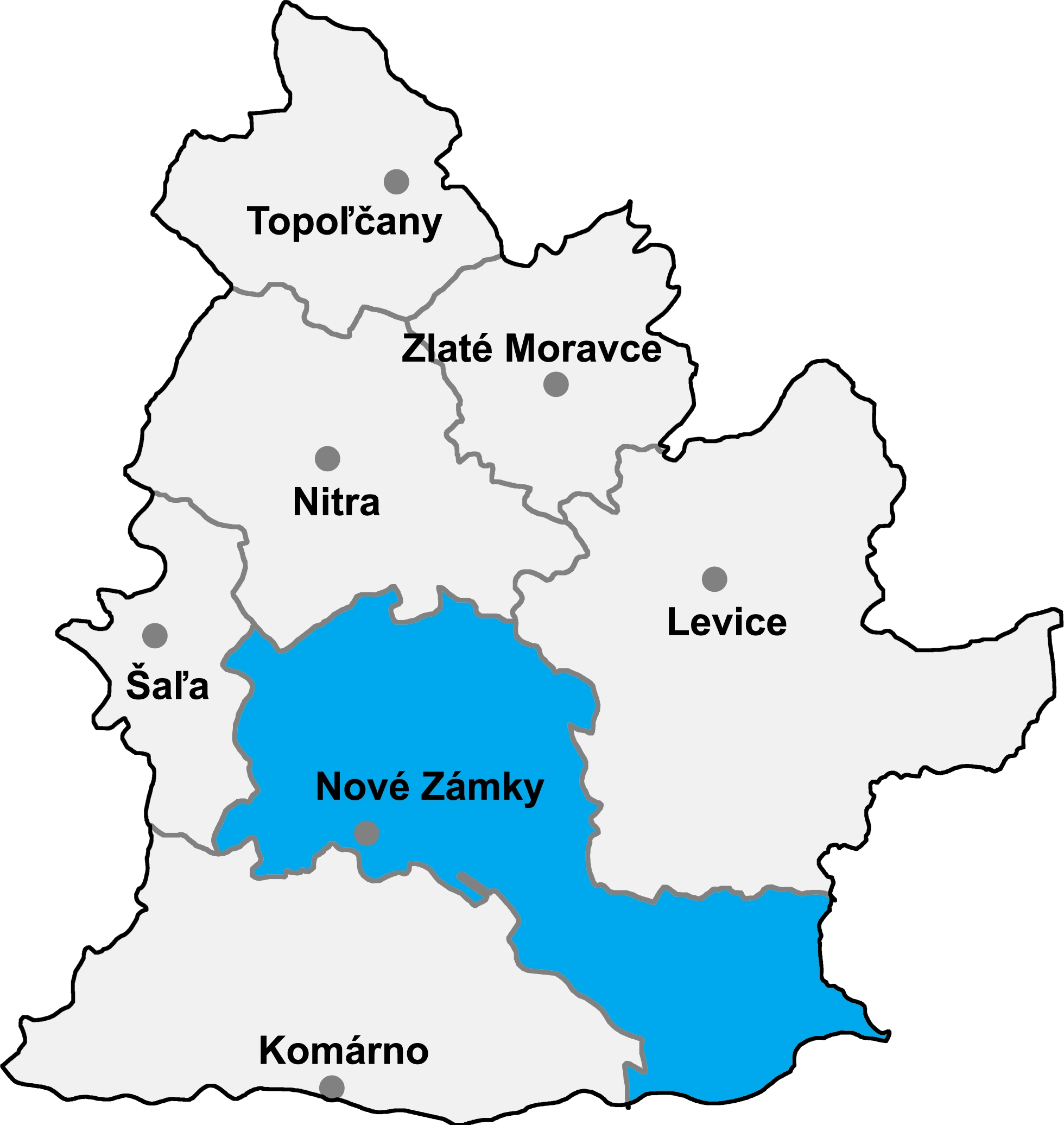
| Region | Nitra | ||
| District | Nové Zámky | ||
| First mentioned | 1075 | ||
| Government | |||
| • Eugen Szabó | |||
| Area | |||
| • Total | 13.44 km2 (5.19 sq mi) | ||
| Elevation | 111 m (364 ft) | ||
| Population (31-12-2014) | |||
| • Total | 10 568 | ||
| • Density | 786.31/km2 (2,036.5/sq mi) | ||
| Time zone | CET (UTC+1) | ||
| • Summer (DST) | CEST (UTC+2) | ||
| Postal code | 943 01 | ||
| Area code(s) | 421-36 | ||
| Car plate | NZ | ||
| Website | [www.sturovo.sk www.sturovo.sk] | ||

Štúrovo (Hungarian: Párkány, German: Gockern, Turkish: Ciğerdelen) is a town in Nové Zámky District, Nitra Region, Slovakia, situated on the River Danube. Its population in 2005 was 11,172.
The town is situated opposite the Hungarian city of Esztergom. The Mária Valéria bridge connects the settlements. The bridge was destroyed in 1944 during World War II, but reconstructed in 2001.
Name[]
Before the 1920 Treaty of Trianon the town was a part of the Kingdom of Hungary and it was named Párkány. Later, until 1948, the town was known as Parkan in Slovak. It was given its current name after World War II and is named after the 19th century Slovak national leader, Ľudovít Štúr. Despite the Beneš decrees and other anti-Hungarian programs, the town remains majority Hungarian and there was an attempt to return the old name in a 1991 referendum; however, the government refused to rename the town.[1]
History[]
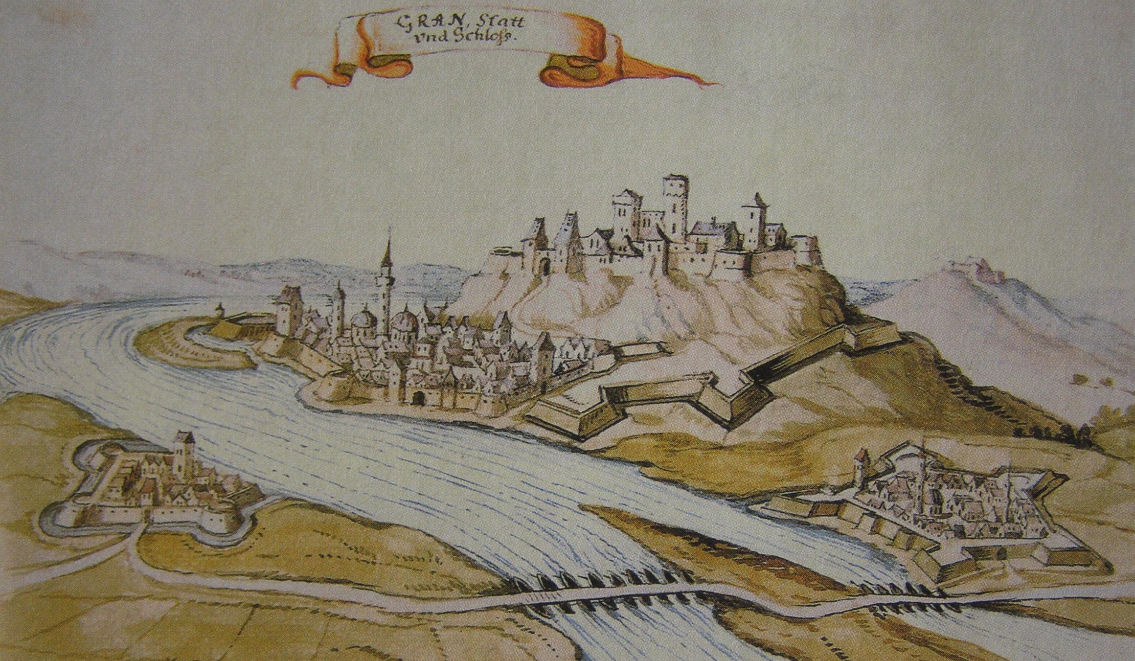

Párkány and Esztergom in 1664
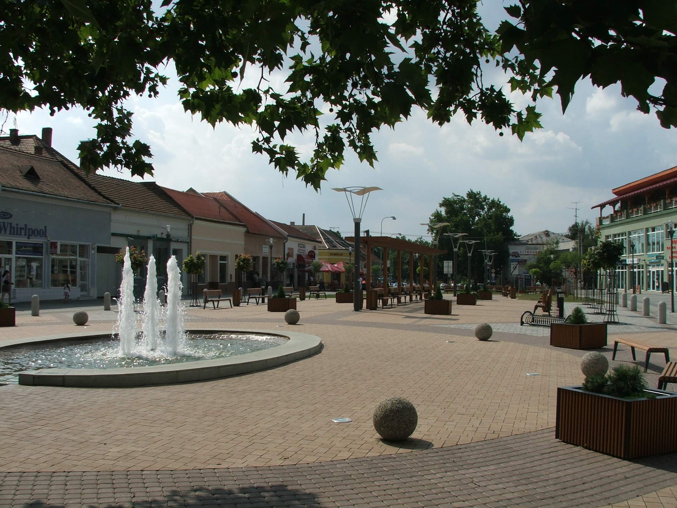

Pedestrian zone in Štúrovo
The town was inhabited in the prehistoric ages, thanks to its favourable location. At one time, it was an important river crossing, and part of the Limes Romanus system named as Avanum during Roman rule. The first written record of the town is from 1075 under the name Kakath. In the 16th century, after the Turks conquered Buda in 1541, the town, along with Esztergom, came under the Ottoman rule. Many attempts to retake the town from the Turks followed, but they were unsuccessful except 1595–1605 period, until 1683, when the Turks lost a battle near Párkány which became referred to as Ciğerdelen ("Liver driller" in Turkish) during the Ottoman rule.
During the reign of Maria Theresa, the town regained its rights and became a district town.
In 1850, Párkány became a station on the railway track from as Pressburg / Pozsony (now: Bratislava) to Budapest. In 1895, the Mária Valéria bridge to Esztergom was opened.
After World War I, the town became a border town of Czechoslovakia. In 1938, as a result of the First Vienna Award, Párkány and parts of Southern Slovakia were returned to Hungary. It was occupied in the years 1944/1945 by Soviet troops. The Mária Valéria bridge was destroyed for a second time (first time in 1920) by retreating German forces.
After World War II, the town was again ceded Czechoslovakia. It was renamed to Štúrovo in 1948. The formerly independent villages of Nána and Obid were annexed to Štúrovo (in 1960 and 1972, respectively). Štúrovo ceased to be a district in 1960 and merged into Nové Zámky District.
After WWII it began to industrialize. The biggest factory called Juhoslovenské celulózky a papierne (South Slovakian pulpwood and paper works) was opened in 1968, employing some 4,000 people. A new thermal swimming resort Vadaš was built in 1978. The local railway station became the second biggest in Slovakia (1975).[1]
After the Velvet Revolution, Nána (1990) and Obid (1998) became separate villages again and the Mária Valéria bridge was opened for the third time in 2001, boosting the local economy.
Border crossing[]


Pre-EU passport stamp from Štúrovo.


Pre-Schengen passport stamp from Štúrovo.
Until 21 December 2007 when both Slovakia and Hungary became part of the Schengen Area, Štúrovo was a major border crossing between Slovakia and Hungary, with Esztergom located on the Hungarian side of the River Danube. The two cities are linked by the Mária Valéria bridge. The road bridge is some 500 metres in length and is named after Archduchess Marie Valerie of Austria, (1868–1924), the fourth child of Emperor Franz Josef, and Elisabeth.
The bridge was originally opened on 28 September 1895 but was destroyed twice. On 22 July 1919 the bridge was destroyed by a detonation at its first pier on its western side but the bridge was renovated in 1922 and completely reconstructed in 1926. During World War II, retreating German troops blew up the bridge on 26 December 1944 along with other bridges near Esztergom.
Decades of intransigence between the Communist governments of Hungary and Czechoslovakia meant that the bridge was not rebuilt until the new millennium, finally reopening on 11 October 2001. Half the costs of the project were covered by a 10 million Euro grant from the European Union, as part of the EU PHARE project to assist applicant countries in their preparations to join the EU.
Štúrovo was also a major railway border crossing between Slovakia and Hungary as it is on the main Bratislava-Budapest railway line. The main station across the border in Hungary is Szob which is located to the east on the same side of the River Danube.
Demographics[]


Bilingual (Slovak/Hungarian) street sign (Saint Stephen street)
According to the 2001 census, there were 11,708 people living in the town with 68.7% of the inhabitants being ethnic Hungarian, as opposed to 28.1% ethnic Slovak. The religious make-up was as follows: Roman Catholic 77.18%, without denomination or not specified 16.45%, Evangelic 1.36%.

Partner towns[]
 Esztergom, Hungary
- Bruntál, Czech Republic
- Castellarano, Italy
- Baraolt, Romania
- Novi Bečej, Serbia
- Kłobuck, Poland
References[]
- ^ a b http://www.sturovo.sk/main.php?id_menu=17329&id_menu_obsah_m34873=10106&firmy_slovenska_flag=0&caption1=0 Štúrovo - History (contains a link to .doc file, in Slovak)
External links[]
- Official website (Slovak), (Hungarian), (English)
- Thermal swimming resort Vadaš
- Virtual Tour of Štúrovo
| |||||||