| ||||||||||||||
| Ahmedabad District | |
|---|---|
| — District — | |
 |
|
| Government | |
| • District Collector | Vijay Nehra |
| Population (2011) | |
| • Total | 7,208,200 |
Ahmedabad District comprises the city of Ahmedabad, the 7th largest city of India located in the central part of the state of Gujarat in western India. It is the eighth most populous district in India (out of 640).[1]
Geography[]
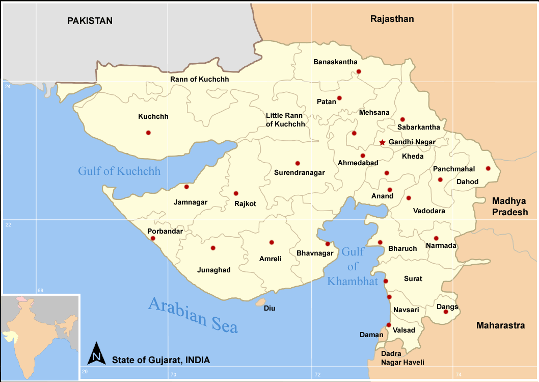
Ahmedabad District is surrounded by Mehsana, Sabarkantha, and Gandhinagar districts to the north, Kheda district to the east, the Gulf of Cambay and Bhavnagar district to the south, and Surendranagar district to the west. Its headquarters is the city of Ahmedabad.
Climate[]
| Climate data for Ahmedabad | |||||||||||||
|---|---|---|---|---|---|---|---|---|---|---|---|---|---|
| Month | Jan | Feb | Mar | Apr | May | Jun | Jul | Aug | Sep | Oct | Nov | Dec | Year |
| Record high °C (°F) | 33 (91) |
38 (100) |
41 (106) |
42.8 (109.0) |
43 (109) |
43.4 (110.1) |
39 (102) |
39 (102) |
42 (108) |
40 (104) |
38 (100) |
32 (90) |
43.4 (110.1) |
| Average high °C (°F) | 28.3 (82.9) |
30.4 (86.7) |
35.6 (96.1) |
39.8 (103.6) |
41.5 (106.7) |
38.4 (101.1) |
33.4 (92.1) |
31.8 (89.2) |
34.0 (93.2) |
35.8 (96.4) |
32.8 (91.0) |
29.3 (84.7) |
34.26 (93.66) |
| Average low °C (°F) | 11.8 (53.2) |
13.9 (57.0) |
18.9 (66.0) |
23.7 (74.7) |
26.2 (79.2) |
27.2 (81.0) |
25.6 (78.1) |
24.6 (76.3) |
24.2 (75.6) |
21.1 (70.0) |
16.6 (61.9) |
13.2 (55.8) |
20.58 (69.05) |
| Record low °C (°F) | 7 (45) |
6 (43) |
10 (50) |
18 (64) |
18 (64) |
22 (72) |
22 (72) |
21 (70) |
20 (68) |
13 (55) |
10 (50) |
5 (41) |
5 (41) |
| Rainfall mm (inches) | 2.0 (0.079) |
1.0 (0.039) |
0 (0) |
3.0 (0.118) |
20.0 (0.787) |
103.0 (4.055) |
247.0 (9.724) |
288.0 (11.339) |
83.0 (3.268) |
23.0 (0.906) |
14.0 (0.551) |
5.0 (0.197) |
789 (31.06) |
| Avg. rainy days (≥ 0.1 mm) | 0.3 | 0.3 | 0.1 | 0.3 | 0.9 | 4.8 | 13.6 | 15.0 | 5.8 | 1.1 | 1.1 | 0.3 | 43.6 |
| Mean monthly sunshine hours | 288.3 | 274.4 | 279.0 | 297.0 | 328.6 | 237.0 | 130.2 | 111.6 | 222.0 | 291.4 | 273.0 | 288.3 | 3,020.8 |
| Source: HKO | |||||||||||||
Divisions[]
Ahmedabad District is divided into a number of taluka including Barwala, Daskroi, Dholka, Dhandhuka, Detroj, Sanand, Bavla, Ranpur, Mandal and Viramgam.
Some of the regions of the city includes:
- Dariyapur - Old City
- Shahpur - Old City
- Khanpur - Old City
- Kalupur - Old City
- Jamalpur - Old City
- Shah-e-Alam - Old City
- Mirzapur - Old City
- Bapunagar
- Shahibaug
- Bodakdev
- Maninagar
- Vastrapur
- Nava Vadaj
- Ellis Bridge
- Navrangpura
- Naranpura
- Naroda
- Paldi
- Bopal
Demographics[]
According to the 2011 census Ahmedabad district has a population of 7,208,200,[1] roughly equal to Hong Kong[2] or the US state of Washington.[3] This gives it a ranking of 8th in India (out of a total of 640).[1] The district has a population density of 890 inhabitants per square kilometre (2,300 /sq mi) .[1] Its population growth rate over the decade 2001-2011 was 22.31 %.[1] Ahmedabad has a sex ratio of 903 females for every 1000 males,[1] and a literacy rate of 86.65 %.[1]
It had a population of 5,816,519 of which 80.18% were urban as of 2001.[4]
The language people speak in Ahmedabad is Gujarati which is the mother-tongue of the State of Gujarat, in addition to Hindi which is also quite popular among the people.
Culture[]
Notable personalities[]
Acharya Hemachandra (1089–1172) Jain polymath. Born in Dhandhuka.[5]
References[]
- ^ a b c d e f g "District Census 2011". Census2011.co.in. 2011. http://www.census2011.co.in/district.php. Retrieved 2011-09-30.
- ^ US Directorate of Intelligence. "Country Comparison:Population". https://www.cia.gov/library/publications/the-world-factbook/rankorder/2119rank.html. Retrieved 2011-10-01. "Hong Kong 7,122,508 July 2011 est."
- ^ "2010 Resident Population Data". U. S. Census Bureau. http://2010.census.gov/2010census/data/apportionment-pop-text.php. Retrieved 2011-09-30. "Washington 6,724,540"
- ^ [1]
- ^ "Hemacandra". Jain World. http://www.jainworld.com/literature/story28.htm. Retrieved 2008-05-06.
External links[]

|
Surendranagar district | Mahesana district | Gandhinagar district |
|
| Surendranagar district | Kheda district Anand district | |||
 Ahmedabad district | ||||
| Bhavnagar district | Bhavnagar district Gulf of Khambhat |
Gulf of Khambhat |
| ||||||||||||||||||||||||||||||
| This article about a location in Ahmedabad district, Gujarat, India is a stub. You can help by expanding it. |
| This page uses content from the English language Wikipedia. The original content was at Ahmedabad district. The list of authors can be seen in the page history. As with this Familypedia wiki, the content of Wikipedia is available under the Creative Commons License. |