| Amberg-Sulzbach District | |||
|---|---|---|---|
| — District — | |||
|
|||
 |
|||
| Country | |||
| State | Bavaria | ||
| Adm. region | Oberpfalz | ||
| Capital | Amberg | ||
| Area | |||
| • Total | 1,255 km2 (485 sq mi) | ||
| Population (31 December 2010)[1] | |||
| • Total | 105,180 | ||
| • Density | 84/km2 (220/sq mi) | ||
| Time zone | CET (UTC+1) | ||
| • Summer (DST) | CEST (UTC+2) | ||
| Vehicle registration | AS | ||
| Website | amberg-sulzbach.de | ||
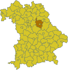
Amberg-Sulzbach District is a district in Bavaria, Germany. It surrounds but does not include the city of Amberg. It is bounded by (from the north and clockwise) the districts of Neustadt an der Waldnaab , Schwandorf, Neumarkt in der Oberpfalz, Nürnberger Land and Bayreuth.
History[]
The history is linked with the history of the Upper Palatinate and the city of Amberg.
The district was established in 1972 by merging the former district of Amberg and the district-free city of Sulzbach-Rosenberg (the latter one lost its status as a district-free city in this administrative reform).
Geography[]
The district is located in the geographical centre of Bavaria, 40 km east of Nuremberg. The main axis of the region is the Vils River (an affluent of the Naab) crossing the district from north to south. West of the river the land rises to the Franconian Jura, while there are gentle hills on the eastern side in the angle between Naab and Vils. The district is mainly covered by forests, especially in its western half.
Coat of arms[]

|
The coat of arms displays:
|
Towns and municipalities[]
| Towns | Municipalities | |
|---|---|---|
|
|
|
References[]
- ^ "Fortschreibung des Bevölkerungsstandes" (in German). Bayerisches Landesamt für Statistik und Datenverarbeitung. 31 December 2010. https://www.statistikdaten.bayern.de/genesis/online?language=de&sequenz=tabelleErgebnis&selectionname=12411-009r&sachmerkmal=QUASTI&sachschluessel=SQUART04&startjahr=2010&endjahr=2010.
External links[]
- Official website (German)
- Tourist information (German, French; English and Czech versions in process)
| This page uses content from the English language Wikipedia. The original content was at Amberg-Sulzbach District. The list of authors can be seen in the page history. As with this Familypedia wiki, the content of Wikipedia is available under the Creative Commons License. |