| Main | Births etc |
|---|
| Amherst, New Hampshire | |||
|---|---|---|---|
| — Town — | |||
|
|||
 |
|||
| Coordinates: Coordinates: | |||
| Country | United States | ||
| State | New Hampshire | ||
| County | Hillsborough | ||
| Incorporated | 1760 | ||
| Government | |||
| • Board of Selectmen | Bruce Bowler, Chair Thomas Grella Brad Galinson Dwight Brew George Infanti |
||
| Area | |||
| • Total | 34.8 sq mi (90.2 km2) | ||
| • Land | 34.3 sq mi (88.8 km2) | ||
| • Water | 0.5 sq mi (1.3 km2) 1.49% | ||
| Elevation | 259 ft (79 m) | ||
| Population (2010) | |||
| • Total | 11,201 | ||
| • Density | 320/sq mi (120/km2) | ||
| Time zone | Eastern (UTC-5) | ||
| • Summer (DST) | Eastern (UTC-4) | ||
| ZIP code | 03031 | ||
| Area code(s) | 603 | ||
| FIPS code | 33-01300 | ||
| GNIS feature ID | 0873531 | ||
| Website | www.amherstnh.gov | ||
Amherst is a town in Hillsborough County, New Hampshire, United States. The population was 11,201 at the 2010 census.[1] Amherst is home to Ponemah Bog Wildlife Sanctuary, Hodgman State Forest, the Joe English Reservation and Baboosic Lake.
The town center village, where 613 people resided at the 2010 census,[1] is defined as the Amherst census-designated place. The village is also listed on the National Register of Historic Places as Amherst Village Historic District.
History[]

Amherst Town Common in 2006
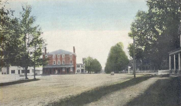
Post Office Square in 1910
Like many New England towns, Amherst was the result of a land grant given to soldiers - in this case, to soldiers in 1728 who had participated in King Philip's War. Settled about 1733, it was first called "Narragansett Number 3," and then later "Souhegan Number 3." In 1741, settlers formed the Congregational church and hired the first minister. Chartered in 1760 by Colonial Governor Benning Wentworth, the town was named for General Lord Amherst, who commanded British forces in North America during the French and Indian War. Lord Jeffrey Amherst is also infamous for initiating the practice of giving smallpox blankets to Native Americans in a genocidal effort "to Extirpate this Execrable Race" (as quoted from his letter to Colonel Henry Bouquet on July 16, 1763).
In 1770, Amherst became the county seat of Hillsborough County, due largely to its location on the county's major east-west road. It continued to prosper through the Revolutionary War and afterwards. In 1790, the southwestern section broke off and became the town of Milford, and in 1803, the northwest section departed to become Mont Vernon. The development of water-powered mills allowed Milford to grow at Amherst's expense, and the county seat was moved to Milford in 1866.
The town population remained relatively stagnant until after World War II, when Amherst and many surrounding towns saw an influx of newcomers as they became part of the greater Boston, Massachusetts region.
Franklin Pierce, who later become the 14th President of United States of America, studied under Judge Edmund Parker in Amherst. He also wed Jane Means Appleton, the daughter of a former president of Bowdoin College, in a house on the town green.
Geography[]
According to the United States Census Bureau, the town has a total area of 34.8 square miles (90 km2), of which 34.3 square miles (89 km2) is land and 0.5 square miles (1.3 km2) is water, comprising 1.49% of the town. Located on the Souhegan River, Amherst is drained by Beaver, Bloody, and Joe English brooks. Amherst's highest point is on Chestnut Hill at the town's northern border, where the elevation reaches 865 feet (264 m) above sea level. Amherst lies fully within the Merrimack River watershed.[2]
Amherst is bordered by Mont Vernon and New Boston to the northwest, Bedford to the northeast, Merrimack to the east, Hollis to the south, and Milford to the southwest.
Demographics[]
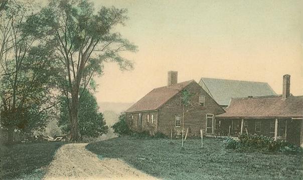

Greeley birthplace c. 1905
As of the census[3] of 2000, there were 10,769 people, 3,590 households, and 3,065 families residing in the town. The population density was 314.1 people per square mile (121.3/km²). There were 3,752 housing units at an average density of 109.4 per square mile (42.2/km²). The racial makeup of the town was 97.00% White, 0.43% African American, 0.13% Native American, 1.34% Asian, 0.02% Pacific Islander, 0.21% from other races, and 0.87% from two or more races. Hispanic or Latino of any race were 1.01% of the population.
There were 3,590 households out of which 47.5% had children under the age of 18 living with them, 78.3% were married couples living together, 4.6% had a female householder with no husband present, and 14.6% were non-families. 11.4% of all households were made up of individuals and 4.0% had someone living alone who was 65 years of age or older. The average household size was 3.00 and the average family size was 3.26.
In the town the population was spread out with 31.7% under the age of 18, 4.5% from 18 to 24, 27.5% from 25 to 44, 29.0% from 45 to 64, and 7.3% who were 65 years of age or older. The median age was 39 years. For every 100 females there were 101.3 males. For every 100 females age 18 and over, there were 98.4 males.
The median income for a household in the town was $89,384, and the median income for a family was $97,913. Males had a median income of $73,432 versus $35,250 for females. The per capita income for the town was $35,531. About 1.0% of families and 1.9% of the population were below the poverty line, including 1.8% of those under age 18 and 2.6% of those age 65 or over.
Public education[]
Amherst is home to Clark and Wilkins elementary schools, Amherst Middle School and Souhegan High School. The elementary schools handle children from Amherst only. Children from neighboring Mont Vernon, New Hampshire attend the middle school, but on a tuition basis, while Amherst and Mont Vernon jointly own Souhegan High School, which serves both towns.[4]
Notable people[]
- Charles G. Atherton (1804–1853), US congressman and senator
- Charles Humphrey Atherton (1773–1853), US congressman
- John S. Barry (1802–1870), fourth and eighth Governor of Michigan
- Clifton Clagett (1762–1829), US congressman
- Jonathan Fisk (1778–1832), US congressman from New York
- Horace Greeley (1811–1872), editor, founder of the Liberal Republican Party
- Jon "maddog" Hall (1950–present), programmer, computer scientist, free software advocate
- Neal Huntington (1969-present), General Manager of the Pittsburgh Pirates (2007-present)
- Moses Nichols (1740–1790), physician, revolution era soldier and statesman
- Jane Means (Appleton) Pierce (1806–1863), first lady; wife of Franklin Pierce
- Frank Selee (1859–1909), manager for the Boston Beaneaters and Chicago Orphans
Trivia[]
- The town song of Amherst, Amherst is my Home, was composed by James Durst on a grant from the NH State Council on the Arts/NEA.[5]
Sites of interest[]
- Chapel Museum (1858)
- Wigwam Museum (1839)
- Peabody Mill Environmental Center
References[]
- ^ a b United States Census Bureau, American FactFinder, 2010 Census figures. Retrieved March 23, 2011.
- ^ Foster, Debra H.; Batorfalvy, Tatianna N.; and Medalie, Laura (1995). Water Use in New Hampshire: An Activities Guide for Teachers. U.S. Department of the Interior and U.S. Geological Survey. http://nh.water.usgs.gov/Publications/nh.intro.html.
- ^ "American FactFinder". United States Census Bureau. http://factfinder.census.gov. Retrieved 2008-01-31.
- ^ SAU 39 school district
- ^ [1]
External links[]
- Town of Amherst official website
- Amherst Historical Society
- Amherst Town Library
- SAU 39, school district
- New Hampshire Economic and Labor Market Information Bureau Profile
- Peabody Mill Environmental Center
| |||||||||||||||||

| This page uses content from the English language Wikipedia. The original content was at Amherst, New Hampshire. The list of authors can be seen in the page history. As with this Familypedia wiki, the content of Wikipedia is available under the Creative Commons License. |