| ||||||||||||||

Districts of Punjab along with their headquarters
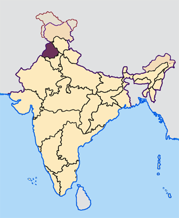
Amritsar district (Doabi:ਅੰਮ੍ਰਿਤਸਰ ਜ਼ਿਲਾ) is one of 22 districts in the state of Punjab in West India. It has a population of 3,074,207 (2001 Indian census) and covers an area of 5075 km². The city of Amritsar is headquarters of this district.
As of 2011 it is the second most populous district of Punjab (out of 22), after Ludhiana.[1]
History[]
During British Rule Amritsar was part of Lahore Division and was administratively subdivided into 3 tehsils namely - Amritsar, and Ajnala. Tarn Taran has itself formed into a district headquarters.[2] However as part of the partition of India in 1947 Amritsar district was separated from the rest of the division and awarded to India. During the partition period, the Muslim population of the district, Some 30%, left for Pakistan while Hindus and Sikhs from West Punjab in newly created Pakistan migrated in the opposite direction.
The Sikhs Were a Majority in the Amritsar District About 60% Before the Partition of 1947. present day the make up about 90%, and the Hindus being 10%.
The Majha Region is the Birthplace of the Sikh religion, and the Birthplace of the Sikh Misls (Sikh Confederacy).
Demographics[]
According to the 2011 census Amritsar district has a population of 2,490,891,[1] roughly equal to the nation of Kuwait[3] or the US state of Nevada.[4] This gives it a ranking of 175th in India (out of a total of 640).[1] The district has a population density of 932 inhabitants per square kilometre (2,410 /sq mi) .[1] Its population growth rate over the decade 2001-2011 was 15.48 %.[1] Amritsar has a sex ratio of 884 females for every 1000 males,[1] and a literacy rate of 77.2 %.[1]
District administration[]
| Climate chart for Amritsar | |||||||||||
|---|---|---|---|---|---|---|---|---|---|---|---|
| J | F | M | A | M | J | J | A | S | O | N | D |
28.0
13.3
0.9
|
21.7
20.2
2.5
|
29.0
25.4
9.3
|
12.2
32.0
10.6
|
14.4
40.7
16.1
|
57.6
42.1
22.1
|
186.2
45.4
25.7
|
184.1
35.3
25.3
|
102.2
34.5
22.0
|
24.8
32.4
14.3
|
6.2
20.9
6.0
|
14.8
15.3
1.6
|
| temperatures in °C • precipitation totals in mm source: IMD | |||||||||||
- The Deputy Commissioner, an officer belonging to the Indian Administrative Service is in charge of general administration of the district. He is generally a middle-level IAS officer of Punjab Cadre. As the District Magistrate, he also effectively the head of the police force.
- Administration of departments such as public works, health, education, agriculture, animal husbandry, etc. is headed by district officers who belong to various Punjab state services.
- The Senior Superintendent of Police, an officer belonging to the Indian Police Service is responsible for maintaining law and order in the district. He is assisted by officers of the Punjab Police Service and other Punjab Police officials.
- The Divisional Forest Officer, an officer belonging to the Indian Forest Service is responsible for the management of forests and wildlife in the district. He is assisted by officers of the Punjab Forest Service, other Punjab Forest officials and Punjab Wildlife officials.
- A Municipal corporation is responsible for the management of public works and health systems in the city of Amritsar. The municipal corporation is a democratic body of councilors and is presided over by the Mayor, who is elected by the councilors. At present, there are more than 70 councilors.
- The state government's department of Town and Country Planning has a district level office of District Town Planning. Since the formation of this office, the city has not received a comprehensive development plan. Amritsar has been selected by the government of India recently to receive Rs. 1000 Crore in development assistance over the next few years.
Amritsar District Borders the Pakistani Punjab Districts of Lahore, Kasur, Shiekhupura along the Ravi River Firozpur District to the South along Sutlej River, Kapurthala District along the Beas River and Gurdaspur District to the North.
References[]
- ^ a b c d e f g "District Census 2011". Census2011.co.in. 2011. http://www.census2011.co.in/district.php. Retrieved 2011-09-30.
- ^ Amritsar District - Imperial Gazetteer of India, v. 5, p. 319.
- ^ US Directorate of Intelligence. "Country Comparison:Population". https://www.cia.gov/library/publications/the-world-factbook/rankorder/2119rank.html. Retrieved 2011-10-01. "Kuwait 2,595,62"
- ^ "2010 Resident Population Data". U. S. Census Bureau. http://2010.census.gov/2010census/data/apportionment-pop-text.php. Retrieved 2011-09-30. "Nevada 2,700,551"
External links[]

|
Gurdaspur district |
| ||
| Pakistan | ||||
 Amritsar district | ||||
| Taran Taran district | Kapurthala district |
Template:Amritsar district
| ||||||||||||||||||||
| This page uses content from the English language Wikipedia. The original content was at Amritsar district. The list of authors can be seen in the page history. As with this Familypedia wiki, the content of Wikipedia is available under the Creative Commons License. |