| Main | Births etc |
|---|
| Bátka Former name, until 1927: Batka |
|||
|---|---|---|---|
| — Village — | |||
 |
|||
|
|||
 |
|||

Bátka |
|||

Bátka |
|||
| Coordinates: | |||
| Country | |||
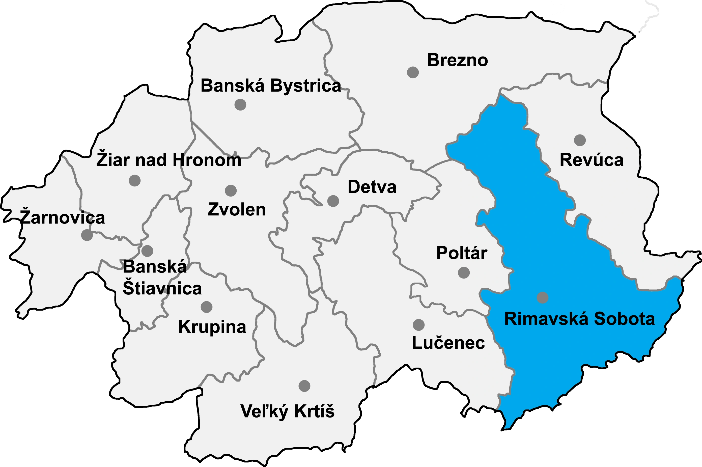
| Region | Banská Bystrica | ||
| District | Rimavská Sobota | ||
| Established | 1906 | ||
| Government | |||
| • Mayor | Peter Hencz (MOST-HÍD) | ||
| Area | |||
| • Total | 12.02 km2 (4.64 sq mi) | ||
| Elevation | 182 m (597 ft) | ||
| Population (31 Dec. 2014) | |||
| • Total | 910 | ||
| • Density | 75.71/km2 (196.1/sq mi) | ||
| Time zone | CET (UTC+1) | ||
| • Summer (DST) | CEST (UTC+2) | ||
| Postal code | 982 51 | ||
| Area code | 421-47 | ||
| Vehicle registration | RS | ||
| Website | http://obecbatka.webnode.sk/ | ||
Bátka (Former name, until 1927: Batka) is a village and commune in Rimavská Sobota District, Banská Bystrica Region, southern Slovakia.
History[]
The village was created in 1906, by merging the former settlements of Dolná Bátka (Alsóbátka) and Horná Bátka (Felsöbátka). The two villages formed one common village (Batka) before the mid-14th century, as well.
In historical records, Dolná Bátka was first mentioned in 1294 (Bathka). It belonged to the Kállay noble family in the 15th and 16th century. Horná Bátka arose in 1294 (as a part of Dolná Batka) as a royal donation to the knight Tumpold Krispin. In 1411 it passed to local landowners Bátky.From 1938 to 1944 it belonged to Hungary.
Genealogical resources[]
The records for genealogical research are available at the state archive "Statny Archiv in Banska Bystrica,Slovakia"
- Roman Catholic church records (births/marriages/deaths): 1789-1896 (parish B)
- Lutheran church records (births/marriages/deaths):1685-1897 (parish B)
- Reformated church records (births/marriages/deaths): 1786-1895 (parish A)
See also[]
External links[]
- http://www.statistics.sk/mosmis/eng/run.html
- http://www.batka.ou.sk/
- http://www.batka.gemer.org/
- http://www.e-obce.sk/obec/batka/batka.html
- Surnames of living people in Batka
| |||||||