| ||||||||||||||
| Bartow County, Georgia | |
 The Bartow County Courthouse built in 1902
| |
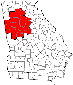
 Location in the state of Georgia (U.S. state) | |
 Georgia's location in the U.S. | |
| Founded | December 3, 1832 |
|---|---|
| Named for | Francis S. Bartow |
| Seat | Cartersville |
| Largest city | Cartersville |
| Area - Total - Land - Water |
470 sq mi (1,217 km²) 460 sq mi (1,191 km²) 11 sq mi (28 km²), 2.2% |
| Population - (2010) - Density |
100,157 218/sq mi (84/km²) |
| Congressional district | 11th |
| Time zone | Eastern: UTC-5/-4 |
| Website | www.bartowga.org |
Bartow County is a county located in the U.S. state of Georgia. As of the 2010 census, the population was 100,157.[1] The county seat is Cartersville.[2]
Bartow County is included in the Atlanta-Sandy Springs-Roswell, GA Metropolitan Statistical Area. It has a sole commissioner government, and is the largest county with a sole commissioner.
History
Bartow County was created from the Cherokee lands of the Cherokee County territory on December 3, 1832, and named Cass County, after General Lewis Cass (1782–1866) Secretary of War under President Andrew Jackson, Minister to France and Secretary of State under President James Buchanan,[3] until renamed on December 6, 1861 in honor of Francis S. Bartow, due to the former's opposition to slavery.[4] The first county seat was at Cassville, but after the burning of the county courthouse and the Sherman Occupation the seat moved to Cartersville, where it remains.
The county was profoundly affected by the Civil War, setting it back economically for many decades. May 18 and 19, 1864, General George Henry Thomas led the Army of the Cumberland after General William J. Hardee's Corps of the Army of Tennessee, and General James B. McPherson led his Federal Army of the Tennessee flanking Hardee's army to the west. This huge army was disruptive and sought food. Elements were out of control and sacked homes depleting meager supplies.[5]
Property destruction and the deaths of one-third of the county's soldiers during the war caused financial and social calamity for many.
Slaves gained their freedom, and briefly exercised political franchise through the Republican Party. In 1870, about 1 black family in 12 owned real estate. Over a third of the blacks lived in white-headed households, working as domestic servants and laborers. The great majority of freedpeople were day laborers or farm laborers, while a sizable minority occupied skilled positions such as blacksmiths, wheelwrights, and iron workers.[6]
By the late 1870s, hardship was experienced by everyone. Blacks had been relegated to second-class citizenship by Jim Crow laws.
Geography
According to the U.S. Census Bureau, the county has a total area of 470 square miles (1,200 km2), of which 460 square miles (1,200 km2) is land and 11 square miles (28 km2) (2.2%) is water.[7]
Adjacent counties
- Gordon County – north
- Pickens County – northeast
- Cherokee County – east
- Cobb County – southeast
- Paulding County – south
- Polk County – southwest
- Floyd County – west
Demographics
| Historical populations | |||
|---|---|---|---|
| Census | Pop. | %± | |
| 1840 | 9,390 | ||
| 1850 | 13,300 | 41.6% | |
| 1860 | 15,724 | 18.2% | |
| 1870 | 16,566 | 5.4% | |
| 1880 | 18,690 | 12.8% | |
| 1890 | 20,616 | 10.3% | |
| 1900 | 20,823 | 1.0% | |
| 1910 | 25,388 | 21.9% | |
| 1920 | 24,527 | −3.4% | |
| 1930 | 25,364 | 3.4% | |
| 1940 | 25,283 | −0.3% | |
| 1950 | 27,370 | 8.3% | |
| 1960 | 28,267 | 3.3% | |
| 1970 | 32,663 | 15.6% | |
| 1980 | 40,760 | 24.8% | |
| 1990 | 55,911 | 37.2% | |
| 2000 | 76,019 | 36.0% | |
| 2010 | 100,157 | 31.8% | |
| Est. 2013 | 101,273 | 33.2% | |
As of 2000, there are 76,019 people, 27,176 households, and 21,034 families residing in the county. The population density is 64/km2 (166/mi2). There are 28,751 housing units at an average density of 24 persons/km2 (63 persons/mi2). The racial makeup of the county is 87.79% White, 8.68% African American, 0.28% Native American, 0.51% Asian, 0.03% Pacific Islander, 1.62% from other races, and 1.10% from two or more races. 3.32% of the population are Hispanic or Latino of any race.
There are 27,176 households out of which 38.20% have children under the age of 18 living with them, 61.90% are married couples living together, 11.10% have a woman whose husband does not live with her, and 22.60% are non-families. 18.70% of all households are made up of individuals and 6.70% have someone living alone who is 65 years of age or older. The average household size is 2.76 and the average family size is 3.14.
In the county the population is spread out with 27.90% under the age of 18, 8.30% from 18 to 24, 33.00% from 25 to 44, 21.40% from 45 to 64, and 9.40% who are 65 years of age or older. The median age is 34 years. For every 100 females there are 97.70 males. For every 100 females age 18 and over, there are 94.90 males.
The median income for a household in the county is $43,660, and the median income for a family is $49,198. Males have a median income of $35,136 versus $24,906 for females. The per capita income for the county is $18,989. 8.60% of the population and 6.60% of families are below the poverty line. Out of the total people living in poverty, 9.60% are under the age of 18 and 12.20% are 65 or older.
Education
Excel Christian Academy (Kindergarten - 12th Grade, SACS Accredited Academy)
The Trinity School (Kindergarten - 8th Grade, SACS Accredited School)
Politics
Bartow County has voted Republican since the 1960s. Mitt Romney carried the county in the 2012 presidential election with 75.1% of the vote. Barack Obama won the minority of votes in the county, at 23.5%, making Bartow County one of the least Democratic counties in Georgia.
Transportation
Major highways
 Interstate 75
- U.S. Route 41
- U.S. Route 411
- State Route 3
- State Route 20
- State Route 20 Spur
- State Route 61
- State Route 113
- State Route 140
- State Route 293
- State Route 293 Connector
- State Route 401 (unsigned designation for I-75)
Secondary highways
- Euharlee Road
- Old S.R. 293. Portion south of Emerson and east of U.S. 41 into Cobb County.
- Old Alabama Road. Future route of S.R. 113.
- Burnt Hickory Road
- Taylorsville-Macedonia Road
- Macedonia Road
- Halls Station Road
- Spring Place Road
- Cassville-White Road
- Glade Road
- Red Top Mountain Rd
- Peeples Valley Rd
- Cassville Rd (Old U.S. 41)
Museums
- Bartow History Museum[12] opened in 1987 and is located in the historic 1869 Courthouse in downtown Cartersville. Artifacts, photographs, documents and a variety of permanent exhibits focus on the settlement and development of Bartow County, Georgia, beginning with the early nineteenth century when the Cherokee inhabited the area. Early European settler life, the iron ore and bauxite industries, Civil War strife, post-war recovery, the Great Depression era, early textile industries and notable figures are depicted through interactive exhibits in the permanent gallery space. The museum offers a wide variety of education programs, and lectures.
- Booth Western Art Museum,[13] an Affiliate of the Smithsonian Institution, is a 120,000-square-foot (11,000 m2) museum located in Cartersville. Guests are invited to See America’s Story through contemporary Western artwork, Presidential portraits and letters, Civil War art, more than 200 Native American artifacts, and Sagebrush Ranch children’s gallery. Open since August 2003, Booth Museum is the second largest art museum in the state of Georgia, and houses the largest permanent exhibition space for Western art in the country.
- Tellus Science Museum,[14] an affiliate of the Smithsonian Institution, is a world-class 120,000-square-foot (11,000 m2) museum is located in Cartersville, just off I-75 at exit 293. The museum features four main galleries: The Weinman Mineral Gallery, The Fossil Gallery, Science in Motion and The Collins Family My Big Backyard. There is also a 120-seat digital planetarium and an observatory with a state-of-the-art 20-inch telescope located at Tellus.
- Euharlee History Museum, [15] is located adjacent to the Euharlee Covered Bridge in Euharlee, Georgia, about 9 miles west of downtown Cartersville. The museum opened in 1997 and is a cooperation between the Euharlee Historical Society and the City of Euharlee.
- Adairsville Rail Depot Age of Steam Museum,[16] is located in a restored 1847 railroad depot on the Historic Public Square, in Adairsville along with a locally operated Welcome Center. The Museum displays artifacts and pictures covering almost 150 years of life in the area, including the Civil War, the chenille boom, railroad history, early farming implements, and weapons.
Recreation
- Bartow County Georgia Hiking Trails[17]
Communities
Cities
- Cartersville
- Emerson
- Adairsville
- Euharlee
- White
- Kingston
- Taylorsville
Unincorporated communities
- Atco
- Cassville
- Rowland Springs
- Stilesboro
- Rydal (south of Pine Log)
- Pine Log (north of Rydal)
- Folsom
- Center
- Funkhouser
- Allatoona (mostly lost to Lake Allatoona, but portion remains at Allatoona Pass)
Historical Communities[18]
| Allatoona | Aylmer | ATCO | Aubrey | Bartow |
| Best's | Birmingham | Bochee | Bolivar | Cass Line |
| Cass Station | Cassville (Manassas) | Cave | Cement | Center |
| Clifford | Connaseena | Corbin | Dewey | Etowah |
| Etowah Valley (see Rowland Springs) | Eves | Ferrobutte (see Rogers Station) | Five Forks | Flexatile (see Funkhouser) |
| Folsom | Ford | Grassdale | Gum Springs | Halls Station (see Linwood) |
| Iron Hill | Ironville | Junta | Ladds | Ligon |
| Linwood (see Hall's Station) | Little Prairie | Malbone | McCallie | McGinnis |
| Mountain House | Murchisons | Pine Log (see Rydal) | Rogers Station (aka Rogersille) | Rowland Springs (see Etowah Valley) |
| Ruby | Rydal (see Pine Log) | Sanfordsville | Sophia | Stamp Creek |
| Stilesboro | Sugar Hill | Woolley's | Wyvern |
See also
- National Register of Historic Places listings in Bartow County, Georgia
References
- ^ a b "State & County QuickFacts". United States Census Bureau. http://quickfacts.census.gov/qfd/states/13/13015.html. Retrieved June 18, 2014.
- ^ "Find a County". National Association of Counties. http://www.naco.org/Counties/Pages/FindACounty.aspx. Retrieved 2011-06-07.
- ^ [1],
- ^ "Bartow County". Calhoun Times: pp. 13. September 1, 2004. https://news.google.com/newspapers?id=IP4vAAAAIBAJ&sjid=2jsDAAAAIBAJ&pg=4196%2C213560. Retrieved 23 April 2015.
- ^ Howard, Frances Thomas (2007). In and Out of the Lines. Cartesville, Georgia: Etowah Valley Historical Society. pp. 9, overleaf.
- ^ Keith S. Hébert, "The Bitter Trial of Defeat and Emancipation: Reconstruction in Bartow County, Georgia, 1865–1872," Georgia Historical Quarterly, Spring 2008, Vol. 92 Issue 1, pp 65–92
- ^ "US Gazetteer files: 2010, 2000, and 1990". United States Census Bureau. 2011-02-12. http://www.census.gov/geo/www/gazetteer/gazette.html. Retrieved 2011-04-23.
- ^ "U.S. Decennial Census". United States Census Bureau. http://www.census.gov/prod/www/decennial.html. Retrieved June 18, 2014.
- ^ "Historical Census Browser". University of Virginia Library. http://mapserver.lib.virginia.edu. Retrieved June 18, 2014.
- ^ "Population of Counties by Decennial Census: 1900 to 1990". United States Census Bureau. http://www.census.gov/population/cencounts/ga190090.txt. Retrieved June 18, 2014.
- ^ "Census 2000 PHC-T-4. Ranking Tables for Counties: 1990 and 2000". United States Census Bureau. http://www.census.gov/population/www/cen2000/briefs/phc-t4/tables/tab02.pdf. Retrieved June 18, 2014.
- ^ Bartow History Museum
- ^ Booth Western Art Museum
- ^ Tellus Science Museum
- ^ Euharlee History Museum Facebook page
- ^ Adairsville Rail Depot Museum
- ^ Bartow County Georgia Hiking Trails
- ^ Place names supplied by Etowah Valley Historical Society -- EVHS
External links
- AnteBartow County Official Website
- Antebellum Iron Industry in North Georgia Centered in Bartow County
- Bartow Ancestors - People,Places & History of Bartow County

|
Gordon County | Pickens County |
| |
| Floyd County | Cherokee County | |||
 Bartow County, Georgia | ||||
| Polk County | Paulding County | Cobb County |
| ||||||||||||||||||||

| ||||||||||||||||||||||||||||||||||||||||||||||
| This page uses content from the English language Wikipedia. The original content was at Bartow County, Georgia. The list of authors can be seen in the page history. As with this Familypedia wiki, the content of Wikipedia is available under the Creative Commons License. |