| ||||||||||||||
| Belgaum district | |
|---|---|
| — district — | |
 |
|
 |
|
| Coordinates: Coordinates: | |
| Country | |
| State | Karnataka |
| Region | North Karnataka |
| Division | Belgaum Division |
| Headquarters | Belgaum |
| Area[1] | |
| • Total | 13,415 km2 (5,180 sq mi) |
| Population (2011)[1] | |
| • Total | 4,778,439 |
| • Density | 360/km2 (920/sq mi) |
| Languages | |
| • Official | Kannada |
| Time zone | IST (UTC+5:30) |
| Sex ratio | 1.04 ♂/♀ |
| Literacy | 64.2% |
| Precipitation | 823 millimetres (32.4 in) |
| Website | belgaum.nic.in |
Belgaum district is a district in the state of Karnataka, India. The city of Belgaum is the district headquarters in North Karnataka. By the 2011 Census of India, it had a population of 4778439 of which 24.03% were urban,[2] making it the second most populous district in Karnataka (out of 30), after Bangalore.[3] The district has an area of 13,415 square kilometers, and is bounded on the west and north by Maharashtra state, on the northeast by Bijapur District, on the east by Bagalkote District, on the southeast by Gadaga District, on the south by Dharawada District and Uttara Kannada districts, and on the southwest by the state of Goa.
History[]


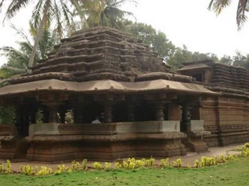
Bhuvaraha Narasimha temple Halasi, Karnataka


Panchalingeshwara temple Hooli
Belgaum is the Divisional Head quarter of North Karnataka The ancient name of the town of Belgaum was Venugrama, meaning Bamboo Village. It is also called as Malnad Pradesh. The most ancient place in the district is Halsi; and this, according to inscriptions on copper plates discovered in its neighborhood, was once the capital of a dynasty of nine Kadamba kings. It appears that from the middle of the 6th century to about 760 the area was held by the Chalukyas, who were succeeded by the Rashtrakutas. After the break-up of the Rashtrakuta power a portion of it survived in the Rattas (875-1250), who from 1210 onward made Venugrama their capital. Inscriptions give evidence of a long struggle between the Rattas and the Kadambas of Goa, who succeeded in the latter years of the 12th century in acquiring and holding part of the district. By 1208, however, the Kadambas had been overthrown by the Rattas, who in their turn succumbed to the Yadavas of Devagiri in 1250. After the overthrow of the Yadavas by the Delhi Sultanate (1320), Belgaum was for a short time under the rule of the latter; but only a few years later the part south of the Ghataprabha River was subject to the Hindu rajas of Vijayanagara. In 1347 the northern part was conquered by the Bahmani Sultanate, which in 1473 took the town of Belgaum and conquered the southern part also. When Aurangzeb overthrew the Bijapura sultans in 1686, Belgaum passed to the Mughals. In 1776 the country was overrun by Hyder Ali of Mysore, but was betrayed by the Madhavrao Peshwa with British assistance. In 1818 it was handed over to the British East India Company. Yadur is situated beside Krishna river, there is famous veerbhadra temple. Many devotees visit this place from Karnataka and Maharastra.
Hooli is one of the oldest villages in Belgaum district. There are many Chalukya temples in the village and the 'Panchaligeswara temple is very famous.
Kittur in Belgaum district is a place of historical importance. Rani Chennamma of Kittur (1778–1829) is known for her resistance to British rule;
The British had a sizable infantry post here, having realised the military importance of its geographic location. It is one of the reasons for Belgaum's sobriquet The Cradle of Infantry. Development of a rail network for movement of resources and later troops was one of the means employed by both the British East India Company and the British to exert control over India. Belgaum's railway station, the Mahatma Gandhi Railway Station was established by the British. A signboard declaring the sobriquet can be seen hung on Platform 1 at the station.
Border dispute[]
Belgaum district was incorporated into the newly formed Mysore state (now Karnataka) with the passage of the States Reorganisation Act (1956), which reorganised India's states along linguistic lines since majority of the people (more than two-third of population) in the district including city spoke Marathi. Because of that, Maharashtra has been claiming the district and the case is now in the Supreme Court of India.
Divisions[]
Administrative divisions[]
Administration of Belgaum District has been divided into 10 talukas. Chikkodi taluka is the largest with an area of 1,995.70 km² and Raybag taluka is the smallest with an area of 958.8 km². The district comprises three revenue sub-divisions and six police sub-divisions. Apart from the Belgaum City Corporation, there are 17 municipalities, 20 towns, 485 gram panchayats, 1,138 habitated villages and 26 non-habitated villages. Belgaum is also the headquarters of the Belgaum Revenue Division.
Cities & Towns[]


Saundatti Fort, Karnataka


Degaon Kamala Narayana temple 5 km from Kittur, Karnataka
- Athani
- Bail Hongal
- Belgaum
- Chikodi
- Gokak
- Hukeri
- Khanapur
- Kudchi
- Mudalagi
- Nipani
- Ramdurg
- Raybag
- Sadalgi
- Sankeshwar
- Saundatti
Demographics[]
According to the 2011 census Belgaumdistrict has a population of 4,778,439,[3] roughly equal to the nation of Singapore[4] or the US state of Alabama.[5] This gives it a ranking of 25th in India (out of a total of 640).[3] The district has a population density of 356 inhabitants per square kilometre (920 /sq mi) .[3] Its population growth rate over the decade 2001-2011 was 13.38 %.[3] Belgaum has a sex ratio of 969 females for every 1000 males,[3] and a literacy rate of 73.94 %.[3] Kannada is the main language spoken in this district(by 73%) .But Language Marathi is spoken in the cities of Belgaum, Nipani etc.
Culture[]
Tourist sites[]

Kamal basadi Jain temple, Belgaum
Tourism attractions of Belgaum District[6]
- CHANDUR,YADUR
situated beside krishna river
- Hooli
Panchalingeshwara temple Munavalli 13 km from Savadatti, one of the oldest village in the district, it is famous for Panchaligeswara temple. Other ruined Chalukya temples await for conservation and restoration.
- Saundatti
Famous for Savadatti Fort.
- Kamala Narayana Temple, Degaon (Degamve / Devgram)
Degaon Kamala Narayana temple 5 km from Kittur.
- Kasamalgi Parshwanatha
Kasamalgi Parshwanatha, 10 km from Kittur and 5 km from Kamala Narayana Temple, Degaon (Degamve/ Devgram).


Kasamalgi Parshwanatha, 5 km from Kittur
- Halasi
There is a famous Kadamba temple of Bhuvaraha Narasimha.
- Yallammagudda
- Navilateertha
- Jamboti, 20 km south-west of Belgaum, is a popular tourist spot with its evergreen hilltop forests.
- Varapoha Falls, where the Mandovi River plunges 60 meters, is a beautiful waterfall in Belgaum district.
- Gokak Falls
- Belgaum Fort which is in the heart of the city. The Kote lake is also a beautiful lake to visit. Inside the fort we can find an ancient Kamala Basadi and Chikka Basadi Jain temples. Just few metres walk to this temple you can find Ramkrishna Ashrama where you can relax. There is an ancient Masjid also in the fort.
- Belgaum Cantonment with both Portuguese and British style buildings, churches and schools.
- Parasgad Fort
- Kittur
Notable personalities[]
- Kaka Kalelkar (1885–1981) Social reformer, scholar, historian, educationist, and journalist. Born in Belgundi.
Education[]
Visveswaraiah Technological University is located in Belgaum. All technical and engineering colleges in the Karnataka State come under this University. Belgaum is also known for the Airmen Training School, an Indian Air Force training centre located at Sambra. The Maratha Light Infantry has its regimental headquarters in Belgaum. The Commando School and School of jungle warfare and the Indian Army is also situated in Belgaum. The Karnataka Lingayat (K.L.E.) Education Society is in Belgaum. The K.L.E.S. Hospital of Belgaum is the second-largest hospital in Asia . The Medical Council of India has one of its regional research centre here, and the Indian Institute of Hydrology and Vaccine Institute are also situated here. Military School Belgaum (Principal - Lt Col Sudhanshu Arya) is one of the five Military Schools in India. The School was set up in 1945 by King George VI for the wards of VCOs (present day JCOs) and NCOs of Indian Army.
References[]
|
External links[]

|
Kolhapur district, Maharashtra | Sangli district, Maharashtra | Bijapur district |
|
| Sindhudurg district, Maharashtra | Bagalkot district Gadag district | |||
 Belgaum district | ||||
| North Goa district, Goa | Uttara Kannada district | Dharwada district |
Template:Settlements in Belgaum district
| |||||||||||||||||||||||||||||
| ||||||||||||||
| This page uses content from the English language Wikipedia. The original content was at Belgaum district. The list of authors can be seen in the page history. As with this Familypedia wiki, the content of Wikipedia is available under the Creative Commons License. |