| ||||||||||||||
| Bent County, Colorado | |
Bent County Courthouse in Las Animas, Colorado
| |
 Location in the state of Colorado | |
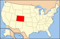
 Colorado's location in the U.S. | |
| Founded | February 6, 1874 |
|---|---|
| Named for | William Bent |
| Seat | Las Animas |
| Largest city | Las Animas |
| Area - Total - Land - Water |
1,541.12 sq mi (3,991 km²) 1,513.90 sq mi (3,921 km²) 27.22 sq mi (70 km²), 1.77% |
| Population - (2000) - Density |
5,968 4.0/sq mi (1.5/km²) |
| Time zone | Mountain: UTC-7/-6 |
| Website | www.bentcounty.org |
Statue of cavalry soldier at Bent County Courthouse
POW-MIA monument at Bent County Courthouse

Bent County Democrat newspaper in Las Animas

Bent County rodeo arena
Bent County is one of the 64 counties of the state of Colorado of the United States. The county is named in honor of frontier trader William Bent. The county population was 5,998 at U.S. Census 2000.[1] The county seat and the only incorporated municipality in the county is the city of Las Animas.
History
Bent County was created by the Colorado legislature on February 6, 1874, when Greenwood County, created only four years earlier, was dissolved and divided between Bent and Elbert counties. At the time of its creation, it included a large portion of southeastern Colorado. In 1889, Bent County acquired its current borders when it lost much of its territory to the newly created Cheyenne, Lincoln, Kiowa, Otero, and Prowers counties.
Geography
According to the 2000 census, the county has a total area of 1,541.12 square miles (3,991.5 km2), of which 1,513.90 square miles (3,921.0 km2) (or 98.23%) is land and 27.22 square miles (70.5 km2) (or 1.77%) is water.[2]
Adjacent counties
- Kiowa County, Colorado - north
- Prowers County, Colorado - east
- Baca County, Colorado - southeast
- Las Animas County, Colorado - southwest
- Otero County, Colorado - west
Demographics

Bent County, Colorado
As of the census[3] of 2000, there were 5,998 people, 2,003 households, and 1,388 families residing in the county. The population density was 4 people per square mile (2/km²). There were 2,366 housing units at an average density of 2 per square mile (1/km²). The racial makeup of the county was 79.53% White, 3.65% Black or African American, 2.23% Native American, 0.57% Asian, 10.25% from other races, and 3.77% from two or more races. 30.24% of the population were Hispanic or Latino of any race.
There were 2,003 households out of which 32.50% had children under the age of 18 living with them, 53.50% were married couples living together, 11.40% had a female householder with no husband present, and 30.70% were non-families. 27.20% of all households were made up of individuals and 12.20% had someone living alone who was 65 years of age or older. The average household size was 2.53 and the average family size was 3.07.
In the county the population was spread out with 23.80% under the age of 18, 9.30% from 18 to 24, 29.20% from 25 to 44, 21.80% from 45 to 64, and 15.90% who were 65 years of age or older. The median age was 37 years. For every 100 females there were 129.00 males. For every 100 females age 18 and over, there were 138.70 males.
The median income for a household in the county was $28,125, and the median income for a family was $34,096. Males had a median income of $22,755 versus $24,261 for females. The per capita income for the county was $13,567. About 16.60% of families and 19.50% of the population were below the poverty line, including 27.40% of those under age 18 and 13.00% of those age 65 or over.
Cities and towns
- Able
- Boggsville
- Caddoa
- Fort Lyon
- Hasty
- Hilton
- Las Animas (county seat)
- Marlman
- McClave
- Melina
- Ninaview
State park
- John Martin Reservoir State Park
Trails and byway
- American Discovery Trail
- Santa Fe National Historic Trail
- Santa Fe Trail National Scenic Byway
See also
- Colorado census statistical areas
- Colorado counties
- Colorado municipalities
- George W. Swink, retailer and cattleman
- National Register of Historic Places listings in Bent County, Colorado
References
- ^ "Annual County Population Estimates and Estimated Components of Change: April 1, 2000 to July 1, 2006 (CO-EST2006-alldata)" (CSV). 2006 Population Estimates. United States Census Bureau, Population Division. 2007-03-22. http://www.census.gov/popest/counties/files/CO-EST2006-ALLDATA.csv. Retrieved 2007-05-17.
- ^ "Census 2000 U.S. Gazetteer Files: Counties". United States Census. http://www.census.gov/tiger/tms/gazetteer/county2k.txt. Retrieved 2011-02-13.
- ^ "American FactFinder". United States Census Bureau. http://factfinder.census.gov. Retrieved 2008-01-31.
External links
- Bent County Government website
- Colorado County Evolution by Don Stanwyck
- Colorado Historical Society

|
Kiowa County | 
| ||
| Otero County | Prowers County | |||
 Bent County, Colorado | ||||
| Las Animas County | Baca County |
Template:Bent County, Colorado
| |||||||||||||||||
| This page uses content from the English language Wikipedia. The original content was at Bent County, Colorado. The list of authors can be seen in the page history. As with this Familypedia wiki, the content of Wikipedia is available under the Creative Commons License. |
