| Main | Births etc |
|---|
| Big Flats | |
|---|---|
| — Town — | |
Big Flats |
|
| Coordinates: Coordinates: | |
| Country | United States |
| State | New York |
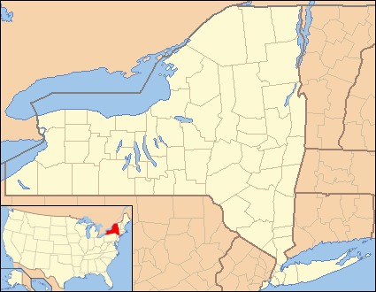
| County | Chemung |
| Government | |
| • Type | Town Council |
| • Town Supervisor | Edward Fairbrother |
| • Town Council | Members
|
| Area | |
| • Total | 45.1 sq mi (117 km2) |
| Population (2010) | |
| • Total | 7,731 |
| • Density | 170/sq mi (66/km2) |
| Time zone | Eastern (EST) (UTC-5) |
| • Summer (DST) | EDT (UTC-4) |
Big Flats is a town in Chemung County, New York, United States. The population was 7,731 at the 2010 census.
The Town of Big Flats is on the west border of the county, west of Elmira, New York. It is part of the "Elmira, New York Metropolitan Statistical Area." The town also contains a hamlet named Big Flats.
History[]
The Town of Big Flats, which had formerly been called "Great Plains," was organized in 1822 from the Town of Elmira.
Geography[]
According to the United States Census Bureau, the town has a total area of 45.1 square miles (116.7 km²), of which, 44.5 square miles (115.2 km²) of it is land and 0.6 square miles, 1.5 km² (1.24%) is water.
The Chemung River flows through the southern portion of the town and forms part of the border. Sing Sing Creek flows through the town and is a tributary of the Chemung. The geography consists of a broad expanse of relatively flat land, the axis of which lies generally northeast to southwest. It is a river valley. The land has historically been very good for agriculture, including tobacco. Diligent searching will result in the finding of fossil seashells indicating the land was anciently a sea bottom. Other evidence is found in the rock of the region, which is mostly shale. The western town line is the border of Steuben County, New York.
The Southern Tier Expressway (Interstate 86/New York State Route 17) passes through Big Flats.
Demographics[]
As of the census[1] of 2000, there were 7,224 people, 2,725 households, and 2,144 families residing in the town. The population density was 162.4 people per square mile (62.7/km²). There were 2,836 housing units at an average density of 63.7 per square mile (24.6/km²). The racial makeup of the town was 96.35% White, 1.18% Black or African American, 0.01% Native American, 1.52% Asian, 0.01% Pacific Islander, 0.15% from other races, and 0.78% from two or more races. Hispanic or Latino of any race were 0.66% of the population.
There were 2,725 households out of which 34.4% had children under the age of 18 living with them, 69.5% were married couples living together, 6.8% had a female householder with no husband present, and 21.3% were non-families. 17.1% of all households were made up of individuals and 6.6% had someone living alone who was 65 years of age or older. The average household size was 2.65 and the average family size was 2.99.
In the town the population was spread out with 26.0% under the age of 18, 4.9% from 18 to 24, 26.9% from 25 to 44, 29.4% from 45 to 64, and 12.8% who were 65 years of age or older. The median age was 41 years. For every 100 females there were 97.8 males. For every 100 females age 18 and over, there were 96.0 males.
The median income for a household in the town was $53,435, and the median income for a family was $59,500. Males had a median income of $42,317 versus $28,327 for females. The per capita income for the town was $23,391. About 1.3% of families and 2.6% of the population were below the poverty line, including 2.1% of those under age 18 and 1.7% of those age 65 or over.
Communities and location in Big Flats[]
- Arnot Mall, shopping mall located in Horseheads
- Big Flats – The hamlet of Big Flats, located at the junction of the Southern Tier Expressway (I-86 and NY-17) and NY-352. It is also a census designated place (CDP).
- Elmira-Corning Regional Airport – An airport with scheduled air service northwest of Elmira.
- Fisherville – A hamlet south of the airport and east of Big Flats village on Chemung County Route 64.
- Golden Glow Heights – A hamlet located by the south town line on the south bank of the Chemung River.
- Harris Hill – A prominent hill south of the airport.
- Harris Hill Gliderport – A small airport on Harris Hill used for glider operations.
- Harris Hill Manor – A hamlet on the north bank of the Chemung River on NY-352.
Climate[]
This climatic region is typified by large seasonal temperature differences, with warm to hot (and often humid) summers and cold (sometimes severely cold) winters. According to the Köppen Climate Classification system, Big Flats has a humid continental climate, abbreviated "Dfb" on climate maps.[2]
References[]
- ^ "American FactFinder". United States Census Bureau. http://factfinder.census.gov. Retrieved 2008-01-31.
- ^ Climate Summary for Big Flats, New York
External links[]
- Town of Big Flats, NY (official site)
- Tri-Counties Genealogy & History: Town of Big Flats, Chemung County NY
| |||||||||||||||||||||||

| This page uses content from the English language Wikipedia. The original content was at Big Flats, New York. The list of authors can be seen in the page history. As with this Familypedia wiki, the content of Wikipedia is available under the Creative Commons License. |