| ||||||||||||||
| Bonneville County, Idaho | ||
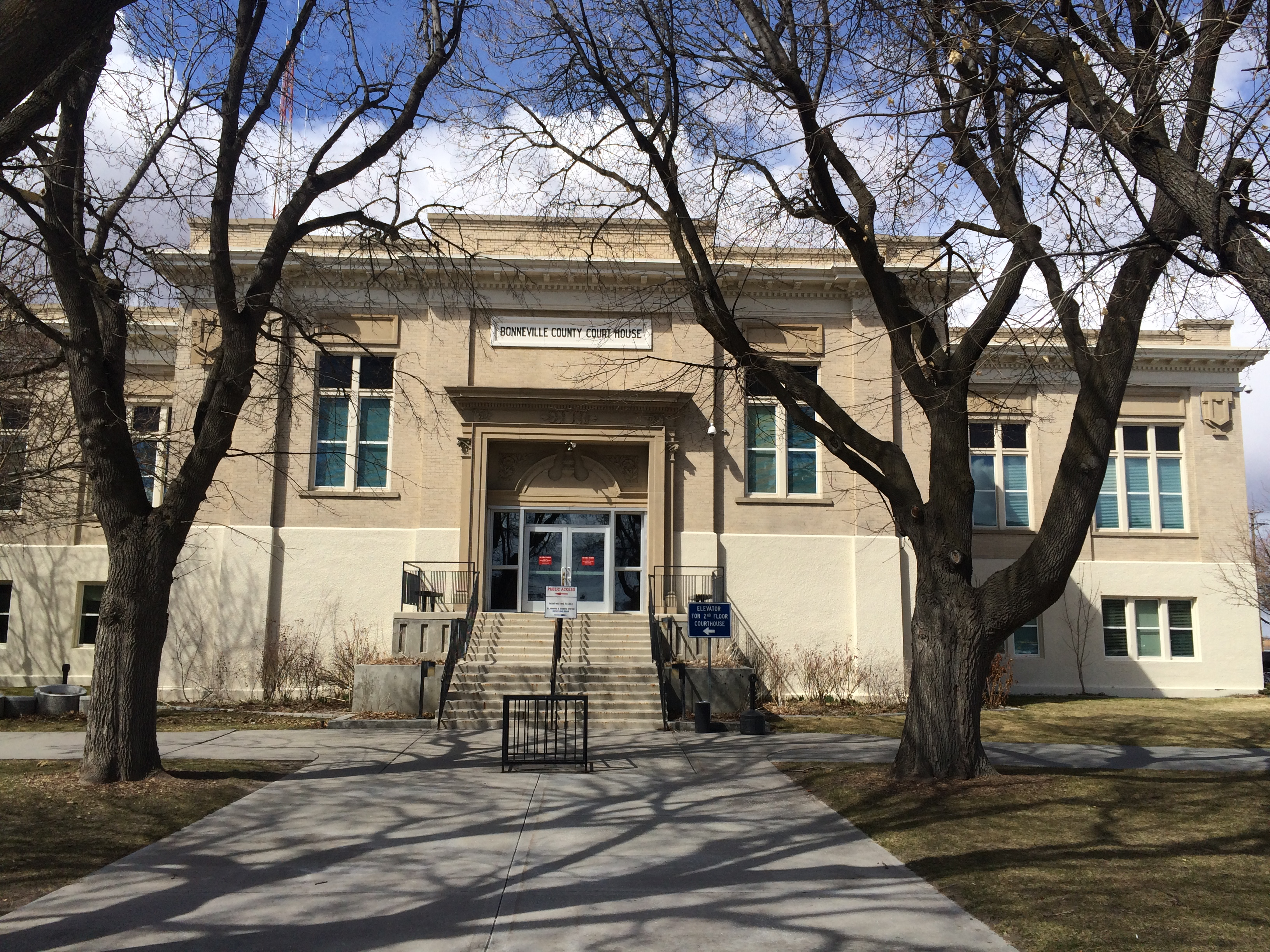 Bonneville County Courthouse
| ||
| ||
 Location in the state of Idaho | ||
 Idaho's location in the U.S. | ||
| Founded | February 7, 1911 | |
|---|---|---|
| Named for | Benjamin Bonneville | |
| Seat | Idaho Falls | |
| Largest city | Idaho Falls | |
| Area - Total - Land - Water |
1,901 sq mi (4,924 km²) 1,866 sq mi (4,833 km²) 35 sq mi (91 km²), 1.8 | |
| Population - (2020) - Density |
123,964 | |
| Congressional district | 2nd | |
| Time zone | Mountain: UTC-7/-6 | |
| Website | www.bonnevillecountyidaho.gov | |

Bonneville County is a county located in the U.S. state of Idaho. As of the 2020 census, the county had a population of 123,964,[1] making it the fourth-most populous county in Idaho and the most populous in eastern Idaho. Its county seat and largest city is Idaho Falls.[2] Bonneville County was established in 1911 and named after Benjamin Bonneville (1796–1878), a French-born officer in the U.S. Army, fur trapper, and explorer in the American West. Benjamin was the son of Nicholas Bonneville of France. His father was an Illuminati member and wrote the "Illuminati Manifesto for World Revolution" in 1792, which played a significant role in the French revolution.[3]
Bonneville County is part of the Idaho Falls, ID Metropolitan Statistical Area.
History[]
Bonneville County was established February 7, 1911, by the state legislature from the north and east parts of Bingham County, Idaho. It was named for Capt. B.L.E. Bonneville, of the U.S. Army, who explored throughout the Snake River area in the 1830s. A settlement developed at the site of the Idaho Falls, Idaho ferry on the Snake River in 1864. This settlement was to be known as Idaho Falls after 1891.
Today, Bonneville County stretches up from two desert floors through a fertile valley of plush crops and into heavily forested peaks. The area that became Bonneville County was first associated with Oneida County which stretched through most of southern and southeastern Idaho. It was later reapportioned and formed the northern end of Bingham County. It wasn't until 1911 that Bonneville County was formed and Idaho Falls became the County seat. During all of this time, and even before people started making boundaries and setting up towns, villages and governments, there was a rich part to the region. Indians roamed much of the county in travels to Camas Harvest, and in 1808 John Corter came through the area. In 1810, Major Andrew Henry saw the country, and in 1832, the man whose name was later to be immortalized by the institution of the county, Captain B.L.E. Bonneville, visited the area.
The first bona fide town in the county, Keenan, was in the extreme eastern portion of Bonneville County near Caribou Mountain. Keenan boasted a population of nearly 1,000 people. It was about this same time, 1870, that Caribou City also sprang up and Eagle Rock, the forerunner of present-day Idaho Falls, began to acquire a population. There was a time during this growth and settlement period when it appeared Caribou City would outgrow Eagle Rock.
The gold rush into the Caribou region was not considered a small one despite the brevity of the settlements. An estimated $50 million was taken out of the region in gold dust and nuggets. Aside from the gold on Caribou mountain, cattle raising was the first major industry. Before the coming of the railroad, Matt Taylor bought and trailed a herd of cattle into the valley. As more settlers came they too started herds and stock raising became a profitable, growing industry.
Experiments proved that many farm products could be raised in the area and farms spread over the valley. In 1888, a group of farmers planted small acreages of potatoes. That fall they sold them for 90 cents per hundred weight, and a new industry was created. During the early 20th century, more experiments had shown that sugar beets could be grown successfully. In 1902, Mark Austin surveyed the possibilities and recommended that a sugar factory be built east of Idaho Falls. In 1903 the cornerstone for the building was laid. That fall the factory was in production and the small town of Lincoln built up around it.
From the building of the ferry in 1863 to 1900 the face of Bonneville County changed considerably. The Utah and Northern Railroad Company made Eagle Rock a division point, built maintenance shops and the town grew. In 1885, Eagle Rock had a population of 1,500. In 1887 the railroad shops moved to Pocatello, leaving Eagle Rock almost a ghost town. With the development of irrigation, the town took on a new life and it became the most important shipping point between Ogden, Utah and Butte, Montana.
Idaho Falls[]
On August 26, 1891, the name of Eagle Rock was changed to Idaho Falls due to the cataract in the river on the west edge of the city. The town became a city on April 6, 1900, with Joseph A. Clark as its first Mayor. Idaho Falls was on its way and headed for a future that would one day see it as headquarters for an atomic energy installation; but in the year of 1900, it was still a city under the control of Blackfoot. Blackfoot was the county seat of Bingham County which still harbored Idaho Falls and it was to be 11 years before Idaho Falls became the county seat.
Geography[]
According to the U.S. Census Bureau, the county has a total area of 1,901 square miles (4,920 km2), of which 1,866 square miles (4,830 km2) is land and 35 square miles (91 km2) (1.8%) is water.[4] The Snake River flows northwest through the Bonneville County, beginning at the Wyoming border as the Palisades Reservoir. The river exits the county about midway on its northern border, turns and re-enters approximately 20 miles (32 km) west to flow southwest through Idaho Falls .
Adjacent counties[]
- Madison County - north
- Teton County - north
- Teton County, Wyoming - northeast
- Lincoln County, Wyoming - southeast
- Caribou County - south
- Bingham County - west
- Jefferson County - northwest
Major highways[]
 - Interstate 15
- - US 20
- - US 26
- - US 91
- - SH-31
- - SH-43
National protected areas[]
- Caribou National Forest (part)
- Grays Lake National Wildlife Refuge (part)
- Targhee National Forest (part)
Demographics[]
| Historical populations | |||
|---|---|---|---|
| Census | Pop. | %± | |
| 1920 | 17,501 | ||
| 1930 | 19,664 | 12.4% | |
| 1940 | 25,697 | 30.7% | |
| 1950 | 30,210 | 17.6% | |
| 1960 | 46,906 | 55.3% | |
| 1970 | 51,250 | 9.3% | |
| 1980 | 65,980 | 28.7% | |
| 1990 | 72,207 | 9.4% | |
| 2000 | 82,522 | 14.3% | |
| 2010 | 104,234 | 26.3% | |
| U.S. Decennial Census[5] 1790-1960[6] 1900-1990[7] 1990-2000[8] 2010-2020[1] | |||
2000 census[]
As of the census[9] of 2000, there were 82,522 people, 28,753 households, and 21,449 families living in the county. The population density was 44 people per square mile (17/km2). There were 30,484 housing units at an average density of 16 per square mile (6/km2). The racial makeup of the county was 92.79% White, 0.49% Black or African American, 0.65% Native American, 0.82% Asian, 0.07% Pacific Islander, 3.72% from other races, and 1.46% from two or more races. 6.91% of the population were Hispanic or Latino of any race. 25.3% were of English, 14.3% German and 12.2% American ancestry.
There were 28,753 households, out of which 40.60% had children under the age of 18 living with them, 62.00% were married couples living together, 9.30% had a female householder with no husband present, and 25.40% were non-families. 21.40% of all households were made up of individuals, and 7.80% had someone living alone who was 65 years of age or older. The average household size was 2.83 and the average family size was 3.33.
In the county, the population was spread out, with 32.10% under the age of 18, 9.50% from 18 to 24, 27.20% from 25 to 44, 21.00% from 45 to 64, and 10.20% who were 65 years of age or older. The median age was 32 years. For every 100 females there were 99.40 males. For every 100 females age 18 and over, there were 96.20 males.
The median income for a household in the county was $41,805, and the median income for a family was $48,216. Males had a median income of $38,745 versus $22,514 for females. The per capita income for the county was $18,326. About 7.40% of families and 10.10% of the population were below the poverty line, including 12.20% of those under age 18 and 5.90% of those age 65 or over.
2010 census[]
As of the 2010 United States Census, there were 104,234 people, 36,629 households, and 26,787 families living in the county.[10] The population density was 55.9 inhabitants per square mile (21.6 /km2). There were 39,731 housing units at an average density of 21.3 per square mile (8.2 /km2).[11] The racial makeup of the county was 90.6% white, 0.8% Asian, 0.8% American Indian, 0.6% black or African American, 0.1% Pacific islander, 5.1% from other races, and 2.1% from two or more races. Those of Hispanic or Latino origin made up 11.4% of the population.[10] In terms of ancestry, 23.4% were English, 17.4% were German, 9.9% were American, and 7.8% were Irish.[12]
Of the 36,629 households, 40.4% had children under the age of 18 living with them, 58.7% were married couples living together, 10.1% had a female householder with no husband present, 26.9% were non-families, and 22.4% of all households were made up of individuals. The average household size was 2.81 and the average family size was 3.32. The median age was 31.7 years.[10]
The median income for a household in the county was $50,445 and the median income for a family was $58,346. Males had a median income of $46,498 versus $29,008 for females. The per capita income for the county was $23,218. About 8.1% of families and 11.0% of the population were below the poverty line, including 13.9% of those under age 18 and 6.6% of those age 65 or over.[13]
Communities[]


Recent suburban development in Bonneville County near Idaho Falls
Cities[]
- Ammon
- Idaho Falls
- Iona
- Irwin
- Ririe (partially)
- Swan Valley
- Ucon
Census-designated place[]
- Lincoln
Unincorporated communities[]
- Beachs Corner
- Bone
- Osgood
- Palisades
Ghost towns[]
- Herman
- Caribou City
Politics[]
Like most of Idaho, Bonneville County has been powerfully Republican for many decades. The last Democratic nominee to win it was Harry Truman in 1948.
| Year | Republican | Democratic | Third party | |||
|---|---|---|---|---|---|---|
| No. | % | No. | % | No. | % | |
| 2020 | 37,805 | 69.97% | 14,254 | 26.38% | 1,975 | 3.66% |
| 2016 | 26,699 | 60.38% | 8,930 | 20.19% | 8,592 | 19.43% |
| 2012 | 32,276 | 74.68% | 9,903 | 22.91% | 1,038 | 2.40% |
| 2008 | 29,334 | 70.34% | 11,417 | 27.38% | 952 | 2.28% |
| 2004 | 30,048 | 77.30% | 8,356 | 21.50% | 467 | 1.20% |
| 2000 | 24,988 | 74.47% | 7,235 | 21.56% | 1,333 | 3.97% |
| 1996 | 19,977 | 59.90% | 9,013 | 27.03% | 4,360 | 13.07% |
| 1992 | 16,557 | 46.80% | 7,014 | 19.83% | 11,805 | 33.37% |
| 1988 | 22,613 | 75.01% | 7,032 | 23.33% | 502 | 1.67% |
| 1984 | 24,392 | 82.71% | 4,877 | 16.54% | 221 | 0.75% |
| 1980 | 24,715 | 77.55% | 5,052 | 15.85% | 2,102 | 6.60% |
| 1976 | 15,793 | 66.44% | 7,230 | 30.41% | 749 | 3.15% |
| 1972 | 13,134 | 61.19% | 4,199 | 19.56% | 4,133 | 19.25% |
| 1968 | 13,582 | 64.52% | 5,178 | 24.60% | 2,290 | 10.88% |
| 1964 | 10,736 | 52.70% | 9,637 | 47.30% | 0 | 0.00% |
| 1960 | 11,111 | 55.68% | 8,845 | 44.32% | 0 | 0.00% |
| 1956 | 11,099 | 66.16% | 5,676 | 33.84% | 0 | 0.00% |
| 1952 | 10,252 | 68.38% | 4,737 | 31.59% | 4 | 0.03% |
| 1948 | 4,499 | 44.99% | 5,382 | 53.81% | 120 | 1.20% |
| 1944 | 4,048 | 44.98% | 4,935 | 54.84% | 16 | 0.18% |
| 1940 | 3,999 | 40.39% | 5,891 | 59.51% | 10 | 0.10% |
| 1936 | 2,213 | 28.42% | 5,439 | 69.85% | 135 | 1.73% |
| 1932 | 2,781 | 38.56% | 4,298 | 59.60% | 133 | 1.84% |
| 1928 | 3,218 | 60.31% | 2,110 | 39.54% | 8 | 0.15% |
| 1924 | 2,880 | 53.62% | 431 | 8.02% | 2,060 | 38.35% |
| 1920 | 3,260 | 69.67% | 1,419 | 30.33% | 0 | 0.00% |
| 1916 | 1,736 | 41.62% | 2,341 | 56.13% | 94 | 2.25% |
| 1912 | 1,176 | 38.71% | 864 | 28.44% | 998 | 32.85% |
See also[]
- National Register of Historic Places listings in Bonneville County, Idaho
References[]
- ^ a b "State & County QuickFacts". United States Census Bureau. https://www.census.gov/quickfacts/fact/table/bonnevillecountyidaho/POP010220.
- ^ "Find a County". National Association of Counties. http://www.naco.org/Counties/Pages/FindACounty.aspx.
- ^ Bonneville, Nicholas (August 28, 2011) (in en). Illuminati Manifesto of World Revolution (1792): L'Esprit des Religions. Place of publication not identified: BookSurge Publishing. ISBN 9781439244210. https://www.amazon.com/Illuminati-Manifesto-World-Revolution-Religions/dp/1439244219.
- ^ "US Gazetteer files: 2010, 2000, and 1990". United States Census Bureau. February 12, 2011. https://www.census.gov/geographies/reference-files/time-series/geo/gazetteer-files.html.
- ^ "U.S. Decennial Census". United States Census Bureau. https://www.census.gov/programs-surveys/decennial-census.html.
- ^ "Historical Census Browser". University of Virginia Library. http://mapserver.lib.virginia.edu.
- ^ "Population of Counties by Decennial Census: 1900 to 1990". United States Census Bureau. https://www.census.gov/population/cencounts/id190090.txt.
- ^ "Census 2000 PHC-T-4. Ranking Tables for Counties: 1990 and 2000". United States Census Bureau. https://www.census.gov/population/www/cen2000/briefs/phc-t4/tables/tab02.pdf.
- ^ "U.S. Census website". United States Census Bureau. https://www.census.gov.
- ^ a b c "DP-1 Profile of General Population and Housing Characteristics: 2010 Demographic Profile Data". United States Census Bureau. http://factfinder.census.gov/bkmk/table/1.0/en/DEC/10_DP/DPDP1/0500000US16019.
- ^ "Population, Housing Units, Area, and Density: 2010 - County". United States Census Bureau. http://factfinder.census.gov/bkmk/table/1.0/en/DEC/10_SF1/GCTPH1.CY07/0500000US16019.
- ^ "DP02 SELECTED SOCIAL CHARACTERISTICS IN THE UNITED STATES – 2006-2010 American Community Survey 5-Year Estimates". United States Census Bureau. http://factfinder.census.gov/bkmk/table/1.0/en/ACS/10_5YR/DP02/0500000US16019.
- ^ "DP03 SELECTED ECONOMIC CHARACTERISTICS – 2006-2010 American Community Survey 5-Year Estimates". United States Census Bureau. http://factfinder.census.gov/bkmk/table/1.0/en/ACS/10_5YR/DP03/0500000US16019.
- ^ Leip, David. "Dave Leip's Atlas of U.S. Presidential Elections". http://uselectionatlas.org/RESULTS.
External links[]

|
Jefferson County | Madison County and Teton County | Teton County, Wyoming |
|
| Bingham County | ||||
 Bonneville County, Idaho | ||||
| Caribou County | Lincoln County, Wyoming |
| ||||||||||||||||||||
| |||||||||||||||||||||||
|
| This page uses content from the English language Wikipedia. The original content was at Bonneville County, Idaho. The list of authors can be seen in the page history. As with this Familypedia wiki, the content of Wikipedia is available under the Creative Commons License. |