| Canterbury Waitaha |
|
|---|---|
| — Region of New Zealand — | |
| Canterbury Region | |
 |
|
| Coordinates: Coordinates: | |
| Country | |
| Island | South Island |
| Established | 1989 |
| Seat | Christchurch |
| Territorial authorities | List
Kaikoura District
Hurunui District Selwyn District Waimakariri District Christchurch City Ashburton District Mackenzie District Timaru District Waimate District Waitaki District (59.61%) |
| Government | |
| • Chairperson | Margaret Bazley |
| Area | |
| • Region | 45,346 km2 (17,508 sq mi) |
| Time zone | NZST (UTC+12) |
| • Summer (DST) | NZDT (UTC+13) |

A map showing population density in the Canterbury Region at the 2006 census
The New Zealand region of Canterbury (Māori: Waitaha) is mainly composed of the Canterbury Plains and the mountains and foothills to the north-west. Its main city, Christchurch, hosts the main office of the Christchurch City Council, the Canterbury Regional Council – called Environment Canterbury (ECAN) – and the University of Canterbury.
History[]
Colonisation[]
In 1848, Edward Gibbon Wakefield, a Briton, and John Robert Godley, an Anglo-Irish aristocrat, founded the Canterbury Association to establish an Anglican colony in the South Island. The colony was based upon theories developed by Wakefield while in prison for eloping with a woman not-of-age. Due to ties to the prestigious Oxford University, the Canterbury Association succeeded in raising sufficient funds and recruiting middle-class and upper-class settlers.[1] In April 1850, a preliminary group led by Godley landed at Port Cooper—modern-day Lyttelton Harbour—and established a port, housing and shops in preparation for the main body of settlers. In December 1850, the first wave of 750 settlers arrived at Lyttelton in a fleet of four ships.[1]
Following 1850, the province's economy developed with the introduction of sheep farming. The Canterbury region's tussock plains in particular were suitable for extensive sheep farming. Since they were highly valued by settlers for their meat and wool, there were over half a million sheep in the region by the early 1850s. By the 1860s, this figure had risen to three million.[1] During this period, the architect Benjamin Mountfort designed many civic and ecclesiastical buildings in the Gothic Revival style.
Canterbury Province[]
The Canterbury Province was formed in 1853 following the passing of the New Zealand Constitution Act 1852 from the part of New Munster Province and covered both the east and west coasts of the South Island. The province was abolished, along with other provinces of New Zealand, when the Abolition of the Provinces Act came into force on 1 Nov 1876.[2] The modern Canterbury Region has slightly different boundaries, particularly in the North, where it includes some districts from the old Nelson Province.
Geography[]
Canterbury is New Zealand's largest region by area, with an area of 45,346 km2. The region is traditionally bounded in the north by the Conway River and to the west by the Southern Alps. The southern boundary is the Waitaki River.
The area is commonly divided into North Canterbury (north of the Rakaia River to the Conway River), Mid Canterbury (from the Rakaia River to the Rangitata River), South Canterbury (south of the Rangitata River to the Waitaki River) and Christchurch City. For many purposes South Canterbury is considered a separate region, centred on the city of Timaru.
The population of Canterbury region is 558,800 (June 2012 estimate),[3] making it the largest region in the South Island and the second largest region in New Zealand by population.
Urban areas[]
| Urban area | Population (June 2012 estimate)[3] |
% of region |
|---|---|---|
| Christchurch | 375,900 | 67.3% |
| Timaru | 27,800 | 5% |
| Ashburton | 18,300 | 3.3% |
| Rangiora | 14,650 | 2.6% |
| Rolleston | 9,150 | 1.6% |
| Lincoln | 3,270 | 0.6% |
| Temuka | 4,080 | 0.7% |
| Waimate | 2,950 | 0.5% |
| Woodend | 2,790 | 0.5% |
| Geraldine | 2,340 | 0.4% |
| Oxford | 1,890 | 0.3% |
| Darfield | 1,790 | 0.3% |
| Kaikoura | 2,150 | 0.4% |
| Methven[nb 1] | 1,710 | 0.3% |
| Leeston | 1,400 | 0.3% |
| Amberley[nb 1] | 1,580 | 0.3% |
| Pleasant Point | 1,270 | 0.2% |
| Twizel | 1,080 | 0.2% |
| Rakaia[nb 1] | 1,110 | 0.2% |
Economy[]
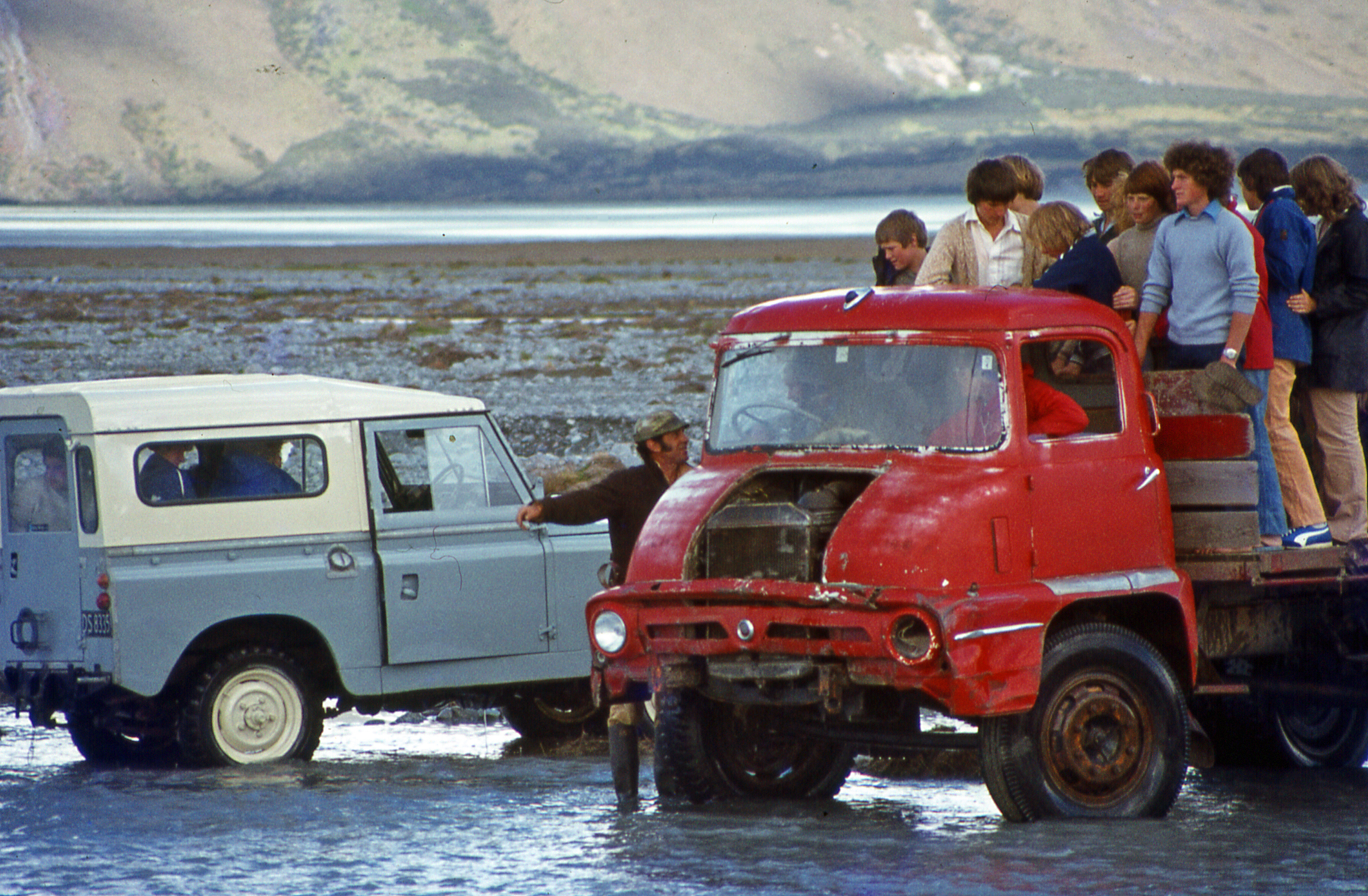

Crossing the Macauley River, Lilybank Station, Canterbury, New Zealand, 1977.
The Canterbury region’s economy is diversified into agriculture, industry, fishing, forestry, tourism and energy resources such as coal and hydroelectricity.[4] Its agriculture sector is also diversified into dairy farming, sheep farming and horticulture particularly viticulture.[5] The strength of the region's agricultural economy is displayed every November at the Canterbury A&P Show. The show coincides with the regional anniversary day and Cup Week. During the interwar period, agricultural productivity was boosted by the introduction of mechanization, lime and the improvement of seed stocks. Canterbury is also New Zealand's main producer of cereal crops such as wheat, barley and oats. As of 2002, the region produced 60.7% of the nation's supply of wheat, 51.1% of its barley stocks and 43.7% of its supply of oats.[5]
The region's viticulture industry was established by French settlers in Akaroa. Since then, wine-growing is concentrated into two regions: Waipara and Burnham.[5] Recently there have been vintages from plantings from Kurow further to the south. White wine has typically predominated in Canterbury from Riesling, Sauvignon blanc, Chardonnay, Gewürztraminer, and to a lesser extent Pinot blanc and Pinot gris. Pinot noir has had some success in the province particularly in Waipara.
The manufacturing industry is the second-largest contributor to the Canterbury economy. With so many agricultural businesses, there is especially room for development and innovation in products for this sector, as well as construction and engineering as a result of the 2011 Christchurch earthquake. 2,000 local manufacturing companies employ 23,000 workers, contributing an estimated $2.2 billion NZD to the national GDP.[6]
The sub-national GDP of the Canterbury region was estimated at US$15.074 billion in 2003, 12% of New Zealand's national GDP.[7]
Environment[]


The Canterbury Plains seen from Mount Hutt
Like much of the Canterbury-Otago tussock grasslands the Canterbury Plains have been highly modified since human settlement and now support a large agricultural industry. Prior to the arrival of Māori settlers in the 13th century, much of the modern Canterbury region was covered in scrub and beech forests. Forest fires destroyed much of the original forest cover which was succeeded by tussock grassland. By the 19th century, only ten percent of this forest cover remained and the European settlers introduced several new exotic grass, lupin, pine and macrocarpa that gradually supplanted the native vegetation. Much of the native vegetation was isolated to the alpine zones and Banks Peninsula. Recently, the amount of forest on Banks Peninsula has increased from a minimum of about one percent of its original forest cover.
The amount of dairy farming is increasing with a corresponding increase in demand for water. Water use is now becoming a contentious issue in Canterbury. Lowland rivers and streams are generally polluted and some of the aquifers are being overdrawn. The Central Plains Water scheme is a proposal for water storage that has attracted much controversy. The Canterbury Water Management Strategy is one of the many means being used to address the water issue.
The Canterbury mudfish (kowaro) is an endangered species that is monitored by the Department of Conservation.
Politics and government[]
Local government[]
The Canterbury region is administered by the Canterbury Regional Council which is divided into ten further territorial authorities including the Christchurch City Council and the Waitaki District which is divided between Canterbury and Otago. When the current local government structure was introduced in 1989, Kaikoura District was part of the Nelson-Marlborough Region. That region was later abolished and replaced with three unitary authorities. Kaikoura was too small to function as an independent unitary authority and was moved under the jurisdiction of the Canterbury Regional Council in 1992. However Kaikoura remains part of Marlborough in the minds of many people. In 2006, the Banks Peninsula District was merged into Christchurch City following a 2005 referendum.
Parliamentary representation[]
The Canterbury Region is covered by eleven parliamentary electorates which consists of ten general electorates and one Maori electorate. The city of Christchurch as a whole consists of five of these electorates, while the electorate of Waimakariri contains a mix of Christchurch and exurban Canterbury. The Port Hills and Wigram electorates are currently held by Labour Party members Ruth Dyson and Megan Woods respectively. Christchurch East, formerly held by former Labour MP Lianne Dalziel is currently vacant, awaiting by-election, due to her resignation to contest Christchurch mayoralty. Meanwhile, Christchurch Central, Ilam and Waimakariri are currently held by the governing National Party's Nicky Wagner, Gerry Brownlee and Kate Wilkinson, respectively. In contrast to Christchurch, much of the surrounding Canterbury region is dominated by the National Party due to its ties to rural farming and business interests.
Under the Maori seats system, Canterbury is part of the large Te Tai Tonga election which covers the entire South Island, the surrounding islands and most of Wellington in the North Island. It is currently held by Labour Party MP Rino Tirikatene.
Following the 2006 Census, several boundary changes were implemented in the Canterbury region. Rakaia and Aoraki were renamed Selwyn and Rangitata respectively while the Banks Peninsula was reconstituted as the Port Hills. The large Kaikoura electorate covers all of the Marlborough Region and is represented by National MP Colin King. The substantial Waitaki electorate coveres most of South Canterbury and neighbouring North Otago. Rangitata and Selwyn are held by National MPs Jo Goodhew and Amy Adams while Waitaki is represented by Jacqui Dean who also represents much of the Otago region with the exception of the Dunedin North and Dunedin South electorates.
| Members of Parliament for Canterbury | |||
|---|---|---|---|
| Electorate | Established | MP | Party |
| Christchurch Central | 1946 | Nicky Wagner | Template:Tc border| National |
| Christchurch East | 1996 | Poto Williams | Template:Tc border| Labour |
| Ilam | 1996 | Gerry Brownlee | Template:Tc border| National |
| Kaikōura* | 1996 | Colin King | Template:Tc border| National |
| Port Hills | 2008 | Ruth Dyson | Template:Tc border| Labour |
| Rangitata | 2008 | Jo Goodhew | Template:Tc border| National |
| Selwyn | 2008 | Amy Adams | Template:Tc border| National |
| Te Tai Tonga* | 1996 | Rino Tirikatene | Template:Tc border| Labour |
| Waimakariri | 1996 | Kate Wilkinson | Template:Tc border| National |
| Waitaki* | 2008 | Jacqui Dean | Template:Tc border| National |
| Wigram | 1996 | Megan Woods | Template:Tc border| Labour |
- *electorates of which the boundaries extend beyond Canterbury
Sport[]
The region is home the Crusaders who play in the Super Rugby competition. The Crusaders also represent other provinces in the upper South Island, but are based in Christchurch. They were formerly known as the Canterbury Crusaders.
In provincial rugby Canterbury is represented by three unions; Canterbury, Mid Canterbury and South Canterbury. For Historical reasons players from Kaikoura District still play for the Marlborough Rugby Union which is part of the Tasman Provincial team (Nelson/Marlborough Unions combined).
The Canterbury Wizards are Canterbury's cricket team in New Zealand's State Championship.
Other sporting teams include the Canterbury Tactix (Netball) and Canterbury United (Football).
Promotion and famous sheep[]
Aoraki Development Business and Tourism organised a very successful campaign promoting the South Canterbury region. This campaign encouraged residents of South Canterbury to promote as far and wide as possible using what ever means available why the region is such a good place to live, work, play. The campaign was a great success and one entry by Tekapo Springs made a local sheep from Tekapo quite famous.[8] The Tekapo Springs video promotes the South Canterbury town of Lake Tekapo and follows the story of a tourist and a local sheep. The video gave the town great exposure and continues to make people laugh.
Canterbury was the location used in the filming The Lord of the Rings for the fictional city of Edoras, Rohan, on Mount Sunday, as well as Helm's deep backdrop, several miles down the valley.[9]
See also[]
- 2010 Canterbury earthquake
- February 2011 Christchurch earthquake
- June 2011 Christchurch earthquake
- Water pollution in the Canterbury Region
References[]
- ^ a b c John Parker, Frontier of Dreams: From Treaty to Nationhood (1830–1913), Auckland, NZ: Scholastic (NZ) Ltd, 2005 (ISBN 978-1-86943-681-0), pp. 58–59
- ^ New Zealand Provinces 1848-77
- ^ a b "Subnational population estimates at 30 June 2012". Statistics New Zealand. 23 October 2012. http://www.stats.govt.nz/browse_for_stats/population/estimates_and_projections/subnational-pop-estimates-tables.aspx. Retrieved 23 October 2012. Also "Infoshare; Group: Population Estimates - DPE; Table: Estimated Resident Population for Urban Areas, at 30 June (1996+) (Annual-Jun)". Statistics New Zealand. 19 December 2012. http://www.stats.govt.nz/infoshare/SelectVariables.aspx?pxID=2f5a6aa2-7aeb-4792-a34a-d5567eb8082f. Retrieved 23 October 2012.
- ^ Wilson, John (2 March 2009). "Canterbury region: Industry". Te Ara Encyclopedia of New Zealand. http://www.teara.govt.nz/en/canterbury-region/9. Retrieved 11 June 2010.
- ^ a b c Wilson, John (2 March 2009). "Canterbury region: Agriculture after 1900". Te Ara Encyclopedia of New Zealand. http://www.teara.govt.nz/en/canterbury-region/8. Retrieved 11 June 2010.
- ^ "Christchurch Manufacturing Jobs". http://www.cdc.org.nz/christchurch/manufacturing-jobs/. Retrieved 9 March 2015.
- ^ "Regional Gross Domestic Product". Statistics New Zealand. 2007. http://www.stats.govt.nz/reports/analytical-reports/regional-gross-domestic-product.aspx. Retrieved 18 February 2010.
- ^ http://vimeo.com/62832161
- ^ http://www.doc.govt.nz/parks-and-recreation/places-to-visit/lord-of-the-rings-locations/#edoras
External links[]
- Canterbury Regional Council (Ecan)
- Canterbury Biodiversity
- History at the Christchurch City Council
- Experience Mid Canterbury Tourism
- Darfield Weather
| ||||||||||||||
| This page uses content from the English language Wikipedia. The original content was at Canterbury, New Zealand. The list of authors can be seen in the page history. As with this Familypedia wiki, the content of Wikipedia is available under the Creative Commons License. |