| ||||||||||||||
| Crow Wing County, Minnesota | |
 Location in the state of Minnesota | |
 Minnesota's location in the U.S. | |
| Founded | May 23, 1857 [1] |
|---|---|
| Named for | Crow Wing River |
| Seat | Brainerd |
| Largest city | Brainerd |
| Area - Total - Land - Water |
1,156.56 sq mi (2,995 km²) 996.57 sq mi (2,581 km²) 160.00 sq mi (414 km²), 13.83% |
| Population - (2010) - Density |
62,500 55/sq mi (21/km²) |
| Time zone | Central: UTC-6/-5 |
| Website | www.co.crow-wing.mn.us |
Crow Wing County is a county located in the U.S. state of Minnesota. As of 2010, the population was 62,500.[2] Its county seat is Brainerd[3].
Geography
According to the 2000 census, the county has a total area of 1,156.56 square miles (2,995.5 km2), of which 996.57 square miles (2,581.1 km2) (or 86.17%) is land and 160.00 square miles (414.4 km2) (or 13.83%) is water.[4]
History
Crow Wing county was established on May 23, 1857 and organized March 3, 1879. It is named for the Crow Wing River which gets its name from an island in the river that is shaped like the wing of a crow.
Twenty years or more before the county was outlined and named, a trading post was established on the east side of the Mississippi River opposite the mouth of the Crow Wing River. In 1837 there was again a station of the fur traders facing the northern mouth of the Crow Wing River. A few years later it became the center of Indian trading and had the general supply store for the area. By 1866 the village contained about 600 whites and Chippewas.
The part of Crow Wing County west of the Mississippi was annexed from Cass County by an act of the Legislature on February 18, 1887, doubling its former area.
Brainerd township was founded in 1870 when the Northern Pacific survey determined that the crossing of the Mississippi should be there. It became a city on November 19, 1881. The name was chosen in honor of the wife of J. Gregory Smith, the first president of the Northern Pacific Railroad Company. Mrs. Brainerd Smith was the author of novels, books of travel and other works.
The Northern Pacific Railroad ran its first train to Brainerd, a special train, on march 11, 1871 and its regular passenger service began the next September. The first passenger train from the Twin Cities, by way of Sauk Rapids, came November 1, 1877. Crow Wing, the former trading post, was soon superseded by Brainerd.
| Year | Democrat | Republican |
|---|---|---|
| 2008 | 45.10% 15,859 | 52.80% 18,567 |
| 2004 | 41.75% 14,005 | 56.96% 19,106 |
| 2000 | 40.01% 11,255 | 53.45% 15,035 |
Topography
Crow Wing County has two state forests, the Crow Wing State Forest and the Emily State Forest. It also has the Cuyuna Lakes State Trail which lies in the Upper Mississippi River Basin. The topography of the region is gently rolling to flat, with waters and wetlands generously interspersed with the woodlands that cover the landscape. It is home to an abundance of wildlife. Visitors may have the opportunity to see white-tailed deer, cottontail rabbit, snowshoe hare, raccoon, red fox, gray fox, coyote, mink, muskrat, squirrels, and beaver. Occasionally, American Black Bears may be observed. Bald Eagles and Osprey frequent the area, and many species of waterfowl also take advantage of the abundant aquatic habitat found in the marshes and lakes of the county.
There are many lakes and rivers in Crow Wing County. The main river is the Crow Wing River although there are more smaller streams in the county too. It has about 417 recognized lakes. The top ten ranked according to size are:
1.Gull Lake – 9,419 acres (38.117 km2)
2.Pelican Lake – 8,254 acres (33.403 km2)
3. Upper and Lower White Fish Lake – 7,372 acres (29.833 km2)
4.North Long Lake – 5,997 acres (24.269 km2)
5.Bay Lake – 2,393 acres (9.684 km2)
6.Edward Lake – 2,033 acres (8.227 km2)
7.Cross Lake – 1,752 acres (7.090 km2)
8.Round Lake – 1,645 acres (6.657 km2)
9.Big Trout Lake – 1,343 acres (5.435 km2)
10.Lower South Long Lake – 1,312 acres (5.309 km2)
Major highways
|
Adjacent counties
- Aitkin County (northeast)
- Mille Lacs County (southeast)
- Morrison County (southwest)
- Cass County (northwest, north)
Demographics
| Historical populations | |||
|---|---|---|---|
| Census | Pop. | %± | |
| 1860 | 269 | ||
| 1870 | 200 | −25.7% | |
| 1880 | 2,319 | 1,059.5% | |
| 1890 | 8,852 | 281.7% | |
| 1900 | 14,250 | 61.0% | |
| 1910 | 16,861 | 18.3% | |
| 1920 | 24,566 | 45.7% | |
| 1930 | 25,627 | 4.3% | |
| 1940 | 30,226 | 17.9% | |
| 1950 | 30,875 | 2.1% | |
| 1960 | 32,134 | 4.1% | |
| 1970 | 34,826 | 8.4% | |
| 1980 | 41,722 | 19.8% | |
| 1990 | 44,249 | 6.1% | |
| 2000 | 55,099 | 24.5% | |
| 2010 | 62,500 | 13.4% | |
As of the census[5] of 2000, there were 55,099 people, 22,250 households, and 15,174 families residing in the county. The population density was 55 people per square mile (21/km²). There were 33,483 housing units at an average density of 34 per square mile (13/km²). The racial makeup of the county was 97.64% White, 0.31% Black or African American, 0.78% Native American, 0.28% Asian, 0.01% Pacific Islander, 0.20% from other races, and 0.78% from two or more races. 0.69% of the population were Hispanic or Latino of any race. 32.5% were of German, 16.4% Norwegian, 9.4% Swedish, 6.2% Irish and 5.2% American ancestry according to Census 2000.
There were 22,250 households out of which 30.20% had children under the age of 18 living with them, 56.70% were married couples living together, 8.00% had a female householder with no husband present, and 31.80% were non-families. 26.40% of all households were made up of individuals and 11.70% had someone living alone who was 65 years of age or older. The average household size was 2.43 and the average family size was 2.93.


Age pyramid of county residents based on 2000 U.S. census data.
In the county the population was spread out with 24.80% under the age of 18, 8.10% from 18 to 24, 25.60% from 25 to 44, 24.40% from 45 to 64, and 17.10% who were 65 years of age or older. The median age was 39 years. For every 100 females there were 96.80 males. For every 100 females age 18 and over, there were 94.50 males.
The median income for a household in the county was $37,589, and the median income for a family was $44,847. Males had a median income of $33,838 versus $22,896 for females. The per capita income for the county was $19,174. About 6.50% of families and 9.80% of the population were below the poverty line, including 11.40% of those under age 18 and 9.90% of those age 65 or over.
Cities and towns
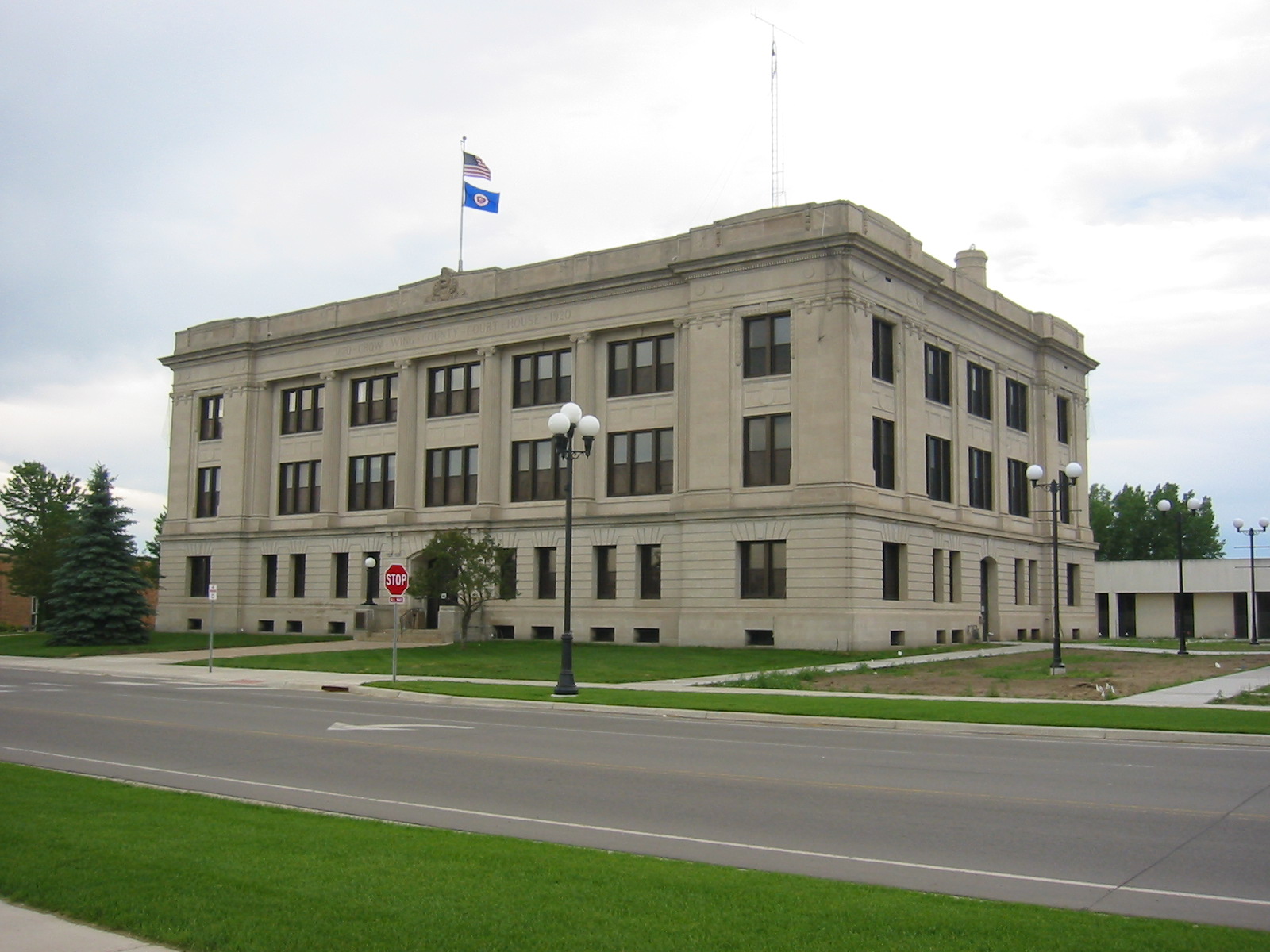

Historic Crow Wing County courthouse
| Cities | Townships | Unorganized | Ghost town | |
|---|---|---|---|---|
|
|
|
|
|
See also
- National Register of Historic Places listings in Crow Wing County, Minnesota
References
- ^ http://www.house.leg.state.mn.us/hinfo/govseries/No32.htm
- ^ "2010 Census Redistricting Data (Public Law 94-171) Summary File". American FactFinder. United States Census Bureau. http://factfinder2.census.gov/faces/tableservices/jsf/pages/productview.xhtml?pid=DEC_10_PL_GCTPL2.ST05&prodType=table. Retrieved 25 April 2011.
- ^ "Find a County". National Association of Counties. http://www.naco.org/Counties/Pages/FindACounty.aspx. Retrieved 2011-06-07.
- ^ "Census 2000 U.S. Gazetteer Files: Counties". United States Census. http://www.census.gov/tiger/tms/gazetteer/county2k.txt. Retrieved 2011-02-13.
- ^ "American FactFinder". United States Census Bureau. http://factfinder.census.gov. Retrieved 2008-01-31.
External links

|
Cass County | Cass County | Aitkin County |
|
 Crow Wing County, Minnesota | ||||
| Morrison County | Mille Lacs County |
| ||||||||||||||||||||||||||

| This page uses content from the English language Wikipedia. The original content was at Crow Wing County, Minnesota. The list of authors can be seen in the page history. As with this Familypedia wiki, the content of Wikipedia is available under the Creative Commons License. |