| ||||||||||||||
| Douglas County, Wisconsin | |
 Location in the state of Wisconsin | |
 Wisconsin's location in the U.S. | |
| Founded | February 8, 1854 |
|---|---|
| Seat | Superior |
| Area - Total - Land - Water |
1,480 sq mi (3,833 km²) 1,309 sq mi (3,391 km²) 171 sq mi (442 km²), 11.54% |
| Population - (2000) - Density |
43,287 33.07/sq mi (12.77/km²) |
| Time zone | Central: UTC-6/-5 |
| Website | www.douglascountywi.org |
Douglas County is a county located at the north-west corner of the U.S. state of Wisconsin. As of 2000, the population was 43,287. Its county seat is Superior.[1]
A portion of the Fond du Lac Indian Reservation is in the county.
History
Douglas County, named after Illinois Senator Stephen A. Douglas, was established on February 8, 1854, from the larger La Pointe County, Wisconsin, and the City of Superoir was immediately selected as the county seat.[2]
In Wisconsin's 1952 U.S. Senate primary, Douglas County was one of two counties (out of 71 in the state at the time) that Sen. Joe McCarthy did not carry.[3]
Geography
According to the U.S. Census Bureau, the county has a total area of 1,480 square miles (3,833.2 km2), of which 1,309 square miles (3,390.3 km2) is land and 171 square miles (442.9 km2) (11.54%) is water.
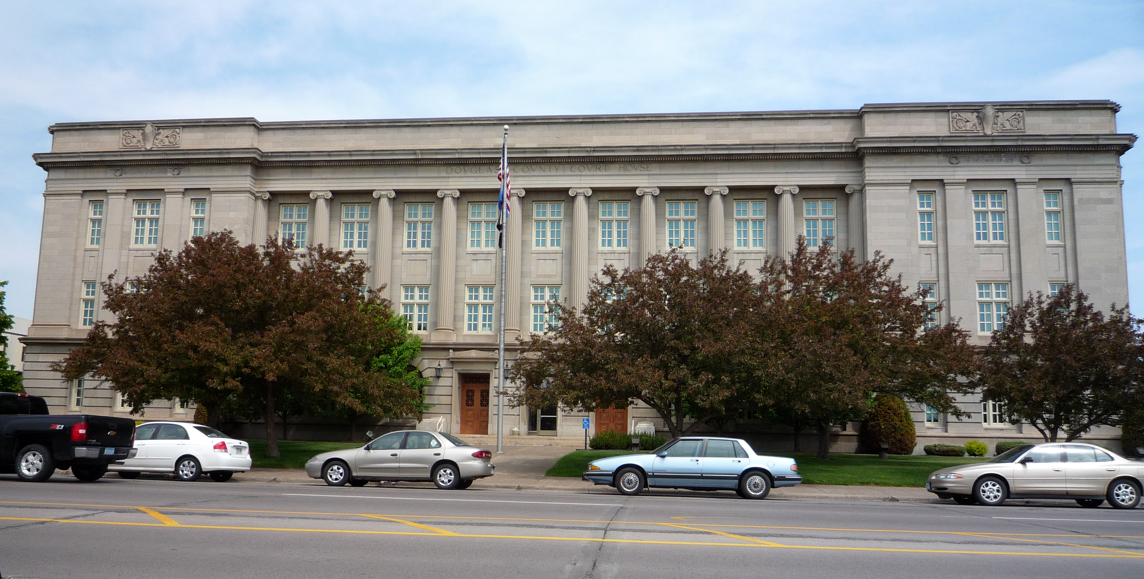
Douglas County Courthouse in Superior
Adjacent counties
- Bayfield County – east
- Sawyer County – southeast
- Washburn County – south
- Burnett County – southwest
- Pine County, Minnesota – southwest
- Carlton County, Minnesota – west
- St. Louis County, Minnesota – northwest
Major highways
|
|
National protected area
- Saint Croix National Scenic Riverway (part)
Demographics

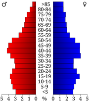
2000 Census Age Pyramid for Douglas County.
| Historical populations | |||
|---|---|---|---|
| Census | Pop. | %± | |
| 1900 | 36,335 | ||
| 1910 | 47,422 | 30.5% | |
| 1920 | 49,771 | 5.0% | |
| 1930 | 46,583 | −6.4% | |
| 1940 | 47,119 | 1.2% | |
| 1950 | 46,715 | −0.9% | |
| 1960 | 45,008 | −3.7% | |
| 1970 | 44,657 | −0.8% | |
| 1980 | 44,421 | −0.5% | |
| 1990 | 41,758 | −6.0% | |
| 2000 | 43,287 | 3.7% | |
| 2010 | 44,159 | 2.0% | |
| WI Counties 1900-1990 | |||
As of the census[4] of 2000, there were 43,287 people, 17,808 households, and 11,272 families residing in the county. The population density was 33 people per square mile (13/km²). There were 20,356 housing units at an average density of 16 per square mile (6/km²). The racial makeup of the county was 95.35% White, 0.57% Black or African American, 1.82% Native American, 0.63% Asian, 0.03% Pacific Islander, 0.20% from other races, and 1.41% from two or more races. 0.73% of the population were Hispanic or Latino of any race. 17.8% had German, 13.5% Norwegian, 11.5% Swedish, 8.5% Irish, 8.2% Finnish, 6.8% Polish and 5.1% United States or American ancestry. 96.7% spoke English and 1.2% Spanish as their first language.
There were 17,808 households out of which 29.20% had children under the age of 18 living with them, 49.10% were married couples living together, 10.10% had a female householder with no husband present, and 36.70% were non-families. 29.80% of all households were made up of individuals and 12.00% had someone living alone who was 65 years of age or older. The average household size was 2.36 and the average family size was 2.93.
In the county, the population was spread out with 23.60% under the age of 18, 10.30% from 18 to 24, 28.00% from 25 to 44, 23.60% from 45 to 64, and 14.50% who were 65 years of age or older. The median age was 38 years. For every 100 females there were 97.20 males. For every 100 females age 18 and over, there were 94.40 males.
Cities, villages, and towns
| Cities and Villages | Towns | Unincorporated Communities | Ghost Towns | ||
|---|---|---|---|---|---|
|
|
|
|
|
|
† Annexed by the City of Superior
See also
- National Register of Historic Places listings in Douglas County, Wisconsin
Notes
- ^ "Find a County". National Association of Counties. http://www.naco.org/Counties/Pages/FindACounty.aspx. Retrieved 2011-06-07.
- ^ Douglas County: County History
- ^ "The Wisconsin Primary," Time, 22 September 1952
- ^ "American FactFinder". United States Census Bureau. http://factfinder.census.gov. Retrieved 2008-01-31.
External links
- Douglas County website
- Superior–Douglas County Convention and Visitors Bureau
- Superior–Douglas County Chamber of Commerce
- Map of Douglas County, Wisconsin Department of Transportation

|
St. Louis County, Minnesota | Lake Superior | Lake County, Minnesota |
|
| Carlton County, Minnesota | Bayfield County | |||
 Douglas County, Wisconsin | ||||
| Pine County, Minnesota and Burnett County | Washburn County | Sawyer County |
| ||||||||||||||||||||||


| |||||||||||||||||||||||

| This page uses content from the English language Wikipedia. The original content was at Douglas County, Wisconsin. The list of authors can be seen in the page history. As with this Familypedia wiki, the content of Wikipedia is available under the Creative Commons License. |