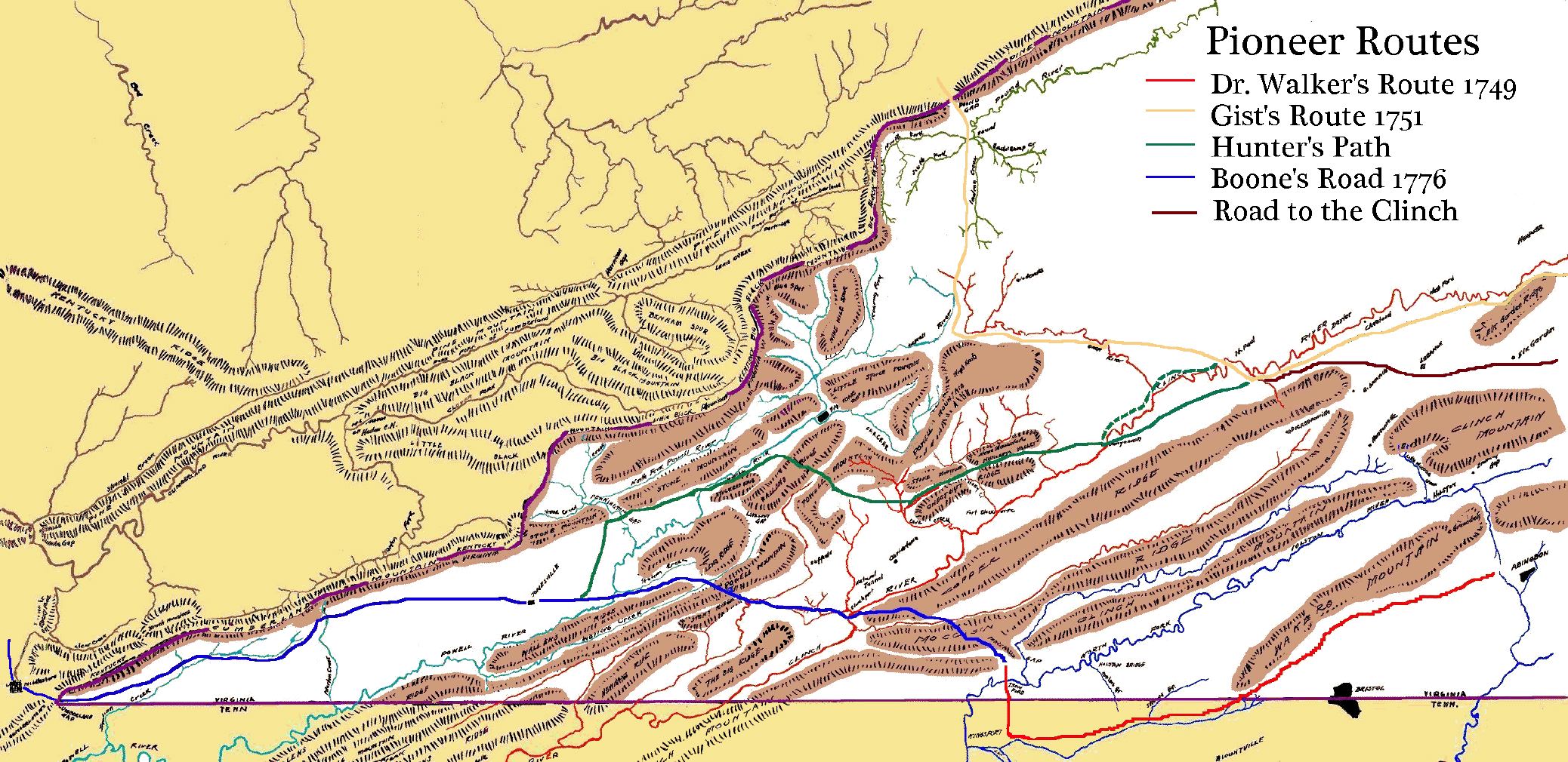
Formal settlement of Southwest Virginia began in 1769, following the signing of the Treaty of Hard Labor the previous year. Until then settlment in the area had been prohibited under the King's Proclamation of 1763. Nonetheless, exploration of the area did take (as well as some settlement) prior to that date. The principal exloration routes are shown on the accompanying map based on Summers, 1929. Routes shown include
- Dr. Thomas Walker's Route of 1749 leading from the Virginia Highlands
- Christopher Gists Route of 1751
- The Hunters Path used by Long Hunters through out the period
- Boone's Road of 1775 aka The Wilderness Road
- Road to the Clinch c1774 latter known as "The Kentucky Road" or "The Kentucky Trace"
Boone's Road of 1775 is included in this list because of its historical importance. Even though it post-dates the opening it became arguably the most significant migration route for settlers seeking lands in Kentucky. Boone's Road extended from Mocassin Gap in the east to the Cumberland Gap and beyond in the west. The exact route utilized portions of The Hunters Path and Dr. Thomas Walker's Route of 1749. Some of the routes shown by Summers are problematical. For example, he shows the Hunters path Crossing the Clinch near modern Castleswood and St. Paul. However, the ford at Dungannon was known as "Hunter's Ford", and from an early date a route extended from there to Castle's Woods. It seems likely that The Hunters Path crossed the Clinch River at Hunter's Ford. Summers version of the route between Castles Wood and Dungannon is shown as a "dashed green" line. The solid green line shows the version of the route following the southside of the Clinch River. Additional work on these early routes, to confirm this and other points, is needed for this article.
Early Exploration and settlement routes in South West Virginia