| ||||||||||||||
| East Champaran district पूर्वी चंपारण ज़िला |
|
|---|---|
| — District of Bihar — | |
 |
|
| Country | India |
| State | Bihar |
| Administrative division | Tirhut |
| Established | |
| Headquarters | Motihari |
| Government | |
| • Lok Sabha constituencies | Purvi Champaran, Paschim Champaran, Sheohar |
| • Assembly seats | Raxaul, Sugauli, Narkatiya, Harsidhi, Govindganj, Kesaria, Kalyanpur, Pipra, Madhuban, Motihari, Chiraia, Dhaka |
| Area | |
| • Total | 3,968 km2 (1,532 sq mi) |
| Population (2001) | |
| • Total | 3,933,636 |
| • Density | 990/km2 (2,600/sq mi) |
| • Urban | 251,086 |
| Demographics | |
| • Literacy | 38.14 per cent[1] |
| • Sex ratio | |
| Major highways | NH 28A, NH 104 |
| Average annual precipitation | 1241 mm |
| Website | Official website |
East Champaran (Hindi: पूर्वी चंपारण ज़िला, Urdu: مشرقی چمپارن ضلع Mašriqī Čaṃpāraṇ Zilā) is an administrative district in the state of Bihar in India. The district headquarters are located at Motihari.
The district occupies an area of 3969 km2 and has a population of 3,933,636 (as of 2001). East Champaran is a part of Tirhut Division. It is currently a part of the Red Corridor.[2]
As of 2011 it is the second most populous district of Bihar (out of 39), after Patna.[3]
Geography[]
East Champaran occupies an area of 3,968 square kilometres (1,532 sq mi),[4] comparatively equivalent to Vanuatu's Espiritu Santo.[5]
Demographics[]
According to the 2011 census East Champaran has a population of 5,082,868 ,[6] roughly equal to the United Arab Emirates[7] or the US state of Colorado.[8] This gives it a ranking of 21st in India (out of a total of 640).[6] The district has a population density of 1,281 inhabitants per square kilometre (3,320 /sq mi) .[6] Its population growth rate over the decade 2001-2011 was 29.01 %.[6] Purbi Champaran has a sex ratio of 901 females for every 1000 males,[6] and a literacy rate of 58.26 %.[6]
Languages[]
Languages include Bhojpuri, a tongue in the Bihari language group with almost 40 000 000 speakers, written in both the Devanagari and Kaithi scripts.[9]
Culture[]
Tourism[]
Mehsi is an entry point of East Champaran if you are travelling from Patna, Muzaffarpur to Raxaul, connected both by railway and roadway. This small community has a number of places of interest at the east side of railway station, Gaighat village is famous for very good agriculture area and here has also a connecting road is Harshidhi and bypass of Bettiah. Gaighat is situated at 15 km west from district headquarters (Motihati). You may found Mr. Arvind Kumar home in this village (Punjabi dera). These include Mirza Halim Shah mosque, Dargah, a very old library 'Nagrik Pustakalaya', an old High School (Tirhut Vidyalaya) of the English period, orchards of lichi and mangoes and other places of interest. There are many button factories, a small scale industry, although most of the people depend upon agriculture and commerce. Mehsi was the birthplace of the writer and intellectual, Rajkamal Chaudhary. The last sentence about the birth place of Rajkamal Chaudhary is not at Mehsi of District East Champaran, but it is at Saharsa district of Bihar.
The mazar of Hazrat Maulana Mohammad Abdul Aziz is in the Kodaria village, Post: Kodaria, via Phenhara. He is a very powerful saint of Awaisiya silsila. His Urs is celebrated every year on 11th and 12th Fasli Vaishakha (according to the Hindu calendar).
On the evening of 11th Fasli Vaishakha, there is a Miladun Nabi after the Magrib nimaz, then Salat-o-Salam and dua. On the 12th Fasli Vaishakha at 10:30 am, the chaders are taken from his room, where he died, to his Mazar Sharief. Then there is Chader Poshi and Milad-e-Nabi. After Milad there happens Salat-o-salam and dua. After dua, a lunch for all the devotees.
Phenhara is a small town in this district. It has a very old middle school, which was established before 1930. Mahatma Gandhi once visited this place. Phenhara provides an example of Hindu and Muslim unity. Phenhara is a well educated and politically aware town. This town has a sangam of Middle School, H F High School and Madrasa Islamia. Kesariya is in the south eastern portion of the district. It is the location of the Kesariya Stupa, locally known as Deura, one of oldest stupas. Dhaka is one of the towns in the district. Siraunais a village of East Champaran. Kasturba Gandhi once visited here to teach the people the basic educational concepts of Mahatma Gandhi. Of late, through reservation of seats in politics, Women of Phenhara have come forward to join hands in the development of the block. In this concern, Dr Anita Sah, the Zila Parshad of Phenhara, has been actively involved in various developmental activities and progress of all sections. She is one of the most popular leader in Phenhara Block and won the election with great majority.
Raxaul is a major town in the district of East Champaran. It is the border town of India with Nepal. This town is known as the Gate way to Nepal. It is connected by NH28A and is 32 km away from Chhapawa (on NH28A), 52 km from Motihari (the District Town) and 60 km from Bettiah - the District town of West Champaran. Now this town has been made the Sub-divisional town under the District of East Chaparan. Manjur Alam the famous advocate of Madras High Court, who studied at Eton College England is from Raxaul town. Birganj - the Second Big City of Nepal is just 3 km away from this town.
Adapur is a famous town with Police Station, Block, Prakhand and Railway Station of same name. It is located on the northern tip of East Champaran district bordering Nepal and is situated at a distance of 13 km by rail from Raxaul.
Lauria Nandangarh is a popular historical place, the site of a great Ashokan pillar. It has a reputation as the place of the world's first democracy, which we know as Luchhawi Ganrajay.[10]
Jihuli Most popular Bhumihar community village in North Bihar.
Notable personalities[]
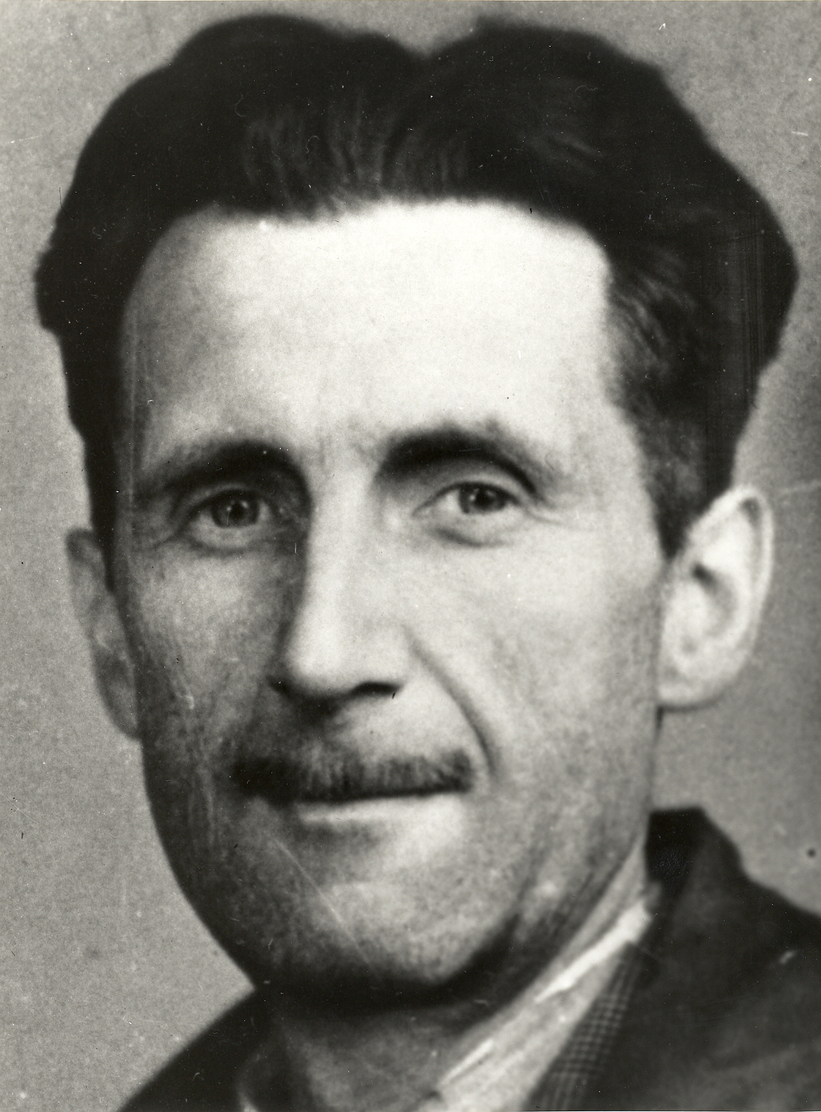
George Orwell, a great writer was also born in the district headquarter, in 1903
See also[]
- Raxaul
- Motihari
- George Orwell
- Districts of Bihar
References[]
- ^ "District-specific Literates and Literacy Rates, 2001". Registrar General, India, Ministry of Home Affairs. http://www.educationforallinindia.com/page157.html. Retrieved 2010-10-05.
- ^ "83 districts under the Security Related Expenditure Scheme". IntelliBriefs. 2009-12-11. http://intellibriefs.blogspot.com/2009/12/naxal-menace-83-districts-under.html. Retrieved 2011-09-17.
- ^ "District Census 2011". Census2011.co.in. 2011. http://www.census2011.co.in/district.php. Retrieved 2011-09-30.
- ^ Srivastava, Dayawanti et al. (ed.) (2010). "States and Union Territories: Bihar: Government". India 2010: A Reference Annual (54th ed.). New Delhi, India: Additional Director General, Publications Division, Ministry of Information and Broadcasting (India), Government of India. pp. 1118-1119. ISBN 978-81-230-1617-7.
- ^ "Island Directory Tables: Islands by Land Area". United Nations Environment Program. 1998-02-18. http://islands.unep.ch/Tiarea.htm. Retrieved 2011-10-11. "Espiritu Santo 3,956km2"
- ^ a b c d e f "District Census 2011". Census2011.co.in. 2011. http://www.census2011.co.in/district.php. Retrieved 2011-09-30.
- ^ US Directorate of Intelligence. "Country Comparison:Population". https://www.cia.gov/library/publications/the-world-factbook/rankorder/2119rank.html. Retrieved 2011-10-01. "United Arab Emirates 5,148,664"
- ^ "2010 Resident Population Data". U. S. Census Bureau. http://2010.census.gov/2010census/data/apportionment-pop-text.php. Retrieved 2011-09-30. "Colorado 5,029,196"
- ^ M. Paul Lewis, ed (2009). "Bhojpuri: A language of India". Ethnologue: Languages of the World (16th edition ed.). Dallas, Texas: SIL International. http://www.ethnologue.com/show_language.asp?code=bho. Retrieved 2011-09-30.
- ^ NGO in Motihari "KHWAB FOUNDATION"
External links[]

|
West Champaran district | Nepal |
| |
| Gopalganj district | Sitamarhi district | |||
 East Champaran district | ||||
| Saran district | Muzaffarpur district | Sheohar district |
| Bhagalpur: Banka | Bhagalpur |
| Darbhanga: Begusarai | Darbhanga | Madhubani | Samastipur |
| Kosi: Madhepura | Saharsa | Supaul |
| Magadh: Arwal | Aurangabad | Gaya | Jehanabad | Nawada |
| Munger: Jamui | Khagaria | Munger | Lakhisarai | Sheikhpura |
| Patna: Bhojpur | Buxar | Kaimur | Patna | Rohtas | Nalanda |
| Purnia: Araria | Katihar | Kishanganj | Purnia |
| Saran: Gopalganj | Saran | Siwan |
| Tirhut: East Champaran | Muzaffarpur | Sheohar | Sitamarhi | Vaishali | West Champaran |
Template:Tirhut Division Template:Tirhut Division topics
| This page uses content from the English language Wikipedia. The original content was at East Champaran. The list of authors can be seen in the page history. As with this Familypedia wiki, the content of Wikipedia is available under the Creative Commons License. |