| Sturt New South Wales | |||||||||||||
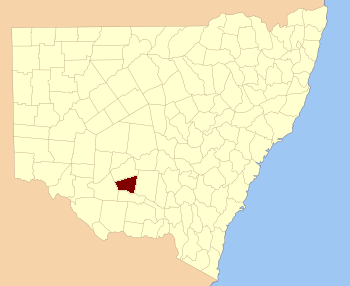 Location in New South Wales | |||||||||||||
| |||||||||||||

The Carathool Bridge over the Murrumbidgee between Sturt and Boyd
Sturt County is one of the 141 Cadastral divisions of New South Wales. It contains the locality of Carrathool. The Murrumbidgee River is the southern boundary.
Sturt County was named in honour of the explorer, soldier and public servant Charles Sturt (1795-1869).[1]
Parishes within this county[]
A full list of parishes found within this county; their current LGA and mapping coordinates to the approximate centre of each location is as follows:
| Parish | LGA | Coordinates |
|---|---|---|
| Alleyne | Carrathool Shire Council | |
| Baillie | City of Griffith | |
| Ballingall | City of Griffith | |
| Beabula | Hay Shire Council | |
| Bendigo | City of Griffith | |
| Benerembah | Carrathool Shire Council | |
| Bringagee | Carrathool Shire Council | |
| Buckley | Carrathool Shire Council | |
| Cajaldura | Carrathool Shire Council | |
| Carrathool | Carrathool Shire Council | |
| Carrego | Carrathool Shire Council | |
| Cockburn | Carrathool Shire Council | |
| Denny | Carrathool Shire Council | |
| Djallah | City of Griffith | |
| Downey | Hay Shire Council | |
| Ercildoune | Carrathool Shire Council | |
| Hervey | Carrathool Shire Council | |
| Houlong | Carrathool Shire Council | |
| Hyde Park | Carrathool Shire Council | |
| Kooba | Carrathool Shire Council | |
| Kooroongal | Carrathool Shire Council | |
| Learmonth | City of Griffith | |
| Lethington | Carrathool Shire Council | |
| Livingstone | Carrathool Shire Council | |
| Maiden | Carrathool Shire Council | |
| Mair | Carrathool Shire Council | |
| Mills | Carrathool Shire Council | |
| Mirrool | City of Griffith | |
| Munro | Carrathool Shire Council | |
| North Bringagee | City of Griffith | |
| North Uardry | Carrathool Shire Council | |
| O'Brien | City of Griffith | |
| Quambatook | Carrathool Shire Council | |
| Tabbita | Carrathool Shire Council | |
| Tabbita | Carrathool Shire Council | |
| Terrapee | Carrathool Shire Council | |
| Toms Point | Carrathool Shire Council | |
| Uardry | Carrathool Shire Council | |
| Warburn | City of Griffith | |
| Wiveon | Carrathool Shire Council | |
| Wowong | Carrathool Shire Council | |
| Wycheproof | Carrathool Shire Council | |
| Yannaway | Carrathool Shire Council |
References[]
| This page uses content from the English language Wikipedia. The original content was at Sturt County. The list of authors can be seen in the page history. As with this Familypedia wiki, the content of Wikipedia is available under the Creative Commons License. |