| ||||||||||||||
| Ellis County, Texas | |
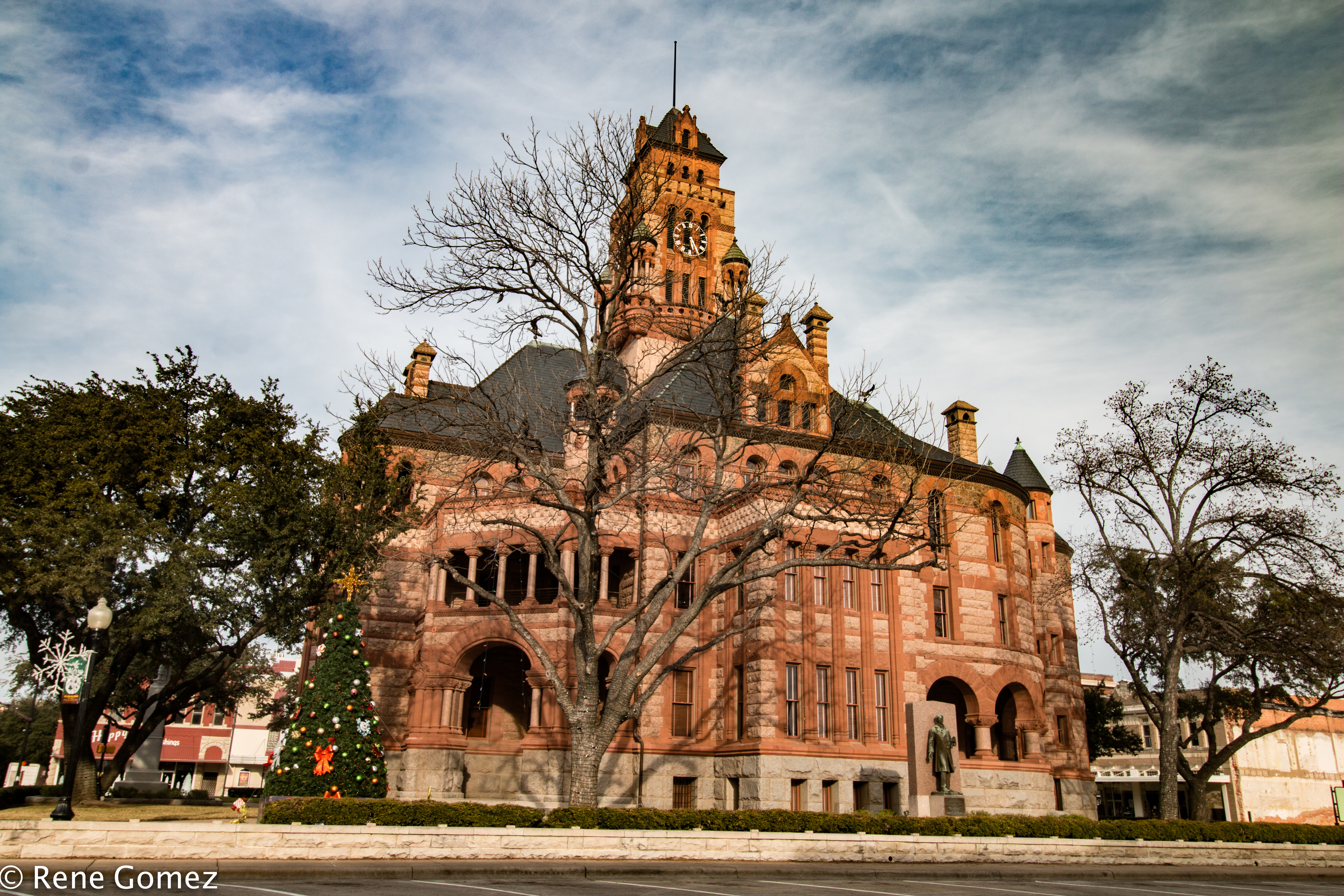 The Ellis County Courthouse in Waxahachie
| |
 Location in the state of Texas | |
 Texas's location in the U.S. | |
| Founded | 1850 |
|---|---|
| Named for | Richard Ellis |
| Seat | Waxahachie |
| Largest city | Waxahachie |
| Area - Total - Land - Water |
952 sq mi (2,466 km²) 936 sq mi (2,424 km²) 16 sq mi (41 km²), 1.7% |
| Population - (2020) - Density |
192,455 191/sq mi (74/km²) |
| Congressional district | 6th |
| Time zone | Central: UTC-6/-5 |
| Website | https://www.co.ellis.tx.us |


Across from the courthouse is the Ellis County Museum.
Ellis County is a county located in the U.S. state of Texas. As of the 2020 census, its population was 192,455. The county seat is Waxahachie.[1] The county was founded in 1849 and organized the next year.[2] It is named for Richard Ellis,[3] president of the convention that produced the Texas Declaration of Independence.
Ellis County is included in the Dallas–Fort Worth–Arlington metropolitan statistical area.
Geography[]
According to the U.S. Census Bureau, the county has a total area of 952 square miles (2,470 km2), of which 935 square miles (2,420 km2) are land and 16 square miles (41 km2) (1.7%) are covered by water.[4]
Major highways[]
 Interstate 35E
- Interstate 45
- U.S. Route 67
- U.S. 77
- U.S. 287
- State Highway 34
- State Highway 342
Adjacent counties[]
- Dallas County (north)
- Kaufman County (northeast)
- Henderson County (east)
- Navarro County (southeast)
- Hill County (southwest)
- Johnson County (west)
- Tarrant County (northwest)
Demographics[]
| Historical populations | |||
|---|---|---|---|
| Census | Pop. | %± | |
| 1850 | 989 | ||
| 1860 | 5,246 | 430.4% | |
| 1870 | 7,514 | 43.2% | |
| 1880 | 21,294 | 183.4% | |
| 1890 | 31,774 | 49.2% | |
| 1900 | 50,059 | 57.5% | |
| 1910 | 53,629 | 7.1% | |
| 1920 | 55,700 | 3.9% | |
| 1930 | 53,936 | −3.2% | |
| 1940 | 47,733 | −11.5% | |
| 1950 | 45,645 | −4.4% | |
| 1960 | 43,395 | −4.9% | |
| 1970 | 46,638 | 7.5% | |
| 1980 | 59,743 | 28.1% | |
| 1990 | 85,167 | 42.6% | |
| 2000 | 111,360 | 30.8% | |
| 2010 | 149,610 | 34.3% | |
| U.S. Decennial Census[5] 1850–2010[6] 2010–2020[7] | |||
As of the census[8] of 2000, 111,360 people, 37,020 households, and 29,653 families resided in the county. The population density was 118 people per square mile (46/km2). The 39,071 housing units averaged 42 per square mile (16/km2). The racial makeup of the county was 80.63% White, 8.64% African American, 0.59% Native American, 0.35% Asian, 7.92% from other races, and 1.86% from two or more races. About 18.42% of the population was Hispanic or Latinos of any race.
Of the 37,020 households, 42.10% had children under the age of 18 living with them, 64.80% were married couples living together, 11.00% had a female householder with no husband present, and 19.90% were not families. About 16.60% of all households were made up of individuals, and 6.50% had someone living alone who was 65 years of age or older. The average household size was 2.96 and the average family size was 3.31.
A Williams Institute analysis of 2010 census data found about 3.2 same-sex couples per 1,000 households were in the county.[9]
In the county, the age distribution was 30.20% under the age of 18, 9.30% from 18 to 24, 29.80% from 25 to 44, 21.50% from 45 to 64, and 9.20% who were 65 years of age or older. The median age was 33 years. For every 100 females, there were 98.30 males. For every 100 females age 18 and over, there were 95.40 males.
The median income for a household in the county was $50,350, and for a family was $55,358. Males had a median income of $37,613 versus $26,612 for females. The per capita income for the county was $20,212. About 6.80% of families and 8.60% of the population were below the poverty line, including 11.10% of those under age 18 and 10.40% of those age 65 or over.
Politics[]
Ellis is a staunchly Republican county in presidential elections. The last Democratic presidential candidate to carry the county was Jimmy Carter in 1976, and since 2000, Republican presidential candidates have won with more than 66% of the vote.
| Year | Republican | Democratic | Third party | |||
|---|---|---|---|---|---|---|
| No. | % | No. | % | No. | % | |
| 2020 | 56,717 | 66.19% | 27,565 | 32.17% | 1,406 | 1.64% |
| 2016 | 44,941 | 70.10% | 16,253 | 25.35% | 2,916 | 4.55% |
| 2012 | 39,574 | 72.94% | 13,881 | 25.59% | 799 | 1.47% |
| 2008 | 38,078 | 70.71% | 15,333 | 28.47% | 442 | 0.82% |
| 2004 | 34,602 | 74.50% | 11,640 | 25.06% | 202 | 0.43% |
| 2000 | 26,091 | 69.94% | 10,629 | 28.49% | 587 | 1.57% |
| 1996 | 16,046 | 53.91% | 10,832 | 36.39% | 2,888 | 9.70% |
| 1992 | 13,564 | 40.50% | 9,537 | 28.47% | 10,394 | 31.03% |
| 1988 | 16,422 | 59.18% | 11,169 | 40.25% | 158 | 0.57% |
| 1984 | 16,873 | 67.56% | 8,029 | 32.15% | 72 | 0.29% |
| 1980 | 10,046 | 51.31% | 9,219 | 47.08% | 315 | 1.61% |
| 1976 | 6,996 | 41.02% | 9,991 | 58.58% | 68 | 0.40% |
| 1972 | 8,779 | 69.53% | 3,839 | 30.41% | 8 | 0.06% |
| 1968 | 3,794 | 31.44% | 5,431 | 45.01% | 2,842 | 23.55% |
| 1964 | 2,779 | 27.62% | 7,278 | 72.33% | 5 | 0.05% |
| 1960 | 3,666 | 38.42% | 5,841 | 61.21% | 36 | 0.38% |
| 1956 | 3,585 | 40.65% | 5,211 | 59.08% | 24 | 0.27% |
| 1952 | 4,183 | 39.91% | 6,275 | 59.86% | 24 | 0.23% |
| 1948 | 1,055 | 13.76% | 5,792 | 75.56% | 818 | 10.67% |
| 1944 | 666 | 8.02% | 7,065 | 85.08% | 573 | 6.90% |
| 1940 | 692 | 8.07% | 7,881 | 91.87% | 5 | 0.06% |
| 1936 | 319 | 5.34% | 5,644 | 94.46% | 12 | 0.20% |
| 1932 | 527 | 6.93% | 7,033 | 92.49% | 44 | 0.58% |
| 1928 | 3,569 | 44.72% | 4,399 | 55.12% | 13 | 0.16% |
| 1924 | 1,220 | 13.50% | 7,678 | 84.93% | 142 | 1.57% |
| 1920 | 819 | 13.98% | 4,081 | 69.68% | 957 | 16.34% |
| 1916 | 324 | 6.32% | 4,718 | 92.02% | 85 | 1.66% |
| 1912 | 293 | 7.42% | 3,483 | 88.24% | 171 | 4.33% |
Law enforcement[]
The Ellis County Sheriff's Office provides law enforcement services to the county. The current sheriff is Brad Norman. The agency also operates the Ellis County Jail in Waxahachie.[11]
Media[]
Ellis County is part of the Dallas/Fort Worth television media market in North Texas. Stations in the market are KDFW-TV, KXAS-TV, WFAA-TV, KTVT-TV, KERA-TV, KTXA-TV, KDFI-TV, KDAF-TV, KFWD-TV, and KDTX-TV.
The county is home to one local radio station KBEC 1390 AM and 99.1 FM. The station has been in continuous operation since 1955 and is the oldest Family owned radio station in Texas. A weekly newspaper, the Ellis County Press, is based in Ferris and published Thursdays. The Waxahachie Daily Light and Waxahachie Sun are published biweekly; other weekly newspapers are The Ennis News and Midlothian Mirror.
Communities[]


Bardwell Dam and Lake in Ellis County near the town of Ennis
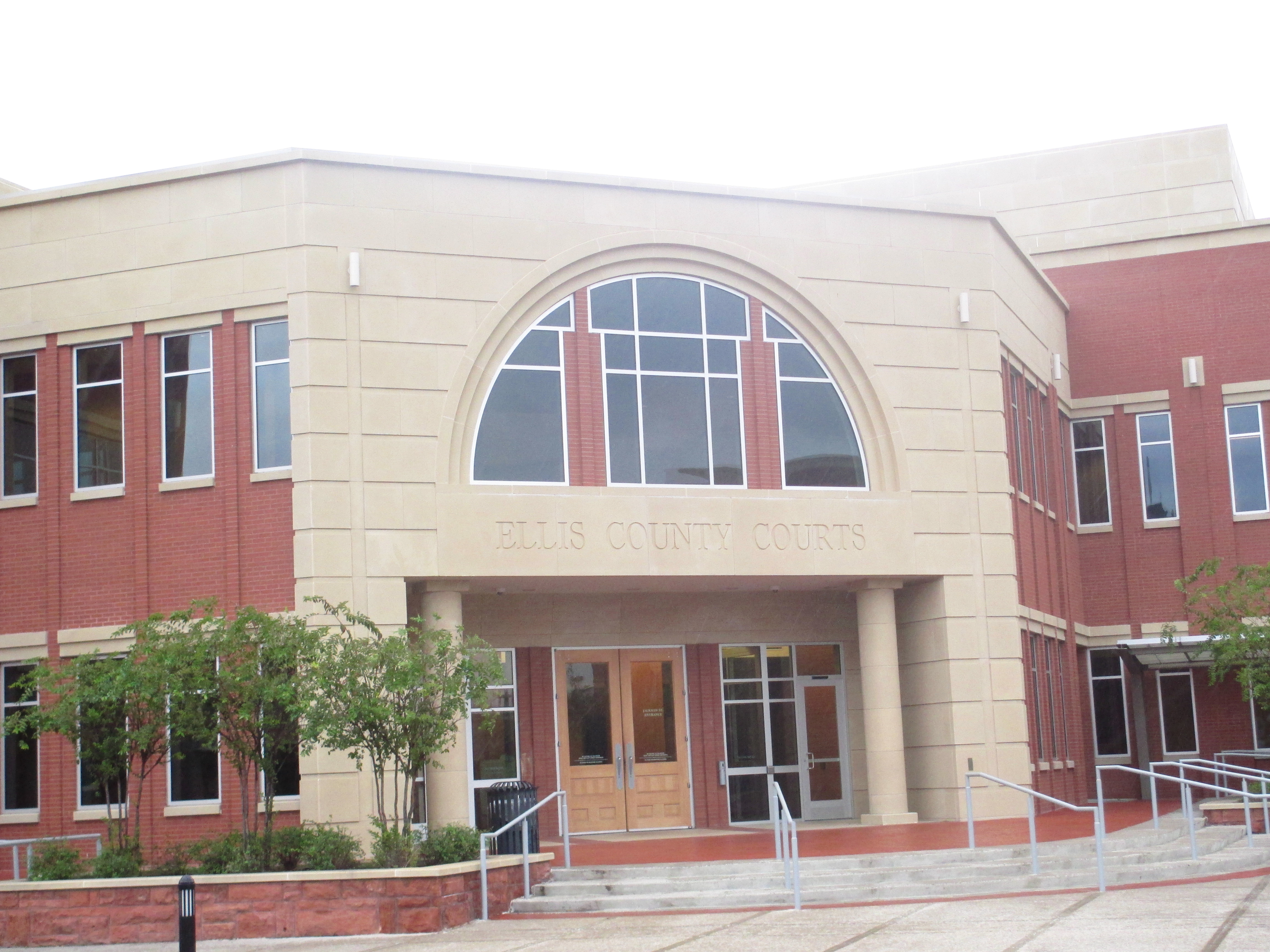
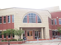
Ellis County Courts building
Cities (multiple counties)[]
- Cedar Hill (mostly in Dallas County)
- Ferris (small part in Dallas County)
- Glenn Heights (partly in Dallas County)
- Grand Prairie (mostly in Dallas and Tarrant Counties)
- Mansfield (mostly in Tarrant County and a small part in Johnson County)
- Ovilla (small part in Dallas County)
Cities[]
- Bardwell
- Ennis
- Maypearl
- Midlothian
- Oak Leaf
- Pecan Hill
- Red Oak
- Waxahachie (county seat)
Towns[]
- Alma
- Garrett
- Italy
- Milford
- Palmer
- Venus (mostly in Johnson County)
Census-designated place[]
- Bristol
Unincorporated communities[]
- Auburn
- Avalon
- Boz
- Crisp
- Forreston
- Ike
- India
- Nena
- Ozro
- Rankin
- Rockett
- Telico
- Trumbull
Notable people[]
- Clyde Barrow of Bonnie and Clyde
- J. D. Grey, clergyman, pastor of Tabernacle Baptist Church in Ennis, 1931–1934; later president of the Southern Baptist Convention
- Ernest Tubb, country singer and songwriter
- Donnie Fleeman professional light-heavyweight boxer, only Ellis County native to fight 3 world champion heavyweights; Sonny Liston, Ezzard Charles, and Muhammad Ali (formerly Cassius Clay). 47 national/international fights in his professional career. 37 wins, 22 KOs. Won State Heavyweight Title (Golden Gloves) in 1953 - contender for National Heavyweight Title, but lost to Sonny Liston. Cassius Clay (Muhammad Ali) was Fleeman's last professional fight, and took place in Miami, FL in 1961. This was Clay's 5th professional fight. [1]
- Lecil Travis Martin, known more commonly as Boxcar Willie, country singer and songwriter
See also[]
- List of museums in North Texas
- National Register of Historic Places listings in Ellis County, Texas
- Recorded Texas Historic Landmarks in Ellis County
References[]
- ^ "Find a County". National Association of Counties. http://www.naco.org/Counties/Pages/FindACounty.aspx.
- ^ "Texas: Individual County Chronologies". Texas Atlas of Historical County Boundaries. The Newberry Library. 2008. http://publications.newberry.org/ahcbp/documents/TX_Individual_County_Chronologies.htm.
- ^ Gannett, Henry (1905). The Origin of Certain Place Names in the United States. Govt. Print. Off.. pp. 117. https://archive.org/details/bub_gb_9V1IAAAAMAAJ.
- ^ "2010 Census Gazetteer Files". United States Census Bureau. August 22, 2012. http://www2.census.gov/geo/docs/maps-data/data/gazetteer/counties_list_48.txt.
- ^ "U.S. Decennial Census". United States Census Bureau. https://www.census.gov/programs-surveys/decennial-census.html.
- ^ "Texas Almanac: Population History of Counties from 1850–2010". Texas Almanac. http://texasalmanac.com/sites/default/files/images/topics/ctypophistweb2010.pdf.
- ^ Cite error: Invalid
<ref>tag; no text was provided for refs namedQF - ^ "U.S. Census website". United States Census Bureau. https://www.census.gov.
- ^ Leonhardt, David; Quealy, Kevin (June 26, 2015), "Where Same-Sex Couples Live", The New York Times, https://www.nytimes.com/2015/06/27/upshot/supreme-court-gay-marriage-ruling-where-same-sex-couples-live.html?_r=0&abt=0002&abg=0, retrieved July 6, 2015
- ^ Leip, David. "Dave Leip's Atlas of U.S. Presidential Elections". http://uselectionatlas.org/RESULTS.
- ^ "Home". https://www.elliscountysheriff.com/ecso/.
External links[]
- Ellis County government's website
- Ellis County Government Official Twitter
- Ellis County Government Official Facebook
- Ellis County from the Handbook of Texas Online
- Memorial and biographical history of Ellis county, Texas ..., published 1892, hosted by the Portal to Texas History
- The Texas spirit of '17: a pictorial and biographical record of the gallant and courageous men from Ellis County who served in the Great War, hosted by the Portal to Texas History

|
Tarrant County | Dallas County |
| |
| Johnson County | Kaufman County | |||
 Ellis County, Texas | ||||
| Hill County | Navarro County | Henderson County |
 |
|
| Counties | Collin | Dallas | Denton | Ellis | Henderson | Hunt | Johnson | Kaufman | Parker | Rockwall | Tarrant | Wise |
| over 500 | Dallas† | Fort Worth† |
| 200 - 500 | Arlington | Garland | Irving | Plano |
| 100 - 200 | Carrollton | Denton† | Grand Prairie | McKinney† | Mesquite |
| 50 - 100 | Allen | Euless | Flower Mound | Frisco | Lewisville | Mansfield | North Richland Hills | Richardson |
| 10 - 50 | Addison | Athens† | Azle | Balch Springs | Bedford | Benbrook | Burleson | Cedar Hill | Cleburne† | Colleyville | Coppell | Corinth | DeSoto | Duncanville | Ennis | Farmers Branch | Forest Hill | Grapevine | Greenville† | Haltom City | Highland Village | Hurst | Keller | Lancaster | Little Elm | Rockwall† | Rowlett | Sachse | Saginaw | Seagoville | Southlake | Terrell | The Colony | University Park | Watauga | Waxahachie† | Weatherford† | White Settlement | Wylie |
| under 10 | Argyle | Blue Mound | Cockrell Hill | Combine | Crowley | Dalworthington Gardens | Decatur† | Edgecliff Village | Everman | Glenn Heights | Highland Park | Hutchins | Kaufman† | Kennedale | Lake Worth | Lakeside | Newark | Ovilla | Pantego | Pelican Bay | Richland Hills | River Oaks | Sansom Park | Sunnyvale | Westover Hills | Westworth Village | Willow Park | Wilmer |
| ↑ thousands of people† - County Seat. A full list of cities under 10,000 is available here. | |
| ||||||||||||||||||||

| |||||||||||||||||||||||

|
| This page uses content from the English language Wikipedia. The original content was at Ellis County, Texas. The list of authors can be seen in the page history. As with this Familypedia wiki, the content of Wikipedia is available under the Creative Commons License. |