| ||||||||||||||
Galveston County Courts Building
| Galveston County, Texas | ||
| ||
 Location in the state of Texas | ||
 Texas's location in the U.S. | ||
| Founded | 1838 | |
|---|---|---|
| Seat | Galveston | |
| Area - Total - Land - Water |
873 sq mi (2,261 km²) 398 sq mi (1,031 km²) 474 sq mi (1,228 km²), 54.35% | |
| Population - (2020) - Density |
350,682 627/sq mi (242/km²) | |
| Website | www.co.galveston.tx.us | |

Galveston County is a county located in the U.S. state of Texas within the Houston–Sugar Land–Baytown metropolitan area. As of the 2020 census, the population is 350,682. Its county seat is Galveston6. League City is the largest city in Galveston County in terms of population [1]; between 2000 and 2005 it surpassed Galveston as the county's largest city.
Geography[]
Galveston County is located on the plains of the Texas Gulf Coast in the southeastern part of the state. The county is bounded on the northeast by Galveston Bay and on the northwest by Clear Creek and Clear Lake. Much of the county covers Galveston Bay, and is bounded to the south by the Galveston Seawall and beaches on the Gulf of Mexico.
According to the U.S. Census Bureau, the county has a total area of 2,261 km² (873 sq mi). 1,032 km² (398 sq mi) of it is land and 1,229 km² (474 sq mi) of it (54.35%) is water.
Major Highways[]
Adjacent counties[]
- Harris County (north)
- Chambers County (northeast)
- Brazoria County (west)
Demographics[]
As of the census² of 2000, there were 250,158 people, 94,782 households, and 66,157 families residing in the county. The population density was 242/km² (628/sq mi). There were 111,733 housing units at an average density of 108/km² (280/sq mi). The racial makeup of the county was 72.69% White, 15.44% Black or African American, 0.47% Native American, 2.10% Asian, 0.04% Pacific Islander, 7.18% from other races, and 2.08% from two or more races. 17.96% of the population were Hispanic or Latino of any race.
There were 94,782 households out of which 33.80% had children under the age of 18 living with them, 52.40% were married couples living together, 13.10% had a female householder with no husband present, and 30.20% were non-families. 25.10% of all households were made up of individuals and 8.10% had someone living alone who was 65 years of age or older. The average household size was 2.60 and the average family size was 3.12.
In the county, the population was spread out with 26.70% under the age of 18, 8.70% from 18 to 24, 30.20% from 25 to 44, 23.30% from 45 to 64, and 11.10% who were 65 years of age or older. The median age was 36 years. For every 100 females there were 95.90 males. For every 100 females age 18 and over, there were 93.10 males.
The median income for a household in the county was $42,419, and the median income for a family was $51,435. Males had a median income of $41,406 versus $28,703 for females. The per capita income for the county was $21,568. About 10.10% of families and 13.20% of the population were below the poverty line, including 17.60% of those under age 18 and 10.20% of those age 65 or over.
Politics[]
United States Congress[]
| U.S. Senators | Name | Party | First Elected | Level | |
|---|---|---|---|---|---|
| Senate Class 2 | John Cornyn | Republican | 2002 | Senior Senator | |
| Senate Class 1 | Ted Cruz | Republican | 2012 | Junior Senator | |
| U.S. Representatives | Name | Party | First Elected | ||
| District 14 | Randy Weber | Republican | 2012 | ||
| Year | Republican | Democratic | Third party | |||
|---|---|---|---|---|---|---|
| No. | % | No. | % | No. | % | |
| 2020 | 93,911 | 60.56% | 58,842 | 37.95% | 2,307 | 1.49% |
| 2016 | 73,757 | 60.01% | 43,658 | 35.52% | 5,488 | 4.47% |
| 2012 | 69,059 | 62.74% | 39,511 | 35.89% | 1,508 | 1.37% |
| 2008 | 62,258 | 59.29% | 41,805 | 39.81% | 941 | 0.90% |
| 2004 | 61,290 | 57.83% | 43,919 | 41.44% | 772 | 0.73% |
| 2000 | 50,397 | 54.20% | 40,020 | 43.04% | 2,566 | 2.76% |
| 1996 | 35,251 | 44.01% | 38,458 | 48.02% | 6,380 | 7.97% |
| 1992 | 31,303 | 34.69% | 38,623 | 42.80% | 20,316 | 22.51% |
| 1988 | 34,913 | 47.15% | 38,633 | 52.18% | 496 | 0.67% |
| 1984 | 40,262 | 52.40% | 36,092 | 46.97% | 482 | 0.63% |
| 1980 | 29,527 | 46.65% | 30,778 | 48.62% | 2,992 | 4.73% |
| 1976 | 25,251 | 39.62% | 37,873 | 59.42% | 611 | 0.96% |
| 1972 | 30,936 | 57.49% | 22,565 | 41.93% | 310 | 0.58% |
| 1968 | 16,229 | 30.86% | 26,041 | 49.52% | 10,322 | 19.63% |
| 1964 | 12,365 | 28.64% | 30,672 | 71.04% | 136 | 0.32% |
| 1960 | 16,373 | 40.10% | 23,940 | 58.64% | 515 | 1.26% |
| 1956 | 17,567 | 52.43% | 15,603 | 46.57% | 336 | 1.00% |
| 1952 | 15,715 | 45.00% | 19,058 | 54.58% | 147 | 0.42% |
| 1948 | 4,857 | 25.85% | 12,491 | 66.47% | 1,444 | 7.68% |
| 1944 | 1,542 | 10.23% | 11,748 | 77.94% | 1,784 | 11.83% |
| 1940 | 2,443 | 17.92% | 11,161 | 81.87% | 28 | 0.21% |
| 1936 | 1,666 | 15.00% | 9,370 | 84.37% | 70 | 0.63% |
| 1932 | 2,011 | 15.98% | 10,491 | 83.38% | 80 | 0.64% |
| 1928 | 4,401 | 42.43% | 5,951 | 57.38% | 20 | 0.19% |
| 1924 | 1,912 | 25.10% | 5,068 | 66.52% | 639 | 8.39% |
| 1920 | 1,625 | 30.27% | 2,933 | 54.63% | 811 | 15.11% |
| 1916 | 1,263 | 25.64% | 3,543 | 71.94% | 119 | 2.42% |
| 1912 | 336 | 10.01% | 2,513 | 74.86% | 508 | 15.13% |
Texas Legislature[]
Texas Senate[]
| District | Name | Party | First Elected | ||
|---|---|---|---|---|---|
| 11 | Larry Taylor | Republican | 1999 | ||
Texas House of Representatives[]
| District | Name | Party | First Elected | Area(s) of Galveston County Represented | |
|---|---|---|---|---|---|
| 23 | Mayes Middleton | Republican | 2014 | Galveston, Jamaica Beach, Texas City, Port Bolivar, Crystal Beach, Gilchrist & High Island | |
| 24 | Greg Bonnen | Republican | 2012 | Hitchcock, La Marque, Santa Fe, Dickinson, League City, Friendswood (Galveston County part), Algoa, Kemah, Clear Lake Shores | |


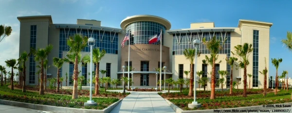
Galveston County Administrative Courthouse


The Joe Max Taylor Galveston Law Enforcement Facility includes the main station of the Galveston County Sheriff's Office
Communities[]
Cities[]
Villages[]
Unincorporated areas[]
Education[]
School districts serving Galveston County communities are:
- Clear Creek ISD
- Dickinson ISD
- Friendswood ISD
- Galveston ISD
- High Island ISD
- Hitchcock ISD
- La Marque ISD
- Santa Fe ISD
- Texas City ISD
Higher Education[]
Galveston County is home to Texas A&M University at Galveston and the University of Texas Medical Branch at Galveston.
Three community colleges also serve the area: College of the Mainland, Galveston College and San Jacinto College.
Public Libraries[]
The Galveston County Library System operates libraries in most of the larger towns and cities. The Rosenberg Library in Galveston has the distinction of being the oldest public library in Texas and serves as the headquarters for the Galveston County Library System. Its librarian also functions as the Galveston County librarian.
Political organization[]
The head of a Texas County, as set up in the Texas Constitution, is the County Judge, who sits as the chair of the county's Commissioners Court. As of 2007, this position in Galveston County is held by Judge James D. Yarbrough. [2] The county is split into four geographical divisions called Precincts. Each precinct elects a Commissioner to sit as a representative of their precinct on the commissioners court and also for the oversight of county functions in their area.
Other elected positions in Galveston County include a County Clerk, a District Attorney, a District Clerk, a County Clerk, a Sheriff, nine Constables, a Tax Assessor-Collector, a County Treasurer, and every judge in the county except municipal judges, who are appointed by the officials of their respective cities.[3]
Hospital services[]
Galveston County is served by a major medical complex in Galveston and a private for-profit hospital in Texas City.
The University of Texas Medical Branch in Galveston is a 1,200 bed, major medical complex comprised of seven hospitals. The main general care hospital is John Sealy Hospital with other on-campus hospitals specializing in women, children, burn victims, geriatrics and psychiatrics. Currently, UTMB is certified as a Level I Trauma Center and serves as the lead trauma facility for the nine-county region in southeast Texas, including the Greater Houston area.[4]
The Mainland Medical Center, 233 bed, private, for-profit, hospital operates in Texas City.[5]
Transportation[]
The City of Galveston is served by Island Transit, a public transportation agency.
Scholes International Airport at Galveston (IATA: GLS, ICAO: KGLS) is a two-runway airport located on Galveston Island that is primarily used for general aviation, offshore energy transportation, and some limited military operations.
The closest airport with regularly scheduled commercial service is Houston's William P. Hobby Airportlocated in adjacent Harris County.
All rail traffic is currently industrial related. Regularly schedule passenger service in Galveston County ceased on April 11, 1967.[6]
External links[]
- Galveston County government’s website
- Historic materials of Galveston County, hosted by the Portal to Texas History
- Galveston Island State Park
- Galveston County, Texas from the Handbook of Texas Online
References[]
- ^ Leip, David. "Dave Leip's Atlas of U.S. Presidential Elections". http://uselectionatlas.org/RESULTS.
- ^ Galveston County, http://www.co.galveston.tx.us/County_Judge/default.htm
- ^ Galveston County Homepage, http://www.co.galveston.tx.us/
- ^ UTMB School of Allied Health Sciences, http://sahs.utmb.edu/respiratory_care/current/Table_of_Contents/01-HANDBOOK-Aug-2007%20gs.pdf
- ^ Mainland Medical Center, http://www.mainlandmedical.com/CustomPage.asp?guidCustomContentID={263215B6-AC55-4276-A52B-B8F34390E0BE}
- ^ Galveston County Railroad Museum, http://www.galvestonrrmuseum.com/explore.htm
| |||||||||||||||||


|
Houston–Sugar Land–Baytown METROPOLITAN AREA |
|---|---|
| Counties | Austin | Brazoria | Chambers | Fort Bend | Galveston | Harris | Liberty | Montgomery | San Jacinto | Waller |
| "Principal" cities |
Houston | Sugar Land | Baytown | Galveston |
| Cities and towns |
Alvin | Angleton | Bellaire | Cleveland | Clute | Conroe | Dayton | Deer Park | Dickinson | Freeport | Friendswood | Galena Park | Hitchcock | Hempstead | Humble | Jacinto City | Jersey Village | Katy | Lake Jackson | La Marque | La Porte | League City | Liberty | Meadows Place | Missouri City | Pasadena | Pearland | Richmond | Rosenberg | Santa Fe | Seabrook | Sealy | South Houston | Stafford | Texas City | Tomball | Webster | West University Place |
| Unincorporated areas | Atascocita | Channelview | Cloverleaf | Cypress | Klein | Spring | The Woodlands |

| This page uses content from the English language Wikipedia. The original content was at Galveston County, Texas. The list of authors can be seen in the page history. As with this Familypedia wiki, the content of Wikipedia is available under the Creative Commons License. |