| ||||||||||||||
| Kannur district കണ്ണൂര് |
|
|---|---|
| — district — | |
 |
|

Kannur district |
|
| Coordinates: Coordinates: | |
| Country | India |
| State | Kerala |
| Headquarters | Kannur |
| Government | |
| • Collector | Rathan Kelkar |
| Area | |
| • Total | 2,966 km2 (1,145 sq mi) |
| Population | |
| • Total | 2,412,365 |
| • Density | 813/km2 (2,110/sq mi) |
| Languages | |
| • Official | Malayalam, English |
| Time zone | IST (UTC+5:30) |
| ISO 3166 code | IN-KL-KNR |
| Sex ratio | 1090 ♂/♀ |
| Literacy | 92.80% |
| Website | kannur.nic.in |
Kannur District (Malayalam: കണ്ണൂര് ജില്ല) is one of the 14 districts in the state of Kerala, India. The town of Kannur is the district headquarters, and gives the district its name. The old name Cannanore is the anglicised form of the Malayalam name Kannur. Kannur district is bounded by Kasaragod District to the north, Kozhikode district to the south and Wayanad District to the south-east. To the east the district is bounded by the Western Ghats, which forms the border with Karnataka State, in its district of Kodagu. The Arabian Sea lies to the west. The district was established in 1957.
Kannur is the most urbanised district in Kerala, with more than 50% of its residents living in urban areas. Kannur has an urban population of 1,212,898, which is the second largest in Kerala after Ernakulam district.[1][2]
Kannur District is known as the land of looms and lores, because of the loom industries functioning in the district and festivals held in temples. The district is a major centre of Theyyam, a ritual dance of northern Kerala. Small shrines known as kavus associated with the Theyyam dot the district. The district is set to have a new international airport. Kannur International Airport will be the fourth International Airport in Kerala.
Etymology[]
There are many myths and legends behind the name Kannur. It is said to be a portmanteau derived from two Malayalam words, ‘Kannan’ (Krishna), a Hindu deity, and ‘Ur’ (place), making it the place of Lord Krishna. One support for this theory is that the deity of the Kadalayi Srikrishna Temple was originally installed in a shrine at Kadalayi Kotta in the southeastern part of the present Kannur town. During British Raj, the city was known as Cannanore, the Portuguese version of its ancient name, 'Kannanore'.
One more major legend is that, Cannanore is derived from the Arabic words of 'Qanan al Noor' (Ruling area under the light of Quran), it was the Capital of one and only Muslim kingdom, Arakkal Sulthanate in the state of Kerala.
History[]
The earliest evidence of human habitation in the district are rock-cut caves and megalithic burial sites of the Neolithic age. The Taliparamba-Kannur-Thalassery area abounds in rock-cut caves, dolmens, burial stone circles and menhirs, all of megalithic burial order. The district was part of the Chera kingdom, which ruled most of Kerala during the first several centuries CE. Later Kannur was the capital of the Kolattiri Rajas, whose kingdom had trading relations with Arabia and Persia in the 12th century and 13th centuries. In his book on travels (Il Milione), Marco Polo recounts his visit to the area in mid 1290s. Other visitors included Faxian, the Buddhist pilgrim and Ibn Batuta, writer and historian of Tangiers.
It is also said that the ships of Solomon had anchored along the coasts of Kannur to collect timber for building the Temple of the Lord. Kannur also finds mention as Naura in the Periplus of the Erythraean Sea, a Greek work of great antiquity.
The Portuguese explorer Vasco da Gama visited Kannur in 1498, and shortly thereafter it became a Portuguese settlement. The Portuguese led by Don Francisco de Almeda, the first Portuguese viceroy for India, built the St. Angelo's Fort north of Kannur in 1505. In 1663 the Dutch captured the fort and in 1772 they sold the fort to Arakkal (King of Kannur). In 1790 the British captured the fort. At present, the fort is under the control of the Archaeological Survey of India. In the latter half of the 18th century, Hyder Ali and Tipu Sultan, rulers of Mysore, conquered much of the district and came into conflict with the British. In 1792, at the conclusion of the Third Anglo-Mysore War, the British took over Kannur and the surrounding region, which became the new Malabar District of British India's Madras Presidency.
Early resistance to British rule[]
Kannur District witnessed one of the longest and bloodiest resistance to British rule in India. This revolt led by Pazhassi Raja in the 1792–1804 period kept a large part of the district in a state of war.
Indian freedom movement[]
Kannur District played an important role in Indian freedom movement. The Indian National Congress, which was founded in 1885, established a Malabar District committee in 1908. A branch of the All India Home Rule League, founded by Dr. Annie Besant, functioned in Thalassery during this period and among its active workers was V.K. Krishna Menon. By the end of 1939, a branch of the Communist Party of India was formally founded at Pinarayi, a village near Thalassery. The decision of the Nagpur Congress to give up constitutional methods of agitation and resort to Non-Violent non Co-operation as a means of achieving swaraj, led to the widespread boycott of foreign goods, Courts of law and educational institutions in Kannur. Mahatma Gandhi and Maulana Shaukat Ali toured the district to carry the message of the Non-Co-operation and Khilafat Movements. The Khilafat movement of 1921 was the uprising of Muslims against the British for abolishing the Islamic Chaliphate in West Asia resulting in the formation of a secular Turkey.
Civil Disobedience Movement[]
Payyannur was the main venue of the Salt Satyagraha, a major turning point in the Indian Freedom Movement, in Malabar. On 13 April 1930, a batch of Congress volunteers under the leadership of K. Kelappan started on foot from Kozhikode to the beaches of Payyannur and broke the salt laws there on April 21. The Satyagraha camp at Payyannur was raided and the campers were beaten up. The Uliyath Kadav Payyanur incident became a turning point in the history of freedom struggle in Kerala. It thrilled the people and thousands were ready to join in the struggle for freedom. There were widespread demonstrations in Kannur, Thalassery and other parts of the district and a number of Congress workers were arrested. The period following the withdrawal of the Civil Disobedience Movement witnessed the emergence of radical wing in the Kerala Provincial Congress. Some of the radical elements in the Kerala Provincial Congress organized a Kerala unit of the Congress Socialist Party in 1934 and functioned as a separate group within the Provincial Congress. The leadership of this group was in the hands of persons like P. Krishna Pillai, A.K. Gopalan and E. M. S. Namboodiripad.K.V.Kunhikkannan Nair of Kadachira, Kannur, a socialist leader. An extremist group of Nationalist Muslims also emerged within the Congress during this period under the leadership of Muhammad Abdur Rahiman. The Congress Socialists and the Nationalist Muslims made common cause against the Gandhi an group known as the Right Wing which was led by such leaders as K. Kelappan, C.K. Govindan Nair and K.A. Damodara Menon.
A notable development in the politics of Malabar during the thirties was the rise of the Muslim League as a district political party. It was the Muslim leaders of Kannur and Thalassery who played the lead role in forming this organization. The leftist elements in the Kerala Provincial Congress were also active in the politics of Malabar in the late thirties. They took an active part in organizing the workers, peasants, students and teachers of Kannur district under their banner. In the election held to the Kerala Pradesh Congress Committee in January 1939, the Rightists suffered a severe setback. Muhammad Abdur Rahiman Sahib [1] was elected as the president of the K.P.C.C and E. M. S. Namboodiripad as its general secretary. Towards the end of the same year, a branch of the Indian Communist Party was formally founded in Malabar. The Congress Socialist Party workers joined the Communist Party en bloc.
Payyannur Conference[]
Kannur district came into the lime light of Kerala politics in May 1928, when the fourth All Kerala Political Conference was held at Payyannur under the auspices of the Kerala Provincial Congress. This conference was presided over by Pandit Jawaharlal Nehru. The Payyannur Conference passed a resolution requesting the Indian National Congress to adopt 'Complete Independence' instead of "Swaraj" as its goal at the annual session which was scheduled to take place at Calcutta during that year.
Morazha Incident[]
The KPCC gave a call to the people of Malabar to observe September 15, 1940 as Anti-Imperialist Day. The action was disapproved by the Congress High Command, but there were meetings and demonstrations all over Malabar on this day. Kannur district was the centre of this agitation. There were violent clashes between the people and the police at several places and lathicharge and firing were resorted to by the police to meet the situation. Two young men were killed in a clash between a mob and a police party at Morazha. The young men were two police officers Sub-Inspector K.M Kuttikrishna Menon and Constable Raman. In connection with this incident, K.P.R. Gopalan, a prominent communist, was arrested on a charge of murder and later sentenced to death. But, owing to the intervention of several top-ranking political leaders, including Mahatma Gandhi, the death penalty was not carried out. The Quit India Movement of August 1942 also had its echoes in Kannur district. A socialist group among the Congress workers under Dr. K.B. Menon, provided leadership to the movement.
Salt Sathyagraha[]
Payyannur was the main venue of the Salt Sathyagraha in Malabar. On April 13, a batch of Congress volunteers under the leadership of K. Kelappan started on foot from Kozhikode to the beaches of Payyannur and broke the salt laws there on Apri1 21. The Satyagraha camp at Payyannur was raided and the campers were beaten up. There were widespread demonstrations in Kannur, Thalassery and other places. Congress workers broke salt laws and picketed foreign good dealers and liquor shops.
The period following the withdrawal of the Civil Disobedience Movement witnessed the emergence of a radical wing in the Kerala Provincial Congress. Some of the radical elements in the Kerala Provincial Congress organised a Kerala unit of the Congress Socialist Party in 1934 and functioned as a separate group within the Provincial Congress. The leadership of this group was in the hands of persons like P. Krishna Pillai, A.K. Gopalan and E.M.S. Namboothiripad. An extremist group of Nationalist Muslims also emerged within the Congress during this period under the leadership of Muhammad Abdur Rahiman. The Congress Socialists and the Nationalist Muslims made common cause against the Gandhian group known as the Right Wing which was led by such leaders as K. Kelappan, C.K. Govindan Nair and K.A. Damodara Menon.
A notable development in the politics of Malabar during the thirties was the rise of the Muslim League as a district political party. It was the Muslim leaders of Kannur and Thalassery who played the lead role in forming this organisation.
The leftist elements in the Kerala Provincial Congress were also active in the politics of Malabar in the late thirties. They took active part in organising the workers, peasants, students and teachers of Kannur district under their banner. In the election held to the Kerala Provincial Congress Committee in January 1939, the Rightists suffered a severe set back. Muhammad Abdur Rahiman was elected as the president of the K.P.C.C. and E.M.S. Namboothiripad as its general secretary. Towards the end of the same year, a branch of the Indian Communist Party was formally founded in Malabar. The Congress Socialist Party workers joined the Communist Party block.
Peasant struggles[]
The War period, especially from 1943 to 1945, had its ravages on the district. Famine and cholera epidemic took thousands of lives from the lower strata of society. On the initiative of the people under the leadership of the Kisan Sabha, commendable services were rendered to tide over the crisis. The “Grow More Food Campaign” organized at Mangattuparamba by the Kisan Sabha was a new chapter in the history of mass movement. More than 50 acres (200,000 m2) of government land was brought under cultivation. But the government suppressed the movement by force and destroyed the farm.
Though the War ended in 1945, famine continued to haunt the people. Karivellor, Poomaram (Thillenkeri) the northern most village of the present Kannur district, made a historic stride in the struggle against poverty and famine. The transporting of paddy from Karivellore to Chirakkal Kovilakom was blocked and distributed to the people of the village. The movement was led by peasant leaders like A.V. Kunhambu and K. Krishnan Master. One Kannan and Kunhambu became martyrs in the struggle when police opened fire.
During the month of December 1946, the people of Kavumbayi, an eastern village of the district, raised their demand for punam cultivation. A strong police contingent was sent to the spot. The peasants resisted the armed forces which led to the killing of five peasants in the firing.
The rise of the organized working class in the industrial sector was another important phenomenon of the period that changed the course of the anti-imperialism movement. The struggle of Aron Mill workers in the year 1946 is noteworthy in this regard. Even after independence, the struggles of the peasantry formed an important part in the history of the state. They fought against landlords and their exploitation. Places like Thillankeri, Manayankunnu, Korom and Paddikkunnu are memorable in the annals of the peasant struggles in the post independence era. The All India Conference of Kisan Sabha, held at Kannur in 1953, resolved to initiate struggles for new tenancy legislations. The movement for 'Aikya Kerala' also got momentum during this period and all sections of the society rallied under the movement.
Government and politics[]
Kannur was once the nurturing ground and think tank of the Communist movement in Kerala, and was home of the famous communist leaders A.K. Gopalan, Azhikodan Raghavan and E. K. Nayanar, former Chief Minister of Kerala. K. Karunakaran, a former Chief Minister, also hails from Kannur.
Communist parties have a strong base in this district. The Communist Party of India (Marxist)-led Left Democratic Front (LDF) governs five of six municipalities in Kannur district. Around 70% of the panchayats are governed by LDF.
Despite of having a strong communist base, both the Member of Parliament and the Member of State Legislative Assembly representing the district are from Indian National Congress, the main political opponent of the left parties.
Panoor, Kuthuparamba and Mattanur areas of Thalassery Taluk in the district have been a hub of political violence between the Communist Party of India (Marxist) (CPI(M)) and the BJP-led Rashtriya Swayamsevak Sangh (RSS) combine. Clashes in 2008 left seven people killed and many have been injured. The High Court of Kerala called this manslaughter a “compelling sport” and suggested permanent deployment of Central forces in the affected areas.[3]
Geography and climate[]
Geography[]
The district lies between latitudes 11° 40' to 12° 48' North and longitudes 74° 52' to 76° 07' East and covers an area of 2,996 km2. Kannur can be geographically divided into highland, midland and lowland regions. Highlands are the mountainous region forming part of the Western Ghats and are covered by rainforests, plantations of coffee, tea and different types of spices like cardamom. There are also timber plantations in this region. The midland region lies between the highlands and lowlands and is made up of undulating hills and valleys. The lowland is the narrow stretch containing rivers, deltas and the coastal region. Six rivers drain Kannur, the longest being the Valapattanam river with a length of 110 km. Other rivers flowing through Kannur district are Kuppam, Mahe River, Anjarakandi, Thalassery, Ramapuram and Perumba. The highest place in the district is Elapeedika (2,500–3,200 ft.), near to Peravoor.
Climate[]
The district has a humid climate with an oppressive hot season from March to the end of May. This is followed by the South-West monsoon which continues till the end of September. October and November from the post-monsoon [North-East Monsoon] or retreating monsoon season.
During the months of April and May, the mean daily maximum temperature is about 35 °C. Temperature is low in December and January and the minimum temperature is about 20 °C. On certain days the night temperature may go down to 16 °C, although this is extremely rare. The annual average rainfall is 3438 mm and more than 80% of it occurs during the period of South-West monsoon. The rainfall during July is very heavy and the district receives 68% of the annual rainfall during this season.
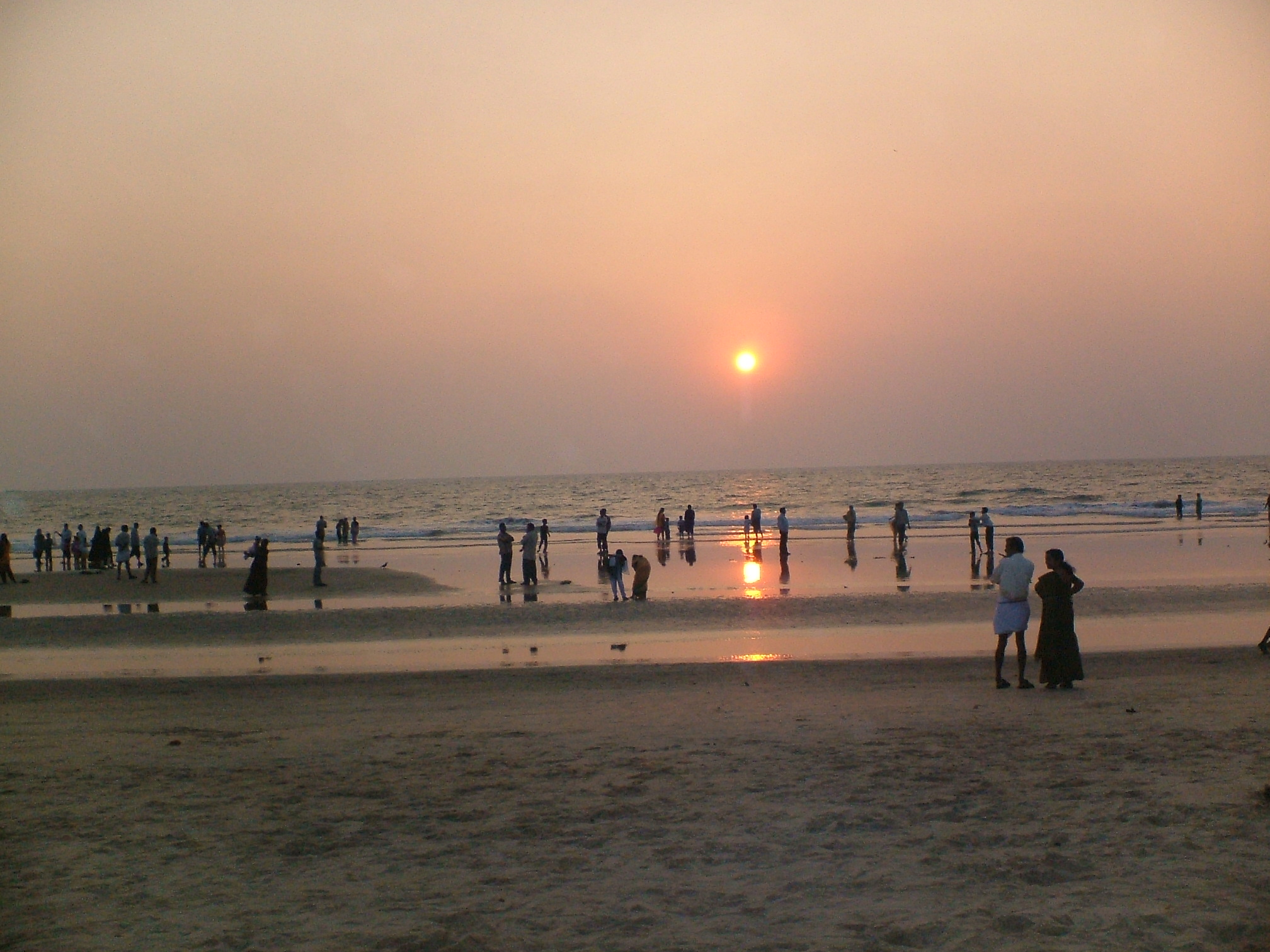
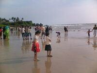
Beaches[]
Kannur has several beaches, some of which are:

Payyambalam Beach
- Payyambalam Beach: It is the beach of the Kannur town. It has an unbroken coastline of a few kilometres. From the beach, one can see ships in transit along the Malabar Coast, that is, beyond Kozhikode and moving towards Mangalore, Goa and Mumbai. The well laid out garden and the massive landscaped sculpture of mother and child erected by noted sculptor Kanayi Kunhiraman makes it extremely captivating.
- Baby Beach: It is so called as it is smaller than its bigger neighbourhood, Payyambalam Beach. The famous St. Angelo Fort is adjacent to it.
- Meenkunnu Beach: Situated at Azhikode, it is a few kilometres from the town.
- Mapila Bay: Situated near the St. Angelo’s Fort, the Mopila bay has a historical background. Centuries ago, it was the seat of Kolathiri Kings. The Kadalayi Fort and Sree Krishna Temple were quite famous. The remnants of the fort and the temple are still seen in Mopila Bay. A fishing harbour, built with Indo-Norwegian project assistance, can be seen at this bay.
- Kizhunna Ezhara Beach: 11 km from Kannur, is one of the most secluded beaches in Kerala.
- Muzhappilangad Drive-in Beach: is Kerala’s only drive-in beach, situated about 5 km north of Thalassery and 15 km from Kannur. There is an unpaved road winding through coconut groves, leading to the beach. The beach is about 5 kilometres long and curves in a wide area providing a good view of Kannur beach on the north. To the South and about 200 metres away from the beach there is a beautiful island called the "Green Island" which adds to the allure of the beach.
- Dharmadam Island: (100 metres away from the mainland at Dharmadam): The small 5 acre (20,000 m2) island covered with coconut palms and dense bushes is a beautiful sight from the Muzhappilangad beach. During low tide, one can walk to the island from the beach. It is surrounded by rivers and seas. Permission is required to enter this privately owned island. Dharmadam, earlier known as Dharmapattanam, was a Buddhist stronghold.
Kannur Town and Kannur City[]
- Kannur town – formerly known as Cannanore, is a town and the administrative headquarters of Kannur District.
- Kannur City – is a part of the Kannur town. This area was the actual downtown in the olden times, but is now mostly a residential area.
Economy[]
A majority of the population of the district is dependent directly or indirectly on agriculture for their livelihood. The main crops grown in the district are paddy, coconut, pepper, cashew, tapioca, arecanut and plantation crops like rubber. Asia's largest cinnamon estate producing cinnamon spice established by Lord Brown of British East India company in the year CE 1767 is located at Anjarakandy in Kannur district
Paddy occupies the largest area among annual crops. Under the high yielding variety programme, substantial increase in paddy production has been achieved, even though the percentage of area sown under paddy is decreasing year after year, due to conversion of paddy fields to other purposes. The average yield of paddy is recorded as 2146 kg. per hectare. Next to paddy, coconut is the most important crop in the district. Coconut is extensively grown throughout the district. An important cash crop grown in the district is cashewnut. The district plays a unique role in its cultivation and production. The vast stretches of suitable waste lands with low fertility status extends scope for expansion of cashew cultivation and its allied industries.
Among spices, pepper occupies an important place. Pepper is mostly grown as an intercrop with coconut, arecanut and various fruit trees. In the hilly areas of the district, the inter-cultivation is done with rubber and cashew. Rubber is the most important industrial cash crop among the plantation crops.
About 55% of the rubber cultivation of Kannur district is in Taliparamba taluk, followed by Thalassery and Kannur taluks. The yield of rubber per hectare varies from 2000 kg to 4000 kg.
Industry[]
Kannur district has had industrial importance from very early days. Being blessed with a variety of factors such as good soil, salubrious climate, rich forests, enormous fishing potentials, minerals as well as infrastructural facilities like road, rail, inland water transport, etc., the district offers ample scope for the development of industries. Nevertheless, Kannur is an industrially backward district in the state. There is only one major and five mini industrial estates in the district. Keltron Complex, Mangattuparamba and Western India Plywood's, Valappattanam are the two major industries. The Western India Plywoods is one of the biggest wood based industrial complexes in South East Asia. The district has 12 medium-scale industries, most of which are either cotton textile or plywood manufacturing.
Handloom Textiles, beedi and coir are the important traditional industries in the district. About one lakh people depend on the textile industry for livelihood. The textile industry which accounts for 40% of all Small Scale Industrial (SSI) units in the district, was introduced in early 19th century by the German Basel Mission. The first ready-made garment unit in Kannur and the first hosiery unit in Kuthuparamba were started around the end of the 19th century. The beedi industry provides employment to about 50,000 people. The famous beedi co-operative ‘Dinesh Beedi’ and privately owned Sadhu Beedi companies are in Kannur district. The coir industry which uses traditional technology provides employment to about 11,000 workers.
There are 6934 small-scale industrial units in the district. The district has 202 sick units which is about 9.3% of the sick units of the state. Only 4828 units are working now. 162 industrial societies and four power loom societies are also functioning here. Kannur, Thalassery, Payyannur, Taliparamba and Edakkad have been identified as growth centers, having potential for industrial development.
Divisions[]
Kannur District came into existence as an administrative unit on January 1, 1957, when the erstwhile Malabar District and Kasaragod taluk of Madras state were reconstituted into three revenue districts, viz; Kannur, Kozhikode and Palakkad. At the time of its formation, the district consisted of seven taluks, viz, Kasaragod, Hosdurg, Taliparamba, Kannur, Thalassery, North Wayanad and South Wayanad. Subsequently, the South Wayanad taluk was included in Kozhikode district with effect from 15 March 1957. Later, on first November 1980, Wayanad District was formed carving out South Wayanad and North Wayanad taluks. The two northernmost taluks of Kannur District, viz; Kasaragod and Hosdurg were separated on 24 May 1984 for the formation of Kasaragod District. Thus Kannur District now has three taluks, viz., Kannur, Taliparamba and Thalassery. Thalassery is also known as Tellicherry.
There are nine development blocks comprising 82 panchayats. The development blocks are Kannur, Edakkad, Irikkur, Iritty, Kuthuparamba, Payyannur, Peravoor, Taliparamba and Thalassery.
The Municipal towns in the district are Taliparamba, Kannur, Thalassery, Kuthuparamba, Payyannur and Mattannur.
The state legislative constituencies of the District are: Irikkur, Payyannur, Taliparamba, Kalliasseri, Azhikode, Kannur, Dharmadam, Thalassery, Mattannur, Kuthuparamba and Peravoor.
Vayannur is a small place in between Kolayad and Peravoor in Underkolayad panchayath. Vayannur is a gateway to Kottiyoor Temple. Other attractions are Siva temple in Mukku Vayannur, Palakeezhil Bhagavathy temple and Chovvakkav Bagavathy temple. Vayannur falls under Vekkalam Village. It has one school. Peravoor is about 5 km and Kolayad is about 4 km away.
Transport[]
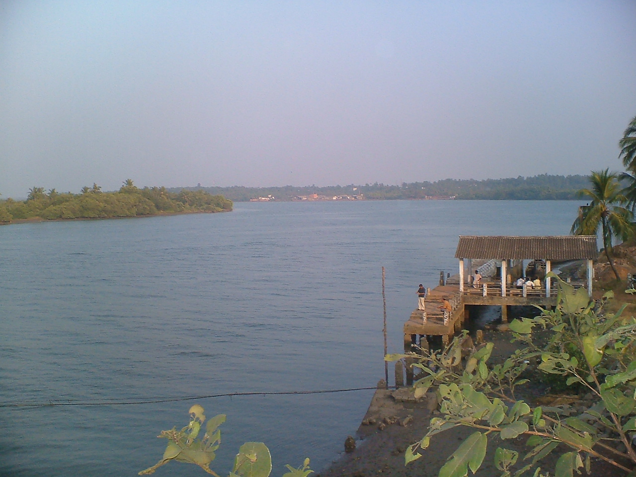

A view of Valapattanam river from the bridge built across it


Kannur Railway Station
The West Coast road from Mahe to Talapady is the backbone of the road system in Kannur district. This is part of the National Highway NH-66(formerly NH-17). Kannur–Mattannur–Iritty Road, Pappinisseri–Pilathara Road, Taliparamba–Sreekandapuram Road, Payyannur–Peringome (Kozhichal) Road, Thalassery–Kodagu road and the Thalassery–Mysore road are the other important roads. The airports at Mangalore in Karnataka and Kozhikode are about 125 kilometres away from Kannur. Kannur Airport is coming up at Mattannur and expected to be completed by the end of 2014.
Thalassery (Tellicherry), Kannur and Azhikkal are the minor ports in the district. Kannur is an ancient port. The nearest all-weather sea port is Mangalore, presently in Karnataka State. The inland water transport system connecting Perumba and Taliparamba was constructed in 1766 by the Ali Raja of Kannur. This 3.8 km long canal is known as the Sultan's Canal. The west flowing rivers are used for navigation. The Kuppam river has 244 km of navigable length; Valappattanam, 55 km and Anjarakandi, 23 km.
The international airport at Kannur is coming up at Mattanur..
Demographics[]
According to the 2011 census Kannur district has a population of 2,525,637,[4] roughly equal to the nation of Kuwait[5] or the US state of Nevada.[6] This gives it a ranking of 170th in India (out of a total of 640).[4] The district has a population density of 852 inhabitants per square kilometre (2,210 /sq mi) .[4] Its population growth rate over the decade 2001-2011 was 4.84%.[4] Kannur has a sex ratio of 1133 females for every 1000 males,[4] which is the highest among any district in India, and a literacy rate of 95.41%.[4]
The District has a population of 2,412,365 (2001 census). This is the most urbanised district in Kerala. About 50.35% of the population reside in the urban agglomerations. The total urban population of Kannur district is 1,212,898. This is the second largest urban population in Kerala after Ernakulam and is more than the population of a metro city. [2]
The high urban population of the district is due to the 45 towns in the district which is the highest in Kerala. Kannur district has 7 statutory towns namely Kannur, Kannur Cantonment, Thalassery, Payyannur, Thaliparamba, Kuthuparamba and Mattannur. In addition to this there are 38 census towns which are Ancharakandy, Azhikode North, Azhikode South, Chala, Chelora, Cherukunnu, Cheruthazham, Chirakkal, Chockli, Dharmadom, Elayavoor, Eranholi, Iriveri, Kadachira, Kadirur, Kalliasseri, Kanhirode, Kannadiparamba, Kannapuram, Kottayam-Malabar, Mavilayi, Munderi, Muzhappilangad, Narath, New Mahe, Paduvilayi, Pallikkunnu, Panniyannur, Panoor, Pappinisseri, Pathiriyad, Pattiom, Peralasseri, Peringathur, Pinarayi, Puzhathi, Thottada, Valapattanam, Varam.[7]
Kannur city has, apart from Malayalam, minorities of Kannada, Tulu and Tamil speakers.
Flora and fauna[]

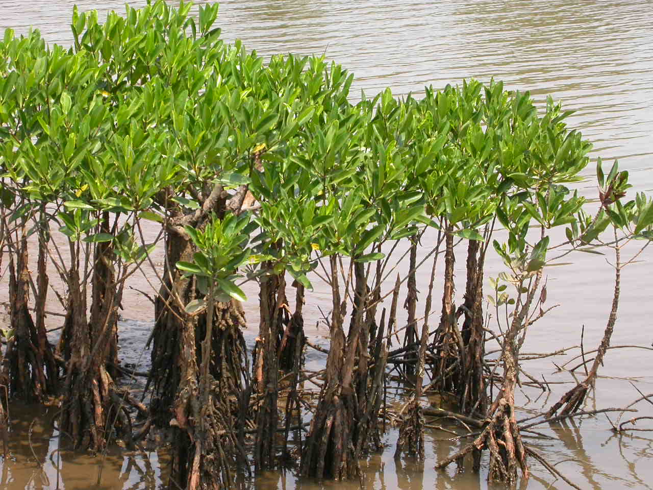
Mangroves on the banks on Valapattanam River
Kannur district is very rich in vegetation. Natural vegetation, except in some coastal regions, consists of different types of forests. But, in spite of generally favourable climatic conditions, vegetation is not uniform. In restricted regions, with their own micro climate or special edaphic features, plant formations assume different characters. Thus, plant communities, ranging from psammophytes and mangroves to evergreen forests are seen in this district.
The coastal region is a comparatively narrow zone, characterised by secondary soil which is rather lose and sandy. The sterile sandy tract supports only a poor vegetation of the psammophyte type. Plants are few and mostly prostrate. Erect species are small and short. Owing to very poor water holding capacity of the soil, these plants are provided with special xerophytic adaptations. Another conspicuous feature of this area is the mangrove vegetation, found at the estuaries of rivers and backwaters, and often extending to the interior along their banks. Human interference has much changed the vegetation of the coastal region.
Major part of the district comes under midland region with numerous hills and dales and it presents an undulating surface gradually ascending and merging into the slopes of Western Ghats. Soil is secondary and lateritic with underlying rock of laterite or disintegrated gneiss. Typical flora of this area is deciduous forest consisting of a mixture of evergreen and deciduous trees. Undergrowth consists of a variety of annuals and perennials.
The mountains are a continuation of the midland region, gradually ascending to the main ridge of the Western Ghats. Soil in the western slopes is a ferruginous red, sandy loam. Vegetation over the whole area is of the forest type. Irregular distribution of teak, localised areas of bamboo dominance, change of good quality forest into open grass lands, etc. are characteristic.
Aralam wildlife[]

A cluster of mangroves on the banks of Vellikeel river in Taliparamba
The Aralam Wildlife sanctuary is spread over 55 square kilometres of undulating forested highlands on the slopes of the Western Ghats. It was established in 1984. The headquarters of the sanctuary is near Iritty, a small town about 55 kilometres from Kannur. The sanctuary adjoins the Central state Farm at Aralam. Aralam wild life is situated at Muzhakkunnu panchayath and Aralam panchayath. Muzhakkunnu is also a tourist spot.
The elevation varies from 50 m to 1145 m. The highest peak here Katti Betta rises to a majestic 1145 m above sea level. Covered with tropical and semi evergreen forests, the Aralam Sanctuary is home to a vast variety of flora and fauna endemic to the Western Ghats. Herds of deer, elephant, boar and bison are common sights. Leopards, jungle cats and various types of squirrels are also seen here. The proposed Ranipuram wildlife sanctuary of Kasaragod district also has similar flora and fauna as that of Aralam wildlife sanctuary
Education[]
In the 14th and 15th centuries, during the regime of the Kolathiri Rajas, Taliparamba was renowned all over Kerala as a seat of learning, enlightenment and culture. In the early days, the Eshuthu pallies under the Ezhuthachan or village school master, provided facilities to pupils to acquire elementary education. After undergoing the preliminary course of study in these institutions, the children were sent to the kalaries for acquiring training in gymnastics and in the use of arms and then they were sent to study Sanskrit in Vedic schools under well trained teachers. This district had in the past, its share of such kalaries and Vedic schools. The art, kalaripayattu, is particularly associated with this district.
The beginning of western education in the district may be traced back to the middle of the 16th century. The first English school, known as the Basel German Mission English School, was started on 1 March 1856 at Thalassery. The Brennen School at Thalassery, the nucleus of the present Govt. Brennen College, was started in 1862 with a donation made by Mr. Brennen, Master Attendant at Thalassery.
Kannur University was established by the Act 22 of 1996 of Kerala Legislative Assembly. The University by the name “Malabar University” had come into existence even earlier by the promulgation of an Ordinance by the Governor of Kerala, on 9 November 1995. The University was inaugurated on 2 March 1996 by the Hon. Chief Minister of Kerala. The objective of the Kannur University Act 1996 is to establish in the state of Kerala a teaching, residential and affiliating University so as to provide for the development of higher education in Kasargod and Kannur revenue Districts and the Mananthavady Taluk of Wayanad district. Pariyaram Medical college established in 1999 near Payyanur and Kannur Medical college with a 500 bed super speciality hospital established in 2006 at Anjarakkandy are two medical colleges functioning in Kannur district.
Arts and Science Colleges: Govt. Brennen College-Thalassey,S.N College Kannur, Payyannur College, Sir Syed College Taliparamba.
Engineering Colleges: Government College of Engineering, Kannur
Kannur hosts the 13th centre for National Institute of Fashion Technology NIFT near Taliparamba. The famous Kalady Sankaracharya Sanskrit University has a regional centre in the district situated in Payyannur.
Sports and games[]
Many well-known personalities in the field of sports and games have adorned Kannur in their respective fields. The Englishmen of the Military Centre brought field hockey, cricket, football, etc. to Kannur during the pre-independence period. The famous Fort Maidan (ground) and Police Maidan provide ample facilities for youths to excel in this field. The CDRE Football team and Hockey team excelled in those days. At the same time, the traditional martial arts like Kalaripayatu has also been flourishing here all along.
After Independence, the football clubs helped spread the spirit of the game in Kannur. Spirited Youths, Lucky Star, Brothers Club and Gymkhana Club were popular and produced well known players like D'cruz, Soman, Dasan, etc. Sree Narayana College in Thottada was considered a nursery of sportsmen the most prominent of them being B Devananad who captained the college and later Calicut University (the college is now under Kannur University) to national universities title. Devananad later played for the Indian Youth team in Bangkok and several other tournaments to be picked by Tata Football team in Mumbai. He was the fullback when Kerala won its first Santosh Trophy title in 1973. Similarly Mani, the captain of the Santosh Trophy winning Kerala team was another well-known player though he faded off the sports horizon.Denson Devadas who is currently playing for Prayag United S.C. in the I-League as a Midfielder is from Kannur.
Jimmy George, the veteran volleyball player who was selected as one of the top 10 strikers in the world when he was playing for an Italian club was born and brought up in Kannur.
In hockey too, apart from the military team, there were good teams in Kannur and Thalassery. Cricket, ball-badminton, weightlifting, gymnastics, wrestling, volleyball, etc. have been widely played in both urban and rural areas. Volleyball has been concentrated upon by youths in rural areas. Former Indian hockey goalkeeper Manuel Frederick is from Kannur. Ivan D'Cruz who hails from Kannur has represented Kerala in cricket and hockey.
When Sports Divisions were started in schools in 1976 to tap talents, one of its divisions was started in the district. The Sports Division attached to Govt. Higher Secondary School, Kannur, produced international stars like P.T Usha and M.D. Valsamma in athletics. Leelamma Thomas and Moly Benedict in basketball and Anitha Retnam and Anandavalli in volleyball. The Police Maidan was the venue for M.D Valsamma and Mercy Mathew to practise athletics; P.K. Balachandran, V.P. Sathyan, D'cruz, Rajan, Ramanan, Sugunan, C.M. Chidanandan, B Devananad and George in football and Ford and Olympian Manuel Frederick in hockey. Westline and Leslie in cricket had their training at Fort Maidan.
Kannur became famous in South India for ball badminton, when T.K. Ramakrishnan and Kumaran were playing. A.M. Bharathan created history in weight lifting in the early fifties. Nelliary Krishnan Nair, the first Malayalee to represent India (weightlifting) at the first Asian Games held at New Delhi in 1951 is from Kannur.
It is also believed that the game of cricket first found its way to Kannur, with the British, thus making it the birthplace of the game in India. A few years back, the district cricket association celebrated the 200th anniversary of the game in the district, in a function attended by eminent cricketers like Dilip Vengsarkar.
Landmarks[]
Snake Park[]
Snake Park is a famous landmark in the district of Snake Park at Parassinikkadavu, en route from Kannur to Taliparamba, 2 km from National Highway (NH) 17. Here one gets to see a large genre of snakes and other small animals and there is even a live show, where trained personnel play and 'interact' with a variety of snakes, including cobras and vipers, and seek to quell mythical fears and superstitions about snakes. The Snake Park set up by the Visha Chikista Kendra at Pappinisseri, has been a centre of attraction to both foreign and domestic tourists. This Kendra (center) offers effective treatment for snake bites with almost 100% cure. This is the only place, perhaps where Ayurveda and Allopathy are effectively combined for curing snake bites. The snake park here houses about 150 varieties of snakes including the Spectacled Cobra, King Cobra, Russell's viper, Krait and various pit vipers. There is also a large collection of non-poisonous snakes including Pythons. A research laboratory to extract venom from snakes is proposed to be set up here. The park is dedicated to the preservation and conservation of snakes, many species of which are getting extinct gradually. It is located 16 km from Kannur. Parassinikkadavu is also noted for the famous Muthappan temple. This is the only temple in Kerala where a Theyyam performance is a daily ritual offering.
St. Angelo Fort[]
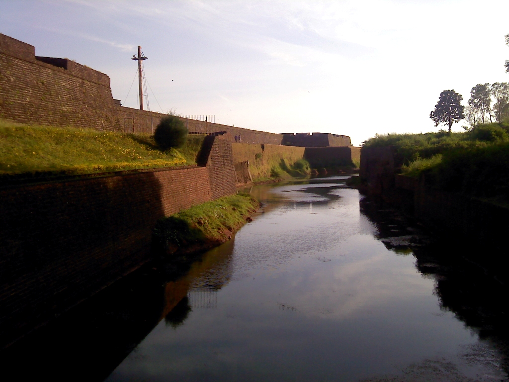

St. Angelo Fort
St. Angelo Fort, built in 1505 by Sir Francisco de Almeida, the first Portuguese Viceroy of India, is situated near the sea coast and about 2 km from Kannur town. This fort has a legendary past. Having witnessed several wars for seizing the control of the fort, the British flag flew over it finally in 1790. Even now, it is in a fairly good state of preservation, and is a protected monument under Archaeological Survey of India (ASI). A painting of this fort and the fishing ferry behind the fort can be seen in the Rijksmuseum in Amsterdam.
St Angelo Fort is an important historical monument and tourist centre. Kerala Police has posted six Tourism Police Officers for protection and guidance to the tourists. Among them, Sathyan Eddakkad has detailed knowledge about this fort and the surrounding places. He wrote and published a book in Malayalam named Vasco Da Gaamyum charithrathile kaanaappurangalum (Vasco Da Gama and the unknown pages of history) in which he describes the past and present of the Fort.
The fort, though not as large as the famous Bekal Fort in Kasaragod, is a treat to the eyes with lush greenery and well maintained surroundings. The Payyambalam and Government guest house are some of the other famous landmarks near the fort.
Vaithalmala[]
Vaithalmala is a hill station on the Kerala-Karnataka border and is 65 km north of Kannur. Ideal for trekking; it is around 1,371.6 metres above sea level. A base reception centre and a watchtower atop the cliff function for the benefit of tourists and trekkers. It is near to Kudianmala.
Ezhimala[]
Ezhimala, the capital of the ancient Mooshika kings, is considered to be an ancient historical site. It is a conspicuous, isolated cluster of hills, forming a promontory, 38 km north of Kannur town. A flourishing sea port and centre of trade in ancient Kerala, it was one of the major battle fields of the Chola-Chera war of the 11th century. It is believed that Lord Buddha had visited Ezhimala. An old mosque, believed to contain the mortal remains of Shaikh Abdul Latif, a Muslim reformist, is also located here. The hill is noted for rare medicinal herbs. There is an old tower of great antiquity here, the Mount Deli Light House. It is maintained by the Indian Navy and is a restricted area. The beach sand is of a different texture and the sea is bluer than in other areas. At Ettikulam bay, one can enjoy watching dolphins. Bordered by sea on three sides, Ezhimala is set to occupy a prominent place in the Naval history of the country, subsequent to the proposal for commissioning the Indian Naval Academy there.
Madayipara[]


Madayi Para in August
Madayipara is significant owing to its biodiversity as well as history. Madayipara was the administrative center of the Ezhimala kings. In and around Madayipara, one can find remnants from the past. At the southern side of the hill, stand the remains of a fort called Pazhi Kotta (kotta means fort in Malayalam). Here one can also find watchtowers at the four corners of the fort. Between AD 14 and AD 18, Madayipara used to be the site for the coronation ceremony of the rulers of the princely state of Kolathunadu.
The hillock of Madayipara, which carries several signs of historic relevance, is also a place important from a religious point of view. Here, a pond in the shape of a hand held mirror, connected to ancient Jewish settlers, is another historic attraction. Similarly, a temple at this site, called Vadukunda Siva Temple, and the adjoining lake, about an acre in extent, form another attraction. The lake near the temple will not go dry even in hot summer months and remains a source of nourishment to life forms. The pooram festival of Madayi Kavu (kavu – family temples and those in the midst of thick vegetation) held at Madayipara has been responsible for much of its fame.
With regard to the biodiversity of Madayipara, the region contains about 300 flowering plants, about 30 varieties of grass, and several insect-eating plant species. Madayipara is also home to several rare medicinal herbs. Coming to avian life, Madayipara sustains about 100 species of butterflies and about 150 species of birds. Among the biggest butterflies in the world, the Atlas butterfly is a visitor to Madayipara.
District Agricultural Farm, Taliparamba[]
Established in 1905, District Agricultural Farm, Kannur is one of the oldest farms in South India. Located at Taliparamba, 20 kilometers from Kannur city, this station was started by Sir Charles Alfred Barber at the behest of the erstwhile Madras Government, based on the recommendation of the Famine Commission of 1880 of Government of India.
Hanging Bridge (Thookku Palam) – Peralassery[]
The hanging bridge of Peralassery is a notable tourist attraction. This is one of the few hanging bridges in Kannur district.
Kanjirakolly Waterfalls, Iritty[]
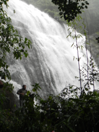
Kanjirakkolly Waterfalls
The Kanjirakkoly waterfalls are situated around 55 km from Kannur. They are some of the beautiful waterfalls in North Kerala. Near to the waterfalls is Sasippaara, a viewpoint, which is 1 km away from the waterfalls.
Places of worship[]
There are places of worship considered important in Kannur district. A list of some of these can be found at Places of worship in Kannur district.
Notable residents[]
The British faced the first resistance from India in 1803 from Pazhassi Raja who was the ruler of Pazhassi kingdom which is in the present Kannur district.
The Kannur district was host to many Kerala politicians, including A. K. Gopalan, greatest leader of the Communist Party of India (Marxist) and first opposition leader of Loksabha, E. K. Nayanar, three time Chief Minister of Kerala, K. Karunakaran, former Chief Minister of Kerala and Congress leader, E. Ahamed, Minister of State for Railways, M. V. Raghavan, former Minister, P. K. Sreemathy, Health Minister, and Pinarayi Vijayan, former Minister.
Other notable people tracing their origin to this district include film actor Sreenivasan, Vineeth, Samvrutha Sunil and Manju Warrier, writers Sanjayan and T. Padmanabhan, sportsmen V P Sathyan (football) and Jimmy George (volleyball) and Fighter pilot Moorkoth Ramunni. K.T. Arun is a notable artist and creative director hailing from the district. C. P. Krishnan Nair a businessman and founder of Leela group of hotels, was also born and brought up in Kannur.
Photo gallery of tourist centers in the Kannur District[]
")
")
")
See also[]
- Kannur town
- Thalassery
- Malabar (disambiguation)
- Kerala
- Kannur International Airport
References[]
- ^ http://urbanindia.nic.in/theministry/subordinateoff/tcpo/pop_name/ANNEX-CONCEPTS_DEFINITIONS.pdf
- ^ http://dic.kerala.gov.in/web/distknr.php
- ^ "Only Centre can end Kannur violence: High Court". Chennai, India: The Hindu. 12 March 2008. http://www.hindu.com/2008/03/12/stories/2008031250410100.htm.
- ^ a b c d e f "District Census 2011". Census2011.co.in. 2011. http://www.census2011.co.in/district.php. Retrieved 2011-09-30.
- ^ US Directorate of Intelligence. "Country Comparison:Population". https://www.cia.gov/library/publications/the-world-factbook/rankorder/2119rank.html. Retrieved 2011-10-01. "Kuwait 2,595,62"
- ^ "2010 Resident Population Data". U. S. Census Bureau. http://2010.census.gov/2010census/data/apportionment-pop-text.php. Retrieved 2011-09-30. "Nevada 2,700,551"
- ^ Indian Census
External links[]

|
Kasaragod district | Kodagu district, Karnataka |
| |
| Lakshadweep Sea | ||||
 Kannur district | ||||
| Kozhikode district | Wayanad district |
| |||||||||||||||||||||||||||||
Template:Kannur district Template:North Malabar Template:Places of interest in North Malabar
| This page uses content from the English language Wikipedia. The original content was at Kannur district. The list of authors can be seen in the page history. As with this Familypedia wiki, the content of Wikipedia is available under the Creative Commons License. |