| ||||||||||||||
| Ramanagara district ರಾಮನಗರ ಜಿಲ್ಲೆ |
|
|---|---|
| — District of Karnataka — | |
 |
|
| Country | India |
| State | Karnataka |
| Administrative division | Bangalore Division |
| Established | |
| Headquarters | Ramanagara |
| Area | |
| • Total | 3,556 km2 (1,373 sq mi) |
| Population (2001) | |
| • Total | 1,030,546 |
| • Density | 290/km2 (750/sq mi) |
Ramanagara district (Kannada: ರಾಮನಗರ ಜಿಲ್ಲೆ) is one of the 30 districts of Karnataka state in southern India. Ramanagara city is the administrative headquarters of this district. The district is part of Bangalore Division.
History[]
Ramanagara district was carved out of the erstwhile Bangalore Rural district on 23 August 2007,[1] comprising the erstwhile Channapatna, Kanakapura, Ramanagara and Magadi taluks of the undivided district.
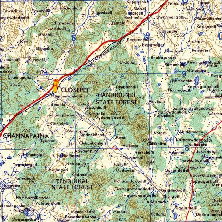
Geography[]
Map of the region
The Anna-Thama rock formation on the left, Handi-Gundi on the right Template:Pufc
Ramanagara is approximately 50 km southwest of Bangalore. It has an average elevation of 747 metres (2450 feet). Ramanagara is famous for the huge rocky outcroppings. Those that are popular for rock climbing are; Savandurga, Ramadevarabetta, SRS betta and Thenginkalbetta.
Demographics[]
According to the 2011 census Ramanagara district has a population of 1,082,739,[2] roughly equal to the nation of Cyprus[3] or the US state of Rhode Island.[4] This gives it a ranking of 421st in India (out of a total of 640).[2] The district has a population density of 303 inhabitants per square kilometre (780 /sq mi) .[2] Its population growth rate over the decade 2001-2011 was 5.06 %.[2] Ramanagara has a sex ratio of 976 females for every 1000 males,[2] and a literacy rate of 69.2 %.[2]
Economy[]
Ramanagara is famous for its silk market, one of the biggest in India, giving it the other name of Silktown. Ramanagara district includes the Bidadi industrial area, which houses the manufacturing units of Toyota and Coca-Cola, and a 1400 MW combined cycle gas-based power plant.
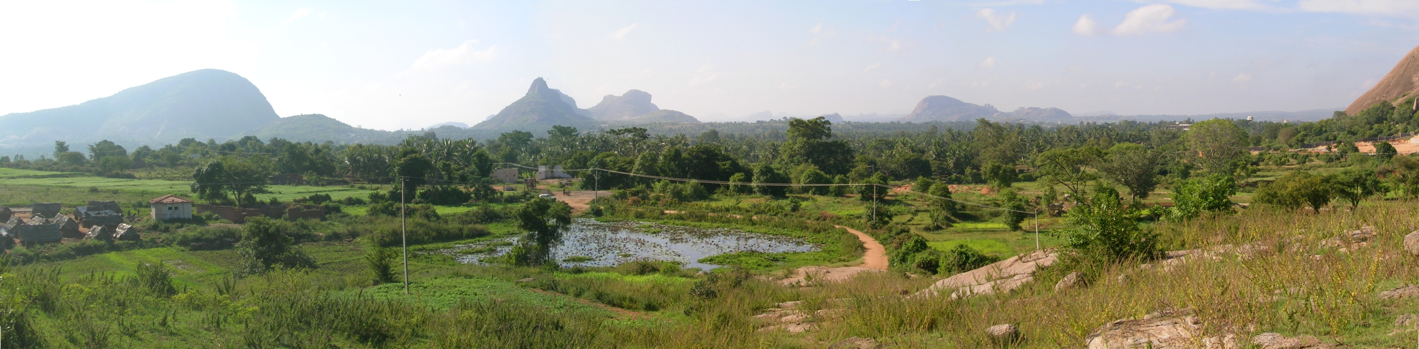
Hills and landscape[]
The region has several tall granitic hills which are famous for many short rock climbs, typically 1 to 2 pitches in length. Grades vary from 5.8 American to 5.11 American. It is home to some of the world's oldest granite outcrops. Some of the interesting climbs are on the Wanakkal wall ("Gabbar ki asli pasand", "Labor pain"), on the Rainbow wall ("UIAA", "Kalia"), on Anna-Thamma ("Darkness at dawn", "Black Diamond", the name Anna-Thama means 'elder-brother-younger-brother' in Kannada).

Ramdevarabetta showing the cave entrances made for the film A Passage to India
Another well known hill is Ramadevarabetta. Along with Savandurga this was one of the shooting locations for David Lean's A Passage to India. Small door like grottoes were made in the rock to resemble caves.[5] It was also in this region that the path-breaking Hindi movie, Sholay, was shot.

View from Ramadevarabetta
Other famous hills in the region include the Revanasideshwara hill and Handigundi.
These hills have been threatened by quarrying and also plans to carve these hills into statues. The region is covered in scrub forest and is home to threatened bird species such as the Yellow-throated Bulbul and Long-billed Vultures.[6] The hill is today one of the few locations in south India where Long-billed Vultures nest. The region is also home to numerous sloth bears.[7]
Closepet granites[]


Distribution of the Closepet granites
The Closepet granites are a major geological feature of this region and are from the Lower Proterozoic era. This belt of rocks extend in the north-south direction in 50 km belt. This belt has younger potassic granites and is believed to separate two distinct crustal blocks of Archaean age. The block to the west has low grade granite-greenstone belts with iron-manganese ores and to the east are younger gneisses of granitic and granodioritic composition with gold-bearing schist belts.[8]
References[]
- ^ "Ramanagara district will be made the best: Kumaraswamy". The Hindu. 24 August 2007. http://www.hindu.com/2007/08/24/stories/2007082458260400.htm. Retrieved 6 August 2010.
- ^ a b c d e f "District Census 2011". Census2011.co.in. 2011. http://www.census2011.co.in/district.php. Retrieved 2011-09-30.
- ^ US Directorate of Intelligence. "Country Comparison:Population". https://www.cia.gov/library/publications/the-world-factbook/rankorder/2119rank.html. Retrieved 2011-10-01. "Cyprus 1,120,489 July 2011 est."
- ^ "2010 Resident Population Data". U. S. Census Bureau. http://2010.census.gov/2010census/data/apportionment-pop-text.php. Retrieved 2011-09-30. "Rhode Island 1,052,567"
- ^ A Passage to India - locations Accessed December 2006
- ^ Subramanya, S. and Naveein, O. C. 2006. Breeding of Long-billed Vulture Gyps indicus at Ramanagara hills, Karnataka, India. Indian Birds 2(2):32 Full text
- ^ http://www.deccanherald.com/deccanherald/jun182005/city2014532005617.asp
- ^ Atomic minerals directorate
External links[]

|
Tumkur district | Bangalore Rural district |
| |
| Mandya district | Bangalore Urban district | |||
 Ramanagara district | ||||
| Chamrajnagar district | Krishnagiri district, Tamil Nadu |
| ||||||||||||||
| This page uses content from the English language Wikipedia. The original content was at Ramanagara district. The list of authors can be seen in the page history. As with this Familypedia wiki, the content of Wikipedia is available under the Creative Commons License. |