| ||||||||||||||
| Shimla district Shimla District ज़िला शिमला |
|
|---|---|
| — District — | |
| Nickname(s): The Queen of Hills | |
 |
|
[[file:Template:Location map India Himachal Pradesh|250px|Shimla district is located in Template:Location map India Himachal Pradesh]]
<div style="position: absolute; top: Expression error: Unrecognized punctuation character "[".%; left: Expression error: Unrecognized punctuation character "[".%; height: 0; width: 0; margin: 0; padding: 0;"> [[File:Template:Location map India Himachal Pradesh|6x6px|Shimla district|link=|alt=]] <div style="font-size: 90%; line-height: 110%; position: relative; top: -1.5em; width: 6em; Expression error: Unrecognized punctuation character "[".">Shimla district |
|
| Coordinates: Coordinates: | |
| Country | |
| State | Himachal Pradesh |
| District | |
| Headquarters | Shimla |
| Area | |
| • Total | 5,131 km2 (1,981 sq mi) |
| Population (2011) | |
| • Total | 8,13,384 |
| • Rank | 3rd |
| • Density | 160/km2 (410/sq mi) |
| Languages | |
| • Official | Hindi |
| Time zone | IST (UTC+5:30) |
| Largest city | Shimla |
| Climate | ETh (Köppen) = |
| Precipitation | 1,520 millimetres (60 in) |
| Avg. annual temperature | 17 °C (63 °F) |
| Avg. summer temperature | 22 °C (72 °F) |
| Avg. winter temperature | 4 °C (39 °F) |
Shimla district of Himachal Pradesh, lies between the longitude 77.00" and 78.19" east and latitude 30.45" and 31.44" north, has its headquarters at Shimla city. It is surrounded by Mandi and Kullu in the north, Kinnaur in the east, Uttarakhand in the south, Sirmaur in the west. The elevation of the district ranges from 300 metres (984 ft) to 6,000 metres (19,685 ft).
As of 2011 it is the third most populous district of Himachal Pradesh (out of 12), after Kangra and Mandi.[1]
The most commonly practised religion in the district is Hinduism. Hindi and Pahari are the languages spoken here. Agriculture is the major source of income.
Administrative Structure[]
| Sl. No. | Particulars | Description |
|---|---|---|
| 1 | Geographical Area | 5,131 km2. |
| 2 | Area(out of total Area) of H.P. | 9.22 % |
| 3 | Tehsils | (12) Rampur, Kumarsain, Seoni, Shimla(R), Shimla(U), Theog, Chaupal, Jubbal, Kotkhai, Rohru, Chirgaon, Dodra Kawar |
| 4 | Sub-Tehsils | (5) Nankhari Rampur, Junga Shimla (R), Cheta(Kupvi) Chaupal, Nerwa Chaupal, Tikar Rohru |
| 5 | Towns | (10) Rampur, Narkanda, Seoni, Kumarsain, Shimla, Theog, Chaupal, Kotkhai, Jubbal, Rohru |
| 6 | Sub-Divisions | (7) Shimla(U), Shimla(R), Theog, Chaupal, Rohru, Rampur, Dodra Kawar |
| 7 | C.D.Blocks | (10) Mashobra, Theog, Chaupal, Jubbal, Kotkhai, Rohru, Kumarsain, Chirgaon, Basantpur, Nankhari |
| 8 | Legislative Assembly | (8) Rampur, Shimla(R), Shimla(U), Theog, Chaupal, Jubbal - Kotkhai, Rohru, Kasumpati |
| 9 | Villages | 2,914 |
| 10 | Inhabited | 2,520 |
| 11 | Un-inhabited | 394 |
| 12 | Density | 159 person per km2 |
| 13 | Panchayts | 363 |
Access[]
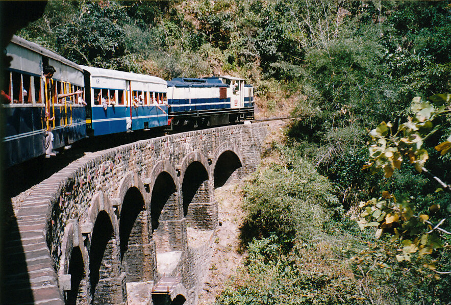
Kalka-ShimlaWERA train
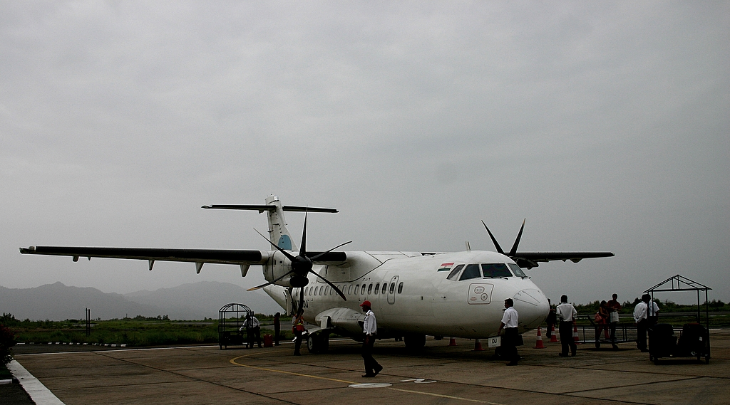

Jubbarhatti Airport
By Road[]
Shimla is connected by road to all the major towns. Distance between the Major Towns and Shimla :-
- Kalka - 80 km
- Chandigarh - 119 km
- Ambala - 166 km
- Delhi - 348 km
- Agra - 568 km
- Amritsar - 342 km
- Jammu (via Pathankot) - 482 km
- Chaupal - 110 km
- Srinagar - 787 km
- Jaipur - 629 km
- Dharmsala (via Mandi) - 270 km
- Dharamsala (via Hamirpur) - 235 km
- Dalhousie - 345 km
- Chamba - 401 km
- Kullu - 235 km
- Manali - 280 km
- Mandi - 143 km
- Palampur - 235 km
- Rohru - 129 km
- Dehradoon - 275 km
- Theog - 32 km
- Rampur - 132 km
Shimla district Profile[]
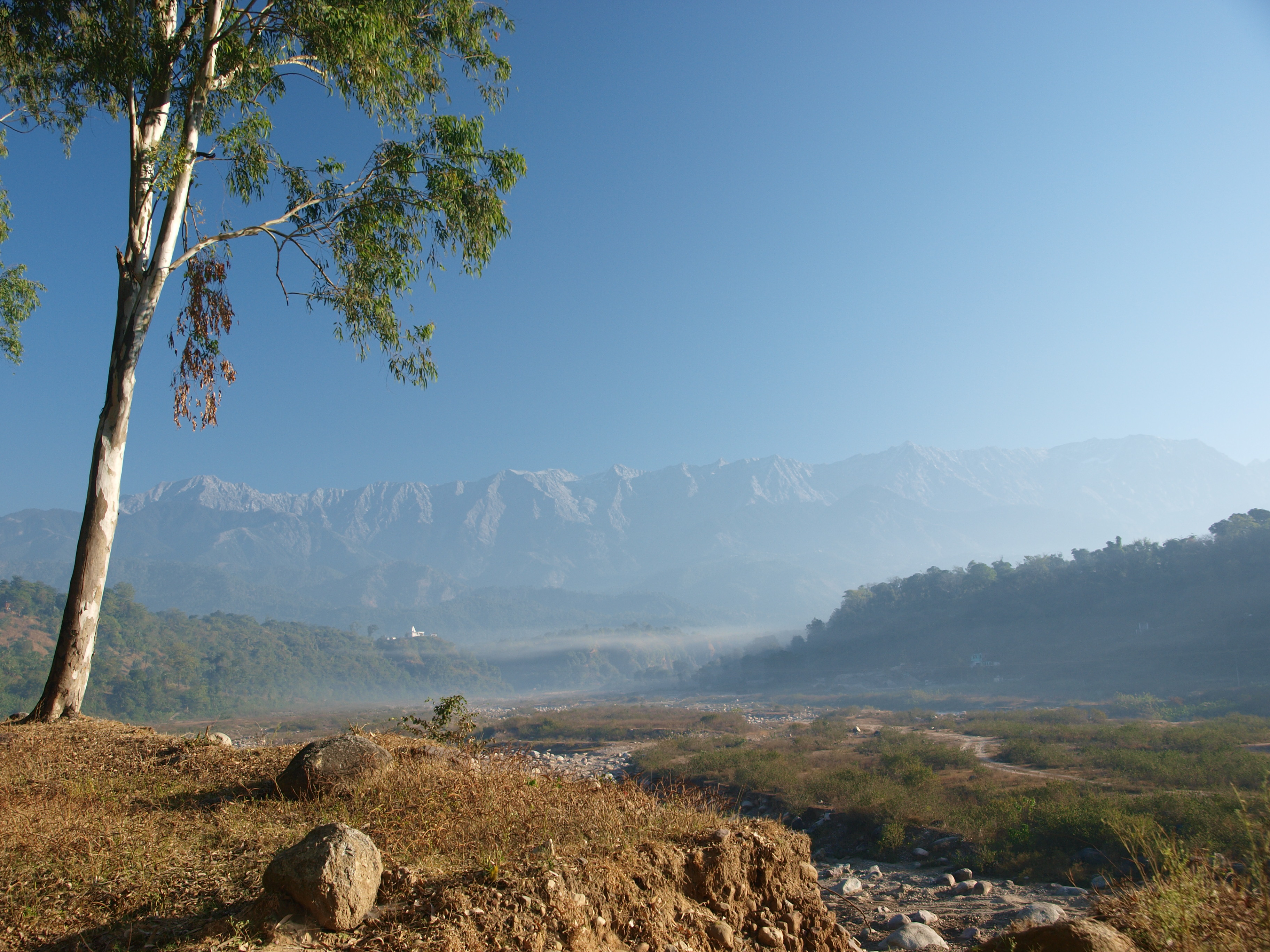

View of a Himalayan valley


Ridge Shimla


Indian Institute of Advanced Studies,Shimla


Sheep flock


Dhami village near Shimla
As of Census of India 2001[2]
Population
Persons - 8,13,384
Males - 4,24,486
Females - 3,88,898
Sex ratio (females per 1000 males) - 916
Growth (2001–2011) - 12.58%
Rural - 555,269
Urban - 167,233
Sex ratio (0–6 years) - 922
Scheduled Caste population - 188,787
Percentage to total population - 26.13%
Scheduled Tribe population - 4,112
Percentage to total population - 0 .57%
Number of households - 1 54,693
Household size (per household) - 5
Literacy and Educational level
Literates
Persons - 6,19,427
Males - 3,47,013
Females - 2,72,414
Literacy rate
Persons - 84.55 %
Males - 90.73 %
Females - 77.80 %
Educational Level attained
Total - 504,330
Without level - 11,640
Below primary - 9 7,060
Primary - 1 14,805
Middle - 7 8,995
Matric/Higher Secondary/Diploma - 1 53,284
Graduate and above - 4 8,464
Age groups
0 – 4 years - 5 9,305
5 – 14 years - 1 49,801
15 – 59 years - 4 55,784
60 years and above (Incl. A.N.S.) - 5 7,612
Religions (Largest three)
1.Hindus - 704,150
2.Muslims - 8,493
3.Sikhs - 4,825
Important Towns
1.Shimla (M Corp.) - 142,555
2.Rampur (M Cl) - 9,653
3.Rohru (M CI) - 8,205
4.Chaupal (NP) - 6786
5.Theog (M CI) - 5435
Total inhabited villages - 2,520
Type of house
(% of households occupying)
Permanent - 83.2
Semi-permanent - 14.6
Temporary - 2.2
| Climate data for Shimla | |||||||||||||
|---|---|---|---|---|---|---|---|---|---|---|---|---|---|
| Month | Jan | Feb | Mar | Apr | May | Jun | Jul | Aug | Sep | Oct | Nov | Dec | Year |
| Record high °C (°F) | 21 (70) |
24 (75) |
26 (79) |
31 (88) |
33 (91) |
36 (97) |
30 (86) |
30 (86) |
28 (82) |
27 (81) |
24 (75) |
22 (72) |
36 (97) |
| Average high °C (°F) | 11 (52) |
13 (55) |
18 (64) |
21 (70) |
23 (73) |
25 (77) |
22 (72) |
19 (66) |
18 (64) |
17 (63) |
13 (55) |
11 (52) |
17 (63) |
| Average low °C (°F) | 2 (36) |
5 (41) |
10 (50) |
14 (57) |
17 (63) |
20 (68) |
18 (64) |
16 (61) |
14 (57) |
11 (52) |
9 (48) |
4 (39) |
11 (52) |
| Record low °C (°F) | −9 (16) |
−8 (18) |
−5 (23) |
−1 (30) |
3 (37) |
2 (36) |
7 (45) |
5 (41) |
4 (39) |
2 (36) |
0 (32) |
−6 (21) |
−9 (16) |
| Precipitation mm (inches) | 61 (2.4) |
69 (2.72) |
61 (2.4) |
53 (2.09) |
66 (2.6) |
175 (6.89) |
424 (16.69) |
434 (17.09) |
160 (6.3) |
33 (1.3) |
13 (0.51) |
28 (1.1) |
1,577 (62.09) |
| Source: wunderground.com [3] | |||||||||||||
Demographics[]
According to the 2011 census Shimla district has a population of 813,384,[1] roughly equal to the nation of Comoros[4] or the US state of South Dakota.[5] This gives it a ranking of 483rd in India (out of a total of 640).[1] The district has a population density of 159 inhabitants per square kilometre (410 /sq mi) .[1] Its population growth rate over the decade 2001-2011 was 12.58 %.[1] Shimla has a sex ratio of 916 females for every 1000 males,[1] and a literacy rate of 84.55 %.[1]
References[]
- ^ a b c d e f g "District Census 2011". Census2011.co.in. 2011. http://www.census2011.co.in/district.php. Retrieved 2011-09-30.
- ^ Census of India
- ^ "Historical Weather for Delhi, India". Weather Underground. http://www.wunderground.com/NORMS/DisplayIntlNORMS.asp?CityCode=42182&Units=both. Retrieved November 27, 2008.
- ^ US Directorate of Intelligence. "Country Comparison:Population". https://www.cia.gov/library/publications/the-world-factbook/rankorder/2119rank.html. Retrieved 2011-10-01. "Comoros 794,683 July 2011 est."
- ^ "2010 Resident Population Data". U. S. Census Bureau. http://2010.census.gov/2010census/data/apportionment-pop-text.php. Retrieved 2011-09-30. "South Dakota 814,180"
External links[]

|
Mandi District | Kullu district |
| |
| Solan district | Kinnaur district Uttarkashi district, Uttarakhand | |||
 Shimla district | ||||
| Sirmaur district | Dehradun district, Uttarakhand |
| |||||
| Lakes | Renuka Lake | Maharana Pratap Sagar | Gobind Sagar (more...) |
|---|---|
| Rivers | Beas | Chenab | Ravi | Sutlej | Yamuna |
| Districts | Bilaspur | Chamba | Hamirpur | Kangra | Kinnaur | Kullu | Lahul and Spiti | Mandi | Sirmaur | Shimla | Solan | Una |
| Other | Climate of Himachal Pradesh | Protected areas of Himachal Pradesh | List of peaks in Himachal Pradesh |
Template:Himachal Pradesh topics
| This page uses content from the English language Wikipedia. The original content was at Shimla district. The list of authors can be seen in the page history. As with this Familypedia wiki, the content of Wikipedia is available under the Creative Commons License. |