| Main | Births etc |
|---|
| Inverness | |
| Scottish Gaelic: Inbhir Nis | |
| File:File:Inverness Castle and River Ness Inverness Scotland - conner395.jpg Inverness Castle looking over the River Ness |
|

Inverness | |
| Population | 46,870 [1] |
|---|---|
| Language | English Scottish Gaelic |
| OS grid reference | |
| - Edinburgh | 158 miles (254 km) |
| - London | 561 miles (903 km) |
| Council area | Highland |
| Lieutenancy area | Inverness-shire |
| Country | Scotland |
| Sovereign state | United Kingdom |
| Post town | INVERNESS |
| Postcode district | IV1-IV3, IV5, IV13, IV63 |
| Dialling code | 01463 |
| Police | Northern |
| Fire | Highlands and Islands |
| Ambulance | Scottish |
| EU Parliament | Scotland |
| UK Parliament | Inverness, Nairn, Badenoch and Strathspey |
| Scottish Parliament | Inverness and Nairn |
| Website | City of Inverness and Area |
| List of places: UK • Scotland • | |
Inverness ( /ɪnvərˈnɛs/; from the Scottish Gaelic: Inbhir Nis [iɲɪɾʲˈniʃ], meaning "Mouth of the River Ness") is a city in the Scottish Highlands. It is the administrative centre for the Highland council area,[2] and is regarded as the capital of the Highlands of Scotland. Inverness lies near two important battle sites: the 11th-century battle of Blàr nam Fèinne against Norway which took place on The Aird and the 18th-century Battle of Culloden which took place on Culloden Moor.[3] It is the northernmost city in the United Kingdom and lies within the Great Glen (Gleann Mòr) at its north-eastern extremity where the River Ness enters the Moray Firth. At the latest, a settlement was established by the 6th century with the first royal charter being granted by Dabíd mac Maíl Choluim (King David I) in the 12th century. The Gaelic king Mac Bethad Mac Findláich (MacBeth) whose 11th-century murder of King Duncan was immortalised in Shakespeare's play Macbeth, held a castle within the city where he ruled as Mormaer of Moray and Ross.[4]
The population of Inverness grew from 40,949 in 2001 to 46,870 in 2012. The Greater Inverness area, including Culloden and Westhill, had a population of 59,910 in 2012.[5] Inverness is one of Europe's fastest growing cities,[6] with a quarter of the Highland population living in or around it,[7] and is ranked fifth out of 189 British cities for its quality of life, the highest of any Scottish city.[8] In the recent past, Inverness has experienced rapid economic growth: between 1998 and 2008, Inverness and the rest of the central Highlands showed the largest growth of average economic productivity per person in Scotland and the second greatest growth in the United Kingdom as a whole, with an increase of 86%.[9] Inverness is twinned with one German city, Augsburg, and two French towns, La Baule and Saint-Valery-en-Caux.[10]
Inverness College is the main campus for the University of the Highlands and Islands.[11] With around 8,500 students, Inverness College hosts around a quarter of all the University of the Highlands and Islands' students, and 30% of those studying to degree level.[12]
In 2014, a survey by a property website described Inverness as the happiest place in Scotland and the second happiest in the UK.[13] Inverness was again found to be the happiest place in Scotland by a new study conducted in 2015.[14]
History[]


"Prospectus Civitatis Innerness", Inverness in 1693
Inverness was one of the chief strongholds of the Picts, and in CE 565 was visited by St Columba with the intention of converting the Pictish king Brude, who is supposed to have resided in the vitrified fort on Craig Phadrig,[15] on the western edge of the city. A 93 oz (2.9 kg) silver chain dating to 500–800 was found just to the south of Torvean in 1983.[16] A church or a monk's cell is thought to have been established by early Celtic monks on St Michael's Mount, a mound close to the river, now the site of the Old High Church[17] and graveyard. The castle is said to have been built by Máel Coluim III (Malcolm III) of Scotland, after he had razed to the ground the castle in which Mac Bethad mac Findláich (Macbeth) had, according to much later tradition, murdered Máel Coluim's father Donnchad (Duncan I), and which stood on a hill around 1 km to the north-east.
The strategic location of Inverness has led to many conflicts in the area. Reputedly there was a battle in the early 11th century between King Malcolm and Thorfinn of Norway at Blar Nam Feinne, to the southwest of the city.[18]
Inverness had four traditional fairs, including Legavrik or "Leth-Gheamhradh", meaning midwinter, and Faoilleach. William the Lion (d. 1214) granted Inverness four charters, by one of which it was created a royal burgh. Of the Dominican friary founded by Alexander III in 1233, only one pillar and a worn knight's effigy survive in a secluded graveyard near the town centre.
Medieval Inverness suffered regular raids from the Western Isles, particularly by the MacDonald Lords of the Isles in the fifteenth century. In 1187 one Domhnall Bán (Donald Bane) led islanders in a battle at Torvean against men from Inverness Castle led by the governor's son, Donnchadh Mac An Toisich (Duncan Mackintosh).[19] Both leaders were killed in the battle, Donald Bane is said to have been buried in a large cairn near the river, close to where the silver chain was found.[20] Local tradition says that the citizens fought off the Clan MacDonald in 1340 at the Battle of Blairnacoi on Drumderfit Hill, north of Inverness across the Beauly Firth.[21] On his way to the Battle of Harlaw in 1411, Donald of Islay harried the city, and sixteen years later James I held a parliament in the castle to which the northern chieftains were summoned, of whom three were arrested for defying the king's command. Clan Munro defeated Clan Mackintosh in 1454 at the Battle of Clachnaharry just west of the city.[22] The Clan MacDonald and their allies stormed the castle during the Raid on Ross in 1491.
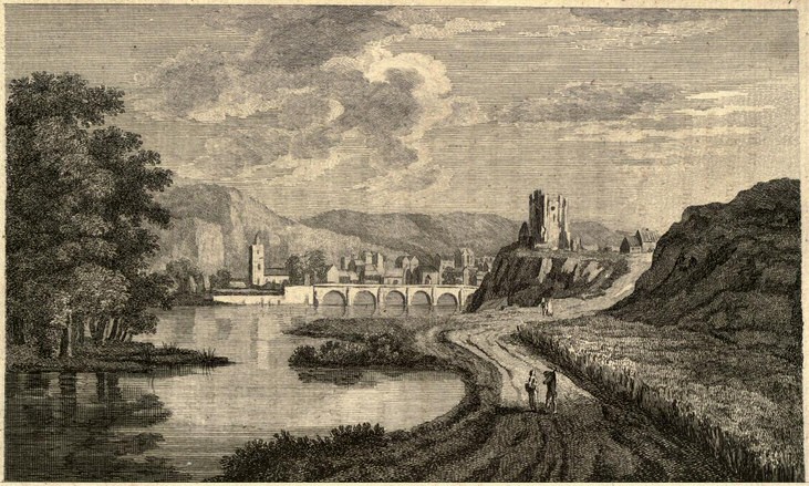

Engraving of Inverness from A Tour in Scotland by Thomas Pennant, 1771.
In 1562, during the progress undertaken to suppress Huntly's insurrection, Mary, Queen of Scots, was denied admittance into Inverness Castle by the governor, who belonged to the earl's faction, and whom she afterwards caused to be hanged. The Clan Munro and Clan Fraser of Lovat took the castle for her.[23] The house in which she lived meanwhile stood in Bridge Street until the 1970s, when it was demolished to make way for the second Bridge Street development.
Beyond the then northern limits of the town, Oliver Cromwell built a citadel capable of accommodating 1,000 men, but with the exception of a portion of the ramparts it was demolished at the Restoration. The only surviving modern remnant is a clock tower.
Inverness played a role in the first Jacobite rising in 1689. In early May, it was besieged by a contingent of Jacobites led by MacDonnell of Keppoch. The town was actually rescued by Viscount Dundee, the overall Jacobite commander, when he arrived with the main Jacobite army, although he required Inverness to profess loyalty to King James VII.[24]
In 1715 the Jacobites occupied the royal fortress as a barracks. In 1727 the government built the first Fort George here, but in 1746 it surrendered to the Jacobites and they blew it up.[25]
Culloden Moor lies nearby, and was the site of the Battle of Culloden in 1746, which ended the Jacobite Rising of 1745–1746.
On 7 September 1921, the first British Cabinet meeting to be held outside London took place in the Town House, when David Lloyd George, on holiday in Gairloch, called an emergency meeting to discuss the situation in Ireland. The Inverness Formula composed at this meeting was the basis of the Anglo-Irish Treaty.
Toponymy[]
Inverness and its immediate hinterland have a large number of originally Gaelic place names as the area was solidly Gaelic-speaking until the late 19th century.[26]


Inverness Castle
| Placename | Original Gaelic | Meaning |
|---|---|---|
| Abertarff | Obar Thairbh | Mouth of the Bull River |
| Aldourie | Allt Dobhraig | River of the Water |
| Allanfearn | An t-Àilean Feàrna | The Alder Meadow |
| Ballifeary | Baile na Faire | The Guard's Farm |
| Balloch | Baile An Locha | Township near the loch |
| Balmore | Baile Mòr | The Big Township |
| Balnafettack | Baile nam Feadag | Farm of the Plovers |
| Balvonie | Bhaile a' Mhonaidh | Village on the hill |
| Balvraid | Baile a' Bhràghaid | Township of the Brae |
| Beauly Firth | Poll an Ròid | Bay of the Cross |
| Ben Wyvis | Beinn Uais | Mount Terror |
| Bogbain | Bog Ban | The White Marsh |
| Bunchrew | Bun Chraoibh | Foot of the Tree |
| Carnarc | Càrn Airc | The Sea Stone |
| Castle Heather | Caisteal Leathoir | Castle on the Slope |
| Charleston | Baile Theàrlaich | Tearlach's Town |
| Clachnaharry | Clach na h-Aithrigh | Stone of Repentance |
| Craggie | Cragaidh | Rocky Place |
| Craig Dunain | Creag Dùn Eun | Rocky Bird Hill |
| Croftnacreich | Croit na Chrithich | The Aspen Hut |
| Crown | Crùn | Crown |
| Croy | Chrothaigh | Hard Place |
| Culcabock | Cùil na Càbaig | Back of the Tillage Land |
| Culduthel | Cuil Daothail | Quiet northern spot |
| Culloden | Cùil Lodair | Nook of the Marsh |
| Dalcross | Dealgros | Prickle Point |
| Dalneigh | Dail an Eich | Field of the Horse |
| Dalmagarry | Dail Mac Gearraidh | The Meadow of Gary's Son |
| Dell | Dail MhicEachainn | MacEachen's Meadow |
| Diriebught | Tìr nam Bochd | Land of the Poor |
| Dochfour | Dabhach Phùir | Davoch of Pasture Land |
| Dochgarroch | Dabhach Gairbheach | Rough Davoch |
| Dores | Dubhras | Black Wood |
| Drumdevan | Druim Dìomhain | The Idle Ridge |
| Drummond | An Druimein | The Ridge |
| Drumossie | Druim Athaisidh | Ridge of the Great Meadow |
| Essich | Easaich | Place of the Stream |
| Inshes | Na h-Innseagan | The Meadows |
| Inverness | Inbhir Nis | Mouth of the River Ness |
| Kessock | Ceasaig | (Saint) Ceasaig |
| Kilmuir | Cille Mhoire | Mary's Church |
| Kilvean | Cill Bheathain | Church of St.Bain |
| Kinmylies | Ceann a' Mhìlidh | The Warrior's Head |
| Lairgmore | Luirg Mór | Big slope |
| Leachkin | Leacainn | Broad Hillside |
| Loch Ness | Loch Nis | Lake Ness |
| Lochardil | Loch Àrdail | The Church Lake |
| Merkinch | Marc Innis | The Horse Meadow |
| Millburn | Allt a' Mhuilinn | The Mill River |
| Muckovie | Mucamhaigh | The Pig Field |
| Raigmore | Rathaig Mhòir | Big Fort |
| Resaurie | Ruigh Samhraidh | Summer Slope |
| Scaniport | Sganaphort | Ferry by the Crack |
| Scorguie | Sgurr Gaoithe | The Windy Hill |
| Slackbuie | An Slag Buidhe | The Yellow Hollow |
| Smithton | Baile a' Ghobhainn | Smiths' Town |
| Tomatin | Tom Aitinn | Hill of the Juniper |
| Tomnahurich | Tom na h-Iubhraich | Hill of the Yew Trees |
| Torvean | Tòrr Bheathain | MacBean's Hill |
Several springs which were traditionally thought to have healing qualities exist around Inverness. Fuaran Dearg, which translates as the "red spring" is a chalybeate spring located near Dochgarroch. Fuaran a' Chladaich (The Spring on the Beach) near Bunchrew was once accessed by a causeweay from the shore, although submerged at high tide it continues to bubble and was traditionally known for treating cholera. Fuaran Allt an Ionnlaid (Well of the Washing Burn) at Clachnaharry, where the Marquis of Montrose was allowed to drink while on his way from his capture in Sutherland to his execution in Edinburgh, was known for treating skin conditions. Also at Clachnaharry, Fuaran Priseag (The Precious Well) was said to have been blessed by Saint Kessock and could treat weak and sore eyes, as well as expelling evil and shielding curses if a silver coin was offered. Tobar na h-Oige (Well of the Young) is located near Culloden and was known for curing all ailments. Fuaran a' Chragan Bhreag (Well of the Speckled Rock) is located near Craig Dundain and Fuaran na Capaich (The Keppoch Well) is located near Culloden.[27] Although a Gaelic name itself, Craig Phadraig is alternatively known as Làrach an Taigh Mhóir, or "the place of the Great house.[28] "Several Gaelic place names are now largely obsolete due to the feature being removed or forgotten. Drochaid an Easain Duibh (Bridge by the Small Dark Waterfall), referred to in the tale Aonghas Mòr Thom na h-Iubhraich agus na Sìthichean (Great Angus of Tomnahurich and the Faries) has not yet been located within Inverness and Slag nam Mèirleach (meaning Robbers' hollow), adjacent to Doors Road in Holm is no longer in use. Until the late 19th century, four mussel beds existed on the delta mouth of the River Ness: 'Scalp Phàdraig Mhòir' (Scalp of Big Patrick), 'Rònach' (Place of the Seals) 'Cridhe an Uisge' (The Water Heart) and 'Scalp nan Caorach' (Scalp of the Sheep) – these mussel beds were all removed to allow better access for fishing boats and ships.[29]
Allt Muineach (The Thicket River) now runs underground between Culcabock Roundabout and Millburn Roundabout. An Loch Gorm (The Turquoise Loch), a small sea loch which was situated beside Morrisons supermarket, was filled in during the 19th century and lives on only in the name of Lochgorm Warehouse. Abban Street stems from the word àban, a word of local Gaelic dialect meaning a small channel of water.
Many prominent points around Inverness retain fully Gaelic names.
Beinn Bhuidhe Bheag – Little Yellow Hill
Beinn Uan – Lamb Hill
Cnoc na Mòine – The Peat Hill
Cnoc na Gaoithe – The Hill of the Wind
Cnoc an t-Seòmair – The Hill of the Room
Creag Liath – Grey Crag
Creag nan Sidhean – The Crag of the Fairies
Doire Mhòr – Great Oakwood
Carn a' Bhodaich – The Old Man's Cairn
Meall Mòr – Great Hill
In the colonial period, a Gaelic speaking settlement named New Inverness was established in McIntosh County, Georgia, by settlers from in and around Inverness. The name was also given by expatriates to settlements in Quebec, Nova Scotia, Montana, Florida, Illinois, and California. The name Inverness is also given to a feature on Miranda, a moon of the planet Uranus, as well as a 2637 m tall mountain in British Columbia, Canada.[30] Inverness is also known by its nicknames Inversnecky or The Sneck, with its inhabitants traditionally known as "Clann Na Cloiche" ("Children of the Stone" in Gaelic) owing to the importance of the Clach Na Cudainn stone to the city's history.
Population[]
| Year | Greater Inverness | Inverness |
|---|---|---|
| 2012 | 59,910[31] | 46,870[32] |
| 2010 | 57,960[33] | 45,050[34] |
| 2008 | 56,660[35] | 44,220[36] |
| 2006 | 54,070[37] | 42,400[38] |
| 2004 | 52,530[39] | 40,880[40] |
| 2003 | 51,610[41] | 40,470[42] |
| 2001 | 46,944[43] | 40,949[44] |
| 1991 | 44,903[45] | 40,918[46] |
| 1981 | 43,246 | 40,011 |
| 1971 | 34,839 | |
| 1961 | 29,774 | |
| 1951 | 28,107 | |
| 1881 | 17,365 | |
| 1871 | 14,469 | |
| 1861 | 12,509 | |
| 1841 | 9,663 | |
| 1831 | 14,324 | |
| 1821 | 12,264 | |
| 1811 | 10,750 | |
| 1801 | 8,732 | |
| 1791 | 7,930 |
The National Records of Scotland define Inverness as the urban area west of the A9. To produce a greater Inverness figure including the villages of Balloch, Culloden, Smithton, and Westhill it is necessary to aggregate NRS figures for each locality.[47]
Geography[]
Inverness is situated at the mouth of the River Ness (which flows from nearby Loch Ness) and at the southwestern extremity of the Moray Firth. The city lies at the end of the Great Glen with Loch Ness, Loch Ashie and Loch Duntelchaig to the west. Inverness's Caledonian Canal also runs through the Great Glen connecting Loch Ness, Loch Oich, and Loch Lochy.
The Ness Islands, a publicly owned park, consist of two wooded islands connected by footbridges and has been used as a place of recreation since the 1840s.[48] Craig Phadraig, once an ancient Gaelic and Pictish hillfort is a 240 m[49] hill which offers hikes on a clear pathway through the wooded terrain.
Inverness lies on the Great Glen Fault. The last earthquake to affect Inverness occurred in 1934.[50]
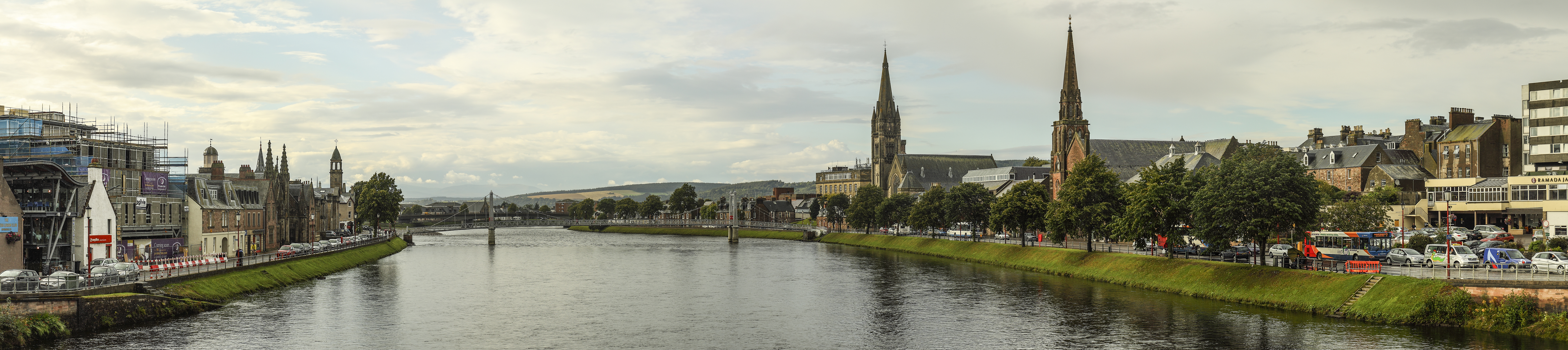

Panorama of Inverness looking downstream to the Greig St Bridge with Huntly Street (left), the River Ness and Bank Street (right)
Location[]

|
Dingwall, Ullapool | Munlochy, Maryburgh, Bonar Bridge, Wick, Thurso | Nairn, Balintore, Forres, Elgin |
|
| Beauly, Muir of Ord | Keith, Turriff, Peterhead | |||
 Inverness | ||||
| Drumnadrochit, Fort Augustus, Fort William | Balnafoich, Aviemore, Dalwhinnie, Perth | Carrbridge, Grantown-on-Spey, Aberdeen, Dundee |
Climate[]
In common with Scotland, Inverness has an oceanic climate. Its sheltered location makes it one of the driest areas in Scotland. In terms of snowfall Inverness sees around 18.3 days of falling snow per year and the record accumulation of snowfall was 1 foot 2 inches in January 2010. The climate here is much colder than south-eastern Britain. The highest temperature recorded is 29.7°C in July 2006. Typically the warmest day should rise to 25.4°C with a total of 2 days reaching or exceeding 25.1°C. The lowest temperature recorded is -18.7°C in January 2010. Typically the coldest night should fall to -10.6°C.[51] Climate in this area has mild differences between highs and lows, and there is adequate rainfall year round. The Köppen Climate Classification subtype for this climate is "Cfb" (Marine West Coast Climate/Oceanic climate).[52]
| Climate data for Inverness (1981-2010) | |||||||||||||
|---|---|---|---|---|---|---|---|---|---|---|---|---|---|
| Month | Jan | Feb | Mar | Apr | May | Jun | Jul | Aug | Sep | Oct | Nov | Dec | Year |
| Record high °C (°F) | 11.9 (53.4) |
12.7 (54.9) |
19.4 (66.9) |
23.7 (74.7) |
26.6 (79.9) |
28.4 (83.1) |
29.7 (85.5) |
29.1 (84.4) |
25.8 (78.4) |
20.3 (68.5) |
15.4 (59.7) |
11.4 (52.5) |
29.8 (85.6) |
| Average high °C (°F) | 6.9 (44.4) |
7.3 (45.1) |
9.3 (48.7) |
11.6 (52.9) |
14.6 (58.3) |
16.9 (62.4) |
18.9 (66.0) |
18.6 (65.5) |
16.1 (61.0) |
12.6 (54.7) |
9.3 (48.7) |
7.0 (44.6) |
12.5 (54.5) |
| Average low °C (°F) | 1.1 (34.0) |
1.2 (34.2) |
2.4 (36.3) |
4.0 (39.2) |
6.4 (43.5) |
9.3 (48.7) |
11.4 (52.5) |
11.2 (52.2) |
8.9 (48.0) |
6.0 (42.8) |
3.5 (38.3) |
1.2 (34.2) |
5.6 (42.1) |
| Record low °C (°F) | −18.3 (−0.9) |
−17.2 (1.0) |
−12.8 (9.0) |
−6.3 (20.7) |
−4.1 (24.6) |
−1.2 (29.8) |
2.4 (36.3) |
1.2 (34.2) |
0.2 (32.4) |
−4.5 (23.9) |
−11.7 (10.9) |
−16.8 (1.8) |
−18.7 (−1.7) |
| Precipitation mm (inches) | 76.9 (3.028) |
58.6 (2.307) |
57.6 (2.268) |
39.4 (1.551) |
51.6 (2.031) |
59.3 (2.335) |
53.4 (2.102) |
59.5 (2.343) |
67.2 (2.646) |
78.1 (3.075) |
66.2 (2.606) |
65.0 (2.559) |
732.8 (28.85) |
| Avg. precipitation days (≥ 1 mm) | 14 | 11 | 14 | 9 | 11 | 11 | 10 | 12 | 12 | 13 | 13 | 13 | 143 |
| Mean monthly sunshine hours | 38.8 | 72.7 | 104.5 | 135.5 | 176.8 | 143.1 | 140.0 | 133.9 | 113.2 | 84.2 | 49.7 | 27.8 | 1,220.1 |
| Source: MetOffice[53] | |||||||||||||
Health[]
Raigmore is the main hospital in Inverness and the entire Highland authority.[54] The present hospital opened in 1970, replacing wartime wards dating from 1941.[55]
Raigmore is also a teaching hospital catering for both the Universities of Aberdeen and Stirling. A new Centre for Health Science is located behind Raigmore Hospital. This is funded by Highlands and Islands Enterprise, the Scottish Executive and Johnson & Johnson. Phase I of this opened in early 2007, with phase II and phase III housing The Diabetes Institute opening in 2009. The University of Stirling moved its nursing and midwifery teaching operations from Raigmore Hospital to the CfHS. The UHI also has strong links with the centre through its Faculty of Health.
Economy[]
Most of the traditional industries such as distilling have been replaced by high-tech businesses, such as the design and manufacture of diabetes diagnostic kits. Highlands and Islands Enterprise has principally funded the Centre for Health Science to attracting more businesses in the medical and medical devices business to the area. Inverness is home to Scottish Natural Heritage following that body's relocation from Edinburgh under the auspices of the Scottish Government's decentralisation strategy. SNH provides a large number of jobs in the area.


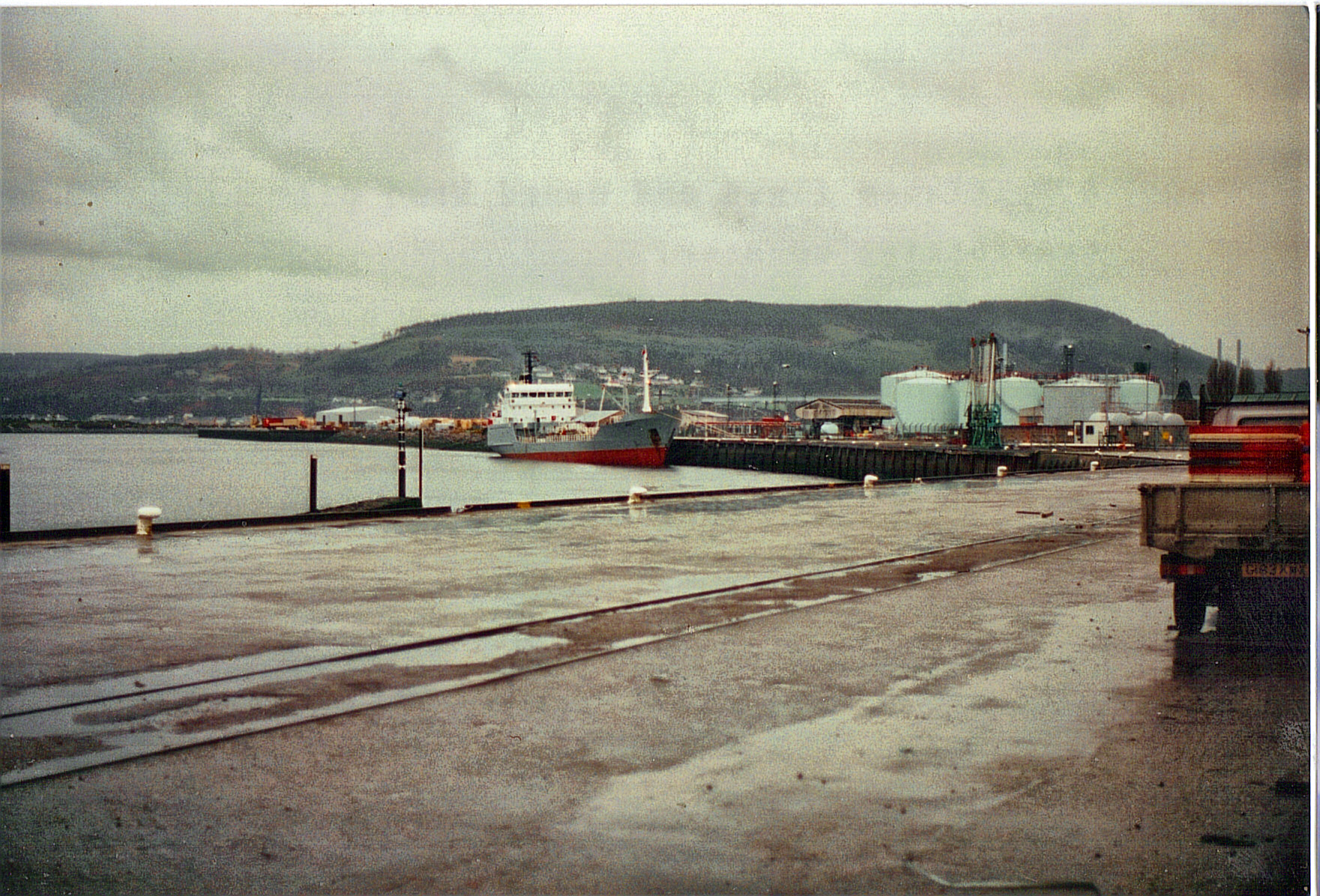
Inverness High Street heading towards Church Street

A view of Inverness harbour in 1999.
Inverness City Centre lies on the east bank of the river and is linked to the west side of the town by three road bridges – Ness Bridge, Friars Bridge and the Black (or Waterloo) Bridge – and by one of the town's suspension foot bridges, the Grieg Street Bridge.[56] The traditional city centre was a triangle bounded by High Street, Church Street and Academy Street, within which Union Street and Queensgate are cross streets parallel to High Street. Between Union Street and Queensgate is the Victorian Market, which contains a large number of small shops.[57] The main Inverness railway station is almost directly opposite the Academy Street entrance to the Market. From the 1970s, the Eastgate Shopping Centre was developed to the east of High Street, with a substantial extension being completed in 2003.
Education[]
The city has a number of different education providers. Inverness is catered for by about a dozen primary schools including Inverness Gaelic Primary School, a specialised institution situated at Slackbuie. There are 5 secondary schools: Inverness High School, Inverness Royal Academy, Charleston Academy, Millburn Academy and Culloden Academy. Additionally there is Inverness College which offers further and higher education courses to those of school leaving age and above. The City also has a new Centre for Health Sciences adjacent to Raigmore Hospital.
University of the Highlands and Islands[]
Inverness College is situated in the city and is a key part of the University of the Highlands and Islands, a federation of 15 colleges and research institutions in the Highlands and Islands of Scotland delivering higher education.
Plans for a new Business R&D and academic campus have been in place for some time with the college at its current Longman site relocation to a new development at the new Inverness Campus at Beechwood Farm.
The planning application for phase 1 of a new campus, lodged by Highlands and Islands Enterprise (HIE) was passed by The Highland Council in May 2010. The original outline planning application for the entire landholding submitted early 2009 remains live. This application forms a vision for the development over the next thirty years. The application includes:
- Academic buildings – up to 70,480 m2
- Business and incubation units – up to 49,500 m2
- Indoor sports complex – up to 9,000 m2
- Student and other short term residences – 44,950 m2
- Associated landscape, open space, outdoor recreation, infrastructure and services necessary to support the development phases
- Up to 200 residential units
- A social enterprise-run hotel[58][59]
The 80-hectare (200 acres) campus at Beechwood, just off the A9 south of Inverness, is considered to be one of the most important developments for the region over the next 20 years. The principal of UHI, James Fraser, said: “This is a flagship development which will provide Inverness with a university campus and vibrant student life. It will have a major impact on the city and on the Highlands and Islands. UHI is a partnership of colleges and research centres throughout the region, and the development of any one partner brings strength to the whole institution."[60]
It is estimated that the new campus would contribute more than £50m to the economy of the Highlands because it could attract innovative commercial businesses interested in research and development, while increasing the number of students who study within the city by around 3,000.[61]
Transport[]
Inverness is linked to the Black Isle across the Moray Firth by the Kessock Bridge. It has a railway station[62] with Abellio ScotRail services to Perth, Edinburgh, Glasgow, Aberdeen, Thurso, Wick and Kyle of Lochlash. Inverness is connected to London Euston by the Caledonian Sleeper, which departs six times a week and by the Virgin Trains East Coast operated Highland Chieftain to London King's Cross which runs daily.
Inverness Airport[63] is located 15 km east of the city and has scheduled flights to airports across the UK including London, Manchester, Belfast and the islands to the north and west of Scotland. Flybe operate flights to Belfast, Birmingham, Manchester and Dublin. Loganair, Flybe's franchise partner, operate Saab 340 aircraft to Benbecula, Kirkwall, Stornoway and Sumburgh. EasyJet operate Airbus aircraft to London Gatwick three times per day, Luton twice a day and Bristol. British Airways daily to London Heathrow, KLM daily to Amsterdam.
Three trunk roads (the A9, A82 and A96) provide access to Aberdeen, Perth, Elgin, Wick, Thurso, Edinburgh and Glasgow.


A picture of a Stagecoach Group bus in Inverness, 1999.
Stagecoach Highlands is the division of the Stagecoach Group which covers most of the former Rapson Group operations after the take-over by Stagecoach. It covers the following depots of the Stagecoach Group.
- Fort William (Ardgour Road, Caol) (t/a Stagecoach in Lochaber)
- Kirkwall (Scott's Road Hatston Industrial Estate) (t/a Stagecoach in Orkney)
- Portree (Park Road) (t/a Stagecoach in Skye)
- Thurso (Janet Street) (t/a Stagecoach in Caithness)
There are various outstations over the division area due to the rural nature of the area covered.
The operation from Aviemore depot comes under the East Scotland division as it trades as Stagecoach in Inverness.
Inverness bus station[]
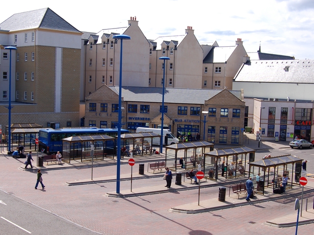

Inverness bus station
Inverness bus station is situated at Farraline Park and can be accessed from Academy Street and Margaret Street. The bus station is managed by the Highland Council and is a short walk away from the Inverness railway station and the main shopping area.
Permission was granted to demolish the existing bus station in 2000. It was then replaced with a new terminal building in the early 2000s.
The bus station's main operators include Stagecoach in Inverness and Stagecoach in Lochaber. Buses operate from the bus station around the town of Inverness and to Inverness Airport and to places as far afield as Fort William, Ullapool, Thurso and Aberdeen.
Megabus and Scottish Citylink operate a regular coach service to the Scotland's capital Edinburgh with connections to Glasgow at Perth.
National Express Coaches operate an overnight service (588) from Inverness to London (Victoria) taking 12 hours 35 minutes.
Inverness Trunk Road Link[]
Plans are in place to convert the A96 between Inverness and Nairn to a dual carriageway and to construct a southern bypass that would link the A9, A82 and A96 together involving crossings of the Caledonian Canal and the River Ness in the Torvean area, southwest of the town.[64]
The bypass, known as the Inverness Trunk Road Link (TRL), is aimed at resolving Inverness’s transport problems and has been split into two separate projects, the east and west sections. The east section will bypass Inshes Roundabout, a notorious traffic bottleneck, using a new road linking the existing Southern Distributor with the A9 and the A96, both via grade separated interchanges. This proposed new link road would bypass Inshes roundabout, as stated before, and separate strategic traffic from local traffic as well as accommodating proposals for new development at the West Seafield Retail and Business Park and also a new UHI campus.
At the west end, two options for crossing the river and canal were developed. One involving a high level vertical opening bridge which will allow the majority of canal traffic to pass under without the need for opening. The other involved a bridge over the river and an aqueduct under the canal. Both of these designs are technically complex and were considered in detail along by the key stakeholders involved in the project. Ultimately it was decided that a bridge over the river and a tunnel under the canal were the best option, allow more expensive.[65]
In late 2008 the controversial decision by the Scottish Government not to include the full Inverness bypass in its transport plan for the next 20 years was made. The government's Strategic Transport Projects Review did include the eastern section of the route, which will see the A9 at Inshes linked to the A96.
But the absence of the TRL's western section, which would include a permanent crossing over the Caledonian Canal and River Ness, sparked dismay among several Highland councillors and business leaders in Inverness who feel the bypass is vital for the city's future economic growth.[66]
Upgrading of the A9 South[]
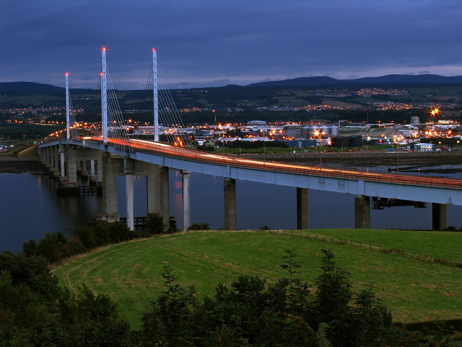

Evening at Kessock Bridge
In late 2008 the Scottish Government's transport plan for the next 20 years was announced. It brings forward planned improvements to the A9 in an attempt to stimulate the economy and protect jobs.
Work costing a total of £8.5 million was undertaken at Moy, Carrbridge and Bankfoot. Northbound overtaking lanes were created and the carriageway was reconstructed at both Moy and Carrbridge. Junction improvements were also made at Moy.
In November 2011 the Scottish Government announced that it will upgrade the entire road from Perth to Inverness to dual carriageway. Work on this project is expected to start in 2015 is scheduled to be completed in 2025, at a cost of £3 billion.[67]
In July 2013, the Scottish Government announced a plan to install average speed cameras on the A9 between Perth and Inverness. This has been undertaken with an aim to reduce accidents and fatalities on the road, and will be the second permanent average speed camera scheme in Scotland.[68]
Port of Inverness[]
The Port of Inverness is located at the mouth of the River Ness and has four quays and receives over 300 vessels a year.
Government[]
Local government[]
Inverness was an autonomous royal burgh, and county town for the county of Inverness (also known as Inverness-shire) until 1975, when local government counties and burghs were abolished, under the Local Government (Scotland) Act 1973, in favour of two-tier regions and districts and unitary islands council areas. The royal burgh was then absorbed into a new district of Inverness, which was one of eight districts within the Highland region. The new district combined in one area the royal burgh, the Inverness district of the county and the Aird district of the county. The rest of the county was divided between other new districts within the Highland region and the Western Isles. Therefore, although much larger than the royal burgh, the new Inverness district was much smaller than the county.
In 1996, under the Local Government etc (Scotland) Act 1994,[69] the districts were abolished and the region became a unitary council area. The new unitary Highland Council, however, adopted the areas of the former districts as council management areas, and created area committees to represent each. The Inverness committee represented 23 out of the 80 Highland Council wards, with each ward electing one councillor by the first past the post system of election. Management area and committee area boundaries later became disconnected as a result of changes to ward boundaries in 1999. Ward boundaries changed again in 2007, and the council management areas were replaced with three new corporate management areas.
Ward boundary changes in 2007, under the Local Governance (Scotland) Act 2004,[70] created 22 new Highland Council wards, each electing three or four councillors by the single transferable vote system of election, a system designed to produce a form of proportional representation. The total number of councillors remaining the same. Also, the Inverness management area was merged into the new Inverness, Nairn and Badenoch and Strathspey corporate management area, covering nine of the new wards and electing 34 of the 80 councillors. As well as the Inverness area, the new area includes the former Nairn management area and the former Badenoch and Strathspey management area. The corporate area name is also that of a constituency, but boundaries are different.
Within the corporate area there is a city management area covering seven of the nine wards, the Aird and Loch Ness ward, the Culloden and Ardersier ward, the Inverness Central ward, the Inverness Millburn ward, the Inverness Ness-side ward, the Inverness South ward and the Inverness West ward. The Nairn ward and the Badenoch and Strathspey ward complete the corporate area. Wards in the city management area are to be represented on a city committee as well as corporate area committees.
| Party | Seats | ||||||||||||||||||||||||||||||||||||||||||||||||
|---|---|---|---|---|---|---|---|---|---|---|---|---|---|---|---|---|---|---|---|---|---|---|---|---|---|---|---|---|---|---|---|---|---|---|---|---|---|---|---|---|---|---|---|---|---|---|---|---|---|
| Scottish National Party | 7 | ||||||||||||||||||||||||||||||||||||||||||||||||
| Liberal Democrats | 6 | ||||||||||||||||||||||||||||||||||||||||||||||||
| Independent | 5 | ||||||||||||||||||||||||||||||||||||||||||||||||
| Labour Party | 4 | ||||||||||||||||||||||||||||||||||||||||||||||||
City status[]
In 2000 city status was granted to the Town of Inverness, and letters patent were taken into the possession of the Highland Council by the convener of the Inverness area committee.[71] These letters patent, which were sealed in March 2000 and are held by Inverness Museum and Art Gallery,[72] create a city of Inverness, but do not refer to anywhere with defined boundaries, except that Town of Inverness may be taken as a reference to the burgh of Inverness. As a local government area the burgh was abolished 26 years earlier, in 1975, and so was the county of Inverness for which the burgh was the county town. Nor do they refer to the former district or to the royal burgh.
The Highland area was created as a two-tier local government region in 1975, and became a unitary local government area in 1996. The region consisted of eight districts, of which one was called Inverness. The districts were all merged into the unitary area. As the new local government authority, the Highland Council then adopted the areas of the districts as council management areas. The management areas were abolished in 2007, in favour of three new corporate management areas. The council has defined a large part of the Inverness, Nairn and Badenoch and Strathspey corporate area as the Inverness city management area.[73] This council-defined city area includes Loch Ness and numerous towns and villages apart from the former burgh of Inverness.
In January 2008 a petition to matriculate armorial bearings for the City of Inverness was refused by Lord Lyon King of Arms on the grounds that there is no legal persona to which arms can be granted.[74]
Parliamentary representation[]
There are three existing parliamentary constituencies with Inverness as an element in their names:
- One county constituency of the House of Commons of the Parliament of the United Kingdom (Westminster), created in 2005:
- Inverness, Nairn, Badenoch and Strathspey, currently represented by Scottish National Party (SNP) Member of Parliament (MP) Drew Hendry.
- One constituency of the Scottish Parliament (Holyrood), created in 2011:
- Inverness and Nairn, currently represented by Scottish National Party Member of the Scottish Parliament (MSP) Fergus Ewing[75]
These existing constituencies are effectively subdivisions of the Highland council area, but boundaries for Westminster elections are now very different from those for Holyrood elections. The Holyrood constituencies are also subdivisions of the Highlands and Islands electoral region.
Historically there have been six Westminster constituencies:
- One burgh constituency:
- Inverness Burghs, 1708 to 1918
- Five county constituencies:
- Inverness-shire, 1708 to 1918
- Inverness, 1918 to 1983
- Inverness, Nairn and Lochaber, 1983 to 1997
- Inverness East, Nairn and Lochaber, 1997 to 2005
- Ross, Skye and Inverness West, 1997 to 2005
Inverness Burghs was a district of burghs constituency, covering the parliamentary burghs of Inverness, Fortrose, Forres and Nairn. Inverness-shire covered, at least nominally, the county of Inverness minus the Inverness parliamentary burgh. As created in 1918, Inverness covered the county minus Outer Hebridean areas, which were merged into the Western Isles constituency. The Inverness constituency included the former parliamentary burgh of Inverness. As created in 1983, Inverness, Nairn and Lochaber was one of three constituencies covering the Highland region, which had been created in 1975. As first used in 1997, the Inverness East, Nairn and Lochaber, and Ross, Skye and Inverness West constituencies were effectively two of three constituencies covering the Highland unitary council area, which had been created in 1996.
International relations[]
Twin towns — Sister cities[]
 Augsburg, Bavaria, Germany
- La Baule-Escoublac, Pays de la Loire, France[76]
- Saint-Valery-en-Caux, Normandy, France
Culture and sports[]
Inverness is an important centre for bagpipe players and lovers, since every September the city hosts the Northern Meeting. The Inverness cape, a garment worn in the rain by pipers the world over, is not necessarily made in Inverness.
Another major event in calendar is the annual City of Inverness Highland Games. The event can trace its roots back to one of the first Highland Games staged in the modern era; the True Highland Games which was staged in 1822 by members of the Northern Meeting Society. In 1864 the Northern Meeting Society built the world's first Highland Games stadium, the Northern Meeting Park. The last Northern Meeting Highland Games was staged in 1938 and following the second world war, responsibility for the organisation of the annual event passed to the Town Council who moved the event to Bught Park in 1948. In 2006 Inverness hosted Scotland's biggest ever Highland Games over two days in July, featuring the Masters' World Championships, the showcase event for heavies aged over 40 years. 2006 was the first year that the Masters' World Championships had been held outside the United States, and it attracted many top heavies from around the world to the Inverness area. The Masters World Championships returned in 2009 when it was staged as part of the Homecoming celebrations. In 2010, the City of Inverness Highland Games returned to Northern Meeting Park where it remains to this day.
The main theatre in Inverness is called Eden Court Theatre. Actress Karen Gillan is the ambassador for Theatre Art Education.
The current music scene within Inverness generally leans towards an emo/punk/hardcore style, but there are also bands who show features of different genres such as rock, metal, pop, classical, grunge, industrial and traditional Scottish music.
Inverness is home to two summer music festivals, Rockness and the Tartan Heart Festival, that bring a variety of different music to the town.
BFBS Radio broadcasts on 87.7FM as part of its UK Bases network.


Caledonian Stadium, home of Inverness Caledonian Thistle
The city is home to four football clubs. Inverness Caledonian Thistle was formed in 1994 from the merger of two Highland League clubs, Caledonian and Inverness Thistle. "Caley Thistle" of the Scottish Premiership plays at the Tulloch Caledonian Stadium. The town's second football club, Clachnacuddin, plays in the Highland League. Inverness Citadel was another popular side which became defunct, but had its name revived. The third football side is Inverness City who play in the North Region Juniors and were formed in 2006. Inverness Athletic became the fourth, joining the North Caledonian Football League in 2016.
Highland RFC is the local rugby union club that competes regularly in the Caledonia Regional League Division One.
Highland HC is the local hockey team, it consists of two men's teams, two ladies teams and a junior team.[77] with both Men's & Ladies' 1st teams in Scottish National Division 2. The Men's 1st team successfully gained promotion from Scottish National Division 3 in 2011.[78]
Inverness Blitz is a charity that promotes the development of American football in Inverness and the surrounding area.[79] Bught Park, located in the centre of Inverness is the finishing point of the annual Loch Ness Marathon and home of Inverness Shinty Club.
In 2011, Inverness hosted professional golf with the Scottish Open on the European Tour, played at Castle Stuart the week before The Open Championship.
Cricket is also played in Inverness, with both Highland CC and Northern Counties playing in the North of Scotland Cricket Association League and 7 welfare league teams playing midweek cricket at Fraser Park. Both teams have been very successful over the years.
Stock car racing was staged in Inverness circa 1973.
Inverness has a mixed Basketball Team, the Inverness Giants, who play exhibition games against local teams throughout the North and Islands
Inverness Botanic Gardens is located in Bught Park a few minutes walk from the west bank of the River Ness near to the Ness Islands.[80]
In 2007, the city hosted Highland 2007, a celebration of the culture of the Highlands, and will also host the World Highland Games Heavy Championships (21 & 22 July) and European Pipe Band Championships (28 July).[81] 2008 saw the first Hi-Ex (Highlands International Comics Expo), held at the Eden Court Theatre.[82][83]
Inverness is the location of Macbeth's castle in Shakespeare's play.
Gaelic in Inverness[]


The use of preaspiration in different Scottish Gaelic dialects throughout the Highlands, from 1 (strong) to 6 (absent). Preaspiration was used in the dialect of Inverness Gaelic and is still evident in both the Gaelic and English spoken in Inverness today.
Historically, Inverness had a solidly Gaelic speaking population, with the majority of the population having Gaelic as their first language. From approximately the end of the 19th century, following the 1872 Education Act, Inverness suffered a decline in the number of Gaelic speakers in line with the rest of the once Gaidhealtachd / Scottish Highlands. Despite the local dialect of Scottish Gaelic gradually falling out of use (although it continued to affect local English language dialect), the language is still spoken in other dialects and standardised forms. By the end of the 19th century, some rural areas to the south east of Inverness still had completely Gaelic speaking populations, such as Strath Dearn where almost 100% of the population were still Gaelic speaking.
1677: Inverness was described as "overwhelmingly" Gaelic speaking by the traveller Thomas Kirk.
1704: Close to 100% of the population was fluent in Gaelic, with 57% of the city's population speaking only Gaelic and the remaining 43% also having some understanding of the Scots language. Edward Lhuyd published major work on Inverness Gaelic and after collecting data from between 1699 and 1700, his findings showed a distinct dialect in the area.[84] The clear dialect of Inverness Gaelic was held in high regard by speakers of other forms, such as those from Lewis, Sutherland and Ross.[85] Gaelic remained the principal language of Invernessians for the rest of the 18th century, despite growing pressure from outwith the Highlands in both political and social contexts.
1798: Thomas Garnett (Professor of Natural Philosophy and Chemistry in the Royal Institution of Great Britain) observed that Inverness had become largely bilingual with Invernessians using Gaelic as the language of the home but English as the language of foreign trade – however, the older generation at the time generally only had the Gaelic. Speaking of those in the countryside immediately surrounding Inverness, Garnett stated that although in Inverness both Gaelic and English “are spoken promiscuously...the language of the country people is Gaelic.”
1828: John Wood praised the standard of both the Gaelic and English spoken in Inverness stating that both languages were spoken with "utmost purity." He noted that children would casually flit between the two languages while playing, asking questions in Gaelic while receiving answers in English and vice versa.
1882: The Celtic Magazine, published in Inverness, complained that enumerators of the 1881 census who assessed whether families were Gaelic speaking, English speaking or both, had supplied false information. The magazine wrote that "whole families .... scarcely any member of whom can express the commonest idea intelligently in English – who are in every sense Gaelic-speaking people only – were returned by the enumerators as English-speaking."
1901: Inhabitants of Inverness voiced regret at the very swift decay of the native language in the short space of twenty years following a complete absence of bilingual education and disregard for Gaelic.[86]
For its size, Inverness today still has a relatively high density of Gaelic speakers and a relatively lively Gaelic scene, making it one of the centres of the Scottish Gaelic Renaissance. According to the 2011 census, 4.8% of residents of greater Inverness over age 3 speak Gaelic compared to 1.1% nationally. At 2,800 Gaelic speakers, only Greater Glasgow and Edinburgh have a higher absolute total.[87] The number of Gaelic speakers has fluctuated over the last century. In 1881, the census reported 4,047 Gaelic speakers in Inverness (23.3% of the population) which by 1891 had risen to 6,356 speakers (30.47%).[88] By 1901 this figure had dropped to 5,072 speakers (23.88%) of the population, from which it continued to drop to present day numbers through emigration and language shift.[88] Scottish Gaelic is slowly re-appearing in the linguistic landscape, appearing on some signs around Inverness. Bun-sgoil Ghàidhlig Inbhir Nis, which opened in August 2007 offering primary school education through the medium of Gaelic, is nearing full capacity and was extended to allow for more pupils in August 2010.[89] Bòrd na Gàidhlig, an organisation responsible for supporting and promoting the use of Scottish Gaelic, has its main office in Inverness.[90] Other Gaelic related groups include the Inverness Gaelic Choir which has existed for over 70 years.[91] Inverness will also host the Royal National Mòd in 2014, a festival celebrating Gaelic culture.[92]
Buildings[]


St. Andrew's Cathedral on the banks of the River Ness
Important buildings in Inverness include Inverness Castle, and various churches.
The castle was built in 1835 on the site of its medieval predecessor. It is now a sheriff court.
Inverness Cathedral, dedicated to St Andrew, is a cathedral of the Scottish Episcopal Church and seat of the ordinary of the Diocese of Moray, Ross and Caithness. The cathedral has a curiously square-topped look to its spires, as funds ran out before they could be completed.
The oldest church is the Old High Church,[93] on St Michael's Mount by the riverside, a site perhaps used for worship since Celtic times. The church tower dates from mediaeval times, making it the oldest surviving building in Inverness. It is used by the Church of Scotland congregation of Old High St Stephen's, Inverness,[94] and it is the venue for the annual Kirking of the Council, which is attended by local councillors.
There is no Catholic cathedral in the area as the Diocese's cathedral (St Mary) is at Aberdeen, the seat of the Diocese of Aberdeen. The Catholic population is served by two parish churches: St Mary's Church, founded in 1837, is the older of the two and the first Catholic church founded in Inverness since the Reformation.[95] St Ninian's was built during the 1960s and 1970s.[96]
Inverness College is the hub campus for the UHI Millennium Institute.[97]
Porterfield Prison, officially HMP Inverness, serves the courts of the Highlands, Western Isles, Orkney Isles and Moray, providing secure custody for all remand prisoners and short term adult prisoners, both male and female (segregated).[98]
Long-Distance Walking Hub[]
Inverness is connected to three long-distance footpaths:
- The Great Glen Way - connects to Fort William along the Great Glen
- The John o' Groats Trail - connects to John o' Groats along the coast
- The East Highland Trail - connects to Blair Atholl and eventually Stirling through the Cairngorms
Towns and villages[]
Apart from the former burgh of Inverness, the Highland Council's city management area includes Ardersier, Beauly, Culloden, Balloch, Drumnadrochit, Fort Augustus, Invermoriston, Smithton, Tomatin, Kirkhill and Kiltarlity.
Shinty[]
Shinty is an integral part of the Highlands and Islands. As the capital of the Highlands, Inverness often hosts a wealth of Shinty finals such as the Camanachd Cup Final (the pinnacle of Shinty) as well as the international game of Shinty and Irish hurling. Despite Inverness Shinty Club not being particularly successful in recent years, some of the towns and villages that surround the city have been, such as Kiltarlity who are the home of Lovat Shinty Club (recent winners of the MacTavish Cup 2013) and Glen Urquhart.
Notable people[]
- Charlie Christie – Footballer; career included playing for Celtic and Inverness Caledonian Thistle
- Charles Fraser Mackintosh (Teàrlach Friseal Mac An Toisich) – lawyer, author and politician. Born and raised in Inverness and represented the Highlands in Wesminster.[99]
- Yvette Cooper – Work and Pensions Secretary in the Brown Cabinet, was born in Inverness
- Don Cowie – Footballer, currently playing for Heart of Midlothian
- James Alexander Forbes – British Vice-Consul to Mexican California as well as the first British Consul to the American state of California
- Karen Gillan – Actress, best known as Amy Pond, the Doctor's Companion in Doctor Who
- Elspet Gray – Actress
- Derry Irvine – Former Lord Chancellor (under Tony Blair); was born in Inverness
- Malcolm Jones – Musician; guitar player for Runrig
- Charles Kennedy – Former leader of the Liberal Democrats; was born in Inverness
- Kevin MacDonald – Former footballer who played for Liverpool FC, and former caretaker first team coach at Aston Villa
- John A. Mackay – Presbyterian theologian, missionary, and educator
- Mary Macpherson – (Màiri Nic a' Phearsain) poet and political activist, "Great Mairi of the Songs" raised her children in Inverness, where she wrote much of her work.[100]
- John McGinlay – Former footballer who played as a striker, most notably for Bolton Wanderers
- Ali Smith – Author; born in Inverness in 1962
- Mr Egg – MacAcidhouse musician; born in Inverness on 7 January 1959
References[]
- ^ "Mid-2012 Population Estimates for Settlements and Localities in Scotland". National Records Scotland (NRS). http://www.nrscotland.gov.uk/files//statistics/population-estimates/special-area/mid-2012-settlements/2012-pop-est-sett-local-main-all%20-tabs.xls. Retrieved 2015-10-29.
- ^ The Highland Council website. Retrieved 6 March 2006.
- ^ "Inverness city". Inverness-scotland.com. http://www.inverness-scotland.com/in-and-around-2-inverness.asp. Retrieved 14 July 2010.
- ^ "Destinations :: City Guides :: Inverness". Loganair. http://www.loganair.co.uk/destinations/city-guides/inverness. Retrieved 30 October 2012.
- ^ "Mid-2012 Population Estimates for Settlements and Localities in Scotland". National Records Scotland (NRS). http://www.nrscotland.gov.uk/files//statistics/population-estimates/special-area/mid-2012-settlements/2012-pop-est-sett-local-main-all%20-tabs.xls. Retrieved 2015-10-29.
- ^ "Inverness: the new Shangri-La?". Newstatesman.com. http://www.newstatesman.com/life-and-society/2007/03/city-inverness-poland-local. Retrieved 30 October 2012.
- ^ "Overview of Inverness". Scottish-places.info. http://www.scottish-places.info/towns/townfirst2064.html. Retrieved 14 July 2010.
- ^ "Is your home recession proof?". The Daily Telegraph (London). 7 February 2008. http://www.telegraph.co.uk/property/main.jhtml?xml=/property/2008/02/03/precession103.xml&page=2. Retrieved 14 July 2010.
- ^ "BBC News - Central Highlands 'Scotland's top economic performer'". BBC. 18 July 2011. http://www.bbc.co.uk/news/mobile/uk-scotland-scotland-business-14186837. Retrieved 25 August 2011.
- ^ "City of Inverness Town Twinning Committee". Inverness-town-twinning.com. http://www.inverness-town-twinning.com. Retrieved 14 July 2010.
- ^ "UHI". Inverness.uhi.ac.uk. http://www.uhi.ac.uk. Retrieved 22 Apr 2015.
- ^ "Inverness College". Inverness.uhi.ac.uk. http://www.inverness.uhi.ac.uk. Retrieved 22 Apr 2015.
- ^ "Inverness happiest place in Scotland". BBC. http://www.bbc.co.uk/news/uk-scotland-highlands-islands-27502591. Retrieved 21 May 2014.
- ^ "Inverness is Scotland's happiest place". Herald Scotland. http://www.heraldscotland.com/news/13576978.Inverness_is_Scotland_s_happiest_place/. Retrieved 16 September 2015.
- ^ "''Craig Phadrig, Inverness'', Walk in Scotland, Visitscotland". Walking.visitscotland.com. 27 March 2008. http://walking.visitscotland.com/walks/nescotland/213042. Retrieved 14 July 2010.
- ^ "Site Record for Torvaine, Caledonian Canal, Inverness; Torvean". . Silver chain was found at grid reference NH65424346 when digging the Caledonian Canal in 1809.
- ^ "Inverness churches". Churchesinverness.com. http://www.churchesinverness.com/Old-High-Church-g.asp. Retrieved 14 July 2010.
- ^ "Site Record for Blar Nam Feinne". . Blar Nam Feinne is on Cnoc na Moine (grid reference NH595433).
- ^ "Site Record for Torvaine, Torbane". . RCAHMS locate the battle of Torvean at grid reference NH65414346
- ^ "Site Record for Torvaine". . The cairn at grid reference NH65424346 disappeared in the 19th or 20th centuries, it has also been claimed to mark the resting place of St Bean(Beóán) the Culdee.
- ^ "Site Record for Battle Of Blairnacoi, Drumderfit Hill". grid reference NH656521
- ^ "Site Record for Clachnaharry, Clan Battle Monument, Clachnaharry Memorial". . Battle of Clachnaharry took place at grid reference NH6454946448.
- ^ George Buchanan's (1506 -1582), History of Scotland, completed in 1579, first published in 1582.
- ^ A. M. Scott, Bonnie Dundee (1989), pp. 104-105
- ^ "Inverness on Undiscovered Scotland". Undiscoveredscotland.co.uk. http://www.undiscoveredscotland.co.uk/inverness/inverness/. Retrieved 14 July 2010.
- ^ "A'Chleit (Argyll), A' Chleit" (PDF). http://www.polfest.org/vli/language/gaelic/pdfs/placenamesA-B.pdf. Retrieved 14 July 2010.
- ^ https://archive.org/stream/reminiscencesofc00macluoft#page/104/mode/2up
- ^ "Transactions of the Inverness Scientific Society and Field Club. vol.1 page 126". Am Baile. http://www.ambaile.org.uk/en/item/item_page.jsp?item_id=13088. Retrieved 30 October 2012.
- ^ "Around Clach na Cùdainn: Some Musings on the Gaelic Place Names of Inverness - Scottish Corpus of Texts and Speech". Scottishcorpus.ac.uk. http://www.scottishcorpus.ac.uk/corpus/search/document.php?documentid=1408. Retrieved 25 August 2011.
- ^ "Mount Revelstoke National Park : Revelstoke, BC, Canada". Kootenayseh.com. http://www.kootenayseh.com/revelstoke-bc/parks/mt-revelstoke-park.htm. Retrieved 14 July 2010.
- ^ "Mid-2012 Population Estimates for Settlements and Localities in Scotland". National Records Scotland (NRS). http://www.nrscotland.gov.uk/files//statistics/population-estimates/special-area/mid-2012-settlements/2012-pop-est-sett-local-main-all%20-tabs.xls. Retrieved 2015-10-29.
- ^ "Mid-2012 Population Estimates for Settlements and Localities in Scotland". National Records Scotland (NRS). http://www.nrscotland.gov.uk/files//statistics/population-estimates/special-area/mid-2012-settlements/2012-pop-est-sett-local-main-all%20-tabs.xls. Retrieved 2015-10-29.
- ^ "Mid-2010 Population Estimates - Settlements in alphabetical order". National Records Scotland (NRS). http://www.nrscotland.gov.uk/statistics-and-data/statistics/statistics-by-theme/population/population-estimates/special-area-population-estimates/settlements-and-localities/mid-2010/list-of-tables. Retrieved 2015-10-29.
- ^ "Mid-2010 Population Estimates - Localities in alphabetical order". National Records Scotland (NRS). http://www.nrscotland.gov.uk/statistics-and-data/statistics/statistics-by-theme/population/population-estimates/special-area-population-estimates/settlements-and-localities/mid-2010/list-of-tables. Retrieved 2015-10-29.
- ^ "Mid-2008 Population Estimates - Settlements in alphabetical order". National Records Scotland (NRS). http://www.nrscotland.gov.uk/statistics-and-data/statistics/statistics-by-theme/population/population-estimates/special-area-population-estimates/settlements-and-localities/mid-2008. Retrieved 2015-10-29.
- ^ "Mid-2008 Population Estimates - Localities in alphabetical order". National Records Scotland (NRS). http://www.nrscotland.gov.uk/statistics-and-data/statistics/statistics-by-theme/population/population-estimates/special-area-population-estimates/settlements-and-localities/mid-2008. Retrieved 2015-10-29.
- ^ "Mid-2006 Population Estimates for Settlements in Scotland". National Records Scotland (NRS). http://www.nrscotland.gov.uk/statistics-and-data/statistics/statistics-by-theme/population/population-estimates/special-area-population-estimates/settlements-and-localities/mid-2006. Retrieved 2015-10-29.
- ^ "Mid-2006 Population Estimates for Localities in Scotland". National Records Scotland (NRS). http://www.nrscotland.gov.uk/statistics-and-data/statistics/statistics-by-theme/population/population-estimates/special-area-population-estimates/settlements-and-localities/mid-2006-localities. Retrieved 2015-10-29.
- ^ "Mid-2004 Population Estimates for Settlements in Scotland". National Records Scotland (NRS). http://www.nrscotland.gov.uk/statistics-and-data/statistics/statistics-by-theme/population/population-estimates/special-area-population-estimates/settlements-and-localities/mid-2004. Retrieved 2013-06-26.
- ^ "Mid-2004 Population Estimates for Localities in Scotland". National Records Scotland (NRS). http://www.nrscotland.gov.uk/statistics-and-data/statistics/statistics-by-theme/population/population-estimates/special-area-population-estimates/settlements-and-localities/mid-2004-localities. Retrieved 2013-06-26.
- ^ "Mid-2003 Population Estimates for Settlements in Scotland". National Records Scotland (NRS). http://www.nrscotland.gov.uk/statistics-and-data/statistics/statistics-by-theme/population/population-estimates/special-area-population-estimates/settlements-and-localities/mid-2003-settlements. Retrieved 2015-10-29.
- ^ "Mid-2003 Population Estimates for Localities in Scotland". National Records Scotland (NRS). http://www.nrscotland.gov.uk/statistics-and-data/statistics/statistics-by-theme/population/population-estimates/special-area-population-estimates/settlements-and-localities/mid-2003-localities. Retrieved 2015-10-29.
- ^ "Scotland's Census 2001 - KS01 Usual Resident Population". National Records Scotland (NRS). http://www.nrscotland.gov.uk/statistics-and-data/census/2001-census/results-and-products/reports-and-data/key-statistics-for-settlements-and-localities-scotland. Retrieved 2015-10-29.
- ^ "Scotland's Census 2001 - KS01 Usual Resident Population". National Records Scotland (NRS). http://www.nrscotland.gov.uk/statistics-and-data/census/2001-census/results-and-products/reports-and-data/key-statistics-for-settlements-and-localities-scotland. Retrieved 2015-10-29.
- ^ "Scotland's Census 2001 - KS01 Usual Resident Population". National Records Scotland (NRS). http://www.nrscotland.gov.uk/statistics-and-data/census/2001-census/results-and-products/reports-and-data/key-statistics-for-settlements-and-localities-scotland. Retrieved 2015-10-29.
- ^ "Scotland's Census 2001 - KS01 Usual Resident Population". National Records Scotland (NRS). http://www.nrscotland.gov.uk/statistics-and-data/census/2001-census/results-and-products/reports-and-data/key-statistics-for-settlements-and-localities-scotland. Retrieved 2015-10-29.
- ^ "Mid-2012 Population Estimates for Settlements and Localities in Scotland". National Records Scotland (NRS). http://www.nrscotland.gov.uk/files//statistics/population-estimates/special-area/mid-2012-settlements/2012-pop-est-sett-local-main-all%20-tabs.xls. Retrieved 2015-10-29.
- ^ "River Ness - Inverness - Ness Islands". nessriver.co.uk. http://www.nessriver.co.uk/pages/nessriver/nessIslands.html. Retrieved 25 August 2011.
- ^ "Walk Scotland - Perfect Walks - Dunain Hill & Craig Phadraig". Walking.visitscotland.com. 27 March 2008. http://walking.visitscotland.com/perfect-walks/dunainhill-craigphadraig/. Retrieved 25 August 2011.
- ^ "Inverness Royal Academy". Invernessroyal.highland.sch.uk. 16 August 1934. http://www.invernessroyal.highland.sch.uk/resources/earthquakes.html. Retrieved 25 August 2011.
- ^ "Frost Incidence". KNMI. http://eca.knmi.nl/utils/calcdetail.php?seasonid=0&periodid=1971-2000&indexid=FD&stationid=1809.
- ^ Climate Summary for Inverness, Scotland
- ^ "Inverness Climate 1981 -2010". Met Office. http://www.metoffice.gov.uk/public/weather/climate/gfhyzzs9j#averagesTable. Retrieved 26 March 2016.
- ^ Welcome to NHS Highland Archived February 15, 2015 at the Wayback Machine.
- ^ "Raigmore Hospital". Nhshighland.scot.nhs.uk. 3 March 1999. http://www.nhshighland.scot.nhs.uk/Services/Pages/RaigmoreHospital.aspx. Retrieved 14 July 2010.
- ^ "Inverness Town Centre Map". Stockphotography.co.uk. http://www.stockphotography.co.uk/UK/Maps/Inverness.asp. Retrieved 14 July 2010.
- ^ "Inverness Shops". Explore-inverness.com. 15 March 2010. http://www.explore-inverness.com/shops.htm. Retrieved 14 July 2010.
- ^ "Welcome". Inverness Campus. http://invernesscampus.co.uk/ee/index.php/about_inverness_campus/news_section/highland_council_approves_plans_for_inverness_campus/. Retrieved 25 August 2011.
- ^ "Welcome". Inverness Campus. http://invernesscampus.co.uk/ee/index.php/about_inverness_campus/news_section/inverness_college_to_locate_to_beechwood_farm/. Retrieved 25 August 2011.
- ^ [1] Archived September 21, 2009 at the Wayback Machine.
- ^ "Inverness Campus". Inverness Campus. 22 June 2010. http://invernesscampus.co.uk/ee/index.php/economic_benefits/. Retrieved 14 July 2010.
- ^ The Highland Main Line, the Aberdeen-Inverness Line and the Far North Line meet at Inverness (Ordnance Survey grid reference NH667454). Also, Kyle of Lochalsh services run to and from Inverness via the Far North Line to Dingwall.
- ^ Ordnance Survey grid reference for Inverness Airport (access from A96 road): NH776508.
- ^ "The Highland Council website". Highland.gov.uk. 16 March 2007. http://www.highland.gov.uk/yourcouncil/news/newsreleases/2007/March/2007-03-15-02.htm. Retrieved 14 July 2010.
- ^ "The Inverness Courier". The Inverness Courier. 28 September 2007. http://www.inverness-courier.co.uk/news/fullstory.php/aid/3995/Trunk_link_road_tunnel_to_cost__pound;85m.html. Retrieved 14 July 2010.
- ^ "The Inverness Courier". The Inverness Courier. 30 December 2008. http://www.inverness-courier.co.uk/news/fullstory.php/aid/8355/Labour_to_quiz_Holyrood_government_on_TLR_funding.html. Retrieved 14 July 2010.
- ^ http://www.transportscotland.gov.uk/road/projects/a9
- ^ "Average speed cameras for A9 from Dunblane to Inverness". BBC News. 26 July 2013. http://www.bbc.co.uk/news/uk-scotland-highlands-islands-23462860.
- ^ "Local Government etc (Scotland) Act 1994". Office of Public Sector Information. http://www.opsi.gov.uk/acts/acts1994/Ukpga_19940039_en_1.htm. Retrieved 14 July 2010.
- ^ "Local Governance (Scotland) Act 2004". Office of Public Sector Information. http://www.opsi.gov.uk/legislation/scotland/acts2004/20040009.htm. Retrieved 14 July 2010.
- ^ Helen Liddell joins Inverness celebrations as Scotland’s Millennium City, Scotland Office press release 19 March 2001 Archived September 28, 2007 at the Wayback Machine.
- ^ Ordnance Survey grid reference for Inverness Museum and Art Gallery: NH666451
- ^ Key Decisions Taken on Council Post 2007, Highland Council news release, 15 December 2006, includes a list of wards within the Inverness management area
- ^ "''Coat of arms rejected in city status query''". The Inverness Courier. 29 January 2008. http://www.inverness-courier.co.uk/News/Coat-of-arms-rejected-in-city-status-query-5000.htm. Retrieved 16 October 2012.
- ^ Fergus Ewing MSP, Scottish Parliament website. Retrieved 10 July 2007.
- ^ "British towns twinned with French towns". Archant Community Media Ltd. Archived from the original on 5 July 2013. https://web.archive.org/web/20130705094933/http://www.completefrance.com/language-culture/twin-towns. Retrieved 20 July 2013.
- ^ http://highlandhockey.co.uk/teams
- ^ "Scottish Hockey". Scottish Hockey. http://www.scottish-hockey.org.uk/competitions/20102011-archive.aspx. Retrieved 25 August 2011.
- ^ "Inverness Blitz" invernessblitz.co.uk. Retrieved 20 September 2008.
- ^ Inverness Botanic Gardens
- ^ "''Highland 2007'', Information on the European Pipe Band Championships". Highland2007.com. http://www.highland2007.com/default.aspx.locid-07lnew05l.Lang-EN.htm. Retrieved 14 July 2010.
- ^ First superheroes expo for north, BBC, 18 January 2008
- ^ Scots' impact on comics examined, BBC, 18 January 2008
- ^ Campbell, JL & Thomson, D. Edward Lhuyd in the Scottish Highlands 1699–1700 Oxford (1963)
- ^ Campbell, J F. Popular Tales of the West Highlands. Books.google.co.uk. https://books.google.com/books?id=8bmTUD5hiA4C&pg=PA117&lpg=PA117&dq=%22long+island%22+%22Sutherland+Gaelic%22&source=bl&ots=h71ccLyEWY&sig=QrN-RaaTZ6zfjbTgplSVKUiNQ1A&hl=en&sa=X&ei=H_hHT6CbN43D8QPUoZGtDg&ved=0CB8Q6AEwAA#v=onepage&q=%22long%20island%22%20%22Sutherland%20Gaelic%22&f=false. Retrieved 30 October 2012.
- ^ "Full text of "Transactions"". Archive.org. https://archive.org/stream/transactions83unkngoog/transactions83unkngoog_djvu.txt. Retrieved 30 October 2012.
- ^ 2011 Scotland Census, Settlement Table QS211SC.
- ^ a b Withers, C. Gaelic in Scotland (1984) John Donald Publishers ISBN 0-85976-097-9
- ^ "Gaelic Primary School education set to expand in Inverness area (12/11/09) – Comann Nam Pàrant – Inbhir Nis". Cnp-inbhirnis.com. 12 November 2009. http://www.cnp-inbhirnis.com/1/post/2009/11/gaelic-primary-school-education-set-to-expand-in-inverness-area-121109.html. Retrieved 14 July 2010.
- ^ Bòrd na Gàidhlig (Scottish Gaelic)
- ^ "About Inverness Gaelic Choir". Inverness Gaelic Choir. http://invernessgaelicchoir.com/?page_id=2. Retrieved 13 October 2010.
- ^ Urquhart, Frank (16 October 2010). "Inverness to host the Royal National Mòd". Edinburgh: Scotsman Newspaper. http://news.scotsman.com/inverness/Inverness-set-to-host-Mod.6584066.jp. Retrieved 16 October 2010.
- ^ "Old High Church information". www.oldhighststephens.com. http://www.oldhighststephens.com/location//. Retrieved 19 June 2013.
- ^ "Old High St Stephen's website". Oldhighststephens.com. http://oldhighststephens.com/. Retrieved 14 July 2010.
- ^ The Story of St. Mary’s Catholic Church Inverness - St Mary's Inverness official website
- ^ St Ninian's - Story
- ^ "UHI Millennium Institute website". Uhi.ac.uk. http://www.uhi.ac.uk/. Retrieved 14 July 2010.
- ^ "Prisons: Inverness: HMP Inverness". Scottish Prison Service. http://www.sps.gov.uk/Corporate/Prisons/Inverness/HMP-Inverness.aspx. Retrieved 27 March 2016.Ordnance Survey grid reference: NH668449
- ^ "Charles Fraser-Mackintosh". Am Baile. http://www.ambaile.org.uk/en/item/item_photograph.jsp?item_id=4272. Retrieved 25 August 2011.
- ^ "Màiri Mhòr nan Òran". Am Baile. http://www.ambaile.org.uk/en/item/item_photograph.jsp?item_id=39855. Retrieved 25 August 2011.
![]() This article incorporates text from a publication now in the public domain: Chisholm, Hugh, ed. Encyclopædia Britannica. Cambridge University Press.
This article incorporates text from a publication now in the public domain: Chisholm, Hugh, ed. Encyclopædia Britannica. Cambridge University Press.
External links[]
| Wikivoyage has a travel guide for Inverness. |
- Inverness Botanic Gardens
- The Inverness Courier
- Inverness Riverside Churches
- A map of Inverness from 1716
- Photographs of Inverness
- Wildlife Watchiing in Inverness Sunday Post Travel, 15 June 2013
| ||||||||||||||
| |||||
Template:Areas of Inverness
| This page uses content from the English language Wikipedia. The original content was at Inverness. The list of authors can be seen in the page history. As with this Familypedia wiki, the content of Wikipedia is available under the Creative Commons License. |