| ||||||||||||||
| Jewell County, Kansas | |
 Location in the state of Kansas | |
 Kansas's location in the U.S. | |
| Founded | February 26, 1887 |
|---|---|
| Named for | Lieutenant-Colonel Lewis R. Jewell |
| Seat | Mankato |
| Area - Total - Land - Water |
914.47 sq mi (2,368 km²) 909.18 sq mi (2,355 km²) 5.29 sq mi (14 km²), 0.58% |
| Population - (2010) - Density |
3,077 3.7/sq mi (1.4/km²) |
| Time zone | Central: UTC-6/-5 |
Jewell County (county code JW) is a county located in North Central Kansas, in the Central United States. As of the 2010 census, the county population was 3,077.[1] Its county seat and most populous city is Mankato.[2]
History[]
19th century[]
In 1887, Atchison, Topeka and Santa Fe Railway built a branch line from Neva (3 miles west of Strong City) to Superior, Nebraska. This branch line connected Strong City, Neva, Rockland, Diamond Springs, Burdick, Lost Springs, Jacobs, Hope, Navarre, Enterprise, Abilene, Talmage, Manchester, Longford, Oak Hill, Miltonvale, Aurora, Huscher, Concordia, Kackley, Courtland, Webber, Superior. At some point, the line from Neva to Lost Springs was pulled but the right of way has not been abandoned. This branch line was originally called "Strong City and Superior line" but later the name was shortened to the "Strong City line". In 1996, the Atchison, Topeka and Santa Fe Railway merged with Burlington Northern Railroad and renamed to the current BNSF Railway. Most locals still refer to this railroad as the "Santa Fe".
Law and government[]
Although the Kansas Constitution was amended in 1986 to allow the sale of alcoholic liquor by the individual drink with the approval of voters, Jewell County has remained a prohibition, or "dry", county.[3]
Geography[]
According to the 2000 census, the county has a total area of 914.47 square miles (2,368.5 km2), of which 909.18 square miles (2,354.8 km2) (or 99.42%) is land and 5.29 square miles (13.7 km2) (or 0.58%) is water.[4]
Adjacent counties[]
- Nuckolls County, Nebraska (northeast)
- Republic County (east)
- Cloud County (southeast)
- Mitchell County (south)
- Osborne County (southwest)
- Smith County (west)
- Webster County, Nebraska (northwest)
Demographics[]
| Historical populations | |||
|---|---|---|---|
| Census | Pop. | %± | |
| 1900 | 19,420 | ||
| 1910 | 18,148 | −6.5% | |
| 1920 | 16,240 | −10.5% | |
| 1930 | 14,462 | −10.9% | |
| 1940 | 11,970 | −17.2% | |
| 1950 | 9,698 | −19.0% | |
| 1960 | 7,217 | −25.6% | |
| 1970 | 6,099 | −15.5% | |
| 1980 | 5,241 | −14.1% | |
| 1990 | 4,251 | −18.9% | |
| 2000 | 3,791 | −10.8% | |
| 2010 | 3,077 | −18.8% | |

Population pyramid

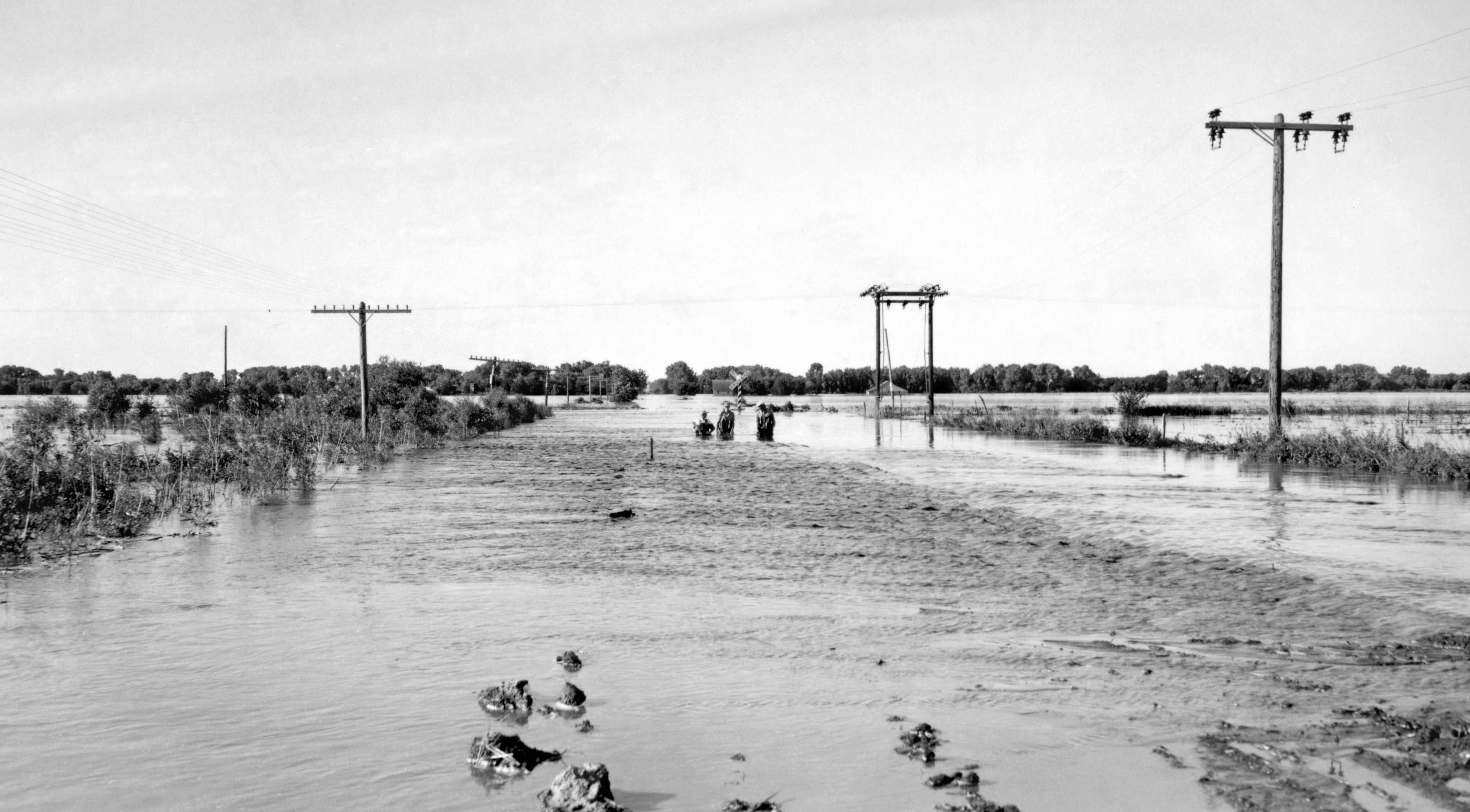
June 24, 1947 flood of the Republican River on the border of Jewell County, Kansas and Republic County, Kansas near Hardy, Nebraska and Webber, Kansas, just south of Nebraska NE-8 on Kansas 1 Rd/CR-1 bridge over the Republican River. The normal flood stage for the river is at the tree line in the foreground.
Jewell County's population was estimated to be 3,324 in the year 2006, a decrease of 440, or -11.7%, over the previous six years.[5]
As of the U.S. Census in 2000,[6] there were 3,791 people, 1,695 households, and 1,098 families residing in the county. The population density was 4 people per square mile (2/km²). There were 2,103 housing units at an average density of 2 per square mile (1/km²). The racial makeup of the county was 98.79% White, 0.34% Native American, 0.05% Asian, 0.03% Black or African American, 0.03% Pacific Islander, 0.05% from other races, and 0.71% from two or more races. Hispanic or Latino of any race were 0.71% of the population.
There were 1,695 households out of which 23.70% had children under the age of 18 living with them, 58.10% were married couples living together, 4.80% had a female householder with no husband present, and 35.20% were non-families. 32.40% of all households were made up of individuals and 18.10% had someone living alone who was 65 years of age or older. The average household size was 2.21 and the average family size was 2.80.
In the county the population was spread out with 21.90% under the age of 18, 4.40% from 18 to 24, 21.50% from 25 to 44, 26.20% from 45 to 64, and 25.90% who were 65 years of age or older. The median age was 46 years. For every 100 females there were 97.90 males. For every 100 females age 18 and over, there were 96.00 males.
The median income for a household in the county was $30,538, and the median income for a family was $36,953. Males had a median income of $24,821 versus $18,170 for females. The per capita income for the county was $16,644. About 8.40% of families and 11.60% of the population were below the poverty line, including 12.80% of those under age 18 and 10.90% of those age 65 or over.
Cities and towns[]
Incorporated cities[]
Name and population (2004 estimate):
- Mankato, 864 (county seat)
- Jewell, 447
- Burr Oak, 233
- Esbon, 135
- Formoso, 118
- Randall, 76
- Webber, 34
Unincorporated areas[]
- Montrose
- North Branch
Townships[]
Jewell County is divided into twenty-five townships. None of the cities within the county are considered governmentally independent, and all figures for the townships include those of the cities. In the following table, the population center is the largest city (or cities) included in that township's population total, if it is of a significant size.
| Township | FIPS | Population center |
Population | Population density /km² (/sq mi) |
Land area km² (sq mi) |
Water area km² (sq mi) |
Water % | Geographic coordinates |
|---|---|---|---|---|---|---|---|---|
| Allen | 01225 | 43 | 0 (1) | 90 (35) | 0 (0) | 0.02% | ||
| Athens | 02975 | 74 | 1 (2) | 102 (39) | 0 (0) | 0% | ||
| Browns Creek | 08725 | 64 | 1 (2) | 93 (36) | 0 (0) | 0.02% | ||
| Buffalo | 09125 | 574 | 5 (14) | 105 (41) | 0 (0) | 0.07% | ||
| Burr Oak | 09550 | 338 | 3 (9) | 102 (39) | 0 (0) | 0% | ||
| Calvin | 10075 | 65 | 1 (2) | 81 (31) | 0 (0) | 0.04% | ||
| Center | 11750 | 1,100 | 12 (31) | 93 (36) | 0 (0) | 0.07% | ||
| Erving | 21575 | 60 | 1 (2) | 93 (36) | 0 (0) | 0.08% | ||
| Esbon | 21625 | 222 | 2 (6) | 93 (36) | 0 (0) | 0.08% | ||
| Grant | 27725 | 220 | 2 (6) | 93 (36) | 0 (0) | 0% | ||
| Harrison | 30350 | 52 | 1 (1) | 93 (36) | 0 (0) | 0% | ||
| Highland | 31900 | 49 | 1 (1) | 93 (36) | 0 (0) | 0.03% | ||
| Holmwood | 32800 | 49 | 1 (1) | 92 (36) | 0 (0) | 0.05% | ||
| Ionia | 34375 | 100 | 1 (3) | 102 (39) | 0 (0) | 0.11% | ||
| Jackson | 34800 | 123 | 1 (3) | 92 (35) | 1 (0) | 0.90% | ||
| Limestone | 40450 | 49 | 0 (1) | 102 (39) | 0 (0) | 0.02% | ||
| Montana | 47800 | 93 | 1 (3) | 94 (36) | 0 (0) | 0.14% | ||
| Odessa | 52125 | 34 | 0 (1) | 93 (36) | 0 (0) | 0.02% | ||
| Prairie | 57400 | 172 | 2 (5) | 96 (37) | 0 (0) | 0.02% | ||
| Richland | 59375 | 36 | 0 (1) | 83 (32) | 9 (4) | 10.13% | ||
| Sinclair | 65675 | 67 | 1 (2) | 89 (34) | 3 (1) | 2.81% | ||
| Vicksburg | 73725 | 28 | 0 (1) | 93 (36) | 0 (0) | 0% | ||
| Walnut | 75000 | 80 | 1 (2) | 102 (39) | 0 (0) | 0.07% | ||
| Washington | 75650 | 50 | 1 (1) | 93 (36) | 0 (0) | 0% | ||
| White Mound | 77925 | 49 | 1 (1) | 93 (36) | 0 (0) | 0.12% | ||
| Sources: "Census 2000 U.S. Gazetteer Files". U.S. Census Bureau, Geography Division. http://www.census.gov/geo/www/gazetteer/places2k.html. | ||||||||
Education[]
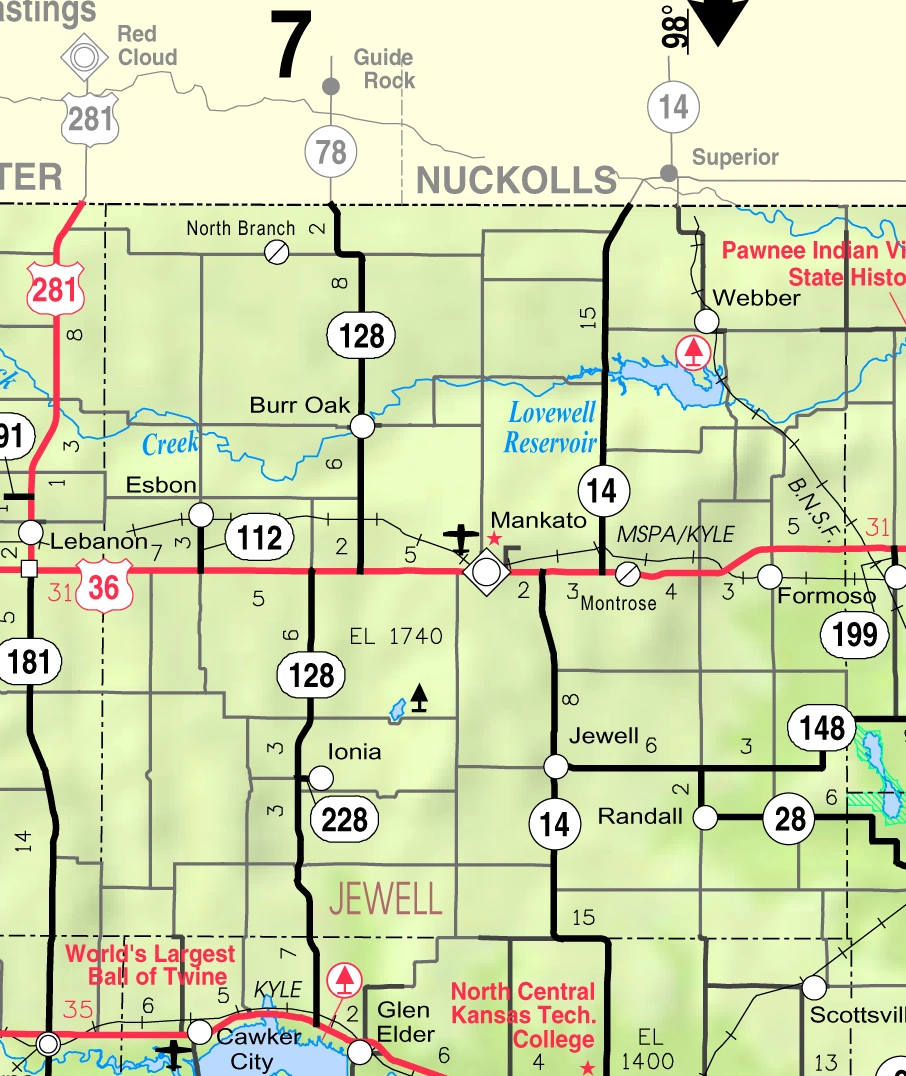
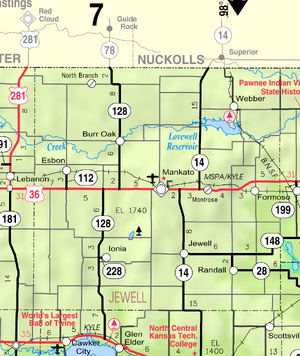
2005 KDOT Map of Jewell County (map legend)
Unified school districts[]
See also[]
Information on this and other counties in Kansas
- List of counties in Kansas
- List of Kansas county name etymologies
- National Register of Historic Places listings in Kansas
- Kansas locations by per capita income
Other information for Kansas
- List of cities in Kansas
- List of unified school districts in Kansas
- List of colleges and universities in Kansas
References[]
- ^ "2010 County Population and Housing Occupancy Status". U.S. Census Bureau. http://factfinder2.census.gov/faces/tableservices/jsf/pages/productview.xhtml?pid=DEC_10_PL_GCTPL2.ST05&prodType=table. Retrieved March 31, 2011.
- ^ "Find a County". National Association of Counties. http://www.naco.org/Counties/Pages/FindACounty.aspx. Retrieved 2011-06-07.
- ^ "Map of Wet and Dry Counties". Alcoholic Beverage Control, Kansas Department of Revenue. November 2004. http://www.ksrevenue.org/abcwetdrymap.htm. Retrieved 2007-01-21.
- ^ "Census 2000 U.S. Gazetteer Files: Counties". United States Census. http://www.census.gov/tiger/tms/gazetteer/county2k.txt. Retrieved 2011-02-13.
- ^ "Population Estimates". U.S. Census Bureau, Population Division. http://www.census.gov/popest/estimates.php. Annual estimates of the population to 2006-07-01. Released 2007-03-22. Six year change is from 2000-07-01 to 2006-07-01.
- ^ "American FactFinder". United States Census Bureau. http://factfinder.census.gov. Retrieved 2008-01-31.
Further reading[]
- History of the State of Kansas; William G. Cutler; A.T. Andreas Publisher; 1883. (Online HTML eBook)
- Kansas : A Cyclopedia of State History, Embracing Events, Institutions, Industries, Counties, Cities, Towns, Prominent Persons, Etc; 3 Volumes; Frank W. Blackmar; Standard Publishing Co; 944 / 955 / 824 pages; 1912. (Volume1 - Download 54MB PDF eBook),(Volume2 - Download 53MB PDF eBook), (Volume3 - Download 33MB PDF eBook)
External links[]
- County
- Jewell County - Official Website
- Jewell County - Directory of Public Officials
- Jewell County - Information, Skyways
- Historical
- Maps
- Jewell County Map, KDOT
- Kansas Highway Map, KDOT
- Kansas Railroad Map, KDOT
- Kansas School District Boundary Map, KSDE

|
Webster County, Nebraska | Nuckolls County, Nebraska |
| |
| Smith County | Republic County | |||
 Jewell County, Kansas | ||||
| Osborne County | Mitchell County | Cloud County |
| |||||
| This page uses content from the English language Wikipedia. The original content was at Jewell County, Kansas. The list of authors can be seen in the page history. As with this Familypedia wiki, the content of Wikipedia is available under the Creative Commons License. |