| Main | Births etc |
|---|
| Kanab | |
|---|---|
| — City — | |
 |
|
| Nickname(s): Utah's Little Hollywood | |
 |
|
 |
|
| Coordinates: Coordinates: | |
| Country | United States |
| State | Utah |
| County | Kane |
| Settled | 1870 |
| Incorporated | 1935 |
| Founder | Jacob Hamblin |
| Named for | Southern Paiute for 'willow'[1] |
| Government | |
| • Type | Council-manager |
| • Mayor | Nina Laycook |
| Area | |
| • Total | 14.1 sq mi (36.4 km2) |
| • Land | 14.0 sq mi (36.3 km2) |
| • Water | 0.0 sq mi (0.1 km2) |
| Elevation | 4,970 ft (1,515 m) |
| Population (2012) | |
| • Total | 4,410 |
| • Density | 254.2/sq mi (98.1/km2) |
| Time zone | Mountain (MST) (UTC-7) |
| • Summer (DST) | MDT (UTC-6) |
| ZIP code | 84741 |
| Area code(s) | 435 |
| FIPS code | 49-39920[2] |
| GNIS feature ID | 1429276[3] |
| Website | http://kanab.utah.gov/ |
Kanab is a city in and the county seat of Kane County, Utah, United States.[4] It is located on Kanab Creek just north of the Arizona state line. This area was first settled in 1864 and the town was founded in 1870 when ten Mormon families moved into the area.[5] The population was 3,564 at the 2000 census.
Locals refer to Kanab as "Little Hollywood" due to its history as a filming location for mostly western movies and television series such as Stagecoach, The Lone Ranger, Gunsmoke, Daniel Boone, El Dorado, Planet of the Apes, The Outlaw Josey Wales, Sergeants 3 and WindRunner: A Spirited Journey.[6]
Kanab is situated in the "Grand Circle" area, centrally located among Vermilion Cliffs National Monument, Bryce Canyon National Park, the Grand Canyon (North Rim), Zion National Park, and Lake Powell. Other nearby attractions include Grand Staircase-Escalante National Monument, Coral Pink Sand Dunes State Park, the privately owned Moqui Cave, and the largest animal sanctuary in the United States, Best Friends Animal Society.
Geography and climate[]
Kanab is located on the western Colorado Plateau.
According to the United States Census Bureau, the city has a total area of 14.1 square miles (36.4 km²), of which, 14.0 square miles (36.3 km²) of it is land and 0.04 square miles (0.1 km²) of it (0.28%) is water.
Kanab has a borderline Mediterranean climate (Köppen Csa), more typical of exposed regions around Arizona’s Mogollon Rim. The city is rather wetter, especially during the winter months, and hotter than the typical Mountain West cool semi-arid climate. The dry spring season from April to June is warm to hot during the day and very clear but the hot sun and thin air typical of Utah mean that nights remain cool and frosts can occur even in May. In the summer, monsoon thunderstorms break up the dry weather between July and October. The winters are cool during the day and very cold at night, though a large proportion of the precipitation is still rain rather than snow, which rarely accumulated beyond 1 inch (2.5 cm) and has a median total fall of only 14.8 inches (0.38 m), or three-tenths that of Salt Lake City. As noted above, overall winter precipitation is slightly in excess of that required to qualify as a subhumid rather than semi-arid climate.
| Climate data for Kanab, Utah (1971 to 2000) | |||||||||||||
|---|---|---|---|---|---|---|---|---|---|---|---|---|---|
| Month | Jan | Feb | Mar | Apr | May | Jun | Jul | Aug | Sep | Oct | Nov | Dec | Year |
| Record high °F (°C) | 72 (22) |
77 (25) |
83 (28) |
90 (32) |
97 (36) |
97 (36) |
107 (42) |
108 (42) |
105 (41) |
103 (39) |
80 (27) |
74 (23) |
107 (42) |
| Average high °F (°C) | 47.3 (8.5) |
52.7 (11.5) |
58.6 (14.8) |
66.5 (19.2) |
75.7 (24.3) |
86.4 (30.2) |
90.8 (32.7) |
87.7 (30.9) |
80.8 (27.1) |
69.8 (21.0) |
56.0 (13.3) |
48.4 (9.1) |
68.39 (20.22) |
| Average low °F (°C) | 21.9 (−5.6) |
25.8 (−3.4) |
29.8 (−1.2) |
34.6 (1.4) |
41.8 (5.4) |
49.7 (9.8) |
56.3 (13.5) |
56.4 (13.6) |
49.4 (9.7) |
39.0 (3.9) |
28.9 (−1.7) |
22.9 (−5.1) |
38.04 (3.36) |
| Record low °F (°C) | −11 (−24) |
−12 (−24) |
3 (−16) |
12 (−11) |
18 (−8) |
30 (−1) |
39 (4) |
42 (6) |
30 (−1) |
13 (−11) |
5 (−15) |
−10 (−23) |
−12 (−24) |
| Precipitation inches (mm) | 1.86 (47.2) |
1.73 (43.9) |
1.91 (48.5) |
0.95 (24.1) |
0.68 (17.3) |
0.40 (10.2) |
1.05 (26.7) |
1.45 (36.8) |
1.37 (34.8) |
1.35 (34.3) |
1.18 (30) |
1.01 (25.7) |
14.94 (379.5) |
| Snowfall inches (cm) | 9.3 (23.6) |
5.0 (12.7) |
2.6 (6.6) |
2.3 (5.8) |
0 (0) |
0 (0) |
0 (0) |
0 (0) |
0 (0) |
0.2 (0.5) |
2.3 (5.8) |
3.7 (9.4) |
25.4 (64.5) |
| Avg. precipitation days (≥ 0.01 inch) | 6.6 | 6.7 | 8.1 | 5.3 | 5.0 | 2.8 | 6.0 | 7.7 | 5.9 | 5.2 | 4.5 | 5.1 | 68.9 |
| Avg. snowy days (≥ 0.1 inch) | 3.2 | 2.1 | 1.7 | 1.0 | 0 | 0 | 0 | 0 | 0 | 0.2 | 1.0 | 1.9 | 11.1 |
| Source: National Oceanic and Atmospheric Administration[7] | |||||||||||||
Demographics[]
| Historical populations | |||
|---|---|---|---|
| Census | Pop. | %± | |
| 1890 | 409 | ||
| 1900 | 710 | 73.6% | |
| 1910 | 733 | 3.2% | |
| 1920 | 1,102 | 50.3% | |
| 1930 | 1,195 | 8.4% | |
| 1940 | 1,397 | 16.9% | |
| 1950 | 1,287 | −7.9% | |
| 1960 | 1,645 | 27.8% | |
| 1970 | 1,381 | −16.0% | |
| 1980 | 2,148 | 55.5% | |
| 1990 | 3,289 | 53.1% | |
| 2000 | 3,564 | 8.4% | |
| 2010 | 4,312 | 21.0% | |
| Est. 2012 | 4,410 | 23.7% | |
As of the census[2] of 2000, there were 3,564 people, 1,335 households, and 978 families residing in the city. The population density was 254.2 people per square mile (98.2/km²). There were 1,492 housing units at an average density of 106.4 per square mile (41.1/km²). The racial makeup of the city was 96.77% White, 0.06% African American, 0.98% Native American, 0.25% Asian, 0.03% Pacific Islander, 0.67% from other races, and 1.23% from two or more races. Hispanic or Latino of any race were 1.88% of the population.
There were 1,335 households out of which 32.1% had children under the age of 18 living with them, 65.2% were married couples living together, 6.1% had a female householder with no husband present, and 26.7% were non-families. 23.8% of all households were made up of individuals and 12.1% had someone living alone who was 65 years of age or older. The average household size was 2.64 and the average family size was 3.17.
The median income for a household in the city was $35,125, and the median income for a family was $40,778. Males had a median income of $31,741 versus $19,116 for females. The per capita income for the city was $16,128. About 4.0% of families and 5.6% of the population were below the poverty line, including 4.6% of those under age 18 and 4.9% of those age 65 or over.
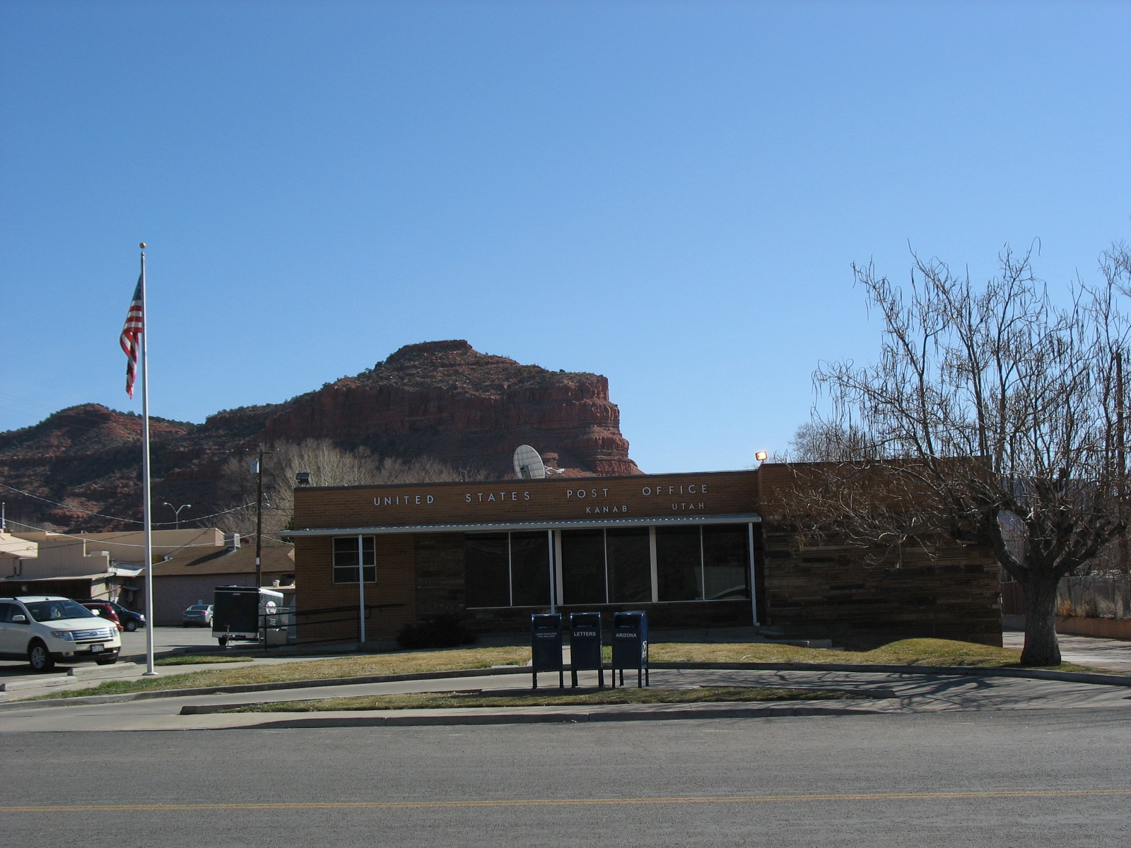
Kanab Post Office
Natural Family Resolution[]
On January 10, 2006, the mayor at that time Kim Lawson and the city council passed Resolution 1-1-06R, titled The Natural Family: A Vision for the City of Kanab, codifying the definition of a "natural family":
- "We envision a local culture that upholds the marriage of a man to a woman, and a woman to a man, as ordained of God... We see our homes as open to a full quiver of children, the source of family continuity and social growth. We envision young women growing into wives, homemakers, and mothers; and we see young men growing into husbands, home-builders, and fathers."[8]
The nonbinding resolution was formulated by a conservative advocacy group from Salt Lake City. Though symbolic, it created controversy within the town, and prompted Arthur Frommer to refer to the community as homophobic, and urge it be boycotted by tourists.[9]
Search for Montezuma's treasure[]
In 1914 Freddy Crystal arrived in Kanab saying that, while researching in Mexico, he had discovered that the great treasure of Montezuma, spirited away by the king's men before he died, was to be found in the mountains around the town. Many searches and digs by Crystal and those who followed him ended when a plan to drain a lake, in the belief that the treasure resided in an under-water cave, was stopped by the Government because it was one of the few refuges of the Kanab ambersnail.[10][11]
Kanab Ambersnail[]
Three Lakes, a privately owned wet meadow near Kanab, is one of only two natural habitats for the Kanab Ambersnail, a snail species which was listed as an endangered species in 1992 by the U.S. Fish and Wildlife Service and a species of conservation priority for the Arizona Game and Fish Department.
Notable residents[]
- Jacob Hamblin
- Levi Stewart
- William Thomas Stewart
- Kelly Sweet
See also[]

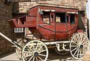
Wells Fargo U.S. Mail Service - Kanab
- Buckskin Gulch
- Coyote Buttes
- Paria Canyon-Vermilion Cliffs Wilderness
- The Wave
- Wire Pass Trailhead
- Best Friends Animal Society
References[]
- ^ Gannett, Henry (1905). The Origin of Certain Place Names in the United States. Govt. Print. Off.. pp. 172. http://books.google.com/books?id=9V1IAAAAMAAJ&pg=PA172#v=onepage&q&f=false.
- ^ a b "American FactFinder". United States Census Bureau. http://factfinder2.census.gov. Retrieved 2008-01-31.
- ^ "US Board on Geographic Names". United States Geological Survey. 2007-10-25. http://geonames.usgs.gov. Retrieved 2008-01-31.
- ^ "Find a County". National Association of Counties. http://www.naco.org/Counties/Pages/FindACounty.aspx. Retrieved 2011-06-07.
- ^ Town official website
- ^ http://www.thegrandcanyons.com/this-is-the-west.html
- ^ "Climatic Averages for the United States 1971–2000: KANAB, UT". National Oceanic and Atmospheric Administration. http://cdo.ncdc.noaa.gov/climatenormals/clim20/ut/424508.pdf. Retrieved 2013-04-06.
- ^ Kanab City Council - City of Kanab, Utah official site
- ^ Welcome to Our Town. Or, Maybe Not. The New York Times, April 30, 2006
- ^ Massey, P. and Wilson, J., Backcountry Adventures Utah: The Ultimate Guide to the Utah Backcountry for Anyone with a Sport Utility Vehicle, Adler Publishing, 2006, p. 259.
- ^ Childress, DH., Lost Cities of North & Central America, Adventures Unlimited Press, 1992, p. 483.
External links[]
- Kanab, Utah Chamber of Commerce : Business listings, area info and more.
- Kane County, Utah Office of Tourism : Official Travel Information.
- Kanab City official government website.
- Agency History of Kanab
 Kanab travel guide from Wikivoyage
| ||||||||||||||||||||

| This page uses content from the English language Wikipedia. The original content was at Kanab, Utah. The list of authors can be seen in the page history. As with this Familypedia wiki, the content of Wikipedia is available under the Creative Commons License. |