| Main | Births etc |
|---|
| Svätý_Peter Hungarian: Komáromszentpéter |
|||
|---|---|---|---|
| — Village — | |||
| Roman-catholic church of Svätý_Peter | |||
|
|||
| Coordinates: | |||
| Country | |||
| Region | Nitra | ||
| District | Komárno | ||
| First mentioned | 1332 | ||
| Government | |||
| • Jozef Jobbágy | |||
| Area | |||
| • Total | 34.327 km2 (13.254 sq mi) | ||
| Elevation | 135 m (443 ft) | ||
| Population (2011-12-31) | |||
| • Total | 2,730 | ||
| Time zone | CET (UTC+1) | ||
| • Summer (DST) | CEST (UTC+2) | ||
| Postal code | 946 57 | ||
| Area code(s) | 036 | ||
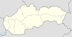
Svätý Peter (Hungarian: Komáromszentpéter) is a village and commune in the Komárno District in the Nitra Region of southwest Slovakia.
History[]
In historical records the village was first mentioned in 1332.
Geography[]
The village lies at an altitude of 138 metres and covers an area of 34.327 km².
It has a population of about 2730 people.
Ethnicity[]
The village is about 74% Magyar, 26% Slovak.
Facilities[]
The village has a public library, a gym and a football pitch.
External links[]
| ||||||||||


