| Main | Births etc |
|---|
| Kootingal | |

Kootingal | |
| Population: | 1,593 (2006 Census)[1] |
| Postcode: | 2352 |
| Elevation: | 452 m (1,483 ft) |
| Location: | |
| LGA: | Tamworth Regional Council |
| County: | Inglis |
| State District: | Tamworth, |
| Federal Division: | New England |
Kootingal is a town in New South Wales, Australia in the Tamworth Regional Council area. It is commonly called a satellite suburb of Tamworth because of its closeness and the fact that its residents use Tamworth's services. Founded as an Aboriginal mission, Kootingal traces its name roots to the local Aboriginal Kamilaroi language. At the 2006 census, Kootingal had a population of 1,593 people.[1]
It is an agricultural based town, with lucerne, fruit, vegetable, chicken and egg farms.[2] It is nestled in a small rich alluvial valley in the Moonbi Range, part of the Great Dividing Range. Kootingal is located on the northern bank of a bend in the Cockburn River. Kootingal is located between the villages of Moonbi to the north and Nemingha to the south. It is located 474 km north west of Sydney and 20 km north east of Tamworth on the New England Highway.
Kootingal holds an annual Pumpkin Festival and Outdoor Leisure Show in April at the Kootingal sports ground. There are a variety of stalls and the show is suitable for all ages.
Services[]
- Bowling Club
- Caravan Park
- Catholic and Anglican Churches
- Kootingal Public School
- Moonbi House Retirement Village
- Motel
- Police Station
- Post Office
- Railway Station
- Swimming Pool
- Sportsground
- Tennis Courts
- War Memorial Hall, Library and Pre-School
Transport[]
| Kootingal | |
|---|---|
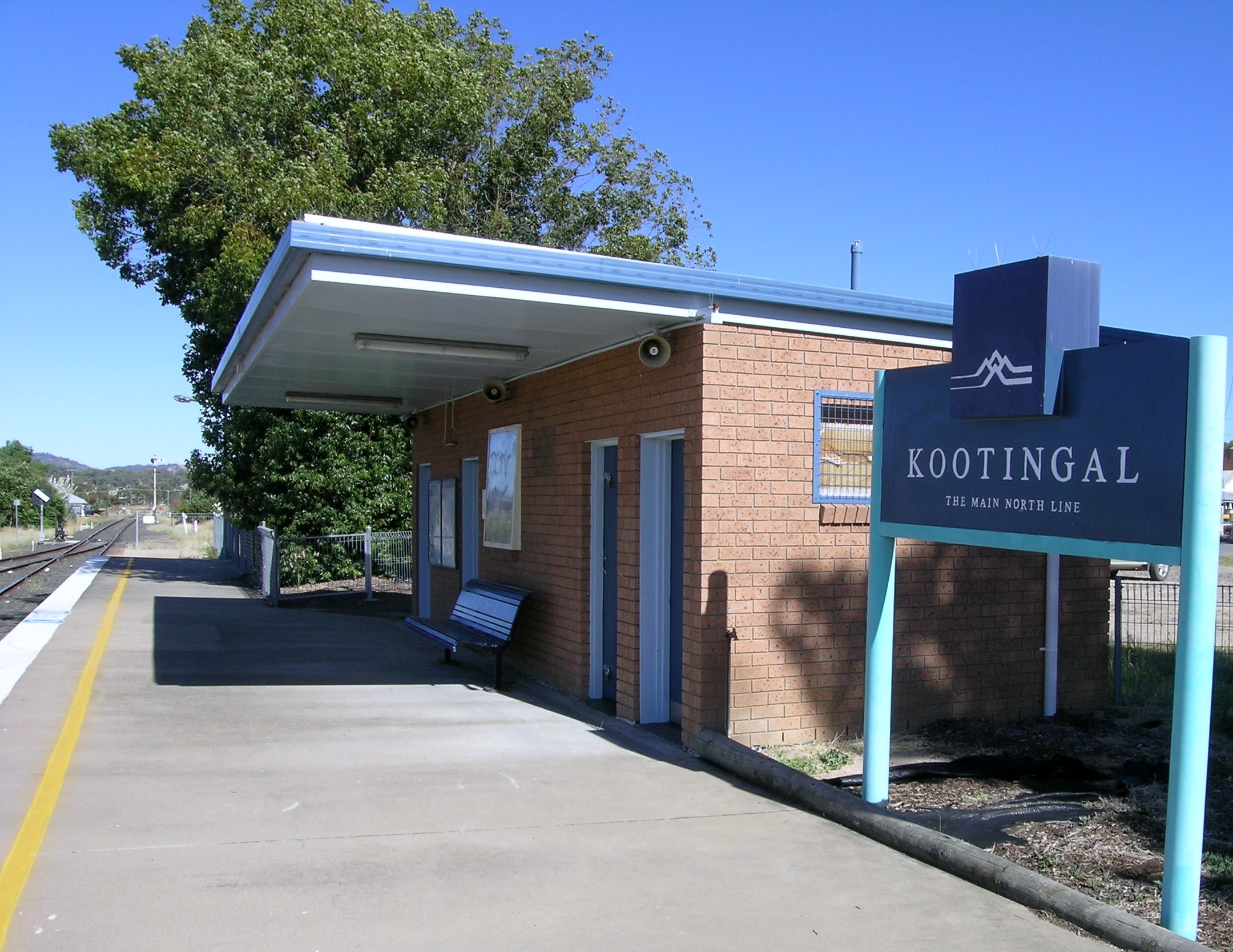 | |
| Station statistics | |
| Address |
Station Street, Kootingal New South Wales, Australia |
| Coordinates | |
| Line(s) | Main North line |
| Distance | 472 km (293 mi) from Central |
| Structure type | Ground |
| Platforms | 1 |
| Tracks | 1 |
| Other information | |
| Station code | KNG |
| Owned by | RailCorp |
| Operator | NSW TrainLink |
Kootingal is situated on the Main North railway line. Trains no longer continue all the way to the Queensland border, but the town is still served twice daily by the NSW TrainLink Xplorer service between Sydney and Armidale in both directions. This station is less than 20 minutes away from Tamworth.
Scouts[]
Kootingal has a Scout group in combination with the village of Moonbi. The Kootingal-Moonbi Scout group consists of Joey Scouts, Cub Scouts and Scouts. It is a thriving Group and enjoys many activities.
References[]
- ^ a b Australian Bureau of Statistics (25 October 2007). "Kootingal (Urban Centre/Locality)". 2006 Census QuickStats. http://www.censusdata.abs.gov.au/ABSNavigation/prenav/LocationSearch?collection=Census&period=2006&areacode=UCL144200&producttype=QuickStats&breadcrumb=PL&action=401. Retrieved 20 October 2009.
- ^ Kootingal Community Development Committee, "Kootingal", n.d.
External links[]
| ||||||||
| This New South Wales geography article is a stub. You can help by expanding it. |
| This page uses content from the English language Wikipedia. The original content was at Kootingal, New South Wales. The list of authors can be seen in the page history. As with this Familypedia wiki, the content of Wikipedia is available under the Creative Commons License. |