| ||||||||||||||
| Lake County, Indiana | ||
| ||
 Location in the state of Indiana | ||
 Indiana's location in the U.S. | ||
| Founded | 1837 | |
|---|---|---|
| Seat | Crown Point | |
| Area - Total - Land - Water |
626 sq mi (1,621 km²) 497 sq mi (1,287 km²) 129 sq mi (334 km²), 20.65% | |
| Population - (2020) - Density |
498,700 975/sq mi (376/km²) | |
| Website | www.lakecountyin.org/index.jsp | |
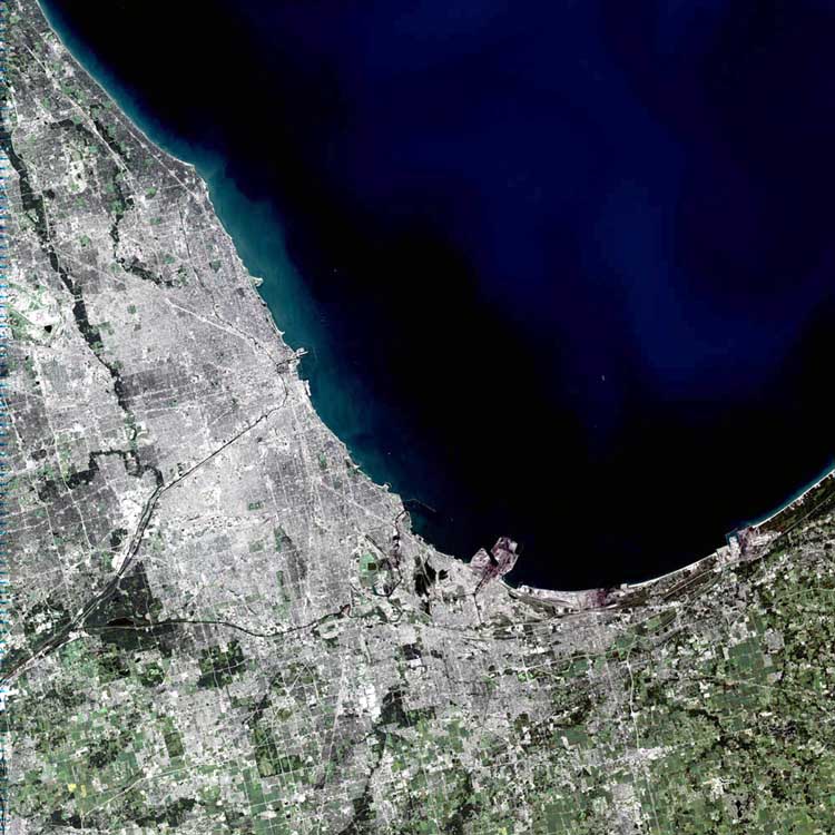
Lake County is a county located in the U.S. state of Indiana. As of 2020, the population was 498,700, making it Indiana's second most populous county. The county seat is Crown Point6. This county is part of Northwest Indiana and the Chicago metropolitan area.
History[]
Lake County was formed in 1837. It was named for its location on Lake Michigan.
Geography[]
According to the U.S. Census Bureau, the county has a total area of 1,622 km² (626 sq mi). 1,287 km² (497 sq mi) of it is land and 335 km² (129 sq mi) of it (20.65%) is water.
Commercial Airport[]
Major highways[]
 Interstate 65
- Interstate 80
- Interstate 90
- Interstate 94
- U.S. Route 6
- U.S. Route 12
- U.S. Route 20
- U.S. Route 30
- U.S. Route 41
- U.S. Route 231
- Indiana State Road 2
- Indiana State Road 53
- Indiana State Road 55
Railroads[]
Adjacent counties[]
- Cook County (west and north, in Lake Michigan)
- Porter County (east)
- Jasper County (southeast)
- Newton County (south)
- Kankakee County (southwest)
- Will County (west)
Demographics[]
| Historical populations | |||
|---|---|---|---|
| Census | Pop. | %± | |
| 1840 | 1,468 | ||
| 1850 | 3,991 | 171.9% | |
| 1860 | 9,145 | 129.1% | |
| 1870 | 12,339 | 34.9% | |
| 1880 | 15,091 | 22.3% | |
| 1890 | 23,886 | 58.3% | |
| 1900 | 37,892 | 58.6% | |
| 1910 | 82,864 | 118.7% | |
| 1920 | 159,957 | 93.0% | |
| 1930 | 261,310 | 63.4% | |
| 1940 | 293,195 | 12.2% | |
| 1950 | 368,152 | 25.6% | |
| 1960 | 513,269 | 39.4% | |
| 1970 | 546,253 | 6.4% | |
| 1980 | 522,965 | −4.3% | |
| 1990 | 475,594 | −9.1% | |
| 2000 | 484,564 | 1.9% | |
| 2010 | 496,005 | 2.4% | |
As of the census² of 2000, there were 484,564 people, 181,633 households, and 126,961 families residing in the county. The population density was 376/km² (975/sq mi). There were 194,992 housing units at an average density of 151/km² (392/sq mi). The racial makeup of the county was 66.72% White, 25.33% Black or African American, 0.28% Native American, 0.82% Asian, 0.04% Pacific Islander, 4.96% from other races, and 1.85% from two or more races. 12.20% of the population were Hispanic or Latino of any race. 12.2% were of German, 9.6% Polish and 7.1% Irish ancestry according to Census 2000.
According to 2005 Census estimates 58.6% of Lake County's population was non-Hispanic whites, 26.2% African-American, 13.7% Latino and 1.0% Asian.[1] In 2000 there were 181,633 households out of which 32.80% had children under the age of 18 living with them, 48.70% were married couples living together, 16.60% had a female householder with no husband present, and 30.10% were non-families. 25.80% of all households were made up of individuals and 9.60% had someone living alone who was 65 years of age or older. The average household size was 2.64 and the average family size was 3.19.
In the county the population was spread out with 26.80% under the age of 18, 9.30% from 18 to 24, 28.30% from 25 to 44, 22.60% from 45 to 64, and 13.00% who were 65 years of age or older. The median age was 36 years. For every 100 females there were 92.90 males. For every 100 females age 18 and over, there were 89.00 males.
The median income for a household in the county was $41,829, and the median income for a family was $50,131. Males had a median income of $41,986 versus $26,393 for females. The per capita income for the county was $19,639. About 9.70% of families and 12.20% of the population were below the poverty line, including 17.80% of those under age 18 and 8.00% of those age 65 or over.
Politics[]
While the state of Indiana is strongly Republican, having voted Republican in every election since 1964 (except in 2008), Lake County has long been a Democratic stronghold, giving pluralities or majorities to Democrats in every Presidential election since 1932 with the exceptions of 1956 and 1972.
Lake is part of Indiana's 1st congressional district, which is held by Democrat Frank J. Mrvan.[2] In the State Senate, Lake is part of the 1st, 2nd, 3rd and 6th districts, which are held by three Democrats and one Republican. In the Indiana House of Representatives, Lake is part of the 1st, 2nd, 3rd, 11th, 12th, 14th, 15th and 19th districts, which are held by four Democrats and four Republicans.
| Year | Republican | Democratic | Third party | |||
|---|---|---|---|---|---|---|
| No. | % | No. | % | No. | % | |
| 2020 | 91,760 | 41.65% | 124,870 | 56.67% | 3,700 | 1.68% |
| 2016 | 75,625 | 37.29% | 116,935 | 57.66% | 10,241 | 5.05% |
| 2012 | 68,431 | 33.85% | 130,897 | 64.75% | 2,819 | 1.39% |
| 2008 | 67,742 | 32.41% | 139,301 | 66.64% | 1,996 | 0.95% |
| 2004 | 71,903 | 38.24% | 114,743 | 61.03% | 1,376 | 0.73% |
| 2000 | 63,389 | 36.02% | 109,078 | 61.98% | 3,527 | 2.00% |
| 1996 | 47,873 | 29.22% | 100,198 | 61.15% | 15,789 | 9.64% |
| 1992 | 53,867 | 28.91% | 102,778 | 55.17% | 29,653 | 15.92% |
| 1988 | 79,929 | 43.03% | 105,026 | 56.55% | 780 | 0.42% |
| 1984 | 94,870 | 44.30% | 117,984 | 55.10% | 1,289 | 0.60% |
| 1980 | 95,408 | 46.02% | 101,145 | 48.78% | 10,786 | 5.20% |
| 1976 | 90,119 | 42.36% | 120,700 | 56.74% | 1,922 | 0.90% |
| 1972 | 115,480 | 56.24% | 88,510 | 43.10% | 1,352 | 0.66% |
| 1968 | 77,911 | 36.48% | 99,897 | 46.77% | 35,766 | 16.75% |
| 1964 | 73,722 | 35.19% | 134,978 | 64.42% | 823 | 0.39% |
| 1960 | 78,278 | 37.04% | 132,554 | 62.72% | 526 | 0.25% |
| 1956 | 92,803 | 52.00% | 85,000 | 47.63% | 657 | 0.37% |
| 1952 | 74,073 | 44.66% | 90,721 | 54.70% | 1,051 | 0.63% |
| 1948 | 51,413 | 38.77% | 77,025 | 58.09% | 4,157 | 3.14% |
| 1944 | 48,147 | 38.84% | 75,066 | 60.56% | 737 | 0.59% |
| 1940 | 45,898 | 38.79% | 71,985 | 60.83% | 447 | 0.38% |
| 1936 | 33,689 | 32.47% | 68,551 | 66.07% | 1,510 | 1.46% |
| 1932 | 42,596 | 46.56% | 46,060 | 50.34% | 2,836 | 3.10% |
| 1928 | 48,768 | 59.68% | 32,321 | 39.55% | 630 | 0.77% |
| 1924 | 30,990 | 64.61% | 10,918 | 22.76% | 6,060 | 12.63% |
| 1920 | 26,296 | 69.15% | 7,136 | 18.77% | 4,596 | 12.09% |
| 1916 | 13,262 | 55.00% | 9,946 | 41.25% | 903 | 3.75% |
| 1912 | 5,176 | 29.61% | 5,136 | 29.38% | 7,171 | 41.02% |
| 1908 | 9,499 | 60.97% | 5,502 | 35.32% | 578 | 3.71% |
| 1904 | 6,429 | 64.11% | 2,933 | 29.25% | 666 | 6.64% |
| 1900 | 5,337 | 58.00% | 3,733 | 40.57% | 131 | 1.42% |
| 1896 | 4,883 | 58.11% | 3,418 | 40.68% | 102 | 1.21% |
| 1892 | 2,958 | 48.02% | 3,010 | 48.86% | 192 | 3.12% |
| 1888 | 2,543 | 54.21% | 2,068 | 44.08% | 80 | 1.71% |
Cities and towns[]
- Cedar Lake
- Crown Point
- Dyer
- East Chicago
- Gary
- Griffith
- Hammond
- Highland
- Hobart
- Lake Dalecarlia
- Lake Station
- Lakes of the Four Seasons
- Lowell
- Merrillville
- Munster
- New Chicago
- Schererville
- Schneider
- St. John
- Whiting
- Winfield
Townships[]
Education[]
The administration of public schools in Lake County is divided among 16 corporations and governing bodies, more than any other Indiana county. [1]
- Crown Point Community School Corporation – Web site
- Gary Community School Corporation – Web site
- Griffith Public Schools – Web site
- Hanover Community School Corporation – Web site
- Lake Central School Corporation – Web site
- Lake Ridge Schools Corporation – Web site
- Lake Station Community Schools – Web site
- Merrillville Community School Corporation – Web site
- River Forest Community School Corporation – Web site
- School City of East Chicago – Web site
- School City of Hammond – Web site
- School City of Hobart – Web site
- School City of Whiting – Web site
- School Town of Highland – Web site
- School Town of Munster – Web site
- Tri-Creek School Corporation – Web site
Colleges and Universities
- Calumet College of St. Joseph
- Hyles-Anderson College
- Indiana University Northwest
- Ivy Tech Northwest
- Purdue University Calumet
- Kaplan College
Major businesses[]
- BP
- Cargill
- Commonwealth Edison (coal fired powerplant)
- Dietrich Industries (steel framing)
- Harrah's Casino
- Horseshoe Casino
- Lear Corporation (auto interiors)
- Majestic Star Casino
- Mittal Steel
- NiSource
- PepsiAmericas
- Unilever
- US Steel
Newspapers[]
The Times is the largest daily newspaper Lake County and Northwest Indiana, and the second largest in the state. Lake County is also served by the Post-Tribune, a daily newspaper based in Merrillville.
Indiana State Quarter[]

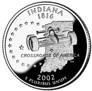
Indiana State Quarter missing the northwest section of Lake County.
The northwest tip of Lake County is seemingly missing from the state outline on the Indiana state quarter. The outline of the state on the quarter shows the Lake Michigan shore line continuing in a southwest direction from the Porter/Lake County line to the Illinois-Indiana state line, showing Lake Michigan where Gary and Hammond are located. Unlike the similar occurrence with Dade County on the Georgia state quarter, fewer complaints were made concerning the omission.
See also[]
External links[]
- Lake County official website
- Lake County Convention and Visitors Bureau
- Lake County Sheriff's DEPT
- Indiana State Police
- LakeNET, The Information Connection for Lake County, IN
References[]
- Forstall, Richard L. (editor) (1996). Population of states and counties of the United States: 1790 to 1990 : from the twenty-one decennial censuses. United States Department of Commerce, Bureau of the Census, Population Division. ISBN 0-934213-48-8.
| ||||||||||||||||||||||||||
| This page uses content from the English language Wikipedia. The original content was at Lake County, Indiana. The list of authors can be seen in the page history. As with this Familypedia wiki, the content of Wikipedia is available under the Creative Commons License. |