| ||||||||||||||
| Lenoir County, North Carolina | |
 Location in the state of North Carolina | |
 North Carolina's location in the U.S. | |
| Founded | 1791 |
|---|---|
| Seat | Kinston |
| Area - Total - Land - Water |
402 sq mi (1,041 km²) 2 sq mi (5 km²), 0.56% |
| Population - (2000) - Density |
59,648 150/sq mi (58/km²) |
| Website | www.co.lenoir.nc.us |
Lenoir County is a county located in the U.S. state of North Carolina. As of 2000, the population was 59,648. Its county seat is Kinston6.
History
The county was formed in 1791 from the southern part of Dobbs County. It was named for William Lenoir (1751-1839), an officer in the American Revolutionary War, who took part in the Battle of Kings Mountain, and prominent political leader who at the time of the county's establishment was serving as Speaker of the North Carolina Senate.
Law and government
Lenoir County is a member of the regional Eastern Carolina Council of Governments.
Geography
According to the U.S. Census Bureau, the county has a total area of 1,041 km² (402 sq mi). 1,036 km² (400 sq mi) of it is land and 6 km² (2 sq mi) of it (0.56%) is water.
Townships
The county is divided into twelve townships: Contentnea Neck, Falling Creek, Institute, Kinston, Moseley Hall, Neuse, Pink Hill, Sand Hill, Southwest, Trent, Vance, and Woodington.
Adjacent Counties
- Greene County - north
- Pitt County - northeast
- Craven County - east
- Jones County - southeast
- Duplin County - southwest
- Wayne County - west
Demographics
As of the census² of 2000, there were 59,648 people, 23,862 households, and 16,178 families residing in the county. The population density was 58/km² (149/sq mi). There were 27,184 housing units at an average density of 26/km² (68/sq mi). The racial makeup of the county was 56.47% White, 40.43% Black or African American, 0.18% Native American, 0.34% Asian, 0.05% Pacific Islander, 1.88% from other races, and 0.66% from two or more races. 3.17% of the population were Hispanic or Latino of any race.
There were 23,862 households out of which 31.30% had children under the age of 18 living with them, 46.40% were married couples living together, 17.30% had a female householder with no husband present, and 32.20% were non-families. 28.40% of all households were made up of individuals and 11.80% had someone living alone who was 65 years of age or older. The average household size was 2.43 and the average family size was 2.96.
In the county the population was spread out with 25.30% under the age of 18, 7.90% from 18 to 24, 27.60% from 25 to 44, 24.60% from 45 to 64, and 14.60% who were 65 years of age or older. The median age was 38 years. For every 100 females there were 90.30 males. For every 100 females age 18 and over, there were 84.70 males.
The median income for a household in the county was $31,191, and the median income for a family was $38,815. Males had a median income of $28,879 versus $21,536 for females. The per capita income for the county was $16,744. About 12.60% of families and 16.60% of the population were below the poverty line, including 22.00% of those under age 18 and 18.40% of those age 65 or over.
Cities and towns
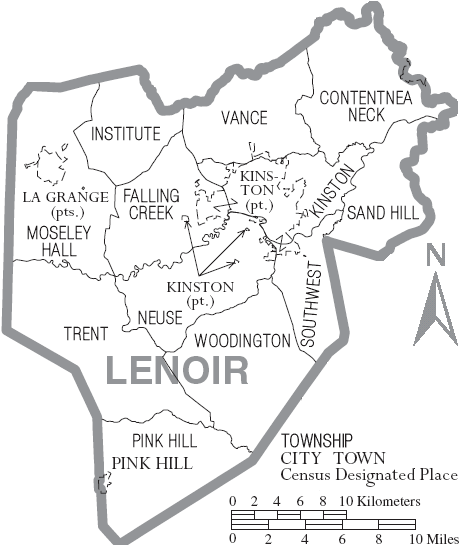
Map of Lenoir County, North Carolina With Municipal and Township Labels
School System
The City of Kinston and Lenoir County have a merged school system There are three public high schools in Lenoir County (9 - 12) ; North Lenoir, South Lenoir, and Kinston High School. There are four public middle schools (6 - 8); E.B. Frink, Rochelle, Woodington, and Savannah. There are ten public elementary schools (K - 5); Banks, Bynum, Contentnea, La Grange, Moss Hill, Northwest, Pink Hill, Southeast, Southwood, and Teachers Memorial. There is one alternative school, Sampson.
Lenoir County also has three private schools; Arendell Parrott Academy, Bethel Christian Academy, and Kinston Charter Academy.
Lenior County Public Schools Website
External links
| ||||||||||||||

| This page uses content from the English language Wikipedia. The original content was at Lenoir County, North Carolina. The list of authors can be seen in the page history. As with this Familypedia wiki, the content of Wikipedia is available under the Creative Commons License. |