| Main | Births etc |
|---|
| Los Gatos, California | |||
|---|---|---|---|
| — Town — | |||
| Town of Los Gatos | |||
 |
|||
|
|||
 |
|||

Los Gatos |
|||
| Coordinates: Coordinates: | |||
| Country | |||
| State | |||
| County | |||
| Incorporated | August 10, 1887[1] | ||
| Government | |||
| • Mayor | Rob Rennie[2] | ||
| • Town Manager | Laurel Prevetti[3] | ||
| Area[4] | |||
| • Total | 11.25 sq mi (29.13 km2) | ||
| • Land | 11.17 sq mi (28.92 km2) | ||
| • Water | 0.08 sq mi (0.21 km2) 0.71% | ||
| Elevation[5] | 344 ft (105 m) | ||
| Population (2010)[6] | |||
| • Total | 29,413 | ||
| • Estimate (2016)[7] | 30,545 | ||
| • Density | 2,735.54/sq mi (1,056.22/km2) | ||
| Time zone | Pacific (UTC−8) | ||
| • Summer (DST) | PDT (UTC−7) | ||
| ZIP codes | 95030 –95033 | ||
| Area codes | 408/669 | ||
| FIPS code | 06-44112 | ||
| GNIS feature IDs | 1659017, 2412917 | ||
| Primary Airport | San Jose International Airport SJC (Major/International) |
||
| State Routes | |||
| Light Rail | |||
| Website | losgatosca.gov | ||

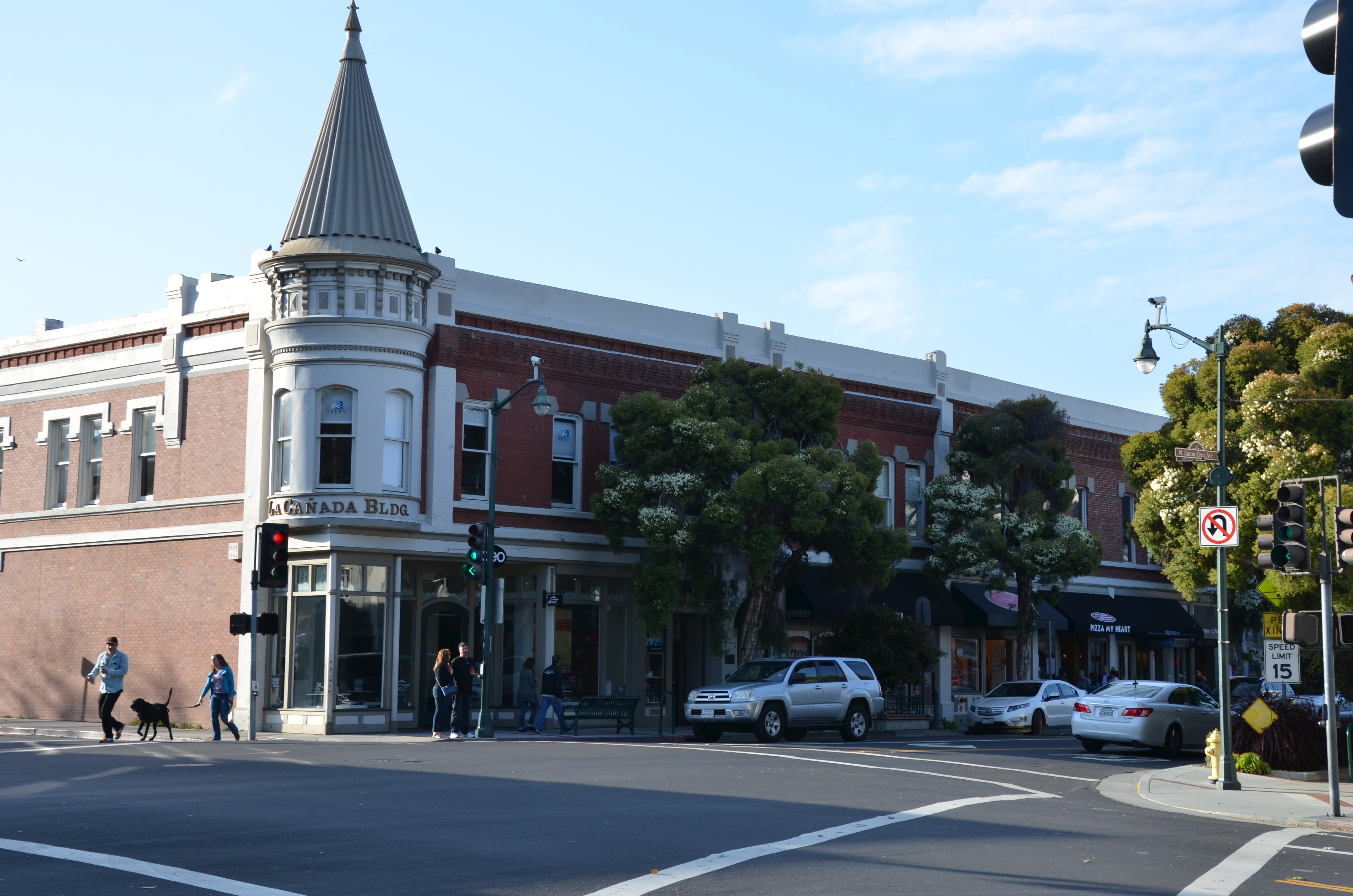
Main Street Los Gatos
Los Gatos (US /loʊs ˈɡɑːtoʊs,_lɔːsʔ/;[8][9] Spanish for "The Cats") is an incorporated town in Santa Clara County, California, United States. The population is 30,391 according to the 2013 United States Census Bureau.[10] According to Bloomberg Businessweek, Los Gatos is ranked the 33rd wealthiest city in the United States.[11] It is located in the San Francisco Bay Area at the southwest corner of San Jose in the foothills of the Santa Cruz Mountains. Los Gatos is part of Silicon Valley, with several high technology companies maintaining a presence there. Most notably, streaming and content creator Netflix is headquartered in Los Gatos and has developed a large presence in the area.
Etymology[]
Los Gatos is Spanish for "The Cats".[12] The name derives from the 1839 Alta California land-grant that encompassed the area, which was called La Rinconada de Los Gatos, ("Cat's Corner"), where "the cats" refers to the cougars and bobcats that are indigenous to the foothills in which the town is located. The name has been anglicized to /lɔːs ˈɡætəs/ lawss-GAT-əs,[13] although one also hears pronunciations truer to the original Spanish, /loʊsˈɡɑːtoʊs/ lohss-GAH-tohss.
History[]
Overview[]
The town's founding dates to the mid-1850s with the building of a flour-milling operation, Forbes Mill, by James Alexander Forbes along Los Gatos Creek. The mill's two-story stone storage annex has been preserved as a museum just off of Main Street.
The settlement that was established in the 1860s was originally named for the mill, but the name was changed to Los Gatos after the Spanish land grant. The town was incorporated in 1887 and remained an important town for the logging industry in the Santa Cruz Mountains until the end of the 19th century. In the early 20th century, the town became a thriving agricultural town with apricots, grapes and prunes being grown in the area. By the 1920s, the Los Gatos area had a local reputation as an arts colony, attracting painters, musicians, writers, actors and their bohemian associates as residents over the years. The violinist Yehudi Menuhin lived there as a boy;[14] the actresses Joan Fontaine and Olivia de Havilland (sisters) were graduates of Los Gatos High School; John Steinbeck wrote The Grapes of Wrath there (the location is now located in Monte Sereno); and Beat hero Neal Cassady lived there in the 1950s. Along with much of the Santa Clara Valley, Los Gatos became a suburban community for San Jose beginning in the 1950s, and the town was mostly built-out by the 1980s.
Downtown Los Gatos has retained and restored many of its Victorian-era homes and commercial buildings. Other notable buildings are the Forbes Mill annex, dating to 1880 and now housing a history museum; Los Gatos High School which dates from the 1920s; and the Old Town Shopping Center, formerly the University Avenue School (the school was established in 1882; the current buildings date to 1923).
A number of brick buildings in Downtown Los Gatos were destroyed or seriously damaged in the 1989 Loma Prieta earthquake, though the district was quickly rebuilt and has made a full recovery.
Recently the Main Street Bridge has emulated the Ponte des Artes bridge in Paris by displaying love locks for anniversaries and engagements.
Rail transportation[]
Transport by rail was an early aspect of Los Gatos. The South Pacific Coast Railroad, a popular narrow-gauge line from Alameda (and San Francisco via ferry) to Santa Cruz in the late 19th century, stopped in Los Gatos.[15] Southern Pacific took over this line in 1887. Los Gatos was also near the Southern Pacific resort town of Holy City, along the rail line in the Santa Cruz Mountains. The last Southern Pacific passenger train to Santa Cruz left Los Gatos in March 1940. In town, the rail line used to run along the shore of Vasona Reservoir to the present-day location of the Post Office, following the path of what is now a continuous string of parking lots between Santa Cruz Ave. and University Ave. There was also a streetcar-type rail line with service to Saratoga and San Jose. Streetcar service via the Peninsular Railway started about 1905 and ended about 1933. San Francisco commuter trains continued into downtown until 1959, and Vasona Junction until 1964. The site of the old railroad station is now occupied by Town Plaza and the post office.
Oil boom[]
Between 1891 and 1929 about 20 oil wells were drilled in and around Los Gatos, starting a minor oil-drilling boom.[16] About 1861, small amounts of oil were discovered in streams, springs, and water wells in the Santa Cruz Mountains in the vicinity of Moody Gulch, about 6.5 km south of the Los Gatos Post Office.[17] An intense search for oil ensued, resulting in the drilling of many wells and establishment of the Moody Gulch oil field.[17][18] The Moody Gulch oil field, however, never met expectations, and it was abandoned about 1938 after producing a total of about 98,000 barrels of oil and 44 million ft3 of gas.[17] In 1891, one of the Moody Gulch drillers, R.C. McPherson, found oil in a well along San Jose Road (now Los Gatos Boulevard) in the Santa Clara Valley flatlands, about 3 km northeast of the Los Gatos Post Office.[17] Although commercial production was never established, small amounts of oil were produced for use as fuel, lubricant, and road tar by local residents.[17]
Geography and environment[]
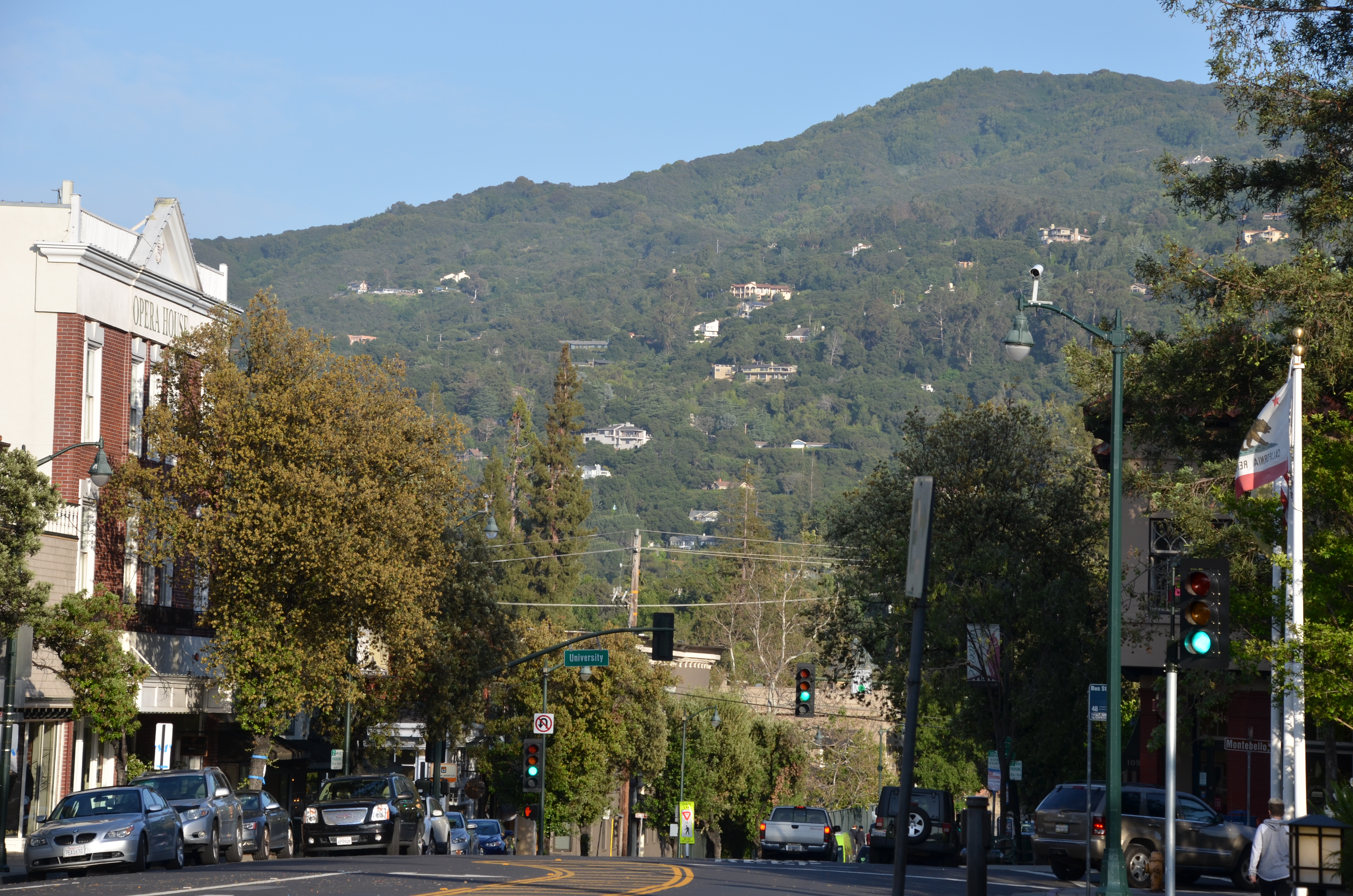
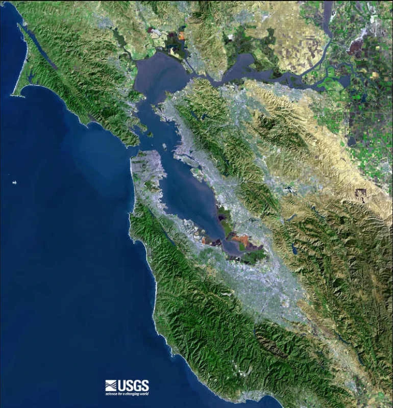
Los Gatos is located at (37.236044, −121.961768).[19] Los Gatos is bisected by State Route 17, which runs through the town from south to north.


Los Gatos Theater on Santa Cruz Ave
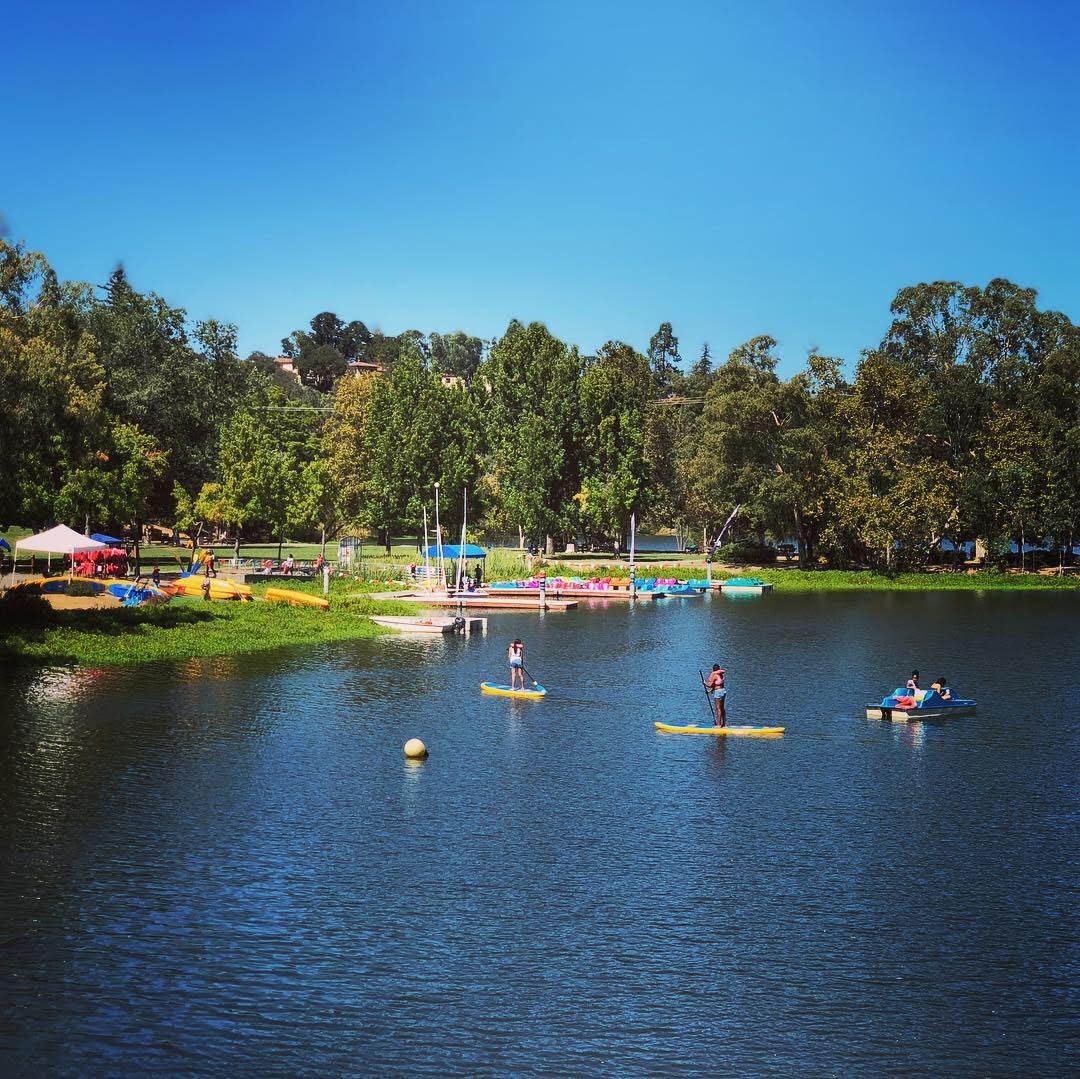

Summer boating in Vasona Lake
State Route 85 roughly marks the northern boundary of the town, although a few pockets of homes to its North are included. Highway 9 (Los Gatos-Saratoga Road) from the coast terminates at Highway 17. Downtown Los Gatos, the area on and around Santa Cruz Avenue and Main Street, is located in the southwest quadrant of town. A left exit on northbound Highway 17 becomes the south end of South Santa Cruz Avenue, leading into downtown. The area around Los Gatos Boulevard, east of Highway 17, is much more typically suburban than downtown, with medium-sized shopping centers clustered at major intersections of the multilane boulevard. Although the town has generally a quiet setting, its principal noise generators are State Route 17 and Los Gatos Boulevard. Sound levels within one hundred and fifty feet of Los Gatos Boulevard exceed 60 CNEL (Community Noise Equivalent Level),[20] a generally unacceptable range for residential living.
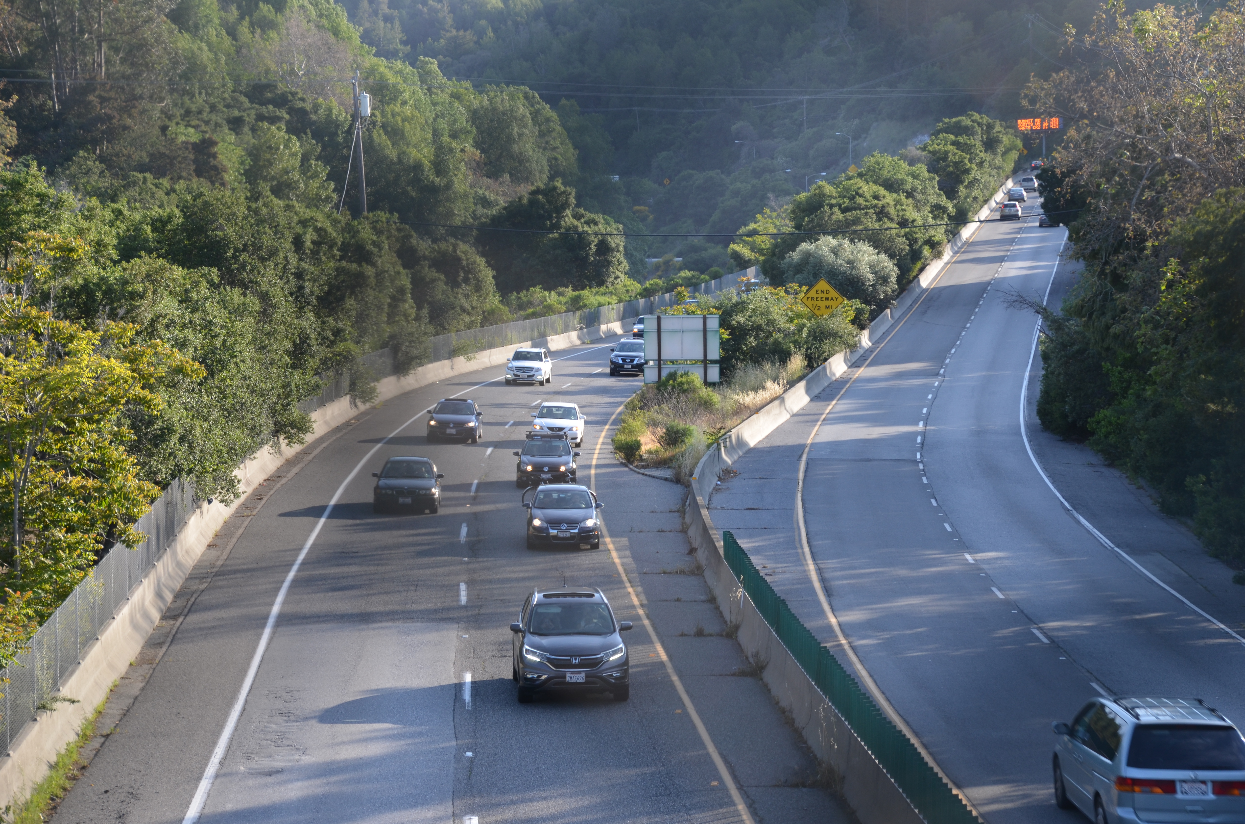

CA 17 freeway passes through Los Gatos


Town Plaza Park in Downtown Los Gatos
Vasona Park, a county park, and neighboring Oak Meadow Park, which belongs to the town, are located in what is roughly the geographic middle of the town, bordered on the south by Blossom Hill Road, on the east by Highway 17, on the west by University Avenue, and reaching at the north end not quite all the way to Lark Avenue. Located in the parks is the popular William "Billy" Jones Wildcat Railroad. In Vasona Park is the trail to Prune Ridge. Los Gatos Creek begins in the Santa Cruz Mountains south of the town and runs through the town parallel to Highway 17 all the way through neighboring Campbell and San Jose to the Guadalupe River, which flows into San Francisco Bay. A walking, jogging, and biking trail called the Los Gatos Creek Trail runs alongside much of the creek from Lexington Dam through Vasona Park and Campbell to Meridian Avenue in San Jose. In Los Gatos, the trail passes the 1854 Forbes Mill.
According to the United States Census Bureau, the town has a total area of 11.2 square miles (29 km2). 11.1 square miles (29 km2) of it is land and 0.1 square miles (0.26 km2) of it (0.71%) is water.


Hiking in the Los Gatos Creek Trail
Los Gatos is surrounded by several mountain bike trails. Cyclists can leave from downtown on a 20-mile (32 km) loop through the Santa Cruz Mountains. From downtown, El Sereno mountain stands to the southwest; El Sombroso stands to the southeast. The El Sereno Open Space Preserve and the Sierra Azul Open Space Preserve open the top and upper flanks of each of these mountains to hiking and cycling.
Though the official total area of the town is 11.2 square miles, approximately 100 square miles of the surrounding Los Gatos Mountains (within the Santa Cruz Mountains range), has a Los Gatos address and uses the 95033 zip code (primarily) for U.S. Postal Service mail delivery (among other purposes).
- Climate
Los Gatos experiences nearly the same temperatures as San Jose, just slightly warmer and with more rain. Los Gatos has a Mediterranean climate like much of California. January's average high is 63 °F (17 °C) and the low is 43 °F (6 °C) while July's average high is 86 °F (30 °C) and low is 57 °F (14 °C). Los Gatos has a Zone 10 hardiness zone. Daytime high temperatures very rarely stay below 50 °F (10 °C). Los Gatos rarely gets a hard frost. Los Gatos gets the slight winter chill that is needed to grow grapes and have vineyards. Types of bananas that ripen within three months grow well during the summer.
The record high temperature was 114 °F (46 °C) on June 14, 1961, and the record low temperature was 16 °F (−9 °C) on December 22, 1990. There are an average of 27.0 days annually with highs of 90 °F (32 °C) or higher and an average of 5.0 days annually with lows of 32 °F (0 °C) or lower. Rainfall averages 21.2 inches annually and falls on an average of 59 days annually. The wettest year was 1909 with 51.77 inches and the driest year was 2007 with 9.47 inches (241 mm). The most rainfall in one month was 26.56 inches in December 1955 and the most rainfall in 24 hours was 8.48 inches on December 23, 1955. Although snow sometimes falls in the nearby Santa Cruz Mountains, it is very rare in Los Gatos. The most snow on record was 2.0 inches in February 1976.[21] Los Gatos averages 330 sunny days per year.[22]
| Climate data for Los Gatos, California | |||||||||||||
|---|---|---|---|---|---|---|---|---|---|---|---|---|---|
| Month | Jan | Feb | Mar | Apr | May | Jun | Jul | Aug | Sep | Oct | Nov | Dec | Year |
| Record high °F (°C) | 79 (26) |
80 (27) |
88 (31) |
96 (36) |
101 (38) |
114 (46) |
113 (45) |
107 (42) |
109 (43) |
103 (39) |
87 (31) |
83 (28) |
114 (46) |
| Average high °F (°C) | 60 (16) |
62 (17) |
66 (19) |
71 (22) |
76 (24) |
82 (28) |
85 (29) |
85 (29) |
83 (28) |
76 (24) |
65 (18) |
61 (16) |
75 (24) |
| Average low °F (°C) | 39 (4) |
41 (5) |
43 (6) |
44 (7) |
48 (9) |
52 (11) |
55 (13) |
55 (13) |
53 (12) |
49 (9) |
42 (6) |
39 (4) |
50 (10) |
| Record low °F (°C) | 18 (−8) |
21 (−6) |
27 (−3) |
30 (−1) |
34 (1) |
37 (3) |
37 (3) |
39 (4) |
38 (3) |
31 (−1) |
28 (−2) |
16 (−9) |
16 (−9) |
| Precipitation inches (mm) | 5.1 (130) |
4.7 (119) |
3.9 (99) |
1.2 (30) |
0.5 (13) |
0.1 (3) |
0.1 (3) |
0.1 (3) |
0.2 (5) |
1.0 (25) |
2.5 (64) |
3.2 (81) |
22.6 (574) |
Economy[]
The following companies are headquartered in Los Gatos:
- Buongiorno
- Cryptic Studios
- Digital Media Academy
- EverSport
- ImageShack
- Import.io
- Netflix
- Par Avion Tea
- Roku, Inc.
- Plex, Inc.
- Smashwords
- Top employers
According to the Town's 2015 Profile,[23] the major employers in the town as of June 30, 2015 are:
| # | Employer | # of Employees |
|---|---|---|
| 1 | Netflix | 1,530 |
| 2 | El Camino Hospital Los Gatos | 560 |
| 3 | Courtside Tennis Club | 440 |
| 4 | Safeway | 314 |
| 5 | Los Gatos Elementary School District | 273 |
| 6 | Vasona Creek Health Care Center | 233 |
| 7 | Good Samaritan Regional Cancer Center | 200 |
| 8 | Whole Foods Market | 179 |
| 9 | Los Gatos-Saratoga Joint Union High School District | 157 |
| 10 | Town of Los Gatos | 157 |
According to the Town's 2012 Comprehensive Annual Financial Report,[24] the top employers in the town were:
| # | Employer | # of Employees |
|---|---|---|
| 1 | Mission Oaks Hospital | 2,000 |
| 2 | Safeway | 900 |
| 3 | Netflix | 900 |
| 4 | El Camino Hospital Los Gatos | 700 |
| 5 | Los Gatos Union School District | 275 |
| 6 | Los Gatos-Saratoga Joint Union High School District | 270 |
| 7 | Courtside Club | 200 |
| 8 | Alain Pinel Realtors | 150 |
| 9 | Town of Los Gatos | 150 |
Demographics[]
| Historical populations | |||
|---|---|---|---|
| Census | Pop. | %± | |
| 1880 | 555 | ||
| 1890 | 1,652 | 197.7% | |
| 1900 | 1,915 | 15.9% | |
| 1910 | 2,232 | 16.6% | |
| 1920 | 2,317 | 3.8% | |
| 1930 | 3,168 | 36.7% | |
| 1940 | 3,597 | 13.5% | |
| 1950 | 4,907 | 36.4% | |
| 1960 | 9,036 | 84.1% | |
| 1970 | 22,613 | 150.3% | |
| 1980 | 26,906 | 19.0% | |
| 1990 | 27,357 | 1.7% | |
| 2000 | 28,592 | 4.5% | |
| 2010 | 29,413 | 2.9% | |
| Est. 2016 | 30,545 | [7] | 6.8% |
| U.S. Decennial Census[25] | |||
- 2010 census
The 2010 United States Census[26] reported that Los Gatos had a population of 29,413. The population density was 2,635.7 people per square mile (1,017.6/km²). The racial makeup of Los Gatos was 24,060 (81.8%) White, 269 (0.9%) African American, 86 (0.3%) Native American, 3,203 (10.9%) Asian, 52 (0.2%) Pacific Islander, 462 (1.6%) from other races, and 1,281 (4.4%) from two or more races. Hispanic or Latino of any race were 2,120 persons (7.2%).
The Census reported that 29,063 people (98.8% of the population) lived in households, 92 (0.3%) lived in non-institutionalized group quarters, and 258 (0.9%) were institutionalized.
There were 12,355 households, out of which 3,775 (30.6%) had children under the age of 18 living in them, 6,417 (51.9%) were opposite-sex married couples living together, 949 (7.7%) had a female householder with no husband present, 435 (3.5%) had a male householder with no wife present. There were 551 (4.5%) unmarried opposite-sex partnerships, and 84 (0.7%) same-sex married couples or partnerships. 3,695 households (29.9%) were made up of individuals and 1,464 (11.8%) had someone living alone who was 65 years of age or older. The average household size was 2.35. There were 7,801 families (63.1% of all households); the average family size was 2.96.
The population was spread out with 6,567 people (22.3%) under the age of 18, 1,442 people (4.9%) aged 18 to 24, 6,722 people (22.9%) aged 25 to 44, 9,417 people (32.0%) aged 45 to 64, and 5,265 people (17.9%) who were 65 years of age or older. The median age was 45.0 years. For every 100 females, there were 92.0 males. For every 100 females age 18 and over, there were 88.0 males.
There were 13,050 housing units at an average density of 1,169.4 per square mile (451.5/km²), of which 7,778 (63.0%) were owner-occupied, and 4,577 (37.0%) were occupied by renters. The homeowner vacancy rate was 1.0%; the rental vacancy rate was 4.5%. 19,901 people (67.7% of the population) lived in owner-occupied housing units and 9,162 people (31.1%) lived in rental housing units.
- 2000 census
As of the census[27] of 2000, there were 28,592 people, 11,988 households, and 7,300 families residing in the town. The population density was 1,030.8/km² (2,669.1/mi²). There were 12,367 housing units at an average density of 445.8/km² (1,154.5/mi²). The ethnic makeup of the town was 86.68% Caucasian, 0.79% African American, 0.30% Native American, 7.60% Asian, 0.07% Pacific Islander, 1.28% from other races, and 3.27% from two or more races. Hispanic or Latino of any race were 5.21% of the population.
There were 11,988 households out of which 27.3% had children under the age of 18 living with them, 50.9% were married couples living together, 7.2% had a female householder with no husband present, and 39.1% were non-families. 29.7% of all households were made up of individuals and 10.0% had someone living alone who was 65 years of age or older. The average household size was 2.33 and the average family size was 2.93.
In the town the population was spread out with 21.2% under the age of 18, 4.3% from 18 to 24, 31.5% from 25 to 44, 27.7% from 45 to 64, and 15.3% who were 65 years of age or older. The median age was 41 years. For every 100 females, there were 90.4 males. For every 100 females age 18 and over, there were 87.2 males.
According to a 2007 estimate, the median income for a household in the town was $126,568, and the median income for a family was $152,940.[28] Males had a median income of $89,420 versus $57,596 for females. The per capita income for the town was $56,094. About 3.1% of families and 4.3% of the population were below the poverty line, including 4.4% of those under age 18 and 5.6% of those age 65 or over.
Government[]
The town is governed by five elected council members with the position of mayor rotating between council members each year. Half the council is elected to a four-year term every two years. There are no term limits for the Town Council.
In the California State Legislature, Los Gatos is in the 15th Senate District, represented by Democrat Jim Beall, and in the 28th Assembly District, represented by Democrat Evan Low.[29]
In the United States House of Representatives, Los Gatos is in California's 18th congressional district, represented by Democrat Anna Eshoo.[30]
Infrastructure[]
- Transportation
The town of Los Gatos is served by the VTA, (Valley Transportation Authority) which also serves the majority of the county of Santa Clara, including San Jose.
The two Los Gatos Community Buses run from Santa Cruz and Main to the Winchester Transit Center, the 49 via Los Gatos Boulevard and the 48 via Winchester.
For railroad transportation the nearby city of Santa Clara has the closest train station served by Caltrain, and nearby in the city of Campbell provides access to VTA light-rail via the Winchester, Downtown Campbell, and Hamilton stations.
For air travel, the closest international airports are San Jose International Airport (SJC), San Francisco International Airport (SFO), and Oakland International Airport (OAK). All these airports are used for air travel by people across the Bay Area.
Education[]
Primary and secondary schools[]
Public schools[]


Los Gatos High School.
- Lakeside Joint School District
- Loma Prieta Joint Union Elementary School District
- Los Gatos-Saratoga Joint Union High School District
- Los Gatos High School
- Los Gatos Union School District
- Raymond J. Fisher Middle School
- Daves Avenue Elementary School
- Louise Van Meter Elementary School
- Blossom Hill Elementary School
- Lexington Elementary School
- Union School District
- Alta Vista Elementary School
- Campbell Union & Campbell High School District
Private schools[]


St. Mary of the Immaculate Conception Catholic Church
- Roman Catholic
- St. Mary's School[31]
- Jewish
- Yavneh Day School
- Secular
- Hillbrook School
- Mulberry School
- Fusion Academy[32]
Public libraries[]
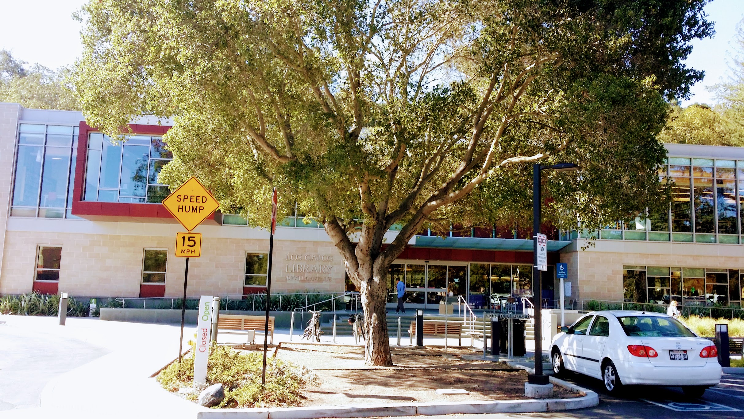

Los Gatos Public Library
The Los Gatos Public Library is operated by the Town of Los Gatos and is not part of the Santa Clara County Library system. The library is located at 100 Villa Ave, Los Gatos, CA in the town Civic Center. Any California resident with proper identification and verification of their mailing address may have borrowing privileges.
Museums[]
The New Museum, NUMU, formerly called Museums of Los Gatos,[33] offers exhibitions and programs on Los Gatos and San Francisco Bay Area art and history.[34]
Outdoor Recreational Activities[]
Los Gatos offers a variety of outdoor activities such as mountain biking, road cycling, trail running, kayaking, hiking. Los Gatos Creek trail is a fun and safe place for the entire family to enjoy all of these activities.
Sister cities[]
Los Gatos has five official sister cities:[35]
 Jhonghe City, Taiwan
- Liaoyang, People's Republic of China
- Listowel, Co. Kerry, Ireland
- Tallinn, Estonia
- Zihuatanejo, Mexico
Notable past and current residents[]
Actors[]


Olivia de Havilland
- Olivia de Havilland – actress, sister of Joan Fontaine, attended Los Gatos High School
- Aaron Eckhart – actor, raised in Los Gatos
- Joan Fontaine – actress, sister of Olivia de Havilland, attended Los Gatos High School
- Jason Jurman – actor (Cougar Club)[36]
Artists[]
- Kari Byron – artist and television personality
- Marshall Merritt – impressionist painter
- Gordon Smedt – pop art painter
Athletes and coaches[]


Kevin Youkilis
- Kiko Alonso – NFL player with Miami Dolphins, attended Los Gatos High School
- Jared Allen – former NFL defensive end, attended Los Gatos High School
- A. J. Allmendinger – race car driver, born in Los Gatos
- Rob Blake – former Los Angeles Kings player
- Jeff Blauser – former Atlanta Braves shortstop, born in Los Gatos
- Brent Burns – San Jose Sharks player, resident
- Joe Cannon – San Jose Earthquakes player
- Hal Chase – early 20th Century baseball star, born in Los Gatos
- Megan Cooke – silver medalist rower, born in Los Gatos
- Vincent Damphousse – San Jose Sharks player, resident
- Trent Edwards – former NFL quarterback, born in Los Gatos
- Peggy Fleming – Olympic gold medalist figure skater
- Dany Heatley – former San Jose Sharks player
- Jason Hinkin – pole vaulter, 5-time All-American
- Tim Hunter – former NHL forward, assistant coach, San Jose Sharks
- Joe Kapp – NFL quarterback
- Andy Levitre – NFL offensive lineman
- Roger Maltbie – PGA Tour golfer and TV analyst
- Patrick Marleau – San Jose Sharks player
- Steve Mariucci - NFL and NCAA coach, resident
- Ryan Nyquist – bicycle moto-cross rider
- Elliana Pogrebinsky - figure skater
- Mike Ricci – San Jose Sharks player, resident
- Jeremy Roenick – former San Jose Sharks player
- Derek Smith – former San Francisco 49ers linebacker
- Joe Thornton – San Jose Sharks player
- Charlie Wedemeyer – football coach
- Doug Wilson – general manager, San Jose Sharks
- Kevin Youkilis - Major League Baseball player[37]
- Russell Mark Tanner – Volleyball player
Business[]


Steve Wozniak
- Jeff George – NASA program director and engineer
- Gary Dahl – inventor of Pet Rock
- Jim Goetz – investor in Whatsapp
- Charles Walton – inventor of RFID, founder of Proximity Devices, Inc
- Steve Wozniak – Apple Computer co-founder
Musicians[]
- Dredg – band formed in Los Gatos
- Yehudi Menuhin – violinist
- Trapt – band formed in Los Gatos
Writers and journalists[]
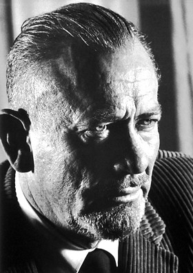

John Steinbeck
- Neal Cassady – author and iconic figure in Beat Movement of 1950s and '60s
- Victor Koman – science fiction writer and publisher
- Ross Macdonald – novelist, born in Los Gatos
- Rudy Rucker – author
- Josh Shipp – TV host, journalist and author
- John Steinbeck – author, resident for several years[38]
- Charles Erskine Scott Wood – author, civil libertarian, soldier, and attorney
Other[]
- Mark Bingham and Todd Beamer – passengers of United Airlines Flight 93 on 9/11 believed to have stormed the cockpit after its hijacking
- Eric Drew – activist and consumer advocate
- Charles A. Lockwood – World War II Commander Submarine Force Pacific Fleet
- Richard Thacker Morris – chairman of sociology department of UCLA
- Kenny Ortega – director, choreographer
- Steve Poizner – State Insurance Commissioner of California, candidate for Governor
- David Kinch – chef and restaurateur, owner of three Michelin star-rated Manresa in Los Gatos
- Dan Jinks - American Film and Television Producer, Oscar Winner for American Beauty
See also[]
References[]
- ^ "California Cities by Incorporation Date" (Word). California Association of Local Agency Formation Commissions. Archived from the original on February 21, 2013. https://web.archive.org/web/20130221091414/http://www.calafco.org/docs/Cities_by_incorp_date.doc. Retrieved August 25, 2014.
- ^ "Town Council". Los Gatos. http://www.losgatosca.gov/16/Town-Council. Retrieved March 4, 2018.
- ^ "About Town Manager". Los Gatos, CA. http://www.losgatosca.gov/423/About-Town-Manager. Retrieved December 14, 2014.
- ^ "2016 U.S. Gazetteer Files". United States Census Bureau. https://www2.census.gov/geo/docs/maps-data/data/gazetteer/2016_Gazetteer/2016_gaz_place_06.txt. Retrieved Jun 28, 2017.
- ^ "Los Gatos". Geographic Names Information System, U.S. Geological Survey. http://geonames.usgs.gov/pls/gnispublic/f?p=gnispq:3:::NO::P3_FID:1659017. Retrieved November 2, 2014.
- ^ "Los Gatos (city) QuickFacts". United States Census Bureau. Archived from the original on August 22, 2012. https://www.webcitation.org/6A73o6gIp?url=http://quickfacts.census.gov/qfd/states/06/0644112.html. Retrieved March 30, 2015.
- ^ a b "Population and Housing Unit Estimates". https://www.census.gov/programs-surveys/popest/data/tables.2016.html. Retrieved June 9, 2017.
- ^ Wells, John C. (2008), Longman Pronunciation Dictionary (3rd ed.), Longman, ISBN 9781405881180
- ^ Also pronounced [loʊz ˈɡatoʊs] or [lɔːz-], [s] is assimilated to its voiced form [z] before voiced consonants.
- ^ United States Census Bureau
- ^ "America’s Richest Zip Codes 2011". https://www.bloomberg.com/bw/slideshows/20111206/america-s-richest-zip-codes-2011#slide20. Retrieved 2012-06-21.
- ^ Gannett, Henry (1905). The Origin of Certain Place Names in the United States. U.S. Government Printing Office. p. 190. https://books.google.com/books?id=9V1IAAAAMAAJ&pg=PA190.
- ^ Merriam Webster's Collegiate Dictionary, 10th ed.
- ^ Pulcrano, Dan. "Yehudi Menuhin’s Los Gatos Days". Losgatos.com. http://www.losgatos.com/1999/03/yehudi-menuhins-los-gatos-days/.
- ^ "The South Pacific Coast Railroad". http://www.spcrr.org/HistorySPCRR.htm.
- ^ Stanley, Richard G. (2002). Subsurface and Petroleum Geology of the Southwestern Santa Clara Valley ("Silicon Valley"), California. Washington, D.C.: U.S. Geological Survey, U.S. Department of the Interior. p. 1. https://books.google.com/books?id=rFRd3wtOWcoC&lpg=PA1&ots=9Rn8TpA7VA&dq=los%20gatos%20oil%20boom&pg=PA1#v=onepage&q&f=false. Retrieved 23 October 2015.
- ^ a b c d e Stanley, Richard G. (2002). Subsurface and Petroleum Geology of the Southwestern Santa Clara Valley ("Silicon Valley"), California. Washington, D.C.: U.S. Geological Survey, U.S. Department of the Interior. p. 15. https://books.google.com/books?id=rFRd3wtOWcoC&lpg=PA1&ots=9Rn8TpA7VA&dq=los%20gatos%20oil%20boom&pg=PA15#v=onepage&q&f=false. Retrieved 23 October 2015.
- ^ Krueger, Max (1943). Moody Gulch Oil Field, in Geologic Formations and Economic Development of the Oil and Gas Fields of California. San Francisco: State of California Dept. of Natural Resources Division of Mines, Bulletin 118. p. 477.
- ^ "US Gazetteer files: 2010, 2000, and 1990". United States Census Bureau. 2011-02-12. https://www.census.gov/geo/www/gazetteer/gazette.html. Retrieved 2011-04-23.
- ^ Environmental Impact Report for the Superlife Care Facility, Earth Metrics Incorporated, prepared for the city of Los Gatos, California and the State of California Environmental Clearinghouse, March, 1989
- ^ "LOS GATOS, CALIFORNIA - Climate Summary". Wrcc.dri.edu. http://www.wrcc.dri.edu/cgi-bin/cliMAIN.pl?ca5123. Retrieved 2012-04-09.
- ^ "LOS GATOS, CALIFORNIA - Climate Summary". http://www.wrcc.dri.edu/cgi-bin/cliMAIN.pl?ca5123.
- ^ "History and Culture of Los Gatos". https://www.losgatosca.gov/DocumentCenter/View/8301.
- ^ Town of Los Gatos CAFR
- ^ "Census of Population and Housing". Census.gov. https://www.census.gov/prod/www/decennial.html. Retrieved June 4, 2015.
- ^ "2010 Census Interactive Population Search: CA - Los Gatos town". U.S. Census Bureau. https://www.census.gov/2010census/popmap/ipmtext.php?fl=06:0644112. Retrieved July 12, 2014.
- ^ "American FactFinder". United States Census Bureau. http://factfinder2.census.gov. Retrieved 2008-01-31.
- ^ "American FactFinder". Factfinder.census.gov. http://factfinder.census.gov/servlet/ACSSAFFFacts?_event=Search&geo_id=16000US0643280&_geoContext=01000US%7C04000US06%7C16000US0643280&_street=&_county=los+gatos&_cityTown=los+gatos&_state=04000US06&_zip=&_lang=en&_sse=on&ActiveGeoDiv=geoSelect&_useEV=&pctxt=fph&pgsl=160&_submenuId=factsheet_1&ds_name=ACS_2007_3YR_SAFF&_ci_nbr=null&qr_name=null®=null%3Anull&_keyword=&_industry=. Retrieved 2012-04-09.
- ^ "Statewide Database". UC Regents. http://statewidedatabase.org/gis/gis2011/index_2011.html. Retrieved November 29, 2014.
- ^ "California's 18th Congressional District - Representatives & District Map". Civic Impulse, LLC. http://www.govtrack.us/congress/members/CA/18. Retrieved March 14, 2013.
- ^ "St. Mary's School". http://stmaryslg.org/school.
- ^ "Fusion Academy". http://www.fusionacademy.com/academy/los-gatos/welcome/.
- ^ Peterson, Judy (2014-10-22). "Los Gatos: Museums get new name, and soon new home". San Jose Mercury News. http://www.mercurynews.com/los-gatos/ci_26780835/los-gatos-museums-get-new-name-and-soon. Retrieved 2 April 2015.
- ^ "NUMU: New Museum Los Gatos breaks Ground". Metroactive Silicon Valley. http://www.metroactive.com/features/columns/NUMU-New-Museum-Los-Gatos.html. Retrieved 2014-10-28.
- ^ "Monte Sereno explores sister city relationship". Los Gatos Weekly Times. http://www.svcn.com/archives/lgwt/02.27.02/sistercity-0209.html. Retrieved 2008-08-20.
- ^ "Jason Jurman obituary". San Jose Mercury News. 2014-10-15. http://www.legacy.com/obituaries/mercurynews/obituary.aspx?pid=172808841. Retrieved 2014-11-01.
- ^ [1]
- ^ "My Town". http://www.svcn.com/archives/lgwt/02.13.02/cover-0207.html.
External links[]
| Wikivoyage has a travel guide for Los Gatos. |
- Media related to Los Gatos, California at Wikimedia Commons
- [http:// Official website]
|
| |||||||||||
| ||||||||||||||||||||||||||||||||
| |||||||||||||||||||||||||
| ||||||||||||||||||||

Template:SFBayshopping
| This page uses content from the English language Wikipedia. The original content was at Los Gatos, California. The list of authors can be seen in the page history. As with this Familypedia wiki, the content of Wikipedia is available under the Creative Commons License. |