| ||||||||||||||
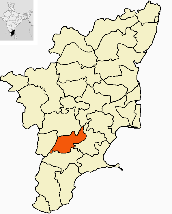
| Madurai district மதுரை மாவட்டம் |
|
|---|---|
| — District — | |
 |
|
 |
|
| Coordinates: Coordinates: | |
| Country | |
| State | Tamil Nadu |
| Metro | |
| Municipal Corporations | Madurai |
| Headquarters | Madurai |
| Government | |
| • Collector | Mr.Ansul Misra IAS |
| Area | |
| • Total | 3,741.73 km2 (1,444.69 sq mi) |
| Population (2011)[1] | |
| • Total | 3,041,038 |
| • Density | 823/km2 (2,130/sq mi) |
| Languages | |
| • Official | Tamil |
| • Other | Tamil, Telegu, Sourashtra, English, Hindi |
| Time zone | IST (UTC+5:30) |
| PIN | 625001 |
| Telephone code | 0452 |
| Vehicle registration | TN-58, TN-59[2] |
| Coastline | 0 kilometres (0 mi) |
| Largest city | Madurai |
| Sex ratio | ♂-50.5% / ♀-49.5% |
| Literacy | 81.5% |
| Lok Sabha constituency | 1 |
| Vidhan Sabha constituency | 10 |
| IUCN category | |
| Website | madurai.tn.nic.in |
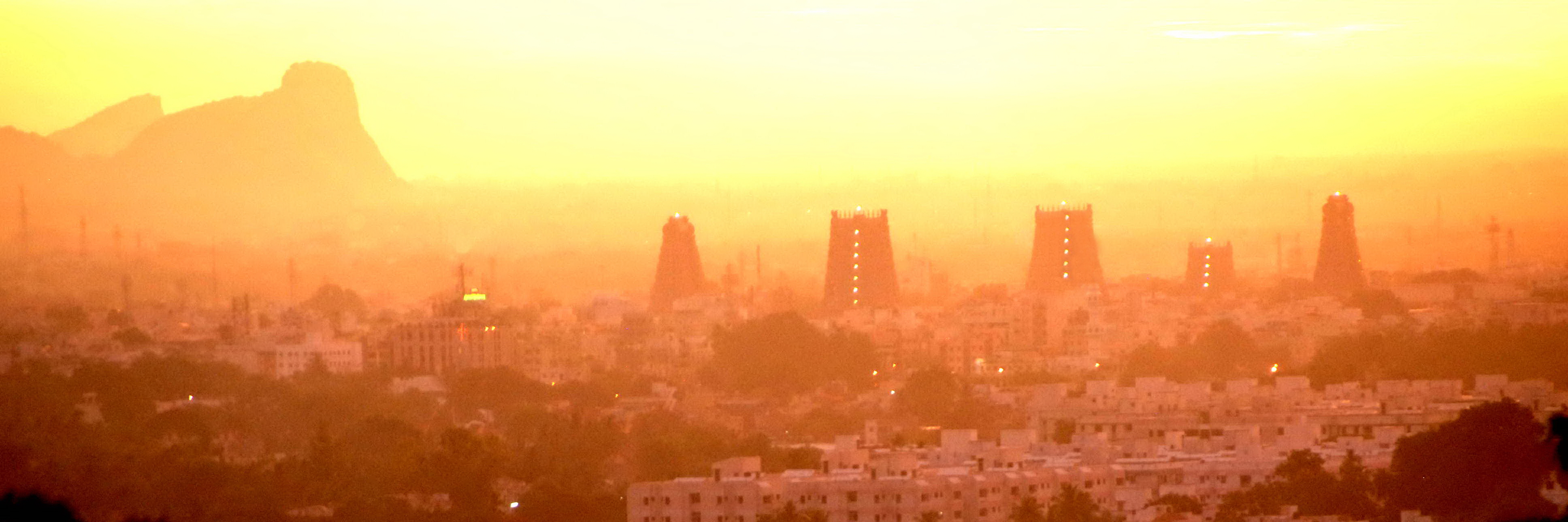
Madurai district is one of the 32 districts of the state of Tamil Nadu, in southeastern India. The city of Madurai serves as the district headquarters. It houses the world famous Sri Meenakshi Sundareshwarar temple and is situated on the banks of river Vaigai. Thiruparankundram is one of the major tourist place in the district. Kazimar Periya Pallivasal and Madurai Maqbara in Kazimar Street are the oldest and major Islamic symbols in the city.
History[]
Madurai, also known as "Athens of the East". The main kingdoms which ruled Madurai during various times are the Pandyas and the Nayaks. Madurai is nicknamed "Thoonga Nagaram", roughly translated as, "city that never sleeps". Madurai is called as temple city
Blocks[]
Madurai district comprises 13 Blocks.The Blocks become the best part of administration due to the number of villages in the district where rural administration is done by the Block hq. The Blocks are sub-divided by Firkas
- Thiruparankundram -- 7 Revenue Firkas
- T.Kallupatti -- 3 Revenue Firkas
- Tirumangalam -- 3 Revenue Firkas
- Kalligudi
- Sedapatti
- Usilampatti
- Vadipatti
- Melur
- Madurai West
- Madurai East
- Kottampatti
- Alanganallur
- Chellampatti[3]
Divisions[]


Bull Taming, Alanganallur
Madurai district comprises seven Taluks.
- Madurai (North)
- Madurai (South)
- Tirumangalam
- Peraiyur
- Usilampatti
- Vadipatti
- Melur
Political Divisions[]
| Assembly Constituency |
Political Party |
Elected Representative |
|---|
| Thirupparankundram | DMDK | A. K. T. Raja |
| Usilampatti | AIFB | P. V. Kathiravan |
| Madurai North | AIADMK | A. K. Bose |
| Melur | AIADMK | R. Samy |
| Madurai East | AIADMK | K. Tamilarasan |
| Madurai Central | DMDK | R.Sundarrajan |
| Sholavandan | AIADMK | M. V. Karuppaiah |
| Tirumangalam | AIADMK | M. Muthuramalingam |
| Madurai South | CPI-M | R. Annadurai |
| Madurai West | AIADMK | K. Raju |
| Lok Sabha Constituency |
Political Party |
Elected Representative |
|---|
| Madurai | DMK | M.K. Azhagiri |
| Source: Indian Elections / Election Commission of India.[4][5] | ||
Demographics[]
According to the 2011 census Madurai district has a population of 3,041,038,[6] roughly equal to the nation of Oman[7] or the US state of Iowa.[8] This gives it a ranking of 119th in India (out of a total of 640).[6] The district has a population density of 823 inhabitants per square kilometre (2,130 /sq mi) .[6] Its population growth rate over the decade 2001-2011 was 17.95 %.[6] Madurai has a sex ratio of 990 females for every 1000 males,[6] and a literacy rate of 81.66 %.[6]
Madurai district population is about 3,041,038 as of 2011,[9] with a decennial growth rate of 18%. The 60% of the district is urbanised, and the literacy rate of the district is about 81.7%.
Tourist attraction[]
- Kutladampatti falls
- Madurai Meenakshiamman temple
- AlagarKoil
- Theppakulam, Vandiyur
- Thirupparankundram Murugan Temple
- Thirumalai Nayakar Mahal
- 1000 kal Mandapam
- Gandhi Museum
- Eco park
- Kuruvithurai Vallaba Perumal Temple
- Vaigai Dam nearby
- Anaipatti Anjaneyar Temple
- Kodaikkanal nearby
- Suruli falls nearby.[10]
Geography[]
Climate[]
| Climate chart for Madurai | |||||||||||
|---|---|---|---|---|---|---|---|---|---|---|---|
| J | F | M | A | M | J | J | A | S | O | N | D |
20
30
20
|
13.5
32
21
|
18
35
22.5
|
55
37
25
|
70
37
26
|
40
36
26
|
49.5
35.5
25
|
104
35
25
|
119
34
24
|
188
32
24
|
145
30
23
|
51
29
21
|
| temperatures in °C • precipitation totals in mm | |||||||||||
References[]
- ^ "2011 Census of India" (Excel). Indian government. 16 April 2011. http://www.censusindia.gov.in/2011-prov-results/prov_data_products_tamilnadu.html.
- ^ www.tn.gov.in
- ^ http://www.madurai.tn.nic.in/block.html
- ^ "Election results". Indian Elections. http://www.indian-elections.com/assembly-elections/tamil-nadu/election-result-06.html.
- ^ "Parties Statistics". Election Commission of India. http://www.eci.gov.in/StatisticalReports/ElectionStatistics.asp.
- ^ a b c d e f "District Census 2011". Census2011.co.in. 2011. http://www.census2011.co.in/district.php. Retrieved 2011-09-30.
- ^ US Directorate of Intelligence. "Country Comparison:Population". https://www.cia.gov/library/publications/the-world-factbook/rankorder/2119rank.html. Retrieved 2011-10-01. "Oman 3,027,959"
- ^ "2010 Resident Population Data". U. S. Census Bureau. http://2010.census.gov/2010census/data/apportionment-pop-text.php. Retrieved 2011-09-30. "Iowa 3,046,355"
- ^ [1]
- ^ Suruli Falls Suruli falls
External links[]

|
Dindigul district | Tiruchirappalli district |
| |
| Theni district | Sivaganga district | |||
 Madurai district | ||||
| Virudhunagar district |
| ||||||||||||||||||||||||||||||||||||||||
Template:Madurai district
| This page uses content from the English language Wikipedia. The original content was at Madurai district. The list of authors can be seen in the page history. As with this Familypedia wiki, the content of Wikipedia is available under the Creative Commons License. |