| ||||||||||||||


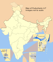
Mahe district is one of the four districts of the Union Territory of Puducherry in India. It consists of the whole of the Mahé region.[1] The total area of Mahe District is surrounded by North Malabar of Kerala State. Three sides by Kannur District and one side by Kozhikode District. In fact, geographically Mahe District is part of North Malabar.
It is the sixth least populous district in the country (out of 640).[2]
Geography[]
Mahe district occupies an area of 8.69 square kilometres (3.36 sq mi). [3] [4]
Demographics[]

According to the 2011 census Mahe district has a population of 41,934,[2] roughly equal to the nation of Liechtenstein.[5] This gives it a ranking of 635th in India (out of a total of 640).[2] The district has a population density of 4,659 inhabitants per square kilometre (12,070 /sq mi) .[2] Its population growth rate over the decade 2001-2011 was 13.86%.[2] Mahe has a sex ratio of 1176 females for every 1000 males,[2] and a literacy rate of 98.35%.[2]
See also[]
- Mahe (disambiguation)
- Karaikal district
- Yanam district
- Pondicherry district
- North Malabar
Notes[]
- ^ Mahe District official website
- ^ a b c d e f g "District Census 2011". Census2011.co.in. 2011. http://www.census2011.co.in/district.php. Retrieved 2011-09-30.
- ^ http://mahe.gov.in/
- ^ Srivastava, Dayawanti et al. (ed.) (2010). "States and Union Territories: Pondicherry: Government". India 2010: A Reference Annual (54th ed.). New Delhi, India: Additional Director General, Publications Division, Ministry of Information and Broadcasting (India), Government of India. pp. 1222. ISBN 978-81-230-1617-7.
- ^ US Directorate of Intelligence. "Country Comparison:Population". https://www.cia.gov/library/publications/the-world-factbook/rankorder/2119rank.html. Retrieved 2011-10-01. "212 Liechtenstein 35,236 July 2011 est."

|
Kannur district, Kerala | 
| ||
| Kannur district, Kerala | Kannur district, Kerala | |||
 Mahe district | ||||
| Kozhikode district, Kerala |
Template:North Malabar
| |||||||||||||||||||||||||||||
| This article related to a location in the Indian union territory of Puducherry is a stub. You can help by expanding it. |
| This page uses content from the English language Wikipedia. The original content was at Mahe district. The list of authors can be seen in the page history. As with this Familypedia wiki, the content of Wikipedia is available under the Creative Commons License. |
