| ||||||||||||||
| Marion County, Mississippi | |
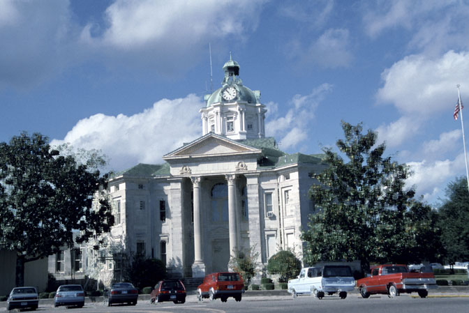 Marion County courthouse in Columbia, Mississippi
| |
 Location in the state of Mississippi | |
 Mississippi's location in the U.S. | |
| Founded | 1811 |
|---|---|
| Seat | Columbia |
| Largest city | Columbia |
| Area - Total - Land - Water |
548.58 sq mi (1,421 km²) 542.34 sq mi (1,405 km²) 6.24 sq mi (16 km²), 1.14% |
| Population - (2010) - Density |
27,088 47/sq mi (18/km²) |
Marion County is a county located in the U.S. state of Mississippi. As of 2010, the population was 27,088. Its county seat is Columbia.[1] Marion County is named for American Revolutionary War guerrilla leader Francis Marion.
Geography
According to the 2000 census, the county has a total area of 548.58 square miles (1,420.8 km2), of which 542.34 square miles (1,404.7 km2) (or 98.86%) is land and 6.24 square miles (16.2 km2) (or 1.14%) is water.[2]
Major highways
 U.S. Highway 98
- Mississippi Highway 13
- Mississippi Highway 35
- Mississippi Highway 43
- Mississippi Highway 44
Adjacent counties
- Jefferson Davis County (north)
- Lamar County (east)
- Pearl River County (southeast)
- Washington Parish, Louisiana (south)
- Walthall County (west)
- Lawrence County (northwest)

|
Lawrence County | Jefferson Davis County |
| |
| Walthall County | Lamar County | |||
 Marion County, Mississippi | ||||
| Washington Parish, Louisiana | Pearl River County |
Demographics
| Historical populations | |||
|---|---|---|---|
| Census | Pop. | %± | |
| 1820 | 3,116 | ||
| 1830 | 3,691 | 18.5% | |
| 1840 | 3,830 | 3.8% | |
| 1850 | 4,410 | 15.1% | |
| 1860 | 4,686 | 6.3% | |
| 1870 | 4,211 | −10.1% | |
| 1880 | 6,901 | 63.9% | |
| 1890 | 9,532 | 38.1% | |
| 1900 | 13,501 | 41.6% | |
| 1910 | 15,599 | 15.5% | |
| 1920 | 17,144 | 9.9% | |
| 1930 | 19,923 | 16.2% | |
| 1940 | 24,085 | 20.9% | |
| 1950 | 23,967 | −0.5% | |
| 1960 | 23,293 | −2.8% | |
| 1970 | 22,871 | −1.8% | |
| 1980 | 25,708 | 12.4% | |
| 1990 | 25,544 | −0.6% | |
| 2000 | 25,595 | 0.2% | |
| 2010 | 27,088 | 5.8% | |
| MS Counties 1900-1990 GeoHive - 2000 & 2010 statistics | |||
As of the census[3] of 2000, there were 25,595 people, 9,336 households, and 6,880 families residing in the county. The population density was 47 people per square mile (18/km²). There were 10,395 housing units at an average density of 19 per square mile (7/km²). The racial makeup of the county was 66.96% White, 31.87% Black or African American, 0.23% Native American, 0.21% Asian, 0.01% Pacific Islander, 0.11% from other races, and 0.62% from two or more races. 0.62% of the population were Hispanic or Latino of any race.
There were 9,336 households out of which 34.80% had children under the age of 18 living with them, 54.00% were married couples living together, 15.60% had a female householder with no husband present, and 26.30% were non-families. 24.20% of all households were made up of individuals and 12.60% had someone living alone who was 65 years of age or older. The average household size was 2.64 and the average family size was 3.13.
In the county the population was spread out with 27.80% under the age of 18, 9.50% from 18 to 24, 26.90% from 25 to 44, 21.50% from 45 to 64, and 14.30% who were 65 years of age or older. The median age was 35 years. For every 100 females there were 93.70 males. For every 100 females age 18 and over, there were 88.80 males.
The median income for a household in the county was $24,555, and the median income for a family was $29,894. Males had a median income of $26,909 versus $17,192 for females. The per capita income for the county was $12,301. About 20.70% of families and 24.80% of the population were below the poverty line, including 32.60% of those under age 18 and 23.00% of those age 65 or over.
Government and infrastructure
The Mississippi Department of Human Services's Division of Youth Services operated the Columbia Training School in unincorporated Marion County.[4][5]
Communities
City
Unincorporated communities
- Bunker Hill
- Cheraw
- East Columbia
- Foxworth
- Goss
- Hub
- Improve
- Kokomo
- Morgantown
- Sandy Hook
- Jamestown
Notable natives and residents
- Earl W. Bascom (1916-1995), "Father of Modern Rodeo" and Hall of Fame cowboy, produced Marion County's first rodeo in 1935
See also
- National Register of Historic Places listings in Marion County, Mississippi
References
- ^ "Find a County". National Association of Counties. http://www.naco.org/Counties/Pages/FindACounty.aspx. Retrieved 2011-06-07.
- ^ "Census 2000 U.S. Gazetteer Files: Counties". United States Census. http://www.census.gov/tiger/tms/gazetteer/county2k.txt. Retrieved 2011-02-13.
- ^ "American FactFinder". United States Census Bureau. http://factfinder.census.gov. Retrieved 2008-01-31.
- ^ "Columbia city, Mississippi." U.S. Census Bureau. Retrieved on July 21, 2010.
- ^ "Public Appearance Calendar Governor Ronnie Musgrove For the Week of December 31, 2001." Mississippi Department of Archives and History. Retrieved on July 21, 2010. "Columbia Training School 1730 Highway 44 Columbia, MS."
| ||||||||||||||

| This page uses content from the English language Wikipedia. The original content was at Marion County, Mississippi. The list of authors can be seen in the page history. As with this Familypedia wiki, the content of Wikipedia is available under the Creative Commons License. |