| ||||||||||||||
| Mason County, Kentucky | |
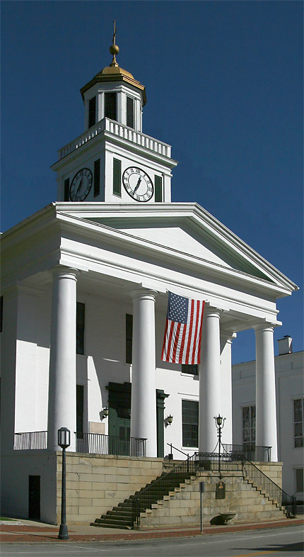 The Mason County courthouse in Maysville
| |
 Location in the state of Kentucky | |
 Kentucky's location in the U.S. | |
| Founded | 1788 |
|---|---|
| Named for | George Mason |
| Seat | Maysville |
| Largest city | Maysville |
| Area - Total - Land - Water |
246 sq mi (637 km²) 240 sq mi (622 km²) 6.3 sq mi (16 km²), 2.6% |
| Population - (2010) - Density |
17,490 73/sq mi (28/km²) |
| Congressional district | 4th |
| Time zone | Eastern: UTC-5/-4 |
| Website | http://masoncountykentucky.us/ |
Mason County is a county located in the U.S. state of Kentucky. As of the 2010 census, the population was 17,490.[1] Its county seat is Maysville.[2] The county was created from Bourbon County, Virginia in 1788 and named for George Mason, a Virginia delegate to the U.S. Constitutional Convention, known as the "Father of the Bill of Rights".[3][4]
Mason County comprises the Maysville, KY Micropolitan Statistical Area, which is included in the Cincinnati-Wilmington-Maysville, OH-KY-IN Combined Statistical Area.
Geography
According to the U.S. Census Bureau, the county has a total area of 246 square miles (640 km2), of which 240 square miles (620 km2) is land and 6.3 square miles (16 km2) (2.6%) is water.[5] The county's northern border with Ohio is formed by the Ohio River.
Adjacent counties
- Brown County, Ohio (north)
- Adams County, Ohio (northeast)
- Lewis County (east)
- Fleming County (south)
- Robertson County (southwest)
- Bracken County (west)
Demographics
| Historical populations | |||
|---|---|---|---|
| Census | Pop. | %± | |
| 1790 | 2,729 | ||
| 1800 | 12,182 | 346.4% | |
| 1810 | 12,459 | 2.3% | |
| 1820 | 13,588 | 9.1% | |
| 1830 | 16,199 | 19.2% | |
| 1840 | 15,719 | −3.0% | |
| 1850 | 18,344 | 16.7% | |
| 1860 | 18,222 | −0.7% | |
| 1870 | 18,126 | −0.5% | |
| 1880 | 20,469 | 12.9% | |
| 1890 | 20,773 | 1.5% | |
| 1900 | 20,446 | −1.6% | |
| 1910 | 18,611 | −9.0% | |
| 1920 | 17,760 | −4.6% | |
| 1930 | 18,862 | 6.2% | |
| 1940 | 19,066 | 1.1% | |
| 1950 | 18,486 | −3.0% | |
| 1960 | 18,454 | −0.2% | |
| 1970 | 17,273 | −6.4% | |
| 1980 | 17,765 | 2.8% | |
| 1990 | 16,666 | −6.2% | |
| 2000 | 16,800 | 0.8% | |
| 2010 | 17,490 | 4.1% | |
| Est. 2016 | 17,190 | [6] | 2.3% |
| U.S. Decennial Census[7] 1790-1960[8] 1900-1990[9] 1990-2000[10] 2010-2013[1] | |||
As of the census[11] of 2000, there were 16,800 people, 6,847 households, and 4,697 families residing in the county. The population density was 70 per square mile (27 /km2). There were 7,754 housing units at an average density of 32 per square mile (12 /km2). The racial makeup of the county was 90.88% White, 7.16% Black or African American, 0.15% Native American, 0.37% Asian, 0.02% Pacific Islander, 0.57% from other races, and 0.85% from two or more races. 0.95% of the population were Hispanic or Latino of any race.
There were 6,847 households out of which 31.30% had children under the age of 18 living with them, 54.20% were married couples living together, 11.10% had a female householder with no husband present, and 31.40% were non-families. 27.60% of all households were made up of individuals and 12.80% had someone living alone who was 65 years of age or older. The average household size was 2.41 and the average family size was 2.92.
In the county, the population was spread out with 24.10% under the age of 18, 8.00% from 18 to 24, 28.50% from 25 to 44, 23.90% from 45 to 64, and 15.50% who were 65 years of age or older. The median age was 38 years. For every 100 females there were 93.70 males. For every 100 females age 18 and over, there were 89.50 males.
The median income for a household in the county was $30,195, and the median income for a family was $37,257. Males had a median income of $30,718 versus $21,216 for females. The per capita income for the county was $16,589. About 12.90% of families and 16.80% of the population were below the poverty line, including 23.60% of those under age 18 and 13.70% of those age 65 or over.
Politics
| Year | Republican | Democratic | Third Parties |
|---|---|---|---|
| 2016 | 68.5% 4,944 | 27.3% 1,970 | 4.2% 305 |
| 2012 | 61.0% 4,197 | 37.7% 2,592 | 1.3% 92 |
| 2008 | 57.6% 4,102 | 40.6% 2,891 | 1.8% 128 |
| 2004 | 61.9% 4,381 | 37.4% 2,644 | 0.8% 54 |
| 2000 | 60.8% 3,572 | 37.1% 2,178 | 2.1% 123 |
| 1996 | 46.7% 2,588 | 44.1% 2,444 | 9.2% 507 |
| 1992 | 40.3% 2,432 | 44.1% 2,657 | 15.6% 940 |
| 1988 | 53.6% 3,158 | 46.2% 2,721 | 0.3% 16 |
| 1984 | 58.2% 3,751 | 41.3% 2,663 | 0.5% 32 |
| 1980 | 46.5% 2,926 | 50.6% 3,181 | 2.9% 180 |
| 1976 | 42.1% 2,529 | 56.6% 3,397 | 1.3% 78 |
| 1972 | 58.5% 3,529 | 40.7% 2,459 | 0.8% 49 |
| 1968 | 40.5% 2,661 | 42.2% 2,772 | 17.3% 1,137 |
| 1964 | 35.1% 4,502 | 64.8% 2,437 | 0.2% 13 |
| 1960 | 57.9% 4,334 | 42.1% 3,153 | 0.0% 0 |
| 1956 | 51.8% 3,880 | 47.7% 3,572 | 0.5% 38 |
| 1952 | 49.9% 3,606 | 50.0% 3,614 | 0.1% 8 |
| 1948 | 40.1% 2,519 | 57.7% 3,620 | 2.2% 138 |
| 1944 | 45.8% 3,256 | 53.6% 3,810 | 0.6% 39 |
| 1940 | 45.6% 3,704 | 54.0% 4,386 | 0.3% 27 |
| 1936 | 41.6% 3,317 | 56.5% 4,503 | 1.9% 147 |
| 1932 | 38.6% 3,213 | 60.8% 5,065 | 0.7% 56 |
| 1928 | 59.8% 5,012 | 40.1% 3,364 | 0.1% 6 |
| 1924 | 48.3% 3,406 | 50.0% 3,525 | 1.8% 124 |
| 1920 | 44.2% 3,743 | 55.3% 4,691 | 0.5% 42 |
| 1916 | 42.5% 2,127 | 56.4% 2,820 | 1.1% 53 |
| 1912 | 33.8% 1,558 | 53.8% 2,475 | 12.4% 572 |
Communities
Cities
- Dover
- Germantown
- Maysville
- Sardis
Census-designated place
- Mays Lick
Other unincorporated places
- Fernleaf
- Helena
- Lewisburg
- Minerva
- Orangeburg
- Shannon
- Somo
- Weedonia
Notable residents
- Joshua Bean, first Mayor of San Diego (1850-1851).
- Judge Roy Bean, Famous Hanging judge of Texas. (Law West of the Pecos)
Darius Miller, Played for University Of Kentucky Basketball. 2012 NCCA Champion, 2008 Ky. Mr. Basketball
Chris Loften, Played for the University of Tennessee. 2003 Ky. Mr. Basketball Deron Feldhaus, Played basketball for the University of Kentucky. Member of "The Unforgettable s."
See also
- National Register of Historic Places listings in Mason County, Kentucky
References
- ^ a b "State & County QuickFacts". United States Census Bureau. Archived from the original on July 14, 2011. http://www.webcitation.org/60AvZ4uju?url=http://quickfacts.census.gov/qfd/states/21/21161.html. Retrieved March 6, 2014.
- ^ "Find a County". National Association of Counties. http://www.naco.org/Counties/Pages/FindACounty.aspx. Retrieved 2011-06-07.
- ^ "Mason County". The Kentucky Encyclopedia. 2000. http://www.kyenc.org/entry/m/MASON02.html. Retrieved August 23, 2014.
- ^ Collins, Lewis (1882). Collins' Historical Sketches of Kentucky: History of Kentucky, Volume 2. Collins & Company. pp. 26. https://books.google.com/books?id=gZFQAQAAIAAJ&pg=PA26#v=onepage&q&f=false.
- ^ "2010 Census Gazetteer Files". United States Census Bureau. August 22, 2012. http://www.census.gov/geo/maps-data/data/docs/gazetteer/counties_list_21.txt. Retrieved August 17, 2014.
- ^ "Population and Housing Unit Estimates". https://www.census.gov/programs-surveys/popest/data/tables.2016.html. Retrieved June 9, 2017.
- ^ "U.S. Decennial Census". United States Census Bureau. http://www.census.gov/prod/www/decennial.html. Retrieved August 17, 2014.
- ^ "Historical Census Browser". University of Virginia Library. http://mapserver.lib.virginia.edu. Retrieved August 17, 2014.
- ^ "Population of Counties by Decennial Census: 1900 to 1990". United States Census Bureau. http://www.census.gov/population/cencounts/ky190090.txt. Retrieved August 17, 2014.
- ^ "Census 2000 PHC-T-4. Ranking Tables for Counties: 1990 and 2000". United States Census Bureau. http://www.census.gov/population/www/cen2000/briefs/phc-t4/tables/tab02.pdf. Retrieved August 17, 2014.
- ^ "American FactFinder". United States Census Bureau. http://factfinder2.census.gov. Retrieved 2008-01-31.
- ^ http://uselectionatlas.org/RESULTS
External links
- Mason County government's website
- Historical Texts and Images of Mason County
- Mason County school district's website
| ||||||||||||||||||||

| This page uses content from the English language Wikipedia. The original content was at Mason County, Kentucky. The list of authors can be seen in the page history. As with this Familypedia wiki, the content of Wikipedia is available under the Creative Commons License. |