| Menindee New South Wales | |||||||||||||
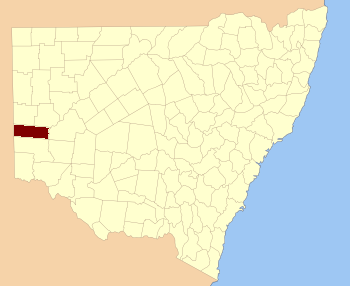 Location in New South Wales | |||||||||||||
| |||||||||||||
Menindee County is one of the 141 Cadastral divisions of New South Wales. It is located between the Darling River and the South Australian border. Menindee is at its north-eastern edge. The Menindee Lakes are located there.
The name Menindee is of unknown origin.[1]
Parishes within this county[]
A full list of parishes found within this county; their current LGA and mapping coordinates to the approximate centre of each location is as follows:
| Parish | LGA | Coordinates |
|---|---|---|
| Bintullia | Unincorporated | |
| Buckalow East | Unincorporated | |
| Buckalow West | Unincorporated | |
| Buckalow | Unincorporated | |
| Burta | Unincorporated | |
| Caari | Unincorporated | |
| Cawndilla | Central Darling Shire | |
| Coonalhugga | Central Darling Shire | |
| Coultra | Unincorporated | |
| Doon | Unincorporated | |
| Enmore | Unincorporated | unknown |
| Ita | Unincorporated | |
| Kinchega | Central Darling Shire | |
| Laidley | Central Darling Shire | |
| Mitta | Unincorporated | |
| Mundybah | Unincorporated | |
| Naloira | Central Darling Shire | |
| Nettlegoe | Unincorporated | |
| Paringi | Unincorporated | |
| Perry | Central Darling Shire | |
| Pinnelco | Central Darling Shire | |
| Putta | Unincorporated | |
| Rantyga | Unincorporated | |
| Tandou | Central Darling Shire | |
| Waneba | Unincorporated | |
| Wanga | Unincorporated | |
| Wendi | Unincorporated | |
| West Mitta | Unincorporated | |
| West Wendi | Unincorporated |
References[]
| This page uses content from the English language Wikipedia. The original content was at Menindee County. The list of authors can be seen in the page history. As with this Familypedia wiki, the content of Wikipedia is available under the Creative Commons License. |