| ||||||||||||||
| Pinal County, Arizona | ||
 Pinal County Courthouse in Florence, Arizona
| ||
| ||
 Location in the state of Arizona | ||
 Arizona's location in the U.S. | ||
| Founded | February 1, 1875 | |
|---|---|---|
| Seat | Florence | |
| Largest city | Casa Grande | |
| Area - Total - Land - Water |
5,374.09 sq mi (13,919 km²) 5,369.59 sq mi (13,907 km²) 4.50 sq mi (12 km²), 0.08% | |
| Population - (2020) - Density |
425,264 70/sq mi (27.0/km²) | |
| Time zone | Mountain: UTC-7 | |
| Website | www.pinalcountyaz.gov | |

Pinal County is located in the central part of the U.S. state of Arizona. As of the 2020 census, its population was 425,264. The county seat is Florence.
Pinal County contains parts of the Tohono O'odham Nation, the Gila River Indian Community and the San Carlos Apache Indian Reservation, as well as the entirety of the Ak-Chin Indian Community.
Because Pinal County is located between Arizona's two largest metropolitan regions, Phoenix and Tucson, suburban growth southward from greater Phoenix has begun to spread into the northern parts of the county; similarly, growth northward from Tucson is spreading into the southern portions of the county. The Pinal County cities of Maricopa and Casa Grande, as well as many unincorporated areas, have shown accelerated growth patterns in recent years; such suburban development is likely to continue for the foreseeable future.
History[]
Pinal County was carved out of neighboring Maricopa County and Pima County on February 1, 1875. Pinal County is the third largest county in Arizona and was the second fastest growing county in the U.S. between 2000 and 2010.[1] The political history of Pinal County is an interesting one. The people of the county had never elected a Republican to a county-wide seat (Supervisor, Sheriff, Attorney, Recorder, Treasurer, Assessor, Superintendent of Schools, and Clerk of the Superior Court) until 2008 with the election of Sheriff Paul Babeu and Supervisor Bryan Martyn. The following election in 2010, also brought in a Republican Clerk of the Superior Court Chad Roche. The elections in 2012 will add two supervisors to Pinal County due to the population increase.
Geography[]


Picketpost Peak, a prominent landmark above Superior.


Spring wildflowers in the Sonoran Desert National Monument.
According to the 2000 census, the county has a total area of 5,374.09 square miles (13,918.8 km2), of which 5,369.59 square miles (13,907.2 km2) (or 99.92%) is land and 4.50 square miles (11.7 km2) (or 0.08%) is water.[2]
Mountain ranges[]
- Mineral Mountains
- Sacaton Mountains
- Superstition Mountains
- Waterman Mountains
Major highways[]
 Interstate 8
- Interstate 10
- U.S. Route 60
- State Route 77
- State Route 79
- State Route 84
- State Route 87
- State Route 177
- State Route 287
- State Route 347
- State Route 387
- State Route 587
Adjacent counties[]
- Maricopa County, Arizona - west, north
- Gila County, Arizona - north
- Graham County, Arizona - east
- Pima County, Arizona - south
National protected areas[]
- Casa Grande Ruins National Monument
- Coronado National Forest (part)
- Hohokam Pima National Monument
- Ironwood Forest National Monument (part)
- Sonoran Desert National Monument (part)
- Tonto National Forest (part)
Demographics[]
| Historical populations | |||
|---|---|---|---|
| Census | Pop. | %± | |
| 1880 | 3,440 | ||
| 1890 | 4,251 | 23.6% | |
| 1900 | 7,779 | 83.0% | |
| 1910 | 9,045 | 16.3% | |
| 1920 | 16,130 | 78.3% | |
| 1930 | 22,081 | 36.9% | |
| 1940 | 28,841 | 30.6% | |
| 1950 | 43,191 | 49.8% | |
| 1960 | 62,673 | 45.1% | |
| 1970 | 67,916 | 8.4% | |
| 1980 | 90,918 | 33.9% | |
| 1990 | 116,379 | 28.0% | |
| 2000 | 179,727 | 54.4% | |
| 2010 | 375,770 | 109.1% | |
2010[]
Whereas according to the 2010 U.S. Census Bureau:
- 72.4% White
- 4.6% Black
- 5.6% Native American
- 1.7% Asian
- 0.4% Native Hawaiian or Pacific Islander
- 3.8% Two or more races
- 11.5% Other races
- 28.5% Hispanic or Latino (of any race)
2000[]
As of the 2000 census, there were 179,727 people, 61,364 households, and 45,225 families residing in the county. The population density was 34 people per square mile (13/km²). There were 81,154 housing units at an average density of 15/sq mi (6/km²). The racial makeup of the county was 70.42% White, 2.76% Black or African American, 7.81% Native American, 0.60% Asian, 0.08% Pacific Islander, 15.66% from other races, and 2.67% from two or more races. 29.86% of the population were Hispanic or Latino of any race. 21.86% reported speaking Spanish at home, while 1.44% speak O'odham and 0.02% speak Apache.[3]
There were 61,364 households out of which 29.80% had children under the age of 18 living with them, 56.90% were married couples living together, 11.50% had a female householder with no husband present, and 26.30% were non-families. 21.10% of all households were made up of individuals and 9.20% had someone living alone who was 65 years of age or older. The average household size was 2.68 and the average family size was 3.09.
In the county the population was spread out with 25.10% under the age of 18, 8.70% from 18 to 24, 27.30% from 25 to 44, 22.70% from 45 to 64, and 16.20% who were 65 years of age or older. The median age was 37 years. For every 100 females there were 114.20 males. For every 100 females age 18 and over, there were 117.00 males.
The median income for a household in the county was $35,856, and the median income for a family was $39,548. Males had a median income of $31,544 versus $23,726 for females. The per capita income for the county was $16,025. About 12.10% of families and 16.90% of the population were below the poverty line, including 25.50% of those under age 18 and 8.70% of those age 65 or over.
Economy[]
As of 2010 the Corrections Corporation of America-operated Saguaro Correctional Center,[4] located in Eloy in Pinal County,[5] houses the majority of Hawaii's male prison inmate population.[4]
Communities[]


Map of incorporated areas and Indian reservations in Pinal County.
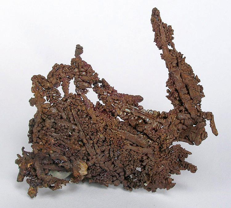

Native copper with cuprite from the Ray Mine near Kearny
Cities[]
| Community | Designation | Latest Census Population |
|---|---|---|
| Apache Junction* | City | 35,840 |
| Casa Grande | City | 48,571 |
| Coolidge | City | 9,570 |
| Eloy | City | 10,855 |
| Maricopa | City | 44,396 |
| Florence | Town | 25,536 |
| Hayden* | Town | 821 |
| Kearny | Town | 3,104 |
| Mammoth | Town | 2,427 |
| Marana* | Town | 34,961 |
| Queen Creek* | Town | 26,361 |
| Superior | Town | 3,091 |
| Winkelman* | Town | 433 |
| Ak-Chin Village | Census-Designated Place | 669 |
| Arizona City | Census-Designated Place | 10,475 |
| Blackwater | Census-Designated Place | 1,062 |
| Chuichu | Census-Designated Place | 339 |
| Dudleyville | Census-Designated Place | 1,323 |
| Gold Canyon | Census-Designated Place | 10,159 |
| Oracle | Census-Designated Place | 3,686 |
| Queen Valley | Census-Designated Place | 820 |
| Sacaton* | Census-Designated Place | 1,584 |
| San Manuel | Census-Designated Place | 4,375 |
| Santan | Census-Designated Place | 651 |
| San Tan Valley | Census-Designated Place | 81,321 |
| Stanfield | Census-Designated Place | 651 |
| Top-of-the-World | Census-Designated Place | 330 |
| Cochran | Ghost Town | 0 |
| Randolph | Other | 0 |
| Ray | Other | 0 |
| Reymert | Other | 0 |
- Part of Apache Junction is in Maricopa County).
- Part of Hayden is in Gila County).
- Most of Marana is in Pima County).
- Most of Queen Creek is in Maricopa County).
- Part of Winkelman is in Gila County).
- Sacaton is the capital of Gila River Indian Community)
Politics[]
During the 20th century, Pinal was very much a bellwether county in U.S. presidential elections, having supported the winning candidate in every election between Arizona's statehood in 1912 and 2004 except for that of 1968, when Hubert Humphrey won the county by 3.2 percentage points but lost to Richard M. Nixon. As a result of the urban sprawl from Phoenix spreading into the county, a major political reversal has taken place between it and neighboring Maricopa County since the turn of the millennium. Pinal voters now trend more Republican than traditionally conservative Maricopa County, and it has become a safely Republican county. Donald Trump carried the county by the second-largest margin for a Republican since statehood.
| Year | Republican | Democratic | Third party | |||
|---|---|---|---|---|---|---|
| No. | % | No. | % | No. | % | |
| 2020 | 107,077 | 57.72% | 75,106 | 40.48% | 3,342 | 1.80% |
| 2016 | 72,819 | 56.21% | 47,892 | 36.97% | 8,835 | 6.82% |
| 2012 | 62,079 | 57.12% | 44,306 | 40.77% | 2,297 | 2.11% |
| 2008 | 59,421 | 56.38% | 44,254 | 41.99% | 1,723 | 1.63% |
| 2004 | 37,006 | 57.27% | 27,252 | 42.17% | 364 | 0.56% |
| 2000 | 20,122 | 48.73% | 19,650 | 47.59% | 1,518 | 3.68% |
| 1996 | 13,034 | 35.33% | 19,579 | 53.07% | 4,282 | 11.61% |
| 1992 | 11,669 | 31.76% | 15,468 | 42.10% | 9,602 | 26.14% |
| 1988 | 14,966 | 51.29% | 13,850 | 47.46% | 364 | 1.25% |
| 1984 | 16,464 | 57.53% | 11,923 | 41.66% | 232 | 0.81% |
| 1980 | 12,195 | 52.43% | 9,207 | 39.59% | 1,856 | 7.98% |
| 1976 | 9,354 | 45.40% | 10,595 | 51.42% | 655 | 3.18% |
| 1972 | 10,584 | 60.28% | 6,404 | 36.47% | 571 | 3.25% |
| 1968 | 6,883 | 42.37% | 7,409 | 45.61% | 1,954 | 12.03% |
| 1964 | 6,956 | 41.23% | 9,911 | 58.74% | 5 | 0.03% |
| 1960 | 6,441 | 47.07% | 7,232 | 52.85% | 11 | 0.08% |
| 1956 | 5,762 | 53.15% | 5,063 | 46.70% | 17 | 0.16% |
| 1952 | 4,985 | 52.44% | 4,522 | 47.56% | 0 | 0.00% |
| 1948 | 2,232 | 37.91% | 3,572 | 60.68% | 83 | 1.41% |
| 1944 | 1,909 | 38.51% | 3,026 | 61.04% | 22 | 0.44% |
| 1940 | 1,996 | 31.05% | 4,411 | 68.61% | 22 | 0.34% |
| 1936 | 1,216 | 24.98% | 3,498 | 71.86% | 154 | 3.16% |
| 1932 | 1,000 | 23.90% | 3,137 | 74.98% | 47 | 1.12% |
| 1928 | 1,631 | 53.41% | 1,419 | 46.46% | 4 | 0.13% |
| 1924 | 1,075 | 40.86% | 988 | 37.55% | 568 | 21.59% |
| 1920 | 1,493 | 54.15% | 1,264 | 45.85% | 0 | 0.00% |
| 1916 | 855 | 39.24% | 1,232 | 56.54% | 92 | 4.22% |
| 1912 | 80 | 9.94% | 352 | 43.73% | 373 | 46.34% |
Elected officials[]
- Pete Rios (D) Board of Supervisors, District 1
- Cheryl Chase (R) Board of Supervisors, District 2,
- Stephen Miller (R) Board of Supervisors, District 3, Chairman
- Anthony Smith (R) Board of Supervisors, District 4, Vice Chairman
- Todd House (R) Board of Supervisors, District 5,
- Virginia Ross (R) County Recorder
- Jill Broussard (R) County School Superintendent
- Lando Voyles (R) County Attorney
- Paul Babeu (R) County Sheriff
- Douglas Wolf (R) County Assessor
- Dodie Doolittle (D) County Treasurer
- Hon. Boyd T. Johnson Division 1
- Hon. Gilbert V. Figueroa Division 2
- Hon. Stephen McCarville Division 3
- Hon. Gilbert V. Figueroa Division 4 - Juvenile Court Presiding Judge
- Hon. Kevin D. White Division 5
- Hon. J. Rudy Georgini Division 6
- Hon. Robert Carter Olson, Division 7 Presiding
- Hon. Brenda Oldham Division 8
- Hon. Steven J. Fuller Division 9
- Hon. Daniel A. Washburn Division 10
- Hon. Chad A. Roche (R) Clerk of the Superior Court
- Hon. Roger Valdez Casa Grande Justice Court
- Hon. Marie A. Lorona Eloy Justice Court
- Hon. Andrew Ramirez Florence Justice Court
- Hon. Arnold Estrada Mammoth Justice Court
- Hon. Robert Kent Oracle Justice Court
- Hon. Larry Bravo Superior Justice Court
- Hon. Shaun Babeu Apache Junction Justice Court
- Hon. Scott Sulley Maricopa Justice Court
*Justice Court Constables
- Ronald LeDuc Apache Junction Justice Court
- Ben Crow Casa Grande Justice Court
- Virginia Duarte-Salazar Eloy Justice Court
- David E. Irvin, Jr. Florence Justice Court
- George Hoffman Maricopa Justice Court
- Henry Velasquez Mammoth Justice Court
- Robert H. Henderson Oracle Justice Court
- Richard Elliott Superior Justice Court
Appointed Positions[]
- Fritz Behring County Manager
- Assistant County Manager for Administrative Services
- Greg Stanley Assistant County Manager for Development Services
- Todd Zweig Director of Adult Probation
- Leo Lew Director of Budget Office
- Steve Brown Director of Building Safety
- Director of Elections
- Director of Human Resources
- Director of Information Technology
- Jerry Stabley Director of Planning & Development
- AJ Blaha Director of Public Works
- Stephanie Jordan Deputy Administrator, Superior Court
- Internal Audit Officer
Salaries for county elected officials are set by the Arizona Revised Statutes. All county elected officials (except the Sheriff and the County Attorney) make a salary of $63,800 along with county benefits and compulsory participation in the Arizona State Elected Official Retirement Plan.[7]
See also[]
- National Register of Historic Places listings in Pinal County, Arizona
References[]
- ^ "PopulationDistributionandChange:2000to2010" (PDF). UnitedStatesCensusBureau. March2011. p. 9. http://www.census.gov/prod/cen2010/briefs/c2010br-01.pdf. Retrieved 2011-03-26.
- ^ "Census 2000 U.S. Gazetteer Files: Counties". United States Census. http://www.census.gov/tiger/tms/gazetteer/county2k.txt. Retrieved 2011-02-13.
- ^ "Language Map Data Center". Mla.org. 2007-07-17. http://www.mla.org/map_data_results&state_id=4&county_id=21&mode=geographic&order=r. Retrieved 2012-08-17.
- ^ a b Brady, Kat. "Using private prisons costs more than it seems." (editorial) Honolulu Star Advertiser. June 18, 2010. Retrieved on September 29, 2010.
- ^ "Saguaro Correctional Center." Corrections Corporation of America. Retrieved on September 30, 2010.
- ^ Leip, David. "Dave Leip's Atlas of U.S. Presidential Elections". http://uselectionatlas.org/RESULTS/.
- ^ "Arizona Revised Statutes". Azleg.gov. http://www.azleg.gov/ArizonaRevisedStatutes.asp?Title=11. Retrieved 2012-08-17.
External links[]

|
Maricopa County and Gila County |
| ||
| Maricopa County | Graham County | |||
 Pinal County, Arizona | ||||
| Pima County |
| ||||||||||||||||||||

| ||||||||||||||
| ||||||||||||||||||||
| This page uses content from the English language Wikipedia. The original content was at Pinal County, Arizona. The list of authors can be seen in the page history. As with this Familypedia wiki, the content of Wikipedia is available under the Creative Commons License. |