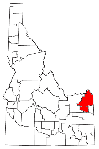
Location of the Rexburg Micropolitan Statistical Area in Idaho
The Rexburg Micropolitan Statistical Area, as defined by the United States Census Bureau, is an area consisting of two counties in eastern Idaho, anchored by the city of Rexburg.
As of the 2000 census, the μSA had a population of 39,286 (though a July 1, 2007 estimate placed the population at 49,164).[1]
Counties[]
Communities[]
- Rexburg (Principal City)
- Ashton
- Drummond
- Island Park
- Lake (unincorporated)
- Newdale
- Parker
- St. Anthony
- Sugar City
- Teton
- Warm River
Demographics[]
As of the census[2] of 2000, there were 39,286 people, 11,014 households, and 7,884 families residing within the μSA. The racial makeup of the μSA was 94.27% White, 0.21% African American, 0.38% Native American, 0.51% Asian, 0.15% Pacific Islander, 3.35% from other races, and 1.14% from two or more races. Hispanic or Latino of any race were 5.94% of the population.
The median income for a household in the μSA was $33,016, and the median income for a family was $38,798. Males had a median income of $27,895 versus $19,149 for females. The per capita income for the μSA was $12,461.
See also[]
- Idaho census statistical areas
References[]
- ^ "Annual Estimates of the Population of Metropolitan and Micropolitan Statistical Areas: April 1, 2000 to July 1, 2007 (CBSA-EST2007-01)" (CSV). 2007 Population Estimates. United States Census Bureau, Population Division. 2008-03-27. http://www.census.gov/popest/metro/tables/2007/CBSA-EST2007-01.csv. Retrieved 2008-04-01.
- ^ "American FactFinder". United States Census Bureau. http://factfinder.census.gov. Retrieved 2008-01-31.
| |||||||||||||||||||||||
| This page uses content from the English language Wikipedia. The original content was at Rexburg, Idaho micropolitan area. The list of authors can be seen in the page history. As with this Familypedia wiki, the content of Wikipedia is available under the Creative Commons License. |