| Rottal-Inn District | |||
|---|---|---|---|
| — District — | |||
|
|||
 |
|||
| Country | |||
| State | Bavaria | ||
| Adm. region | Lower Bavaria | ||
| Capital | Pfarrkirchen | ||
| Area | |||
| • Total | 1,280 km2 (490 sq mi) | ||
| Population (31 December 2010)[1] | |||
| • Total | 117,952 | ||
| • Density | 92/km2 (240/sq mi) | ||
| Time zone | CET (UTC+1) | ||
| • Summer (DST) | CEST (UTC+2) | ||
| Vehicle registration | PAN | ||
| Website | http://www.rottal-inn.de | ||
Rottal-Inn is a Kreis (district) in the southeastern part of Bavaria, Germany. Neighboring districts are (from the south clockwise) Altötting, Mühldorf am Inn, Landshut, Dingolfing-Landau and Passau. To the southeast is the Austrian state Upper Austria (Braunau).
Geography[]
The main rivers in the district are the Inn and its tributary, the Rott.
History[]
The district was created in 1972 by merging the two previous districts Pfarrkirchen and Eggenfelden and parts of the districts Griesbach and Vilsbiburg.
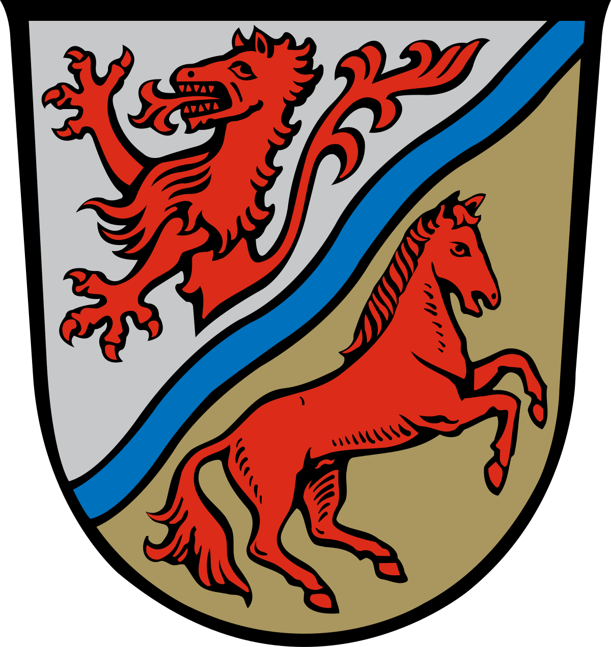
Coat of arms[]
|
The coat of arms combines the symbols of the two previous districts. In the upper-left is a panther as the symbol of Eggenfelden, derived from the coat of arms of the Counts of Spanheim, who ruled the area until the 13th century. In the bottom-right a horse as the symbol of Pfarrkirchen, as the area is famous for the horse-breeding tradition. The blue wavy line between them symbolizes the two rivers in the district, the Inn and the Rott. |
Towns and municipalities[]
| cities | Verwaltungsgemeinschaften | municipalities |
|---|---|---|
Markt(market towns)
¹ administered within a |
|
¹ administered within a |
References[]
- ^ "Fortschreibung des Bevölkerungsstandes" (in German). Bayerisches Landesamt für Statistik und Datenverarbeitung. 31 December 2010. https://www.statistikdaten.bayern.de/genesis/online?language=de&sequenz=tabelleErgebnis&selectionname=12411-009r&sachmerkmal=QUASTI&sachschluessel=SQUART04&startjahr=2010&endjahr=2010.
External links[]
Wikimedia Commons has media related to: