| Main | Births etc |
|---|
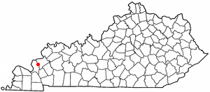
| Salem, Kentucky | |
|---|---|
| — City — | |
 |
|
 |
|
| Coordinates: Coordinates: | |
| Country | United States |
| State | Kentucky |
| County | Livingston |
| Established | before 1816[1] |
| Incorporated | 1869[1] |
| Named for | the Carolinian hometown of the original settlers |
| Area | |
| • Total | 0.8 sq mi (2.0 km2) |
| • Land | 0.8 sq mi (2.0 km2) |
| • Water | 0.0 sq mi (0.0 km2) |
| Elevation | 443 ft (135 m) |
| Population (2010) | |
| • Total | 752 |
| • Density | 987.6/sq mi (381.3/km2) |
| Time zone | Central (CST) (UTC-6) |
| • Summer (DST) | CDT (UTC-5) |
| ZIP code | 42078 |
| Area code(s) | 270 & 364 |
| FIPS code | 21-68052 |
| GNIS feature ID | 0502766 |
Salem is a 6th-class city in Livingston County, Kentucky, in the United States. Salem is part of the Paducah micropolitan area. The population was 752 during the U.S. Census, down from 769 in 2000. It the largest city in Livingston County, although the unincorporated community of Ledbetter has more than twice the population of Salem.
History[]
The city is believed to have been settled c. 1800 by immigrants from Salem, North Carolina, who named their new community after their former home. It replaced Centerville as Livingston Co.'s seat in 1809 but was replaced in turn by Smithland in 1842 after the removal of Crittenden Co. left it more centrally-located.[2]
Geography[]
Salem is located at (37.264694, -88.241221).[3] According to the United States Census Bureau, the city has a total area of 0.8 square miles (2.1 km2), all land.
Demographics[]
| Historical populations | |||
|---|---|---|---|
| Census | Pop. | %± | |
| 1830 | 281 | ||
| 1840 | 233 | −17.1% | |
| 1860 | 192 | ||
| 1870 | 50 | −74.0% | |
| 1880 | 132 | 164.0% | |
| 1900 | 208 | ||
| 1910 | 320 | 53.8% | |
| 1920 | 252 | −21.3% | |
| 1970 | 593 | ||
| 1980 | 833 | 40.5% | |
| 1990 | 770 | −7.6% | |
| 2000 | 769 | −0.1% | |
| 2010 | 752 | −2.2% | |
| Est. 2015 | 739 | [4] | −3.9% |
As of the census[6] of 2000, there were 769 people, 322 households, and 202 families residing in the city. The population density was 987.6 people per square mile (380.7/km²). There were 370 housing units at an average density of 475.2 per square mile (183.2/km²). The racial makeup of the city was 99.22% White, 0.26% African American, 0.13% from other races, and 0.39% from two or more races. Hispanic or Latino of any race were 0.65% of the population.
There were 322 households out of which 20.8% had children under the age of 18 living with them, 51.9% were married couples living together, 8.1% had a female householder with no husband present, and 37.0% were non-families. 34.2% of all households were made up of individuals and 23.0% had someone living alone who was 65 years of age or older. The average household size was 2.14 and the average family size was 2.72.
In the city the population was spread out with 16.9% under the age of 18, 6.6% from 18 to 24, 19.9% from 25 to 44, 25.1% from 45 to 64, and 31.5% who were 65 years of age or older. The median age was 51 years. For every 100 females there were 80.9 males. For every 100 females age 18 and over, there were 80.5 males.
The median income for a household in the city was $29,196, and the median income for a family was $37,857. Males had a median income of $29,375 versus $20,000 for females. The per capita income for the city was $16,156. About 7.1% of families and 10.7% of the population were below the poverty line, including 14.8% of those under age 18 and 12.3% of those age 65 or over.
References[]
- ^ a b Commonwealth of Kentucky. Office of the Secretary of State. Land Office. "Salem, Kentucky". Accessed 26 Aug 2013.
- ^ Rennick, Robert. Kentucky Place Names, p. 262. University Press of Kentucky (Lexington), 1987. Accessed 5 October 2013.
- ^ "US Gazetteer files: 2010, 2000, and 1990". United States Census Bureau. 2011-02-12. http://www.census.gov/geo/www/gazetteer/gazette.html. Retrieved 2011-04-23.
- ^ "Annual Estimates of the Resident Population for Incorporated Places: April 1, 2010 to July 1, 2015". http://www.census.gov/popest/data/cities/totals/2015/SUB-EST2015.html. Retrieved July 2, 2016.
- ^ "Census of Population and Housing". Census.gov. http://www.census.gov/prod/www/decennial.html. Retrieved June 4, 2015.
- ^ "American FactFinder". United States Census Bureau. http://factfinder2.census.gov. Retrieved 2008-01-31.
| |||||||||||||||||

| This page uses content from the English language Wikipedia. The original content was at Salem, Kentucky. The list of authors can be seen in the page history. As with this Familypedia wiki, the content of Wikipedia is available under the Creative Commons License. |