| ||||||||||||||
| Seward County, Kansas | |
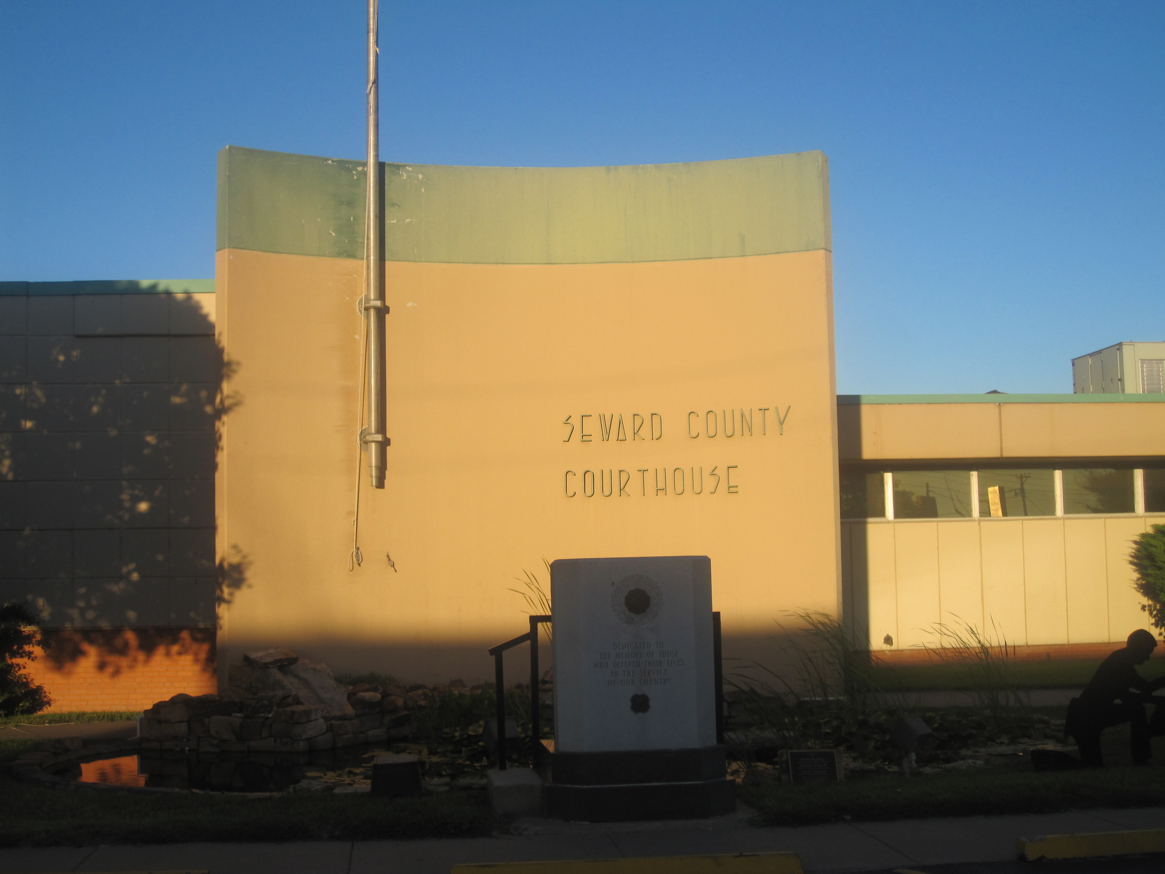 Seward County Courthouse at Liberal
| |
 Location in the state of Kansas | |
 Kansas's location in the U.S. | |
| Founded | March 20, 1873 |
|---|---|
| Seat | Liberal |
| Area - Total - Land - Water |
640.51 sq mi (1,659 km²) 639.52 sq mi (1,656 km²) 0.99 sq mi (3 km²), 0.15% |
| Population - (2010) - Density |
22,952 36.4/sq mi (14.1/km²) |
| Time zone | Central: UTC-6/-5 |
| Website | SewardCountyKS.org |

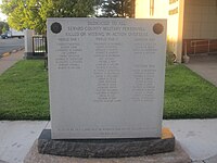
Seward County Veterans Memorial
Seward County (standard abbreviation: SW) is a county of the U.S. state of Kansas. As of the 2010 census, the county population was 22,952.[1] The largest city and county seat is Liberal. The Liberal Micropolitan Statistical Area includes all of Seward County.
Seward County should not be confused with the city of Seward, which is located in Stafford County.
Law and government
Following amendment to the Kansas Constitution in 1986, the county remained a prohibition, or "dry", county until 1996, when voters approved the sale of alcoholic liquor by the individual drink with a 30% food sales requirement.[2]
Elections
It is historically a Republican county. In the last five elections no Democratic candidate for governor has carried the county.[3] The last time the county went for the Democratic candidate for President was when it favored incumbent Democrat Franklin D. Roosevelt in 1936 over Kansas Governor Alf Landon.[4] In the Kansas Senate it is currently represented by Republican Tim Huelskamp. In the Kansas House of Representatives it is represented by Republicans Bill Light and Carl Holmes.[5]
Geography
According to the 2000 census, the county has a total area of 640.51 square miles (1,658.9 km2), of which 639.52 square miles (1,656.3 km2) (or 99.85%) is land and 0.99 square miles (2.6 km2) (or 0.15%) is water.[6]
Adjacent counties
- Haskell County (north)
- Meade County (east)
- Beaver County, Oklahoma (southeast)
- Texas County, Oklahoma (southwest)
- Stevens County (west)
History
Seward County was formed on March 20, 1873. It was named after William Henry Seward, an American politician and Secretary of State under Abraham Lincoln and Andrew Johnson.
Demographics
| Historical populations | |||
|---|---|---|---|
| Census | Pop. | %± | |
| 1900 | 822 | ||
| 1910 | 4,091 | 397.7% | |
| 1920 | 6,220 | 52.0% | |
| 1930 | 8,075 | 29.8% | |
| 1940 | 6,540 | −19.0% | |
| 1950 | 9,972 | 52.5% | |
| 1960 | 15,930 | 59.7% | |
| 1970 | 15,744 | −1.2% | |
| 1980 | 17,071 | 8.4% | |
| 1990 | 18,743 | 9.8% | |
| 2000 | 22,510 | 20.1% | |
| 2010 | 22,952 | 2.0% | |

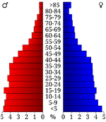
Age pyramid
As of the census[7] of 2000, there were 22,510 people, 7,419 households, and 5,504 families residing in the county. The population density was 35 people per square mile (14/km²). There were 8,027 housing units at an average density of 13 per square mile (5/km²). The racial makeup of the county was 65.44% White, 3.78% Black or African American, 0.77% Native American, 2.86% Asian, 0.06% Pacific Islander, 23.81% from other races, and 3.27% from two or more races. 42.14% of the population were Hispanic or Latino of any race.
There were 7,419 households out of which 43.50% had children under the age of 18 living with them, 59.60% were married couples living together, 10.00% had a female householder with no husband present, and 25.80% were non-families. 20.60% of all households were made up of individuals and 7.80% had someone living alone who was 65 years of age or older. The average household size was 2.98 and the average family size was 3.46.
In the county the population was spread out with 32.00% under the age of 18, 11.70% from 18 to 24, 30.50% from 25 to 44, 16.90% from 45 to 64, and 8.90% who were 65 years of age or older. The median age was 29 years. For every 100 females there were 105.30 males. For every 100 females age 18 and over, there were 103.70 males.
The median income for a household in the county was $36,752, and the median income for a family was $41,134. Males had a median income of $29,765 versus $21,889 for females. The per capita income for the county was $15,059. About 13.90% of families and 16.90% of the population were below the poverty line, including 21.00% of those under age 18 and 7.30% of those age 65 or over.
Cities and towns
Incorporated cities
Name and population (2004 estimate):
- Liberal, 20,218 (county seat)
- Kismet, 518
Townships
Seward County is divided into three townships. The city of Liberal is considered governmentally independent and is excluded from the census figures for the townships. In the following table, the population center is the largest city (or cities) included in that township's population total, if it is of a significant size.
| Township | FIPS | Population center |
Population | Population density /km² (/sq mi) |
Land area km² (sq mi) |
Water area km² (sq mi) |
Water % | Geographic coordinates |
|---|---|---|---|---|---|---|---|---|
| Fargo | 23000 | 1,684 | 3 (8) | 570 (220) | 2 (1) | 0.29% | ||
| Liberal | 39850 | 803 | 2 (4) | 502 (194) | 0 (0) | 0.03% | ||
| Seward | 64075 | 357 | 1 (2) | 556 (215) | 0 (0) | 0.06% |
Education
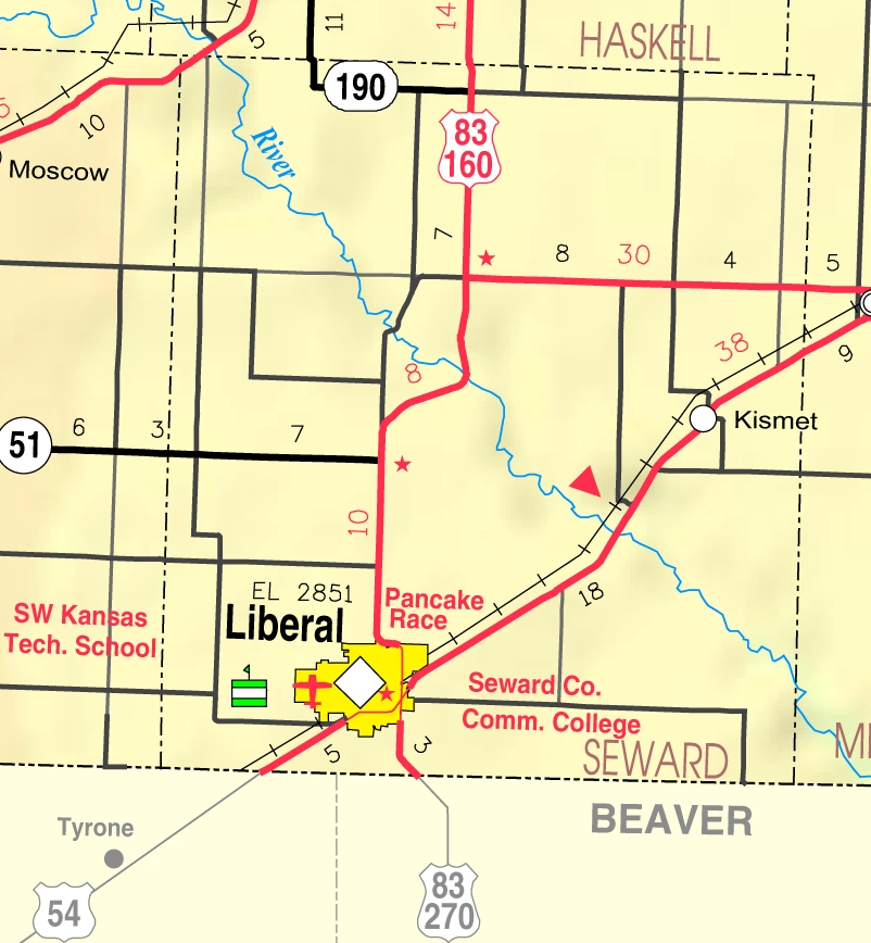
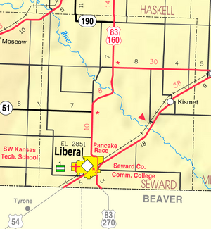
2005 KDOT Map of Seward County (map legend)
Unified school districts
See also
Information on this and other counties in Kansas
- List of counties in Kansas
- List of Kansas county name etymologies
- National Register of Historic Places listings in Kansas
- Kansas locations by per capita income
Other information for Kansas
- List of cities in Kansas
- List of unified school districts in Kansas
- List of colleges and universities in Kansas
References
- ^ "2010 County Population and Housing Occupancy Status". U.S. Census Bureau. http://factfinder2.census.gov/faces/tableservices/jsf/pages/productview.xhtml?pid=DEC_10_PL_GCTPL2.ST05&prodType=table. Retrieved April 7, 2011.
- ^ "Map of Wet and Dry Counties". Alcoholic Beverage Control, Kansas Department of Revenue. November 2006. http://www.ksrevenue.org/abcwetdrymap.htm. Retrieved 2007-12-26.
- ^ David Leip's Atlas of US Elections
- ^ Geographie Electorale
- ^ Institute for Policy and Social Research
- ^ "Census 2000 U.S. Gazetteer Files: Counties". United States Census. http://www.census.gov/tiger/tms/gazetteer/county2k.txt. Retrieved 2011-02-13.
- ^ "American FactFinder". United States Census Bureau. http://factfinder.census.gov. Retrieved 2008-01-31.
Further reading
- History of the State of Kansas; William G. Cutler; A.T. Andreas Publisher; 1883. (Online HTML eBook)
- Kansas : A Cyclopedia of State History, Embracing Events, Institutions, Industries, Counties, Cities, Towns, Prominent Persons, Etc; 3 Volumes; Frank W. Blackmar; Standard Publishing Co; 944 / 955 / 824 pages; 1912. (Volume1 - Download 54MB PDF eBook),(Volume2 - Download 53MB PDF eBook), (Volume3 - Download 33MB PDF eBook)
External links
- Official
- Maps
- Seward County Map, KDOT
- Kansas Highway Map, KDOT
- Kansas Railroad Map, KDOT
- Kansas School District Boundary Map, KSDE

|
Haskell County |
| ||
| Stevens County | Meade County | |||
 Seward County, Kansas | ||||
| Texas County, Oklahoma | Beaver County, Oklahoma |
| |||||
| This page uses content from the English language Wikipedia. The original content was at Seward County, Kansas. The list of authors can be seen in the page history. As with this Familypedia wiki, the content of Wikipedia is available under the Creative Commons License. |