| Main | Births etc |
|---|
| South Petherton | |
 Church of St Peter and St Paul showing the octagonal tower. |
|
| |
| Population | 3,367 [1] |
|---|---|
| OS grid reference | |
| District | South Somerset |
| Shire county | Somerset |
| Region | South West |
| Country | England |
| Sovereign state | United Kingdom |
| Post town | SOUTH PETHERTON |
| Postcode district | TA13 0 |
| Dialling code | 01460 |
| Police | Avon and Somerset |
| Fire | Devon and Somerset |
| Ambulance | South Western |
| EU Parliament | South West England |
| UK Parliament | Yeovil |
| List of places: UK • England • Somerset | |
South Petherton is a village[2] and civil parish on the River Parrett in the South Somerset district of Somerset, England. It is 5 miles (8 km) east of Ilminster and 5 miles (8 km) north west of Crewkerne. It had a population of 3,367 in 2011.[1] The parish includes the hamlets of Yeabridge, Compton Durville, South Harp, and Over Stratton, and is approximately 2 miles (3 km) from East Lambrook, Martock and Lopen.
It is distinctive for the traditional hamstone construction of many of its buildings. In 2005 South Petherton was awarded ‘Somerset Village of the Year’ in a national competition.[3] Historically South Petherton was a market town, but these days is regarded to be a village, with many of its ancient functions having ended by around 1870.[4]
History[]
The village's name may come from the Old English word Pared meaning boundary and the Saxon word ton meaning settlement, forming ’Paredton’.[5]
A site on Lightgate Road, north of the present village, has produced Iron Age occupation material, though archaeological evidence of any structures have not yet been discovered. Roman material, mostly consisting of coins, has also been discovered locally and, as it is only 2 miles (3 km) from the Fosse Way, Roman occupation is likely, although it may have been abandoned between the 4th and 8th centuries.[6]
The Anglo-Saxon Chronicle of 680 refers to a major battle on the site of the village and the Saxon Ine of Wessex of the Kingdom of Wessex built a palace on present day Silver Street.[7]
A large royal estate of South Petherton was created and the Saxon settlement, Sudperetone (the southern tun on the Parrett), included a minster church, a royal palace and a short-lived 11th century mint. Most of the royal estate passed directly to William the Conqueror and was still a possession of the Crown in 1086. The parish was part of the South Petherton Hundred.[8] Part of the estate was also held by Bruton Abbey from the 12th century until the Dissolution of the Monasteries, then becoming known as the manor of Hele. In 1213 a royal warrant by King John was granted for a market and fair, but by 1243 the main manor had been granted away from the Crown under Henry II and by 1243 South Petherton manor was owned outright by the Daubeney family, who continued to hold it until the late 15th century,[6] the family dying out after Henry Daubeney acquired the earldom of Bridgwater and then failed to produce an heir to succeed him.[9]
The manor reverted to the Crown in 1553, before passing into the ownership of Charles Arundell (d. 1587), who left it to his brother Matthew Arundell, in whose family it remained until 1792, when it was sold to John Baker Edmonds. Edmonds also acquired the rectory estate of South Petherton (known also as the manor of Hele), which had had a complicated history of ownership, including purchase in 1753 by Henry Hele, a successful physician from Salisbury.[10]
Another estate (known as the Manor of Wigborough) was shared by members of the Brome Family from 1581 to 1615, when it passed to the family of Hele of Flete (unconnected to the Henry Hele referred to above) who held it for most of the 17th century.[10][11]
During the English Civil War troops from both sides occupied the town during 1644 and 1645. The town also had a role in the Monmouth rebellion of 1680 and two townsmen were among those who prosecuted in the Bloody Assizes.[6]
It was also recently discovered that South Petherton was, during the 17th century, one of the main centres of bronze cauldron and skillet production. These cooking vessels were used all over the UK.[12]
Governance[]
As a civil parish, South Petherton has its own parish council with responsibility for local issues, including setting an annual precept (local rate) to cover the council’s operating costs and producing annual accounts for public scrutiny. The parish council evaluates local planning applications and works with the local police, district council officers, and neighbourhood watch groups on matters of crime, security, and traffic. The council's role also includes initiating projects for the maintenance and repair of parish facilities, as well as consulting with the district council on the maintenance, repair, and improvement of highways, drainage, footpaths, public transport, and street cleaning. Conservation matters (including trees and listed buildings) and environmental issues are also the responsibility of the council. The village is part of the South Somerset local government district within the wider Somerset County Council.
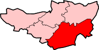
Yeovil is a county constituency represented in the House of Commons of the Parliament of the United Kingdom. It elects one Member of Parliament (MP) by the first past the post system of election. The constituency covers the towns of Yeovil, Chard, Crewkerne and Ilminster in Somerset. Until 1983 Somerset was split into four constituencies and Yeovil constituency also contained the towns of Ilchester, Martock and Somerton but they were moved into the newly created constituency of Somerton and Frome. From the next election, Yeovil constituency will contain Ilchester once again to equalise the populations of the Somerset constituencies. The Boundary Commission for England estimate the electorate of Yeovil constituency after the pending boundary changes to be 77,049. The current MP is David Laws, a member of the Liberal Democrats.[13]
An electoral ward in the same name exists. Although South Petherton is the most populous area the ward stretches to Shepton Beauchamp and Seavington St. Mary. The total ward population at the 2011 census was 4,866.[14]
Residents of South Petherton also form part of the electorate for the South West England constituency for elections to the European Parliament.[15]
Geography[]
South Petherton is situated between the Devon hills to the west, the flat wetland area of the Somerset Levels and Moors to the north, and the hills of Dorset to the south.
It lies on low lying undulating land of Yeovil Sands at the foot of a limestone ridge, which has been quarried for Petherton stone, and for sands and clays suitable for brick and tile making.[6]
Climate[]
Along with the rest of South West England, South Petherton has a temperate climate which is generally wetter and milder than the rest of the country.[16] The annual mean temperature is approximately 10 °C (50.0 °F). Seasonal temperature variation is less extreme than most of the United Kingdom because of the adjacent sea temperatures. The summer months of July and August are the warmest with mean daily maxima of approximately 21 °C (69.8 °F). In winter mean minimum temperatures of 1 °C (33.8 °F) or 2 °C (35.6 °F) are common.[16] In the summer the Azores high pressure affects the south-west of England, however convective cloud sometimes forms inland, reducing the number of hours of sunshine. Annual sunshine rates are slightly less than the regional average of 1,600 hours.[16] In December 1998 there were 20 days without sun recorded at Yeovilton. Most the rainfall in the south-west is caused by Atlantic depressions or by convection. Most of the rainfall in autumn and winter is caused by the Atlantic depressions, which is when they are most active. In summer, a large proportion of the rainfall is caused by sun heating the ground leading to convection and to showers and thunderstorms. Average rainfall is around 700 mm (28 in). About 8–15 days of snowfall is typical. November to March have the highest mean wind speeds, and June to August have the lightest winds. The predominant wind direction is from the south-west.[16]
Economy[]
Agriculture has traditionally been an important local industry, although South Petherton has also been a centre for glove making, cider production and other cottage industries at various points in its history.
Cloth manufacture, continued into the late 18th and 19th century although this was largely replaced by sailcloth and then leather working.[6] The importance of this industry can be seen by the number of mills which remain including; the former flax mill or granary in Hayes End,[17] Joylers Mill,[18] Shutlers Mill,[19] and the former flax mill immediately north of Flaxdrayton Farmhouse.[20]
Landmarks[]


Wigborough Manor House
In Silver Street is a 14th-century manor house.[21] It was restored in the 19th century and nicknamed 'King Ina's Palace'.[22]
The 15th or 16th century Wigborough Manor House was never completed to its original plans and has subsequently been modified many times.[11]
Approximately 1 mile (2 km) from South Petherton is East Lambrook Manor Gardens created by Margery Fish who was known as the 'Leading Lady of Gardening' from the 1950s until her death in 1969.[22] It holds the national collection of geraniums,[23] and a collection of snowdrops.[24]
The "David Hall" (located in the old United Reformed Church) is a local social centre run by the Petherton Arts Trust, a non-profit making organisation formed in 1986 and registered as a charity in 1990.[25] There is also the "Blake Hall" which has a social club downstairs and a hall upstairs where a market is held on the first Sunday of every month, as well as various other activities.
Health and Education[]
During 2007 Somerset Primary Care Trust consulted local residents about proposals for the redevelopment of South Petherton Community Hospital, which provides Out Patient Assessment and Reablement services.[26] In March 2012, the new hospital was opened by Sophie, Countess of Wessex.[27]
Education is provided within the village by two nurseries for pre-school children, an infants’ school (ages 5–7) and a junior school (ages 7–11). The nearest secondary schools are in Stoke-sub-Hamdon (Stanchester Community School), Crewkerne (Wadham) and Huish Episcopi (Huish Episcopi School).
Transport[]
South Petherton is located close to the A303 main road, and the nearest railway stations are in Crewkerne and Yeovil. Formerly there were closer stations at Martock and Ilminster, but both of these were closed in the 1960s.
Religious sites[]
The Church of England Church of St Peter and St Paul has Saxon origins. It retains a 13th-century crosswing, with the remainder of the buildings dating from the 15th century, however it underwent major restorations in the late 19th and early 20th centuries. It has been designated by English Heritage as a grade I listed building. The tower is an irregular octagon on plan, wider on east-west axis,[28] which is believed to be the tallest octagonal church tower in the UK.[29] It houses a ring of twelve bells.[30]


Methodist Church
The Coke Memorial Methodist Church was built in 1881 replacing an 1809 chapel on the site.[31] It was named after Thomas Coke, who was curate of the village 1772-76 and important, along with John Wesley, amongst the founders of Methodism.
A United Reformed Church was built in 1863. This is now the 'David Hall' and hosts various public events.[32]
Sports[]
The South Petherton Walking Group is aimed at the over 50's and aims to encourage this healthy, social activity amongst residents and visitors.[33]
The Recreation Ground provides pitches for football and cricket clubs and there are also facilities for tennis and bowls and a children’s play area. The football pitch is particularly large for the standard of football that the club compete in, being over 120 yards long and 90 yards wide. South Petherton Football Club were relegated from the Premier Division of the Perry Street & District League in 2013 after a highly successful run in recent years,[34] but gained promotion at the first attempt and have since competed well back in the premier division.
Notable people[]


John Harding, 1st Baron Harding of Petherton
John Harding, 1st Baron Harding of Petherton (1896–1989)
John Brunner
References[]
- ^ a b "Statistics for Wards, LSOAs and Parishes — SUMMARY Profiles" (Excel). Somerset Intelligence. http://www.somersetintelligence.org.uk/files/Somerset%20Census%20Key%20Statistics%20-%20Summary%20Profiles.xls. Retrieved 4 January 2014.
- ^ South Petherton Parish Plan
- ^ "Winning the Somerset Village of the Year". South Petherton web site. 2005. http://www.steve-doble.addr.com/photos/Village%20of%20the%20Year/index.html. Retrieved 2008-08-15.
- ^ South Petherton Village History (South Petherton History Society)
- ^ Balch, Tom. "A Concise Potted History of South Petherton". South Petherton web site. http://www.steve-doble.addr.com/history.html. Retrieved 2008-08-15.
- ^ a b c d e Gathercole, Clare. "South Petherton". Somerset Urban Archaeological Survey. Somerset County Council. http://www1.somerset.gov.uk/archives/hes/downloads/EUS_South_PethertonText.pdf. Retrieved 2010-02-02.
- ^ Holmes, Edric. "Wanderings in Wessex". Part 3. Fullbooks.com. http://www.fullbooks.com/Wanderings-in-Wessex3.html. Retrieved 2008-08-15.
- ^ "Somerset Hundreds". GENUKI. http://www.genuki.org.uk/big/eng/SOM/Miscellaneous/. Retrieved 20 October 2011.
- ^ Dunning, Robert (2003). A History of Somerset (3rd ed.). Tiverton: Somerset Books. pp. 53. ISBN 0-86183-476-3.
- ^ a b "Parishes: South Petherton", Victoria County History, A History of the County of Somerset, Volume 4 (1978), at pages 170-198
- ^ a b "Wigborough Manor House". Images of England. English Heritage. http://www.imagesofengland.org.uk/Details/Default.aspx?id=264275. Retrieved 2008-07-23.
- ^ "Where were the sites of the Somerset Foundaries". Somerset County Council. http://www.somerset.gov.uk/somerset/culturecommunity/museums/explore/cookingvessels/potcasting/foundries/. Retrieved 2008-08-15.
- ^ "Alphabetical List of Constituencies and Members of Parliament". House Of Commons Information Office. Archived from the original on 2008-01-17. http://web.archive.org/web/20080117044453/http://www.parliament.uk/directories/hciolists/alcm.cfm#Y. Retrieved 2008-01-19.
- ^ "Ward population 2011.Retrieved 5 March 2015". http://www.ukcensusdata.com/south-petherton-e05006846#sthash.zcpOnaSQ.dpbs.
- ^ "UK MEPs for the South West". European Parliament UK Office. Archived from the original on 2007-12-17. http://web.archive.org/web/20071217202015/http://www.europarl.org.uk/uk_meps/southwest.asp. Retrieved 2008-01-11.
- ^ a b c d "South West England: climate". Met Office. http://www.metoffice.gov.uk/climate/uk/sw/. Retrieved 14 March 2010.
- ^ "Former flax mill or granary". Images of England. English Heritage. http://www.imagesofengland.org.uk/Details/Default.aspx?id=264193. Retrieved 2008-07-23.
- ^ "Joylers Mill". Images of England. English Heritage. http://www.imagesofengland.org.uk/Details/Default.aspx?id=264203. Retrieved 2008-07-23.
- ^ "Shutlers Mill". Images of England. English Heritage. http://www.imagesofengland.org.uk/Details/Default.aspx?id=264210. Retrieved 2008-07-23.
- ^ "Former flax mill immediately north of Flaxdrayton Farmhouse". Images of England. English Heritage. http://www.imagesofengland.org.uk/Details/Default.aspx?id=264187. Retrieved 2008-07-23.
- ^ "Manor House, King Ina's Palace". Images of England. English Heritage. http://www.imagesofengland.org.uk/Details/Default.aspx?id=264248. Retrieved 2008-07-23.
- ^ a b "South Petherton". About Britain. AboutBritain.com. http://www.aboutbritain.com/towns/south-petherton.asp. Retrieved 2008-07-23.
- ^ "East Lambrook Manor Garden". Gardenvisit.com. http://www.gardenvisit.com/garden/east_lambrook_manor_garden. Retrieved 2008-02-06.
- ^ Bourne, Val (2008-01-04). "Snowdrops: White magic". The Telegraph (London). http://www.telegraph.co.uk/gardening/main.jhtml?xml=/gardening/2008/01/05/garden-snowdrop105.xml. Retrieved 2008-02-06.
- ^ "The David Hall". Petherton Arts Trust. http://www.thedavidhall.org.uk/. Retrieved 2008-07-23.
- ^ "South Petherton Community Hospital". Somerset Primary Care Trust. http://www.somerset.nhs.uk/pct/hospitals/southpetherton.html. Retrieved 2008-07-23.
- ^ http://www.thisisthewestcountry.co.uk/news/9593677.The_Countess_of_Wessex_to_visit_South_Petherton_hospital_next_week/
- ^ "Church of St Peter and St Paul". Images of England. English Heritage. http://www.imagesofengland.org.uk/Details/Default.aspx?id=264257. Retrieved 2008-07-23.
- ^ Vallins, John (2003-02-18). "Country Diary". The Guardian (London: The Guardian). http://www.guardian.co.uk/uk/2003/feb/18/ruralaffairs. Retrieved 2008-08-15.
- ^ "South Petherton: SS Peter and Paul". Dove's Guide for Church Bell Ringers. http://dove.cccbr.org.uk/detail.php?DoveID=SOUTH+PETT&showBells=true&showFrames=true. Retrieved 19 October 2015.
- ^ "Coke Memorial Methodist Church". Images of England. English Heritage. http://www.imagesofengland.org.uk/Details/Default.aspx?id=264224. Retrieved 2008-07-23.
- ^ "Former United Reformed Church". Images of England. English Heritage. http://www.imagesofengland.org.uk/Details/Default.aspx?id=264235. Retrieved 2008-07-23.
- ^ "South Petherton Walking Group". South Petherton Walking Group. http://southpethertonwalkinggroup.org/. Retrieved 2008-07-23.
- ^ "Petherton Reign Supreme". ViewFrom. http://viewfrompublishing.co.uk/news_view/6941/5/1/perry-street-football-petherton-open-up. Retrieved 2012-05-31.
External links[]
| |||||||
| ||||||||||||||||||||
| This page uses content from the English language Wikipedia. The original content was at South Petherton. The list of authors can be seen in the page history. As with this Familypedia wiki, the content of Wikipedia is available under the Creative Commons License. |