| Main | Births etc |
|---|
| ||||||||||||||
| South Tripura দক্ষিণ ত্রিপুরা জেলা |
|
|---|---|
| — District — | |
 |
|
 |
|
| Coordinates: Coordinates: | |
| State | Tripura |
| Country | India |
| Seat | Udaipur |
| Area | |
| • Total | 2,152 km2 (831 sq mi) |
| Elevation | 26 m (85 ft) |
| Population (2001) | |
| • Total | 762,565 |
| • Density | 350/km2 (920/sq mi) |
| Time zone | IST (UTC+05:30) |
| ISO 3166 code | IN-TR-ST |
| Website | http://southtripura.nic.in/ |

.JPG)
Hindu temple in Udaipur
South Tripura (Bengali: দক্ষিণ ত্রিপুরা জেলা) is an administrative district in the state of Tripura in northeastern India.
History[]
The district came into existence on 1 September 1970, when the entire state was divided in to three districts.
Geography[]
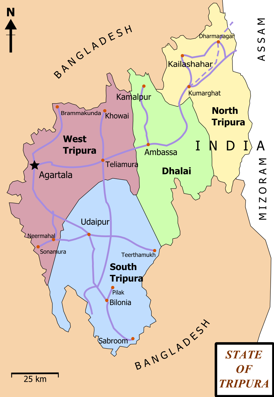
The district occupies an area of 2152 km² and The district headquarters are located at Udaipur. It is around 48 km from the state capital, Agartala. Udaipur is famous for the historic Matabari Temple. Also known as the city of lakes, it is an avid tourist destination.
Divisions[]
District has five sub divisions (Udaipur, Amarpur, Belonia, Sabroom and Santirbazar). Tirthmukh another pilgrimage centre is also located in this district in Amarpur Sub Division.
The district resides in two Lok Sabha constituencies: Tripura West (shared with West Tripura district) and Tripura East (shared with Dhalai and North Tripura districts).
Demographics[]
According to the 2011 census South Tripura district has a population of 875,144 ,[1] roughly equal to the nation of Fiji[2] or the US state of Delaware.[3] This gives it a ranking of 471st in India (out of a total of 640).[1] The district has a population density of 286 inhabitants per square kilometre (740 /sq mi) .[1] Its population growth rate over the decade 2001-2011 was 14.03 %.[1] South Tripura has a sex ratio of 957 females for every 1000 males,[1] and a literacy rate of 85.41 %.[1]
Flora and fauna[]
In 1987 South Tripura district became home to the Trishna Wildlife Sanctuary, which has an area of 195 km².[4] It is also home to the Gumti Wildlife Sanctuary, which was established in 1988 and has an area of 390 km².[4]
References[]
- ^ a b c d e f "District Census 2011". Census2011.co.in. 2011. http://www.census2011.co.in/district.php. Retrieved 2011-09-30.
- ^ US Directorate of Intelligence. "Country Comparison:Population". https://www.cia.gov/library/publications/the-world-factbook/rankorder/2119rank.html. Retrieved 2011-10-01. "Fiji 883,125 July 2011 est."
- ^ "2010 Resident Population Data". U. S. Census Bureau. http://2010.census.gov/2010census/data/apportionment-pop-text.php. Retrieved 2011-09-30. "Delaware 897,934"
- ^ a b Indian Ministry of Forests and Environment. "Protected areas: Tripura". http://oldwww.wii.gov.in/envis/envis_pa_network/page_tripura.htm. Retrieved September 25, 2011.
External links[]

|
West Tripura | Dhalai |
| |
 South Tripura | ||||
| Bangladesh |
| Districts of Tripura |
|---|
| Dhalai district | North Tripura district | South Tripura district | West Tripura district |
| This article related to a location in the Indian state of Tripura is a stub. You can help by expanding it. |
| This page uses content from the English language Wikipedia. The original content was at South Tripura district. The list of authors can be seen in the page history. As with this Familypedia wiki, the content of Wikipedia is available under the Creative Commons License. |