| Upper Peninsula of Michigan | |
| Michigan | |
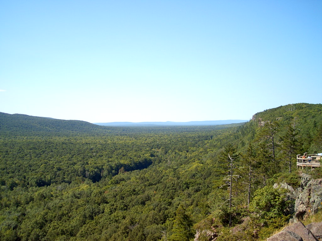 The Porcupine Mountains within the Upper Peninsula of Michigan
| |
| Nickname: The U.P. | |
| Country | United States |
|---|---|
| State | Michigan |
| Area | 16,452 sq mi (42,610 km²) |
| Population | 299,184 (2010) |
| Density | 18.2 / sq mi (7 / km²) |
| Area code | 906 |
 The Upper Peninsula is bordered by the Lower Peninsula, Wisconsin, Minnesota, and Ontario
| |
The Upper Peninsula of Michigan is the northern of the two major land masses that make up the U.S. state of Michigan. It is commonly referred to as the Upper Peninsula, the U.P., or Upper Michigan. More casually it is known as the land "above the Bridge" (above the Mackinac Bridge linking the two peninsulas). It is bounded on the north by Lake Superior, on the east by the St. Mary's River, on the southeast by Lake Michigan and Lake Huron, and on the southwest by Wisconsin.
The Upper Peninsula contains almost a quarter of the land area of Michigan but just three percent of its total population. Residents are frequently called Yoopers (derived from "U.P.-ers") and have a strong regional identity. It includes the only counties in the United States where a plurality of residents claim Finnish ancestry. Large numbers of Finnish, Swedish, Danish and Norwegian emigrants came to the Upper Peninsula, especially the Keweenaw Peninsula, to work in the mines, and they stayed on and prospered even after the copper mines closed.[1]
Ordered by size, the peninsula's largest cities are Marquette, Sault Ste. Marie, Escanaba, Menominee, Iron Mountain, and Houghton. The land and climate are not very suitable for agriculture because of the long harsh winters. The economy has been based on logging, mining and tourism. Most mines have closed since the "golden age" from 1890 to 1920. The land is heavily forested and logging remains a major industry.
History[]
The first known inhabitants of the Upper Peninsula were tribes speaking Algonquian languages. They arrived roughly around AD 800 and subsisted chiefly from fishing. Early tribes included the Menominee, Nocquet, and the Mishinimaki. Étienne Brûlé of France was probably the first European to visit the peninsula, crossing the St. Marys River around 1620 in search of a route to the Far East.[2]
French colonists laid claim to the land in the 17th century, establishing missions and fur trading posts such as Sault Ste. Marie and St. Ignace. Following the end of the French and Indian War (part of the Seven Years' War) in 1763, the territory was ceded to Great Britain.
American Indian tribes formerly allied with the French were dissatisfied with the British occupation, which brought new territorial policies. Whereas the French cultivated alliances among the Indians, the British postwar approach was to treat the tribes as conquered peoples. In 1763 tribes united in Pontiac's Rebellion to try to drive the British from the area. American Indians captured Fort Michilimackinac, near present-day Mackinaw City, Michigan, then the principal fort of the British in the Michilimackinac region, as well as others and killed hundreds of British. In 1764 they began negotiations with the British which resulted in temporary peace and changes in objectionable British policies.
Although the Upper Peninsula nominally became United States territory with the 1783 Treaty of Paris, the British did not give up control until 1797 under terms of the Jay Treaty. As an American territory, the Upper Peninsula was still dominated by the fur trade. John Jacob Astor founded the American Fur Company on Mackinac Island in 1808; however, the industry began to decline in the 1830s as beaver and other game were overhunted.[3]
When the Michigan Territory was first established in 1805, it included only the Lower Peninsula and the eastern portion of the Upper Peninsula. In 1819 the territory was expanded to include the remainder of the Upper Peninsula, all of Wisconsin, and part of Minnesota (previously included in the Indiana and Illinois Territories). When Michigan was preparing for statehood in the 1830s, the boundaries proposed corresponded to the original territorial boundaries, with some proposals even leaving the Upper Peninsula out entirely. Meanwhile, the territory was involved in a border dispute with the state of Ohio in a conflict known as the Toledo War.
The people of Michigan approved a constitution in May 1835 and elected state officials in late autumn 1835. Although the state government was not yet recognized by the United States Congress, the territorial government effectively ceased to exist. A constitutional convention of the state legislature refused a compromise to accept the full Upper Peninsula in exchange for ceding the Toledo Strip to Ohio. A second convention, hastily convened by Governor Stevens Thomson Mason, consisting primarily of Mason supporters, agreed in December 1836 to accept the U.P. in exchange for the Toledo Strip.
In January 1837, the U.S. Congress admitted Michigan as a state of the Union. At the time, Michigan was considered the losing party in the compromise. The land in the Upper Peninsula was described in a federal report as a "sterile region on the shores of Lake Superior destined by soil and climate to remain forever a wilderness."[2]
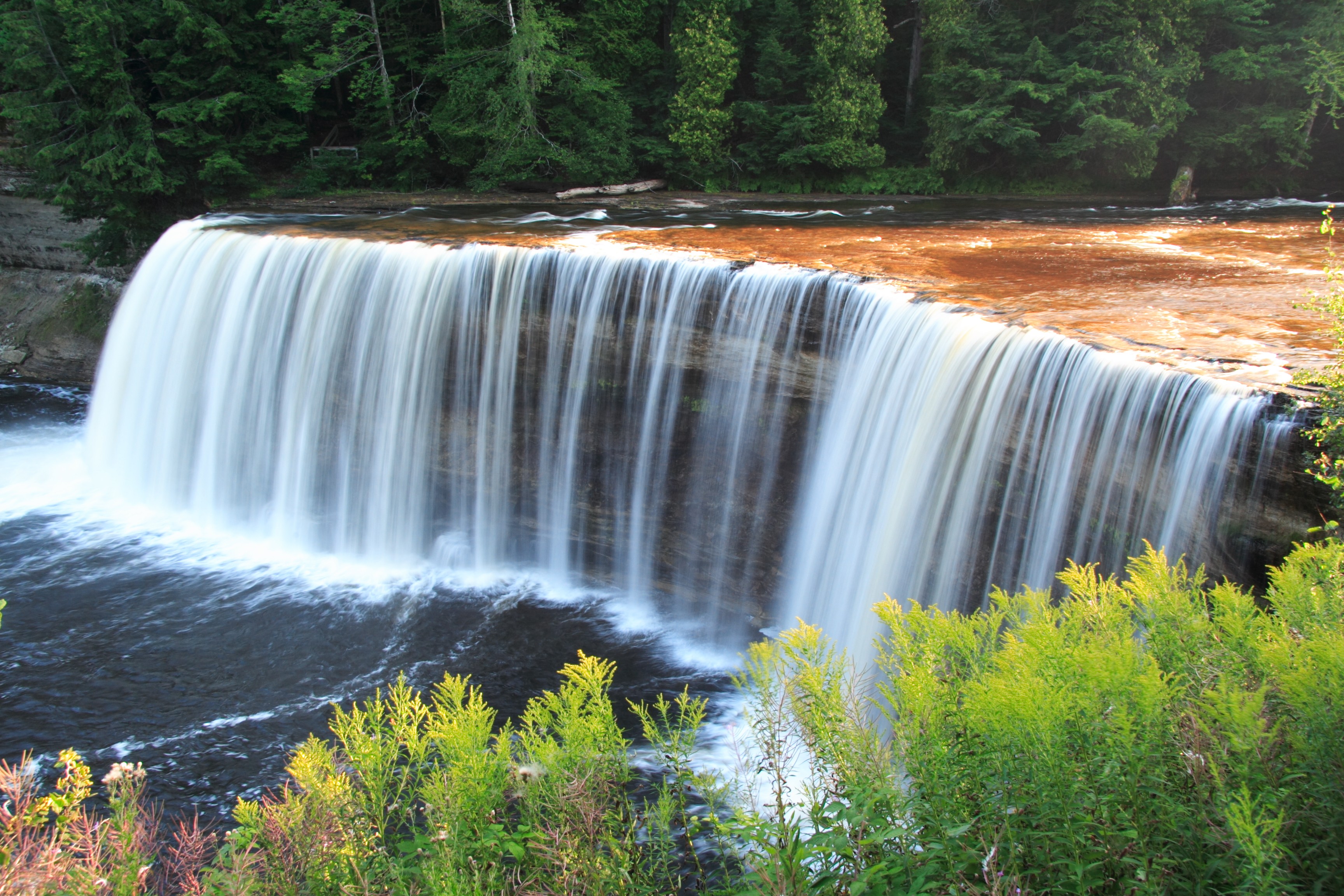
The Upper Falls of the Tahquamenon River, near the northern shore of the peninsula.
This belief changed when rich mineral deposits (primarily copper and iron) were discovered in the 1840s. The Upper Peninsula's mines produced more mineral wealth than the California Gold Rush, especially after shipping was improved by the opening of the Soo Locks in 1855 and docks in Marquette in 1859. The Upper Peninsula supplied 90% of America's copper by the 1860s. It was the largest supplier of iron ore by the 1890s, and production continued to a peak in the 1920s, but sharply declined shortly afterward. The last copper mine closed in 1995, although the majority of mines had closed decades before. Some iron mining continues near Marquette.[2]
Thousands of Americans and immigrants moved to the area during the mining boom, prompting the federal government to create Fort Wilkins near Copper Harbor to maintain order. The first wave were the Cornish from England, with centuries of mining experience; followed by Irish, Germans, and French Canadians. During the 1890s, Finnish immigrants began settling there in large numbers, forming the population plurality in the North-Western half of the peninsula. In the early 20th century, 75% of the population was foreign-born.[3]
Geography[]

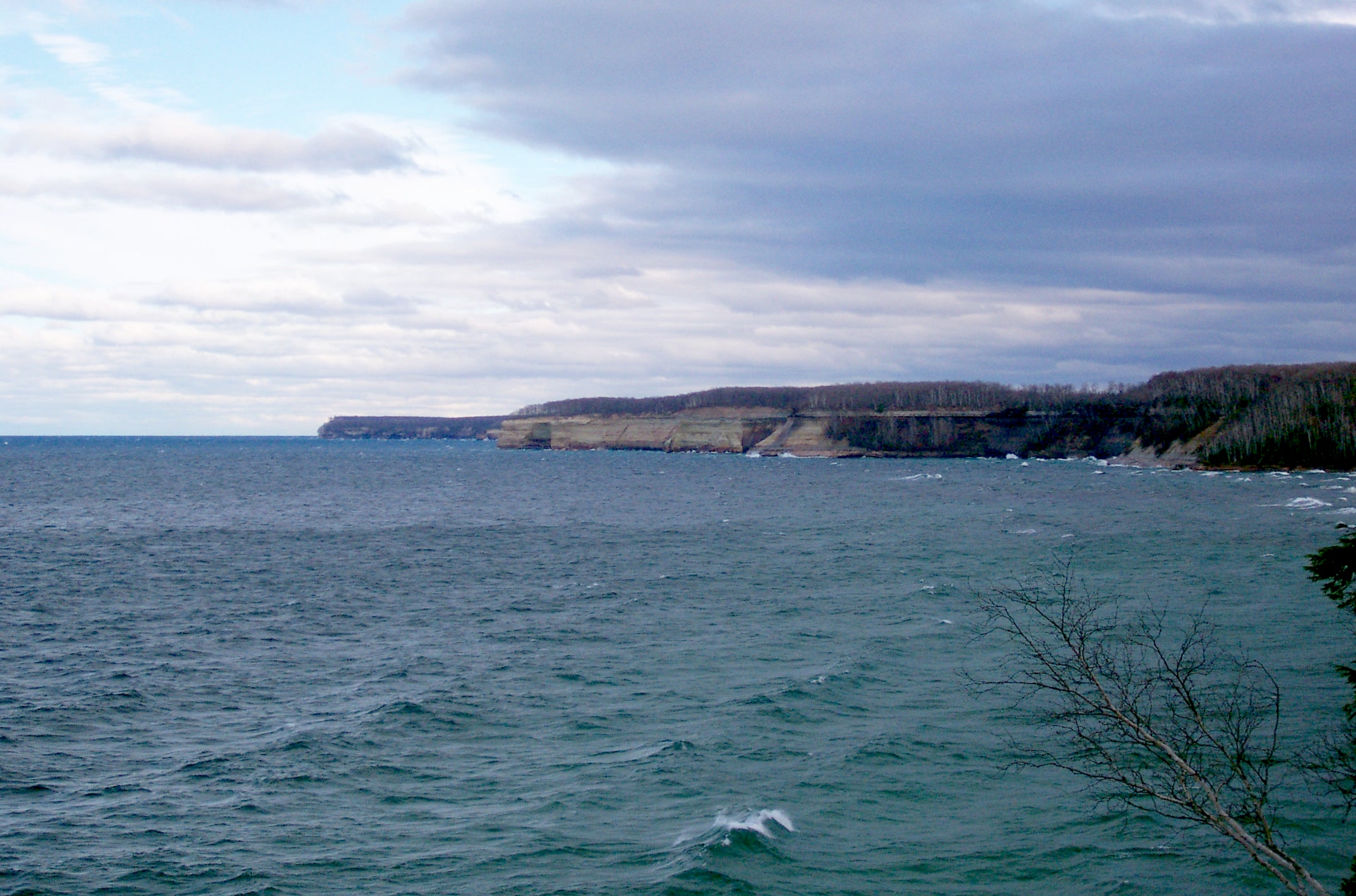
Pictured Rocks National Lakeshore
The Upper Peninsula contains 16,452 square miles (42,610 km²), almost one-third of the land area of the state (exclusive of territorial waters, which constitute about 40% of Michigan's total jurisdictional area). The maximum east-west distance in the Upper Peninsula is about 320 miles (515 km), and the maximum north-south distance is about 125 miles (200 km). It is bounded on the north by Lake Superior, on the east by St. Mary's River, on the south by Lake Michigan and Lake Huron, and on the west by Wisconsin and (counting the water border on Lake Superior) by Minnesota. It has about 1,700 miles (2,700 km) of continuous shoreline with the Great Lakes. There are about 4,300 inland lakes, the largest of which is Lake Gogebic, and 12,000 miles (19,000 km) of streams.[4]
The peninsula is divided between the flat, swampy areas in the east, part of the Great Lakes Plain, and the steeper, more rugged western half, called the Superior Upland, part of the Canadian Shield.[5] The rock in the western portion is the result of volcanic eruptions and is estimated to be at least 3.5 billion years old (much older than the eastern portion) and contains the region's ore resources. Banded-iron formations were deposited Template:Mya; this is the Marquette Range Supergroup. A considerable amount of bedrock is visible. Mount Arvon, the highest point in Michigan, is found in the region, as well as the Porcupine and Huron Mountains. All of the higher areas are the remnants of ancient peaks, worn down over millions of years by erosion and glaciers.[6]
The Keweenaw Peninsula is the northernmost part of the peninsula. It projects into Lake Superior and was the site of the first copper boom in the United States, part of a larger region of the peninsula called the Copper Country. Copper Island is its northernmost section.
About one third of the peninsula is government owned recreational forest land today, including the Ottawa National Forest and Hiawatha National Forest. Although heavily logged in the 19th century, the majority of the land was forested with mature trees by the 1970s.[2]
Wildlife[]
The Upper Peninsula contains a large variety of wildlife. Some of the mammals found in the U.P. include shrews, moles, mice, white tailed deer, moose, black bears, gray & red foxes, wolves, river otters, martens, fishers, muskrats, bobcats, coyotes, snowshoe hares, cotton-tail rabbits, chipmunks, squirrels, raccoons, opposum and bats. There is a large variety of birds, including hawks, osprey, gulls, hummingbirds, chickadees, robins, woodpeckers, warblers, and bald eagles. In terms of reptiles and amphibians, the U.P. has common garter snakes, red bellied snakes, pine snakes, northern water snakes, brown snakes, eastern garter snakes, eastern fox snakes, eastern ribbon back snakes, smooth green snakes, northern ringneck snakes, Eastern Milk snakes (Mackinac and Marquette counties) and Eastern Hognose snakes (Menominee County only), plus snapping turtles, wood turtles, and painted turtles (the state reptile), green frogs, bull frogs, northern leopard frogs, and salamanders. Lakes and rivers contain many fish like walleye, muskie, Northern Pike, Trout, Salmon, and bass. The U.P. also contains many shellfish, such as clams, aquatic snails, and crayfish. The American Bird Conservancy and the National Audubon Society have designated several locations as internationally Important Bird Areas.
There is significant controversy over the presence of cougars in the UP. (See Eastern Cougar.)[7] Historically, the last of the species (or 'subspecies' was killed ("extirpated") near Newberry in 1906, although there have been sightings of the creatures over the years since.[8][9] These reports increased in number over the first decade of the 21st century. The Michigan Department of Natural Resources and Environment (DNRE) formed a four-person team to investigate sightings in the state. The biologists with the DNRE currently do not believe that there is a breeding population anywhere in the state, rather that the sighted animals are visitors to the state.[10] As late as January 2007, the DNRE's official position was that no cougars lived in Michigan.[11] Several residents in the state disagree with both current and previous positions on the part of the DNRE.[11][12] Researchers at Central Michigan University and the Michigan Wildlife Conservancy in 2006 published the findings of a study using DNA analysis of fecal samples taken in the Upper and Lower peninsulas that showed the presence of cougars at the time.[13] These results were disputed in a second journal article in 2007 by other researchers from Eastern Michigan University and the U.S. Forest Service.[14] A citizen's group, the Michigan Citizens for Cougar Recognition (MCCR), independently tracked sightings and in 2009 listed Delta County as the location with the greatest number of reports in the state.[15] The DNRE verified five sets of tracks and two trail camera photos in Delta, Chippewa, Marquette, and Menominee counties since 2008.[16] DNRE officials acknowledge that there are cougars in the UP, but not elsewhere in the state. Critics of the DNRE's position on the species, including the founder of the MCCR, say that the department is attempting to "avoid paying for a cougar management program".[12]
There are also many invasive species that are primarily brought in the ballast water of foreign ships, usually from the ocean bordering Northeastern Asia. This water is dumped directly into the Great Lakes, depositing a variety of fresh and salt water fish and invertebrates, most notably the zebra mussel, Dreissena polymorpha. There are also many plant species that have been transported to the Great Lakes, including Purple Loosestrife Lythrum salicaria[17] and Phragmites australis, both of which are considered to be a threat to native hydrophyte wetland plants.[18][19]
The Emerald ash borer has been reported in the U.P., and is considered to be a serious ecological threat to the habitat and economy.
Climate[]


A cabin in the U.P. after a snowfall
The Upper Peninsula has a humid continental climate (Dfb in the Köppen climate classification system). The Great Lakes have a great effect on most of the peninsula. Winters tend to be long, cold, and snowy for most of the peninsula, and because of its northern latitude, the daylight hours are short— around 8 hours between sunrise and sunset in the winter. Lake Superior has the greatest effect on the area, especially the northern and western parts. Lake-effect snow causes many areas to get in excess of 100–250 inches (250–630 cm) of snow per year—especially in the Keweenaw Peninsula and Gogebic County, and to a lesser extent Baraga, Marquette and Alger counties, making the western U.P. a prominent part of the midwestern snow belt.
Records of 390 inches (990 cm) of snow or more have been set in many communities in this area.[20] The Keweenaw Peninsula averages more snowfall than almost anywhere in the United States—more than anywhere east of the Mississippi River and the most of all non-mountainous regions of the continental United States.[21] Because of the howling storms across Lake Superior, which cause dramatic amounts of precipitation, it has been said that the lake-effect snow makes the Keweenaw Peninsula the snowiest place east of the Rockies. Herman, Michigan, averages 236 inches (600 cm) of snow every year.[22] Lake-effect snow can cause blinding whiteouts in just minutes, and some storms can last days.
The area along the Wisconsin border has a more continental climate since most of its weather does not arrive from the lakes. Summers tend to be warmer and winter nights much colder. Coastal communities have temperatures tempered by the Great Lakes. In summer, it might be 10 °F (5 °C) cooler at lakeside than it is inland, and the opposite effect is seen in winter. The area of the Upper Peninsula north of Green Bay though Menominee and Escanaba (and extending west to Iron River) does not have the extreme weather and precipitation found to the north. Locally it is known as "the banana belt."[2]
Time zones[]
Like the entire Lower Peninsula of Michigan, most of the Upper Peninsula observes Eastern Time. However, the four counties bordering Wisconsin are in the Central Time zone.
In 1967, when the Uniform Time Act came into effect, the Upper Peninsula went under year-round CST, with no daylight saving time.[23] In 1973, the majority of the peninsula switched to Eastern Time;[24] only the four western counties of Gogebic, Iron, Dickinson, and Menominee continue to observe Central Time.
Government[]
There are 15 counties in the Upper Peninsula (see map).


State prisons are located in Baraga, Marquette, Munising, Newberry, Marenisco and Kincheloe.
Politics[]
The U.P. tends to vote for the Democratic Party, which is commonly considered to be politically liberal. However its people tend to be culturally conservative. The vote during the 2008 presidential election ended with some of the counties in the Upper Peninsula going for the Democratic Party, and others for the Republican Party. The breakdown of the 2008 presidential election by county was as follows:[25][26]
| County | Registered Voters | Votes Cast | McCain/Palin | Obama/Biden | Result |
|---|---|---|---|---|---|
| Alger | 4,790 | 4,750 | 2,188 | 2,472 | Dem |
| Baraga | 3,699 | 3,644 | 1,846 | 1,725 | Rep |
| Chippewa | 16,869 | 16,708 | 8,267 | 8,184 | Rep |
| Delta | 19,231 | 19,064 | 8,763 | 9,974 | Dem |
| Dickinson | 13,463 | 13,311 | 7,049 | 5,995 | Rep |
| Gogebic | 8,366 | 8,264 | 3,330 | 4,757 | Dem |
| Houghton | 16,116 | 15,972 | 8,101 | 7,476 | Rep |
| Iron | 6,249 | 6,162 | 2,947 | 3,080 | Dem |
| Keweenaw | 1,428 | 1,410 | 756 | 610 | Rep |
| Luce | 2,769 | 2,740 | 1,490 | 1,191 | Rep |
| Mackinac | 6,466 | 6,396 | 3,268 | 3,027 | Rep |
| Marquette | 33,624 | 33,185 | 12,906 | 19,635 | Dem |
| Menominee | 11,166 | 11,072 | 4,855 | 5,981 | Dem |
| Ontonagon | 3,974 | 3,885 | 1,823 | 1,966 | Dem |
| Schoolcraft | 4,393 | 4,326 | 2,058 | 2,184 | Dem |
| TOTAL | 152,603 | 150,889 | 69,647 | 78,257 | Dem |
Dan Benishek (R) currently represents Michigan's 1st congressional district, which includes the Upper Peninsula. In 2006 incumbent Governor Jennifer Granholm (Dem) received a majority of the votes from the Upper Peninsula to help her win re-election to her second four-year term.
Superior (proposed state)[]
Superior is the name of a longstanding 51st state proposal for the secession of the Upper Peninsula from the rest of Michigan. Named for Lake Superior, the idea has gained serious attention at times. Because stronger connections to the rest of the state exist since completion of the Mackinac Bridge, the proposal's future is vague.[27] Several prominent legislators, including local politician Dominic Jacobetti, attempted to gain passage of the bill in the 1970s, with little traction.[28]
Demographics[]
The Upper Peninsula remains a predominantly rural region. As of the 2010 census, the region had a population of 299,184.
According to the 2000 census, only 91,624 people live in the 12 towns of at least 4,000 people, covering 96.5 square miles (250 km²). Only 114,544 people live in the 21 towns and villages of at least 2,000 people, which cover 123.7 square miles (320.4 km²)—less than 1% of the peninsula's land area.
|
|


Typical ruins found in the western U.P.
The Upper Peninsula is one of the few regions in the United States that experiences population decline. Although not every county in the Upper Peninsula has a declining population, this phenomenon does have a significant impact on the social and economic aspects of many of its communities and citizens. Some of the contributing factors to the Upper Peninsula's shifts in population are the boom and bust cycles of the timber and mining industries, as well as the severity of its winters. Some areas in the Upper Peninsula are more prone to declining population than others, with the six westernmost counties being the most dramatic, going from a 1920 level of 153,674 people (representing 59% of the total population of the entire Upper Peninsula) to a 2000 census level of 85,378 persons (dropping to 29% of the total Upper Peninsula's population). It is quite common to see abandoned buildings and ruins in this area; there are even a number of ghost towns that are slowly succumbing to the ubiquitous forest.
Generally speaking, the population of the Upper Peninsula grew throughout the 19th Century, and then leveled off and even experienced decline during the 20th Century, as can readily be seen in the tables below. The data for these tables is from the U.S. Census;[29][30] A "↑" indicates an increase in population from the previous census, and a "↓" indicates a decrease in population from the previous census.
| County | 1830 | 1840 | 1850 | 1860 | 1870 | 1880 | 1890 | 1900 |
|---|---|---|---|---|---|---|---|---|
| Alger | N/A | N/A | N/A | N/A | N/A | N/A | 1,238↑ | 5,868↑ |
| Baraga | N/A | N/A | N/A | N/A | N/A | 1,804↑ | 3,036↑ | 4,320↑ |
| Chippewa | 626↑ | 534↓ | 898↑ | 1,603↑ | 1,689↑ | 5,248↑ | 12,018↑ | 21,338↑ |
| Delta | N/A | N/A | N/A | 1,172↑ | 2,542↑ | 6,812↑ | 15,330↑ | 23,881↑ |
| Dickinson | N/A | N/A | N/A | N/A | N/A | N/A | N/A | 17,890↑ |
| Gogebic | N/A | N/A | N/A | N/A | N/A | N/A | 13,166↑ | 16,738↑ |
| Houghton | N/A | N/A | 708↑ | 9,234↑ | 13,879↑ | 22,473↑ | 35,389↑ | 66,063↑ |
| Iron | N/A | N/A | N/A | N/A | N/A | N/A | 4,432↑ | 8,990↑ |
| Keweenaw | N/A | N/A | N/A | N/A | 4,205↑ | 4,270↑ | 2,894↓ | 3,217↑ |
| Luce | N/A | N/A | N/A | N/A | N/A | N/A | 2,455↑ | 2,983↑ |
| Mackinac | 877↑ | 923↑ | 3,598↑ | 1,938↓ | 1,716↓ | 2,902↑ | 7,830↑ | 7,703↓ |
| Marquette | N/A | N/A | 136↑ | 2,821↑ | 15,033↑ | 25,394↑ | 39,521↑ | 41,239↑ |
| Menominee | N/A | N/A | N/A | N/A | 1,791↑ | 11,987↑ | 33,639↑ | 27,046↓ |
| Ontonagon | N/A | N/A | 389↑ | 4,568↑ | 2,845↓ | 2,565↓ | 3,756↑ | 6,197↑ |
| Schoolcraft | N/A | N/A | 16↑ | 78↑ | N/A | 1,575↑ | 5,818↑ | 7,889↑ |
| TOTAL | 1,503↑ | 1,457↓ | 5,037↑ | 12,180↑ | 29,821↑ | 62,557↑ | 145,133↑ | 195,299↑ |
| County | 1910 | 1920 | 1930 | 1940 | 1950 | 1960 | 1970 | 1980 | 1990 | 2000 | 2010 |
|---|---|---|---|---|---|---|---|---|---|---|---|
| Alger | 7,675↑ | 9,983↑ | 9,327↓ | 10,167↑ | 10,007↓ | 9,250↓ | 8,568↓ | 9,225↑ | 8,972↓ | 9,862↑ | 9,601↓ |
| Baraga | 6,125↑ | 7,662↑ | 9,168↑ | 9,356↑ | 8,037↓ | 7,151↓ | 7,789↑ | 8,484↑ | 7,954↓ | 8,735↑ | 8,860↑ |
| Chippewa | 24,472↑ | 24,818↑ | 25,047↑ | 27,807↑ | 29,206↑ | 32,655↑ | 32,412↓ | 29,029↓ | 34,604↑ | 38,413↑ | 38,520↑ |
| Delta | 30,108↑ | 30,909↑ | 32,280↑ | 34,037↑ | 32,913↓ | 34,298↑ | 35,924↑ | 38,947↑ | 37,780↓ | 38,520↑ | 37,069↓ |
| Dickinson | 20,524↑ | 19,456↓ | 29,941↑ | 28,731↓ | 24,844↓ | 23,917↓ | 23,753↓ | 25,341↑ | 26,831↑ | 27,427↑ | 26,168↓ |
| Gogebic | 23,333↑ | 33,225↑ | 31,577↓ | 31,797↑ | 27,053↓ | 24,370↓ | 20,676↓ | 19,686↓ | 18,052↓ | 17,370↓ | 16,427↓ |
| Houghton | 88,098↑ | 71,930↓ | 52,851↓ | 47,631↓ | 39,771↓ | 34,654↓ | 34,652↓ | 37,872↓ | 35,446↓ | 36,016↑ | 36,268↑ |
| Iron | 15,164↑ | 22,107↑ | 20,805↓ | 20,243↓ | 17,692↓ | 17,184↓ | 13,813↓ | 13,635↓ | 13,175↓ | 13,138↓ | 11,817↓ |
| Keweenaw | 7,156↑ | 6,322↓ | 5,076↓ | 4,004↓ | 2,918↓ | 2,417↓ | 2,264↓ | 1,963↓ | 1,701↓ | 2,301↑ | 2,156↓ |
| Luce | 4,004↑ | 6,149↑ | 6,528↑ | 7,423↑ | 8,147↑ | 7,827↓ | 6,789↓ | 6,659↓ | 5,763↓ | 7,024↑ | 6,631↓ |
| Mackinac | 9,249↑ | 8,026↓ | 8,783↑ | 9,438↑ | 9,287↓ | 10,853↑ | 9,660↓ | 10,178↑ | 10,674↑ | 11,943↑ | 11,113↓ |
| Marquette | 46,739↑ | 45,786↓ | 44,076↓ | 47,144↑ | 47,654↑ | 56,154↑ | 64,686↑ | 74,101↑ | 70,887↓ | 64,634↓ | 67,077↑ |
| Menominee | 25,648↓ | 23,778↓ | 23,652↓ | 24,883↑ | 25,299↑ | 24,685↓ | 24,587↓ | 26,201↑ | 24,920↓ | 25,109↑ | 24,029↓ |
| Ontonagon | 8,650↑ | 12,428↑ | 11,114↓ | 11,359↑ | 10,282↓ | 10,584↑ | 10,548↓ | 9,861↓ | 8,854↓ | 7,818↓ | 6,780↓ |
| Schoolcraft | 8,681↑ | 9,977↑ | 8,451↓ | 9,524↑ | 9,148↓ | 8,953↓ | 8,226↓ | 8,575↑ | 8,302↓ | 8,903↑ | 8,485↓ |
| TOTAL | 237,528↑ | 260,626↑ | 265,825↑ | 275,913↑ | 262,487↓ | 304,952↑ | 304,347↓ | 319,757↑ | 313,915↓ | 317,213↑ | 299,184↓ |
Economy[]
Industries[]
The Upper Peninsula is rich in mineral deposits including iron, copper, nickel and silver. Small amounts of gold have also been discovered and mined. In the 19th century, mining dominated the economy, and the U.P. became home to many isolated company towns. For many years, mines in the Keweenaw Peninsula were the world's largest producers of copper (see Copper mining in Michigan). The mines began declining as early as 1913, with most closing temporarily during the Great Depression. Mines reopened during World War II, but almost all quickly closed after the war ended. The last copper mine in the Copper Country was the White Pine mine, which closed in 1995.
Ever since logging of white pine began in the 1880s, timber has been an important industry.[31] However, the stands of hemlock and hardwood went under-exploited until the mid-twentieth century as selection cutting was practiced in the western reaches of the forest. Because of the highly seasonal climate and the short growing season, agriculture is limited in the Upper Peninsula, though potatoes, strawberries and a few other small fruits are grown.
Tourism has become the main industry in recent decades. In 2005, ShermanTravel, LLC listed the Upper Peninsula as No. 10 in its assessment of all travel destinations worldwide.[32] The article was republished in April 2006 by MSN.com.[33] The peninsula has extensive coastline on the Great Lakes, large tracts of state and national forests, cedar swamps, more than 150 waterfalls, and low population densities. Because of the camping, boating, fishing, snowmobiling, hunting, and hiking opportunities, many Lower Peninsula and Wisconsin families spend their vacations in the U.P. Tourists also go there from Detroit, Chicago, Milwaukee and other metropolitan areas.
Notable attractions[]
- Au Train Falls
- Bond Falls
- Calumet Theatre
- Calumet Downtown Historic District
- Copper Harbor
- Copper Peak, Ironwood Township – the only ski flying complex in the western hemisphere
- DeYoung Family Zoo
- Fayette Historic State Park
- Fort Mackinac
- Garlyn Zoo
- Grand Hotel (Mackinac Island)
- Grand Island National Recreation Area
- The Great Lakes Shipwreck Museum
- Iron County Historical Museum Complex – Caspian
- Iron Industry Museum – Negaunee
- Iron Mountain Iron Mine – Vulcan
- Isle Royale National Park
- Keweenaw National Historical Park
- Keweenaw Waterway and Portage Lake Lift Bridge
- Kitch-iti-kipi
- Lake Superior
- Lake Superior State University, Lakers
- Laughing Whitefish Falls
- The Mackinac Bridge
- Mackinac Island
- Marquette Arts and Culture Center – Marquette
- The Marquette Lighthouse
- Marquette Mountain Ski Resort
- Michigan Technological University, Huskies
- Mount Bohemia ski center (with the highest vertical drop – 900 feet (270 m) – in the Midwest)
- Munising Falls
- National Ski Hall of Fame
- Northern Michigan University, Wildcats
- Marquette Ore Dock
- Paulding Light
- Pictured Rocks National Lakeshore
- Pine Mountain ski jump in Iron Mountain is one of the largest artificial ski jumps in the world.[34]
- Porcupine Mountains State Park
- Quincy Copper Mine offering guided tours.
- Seney National Wildlife Refuge
- Ski Brule in Iron River.
- The Soo Locks
- Suicide Hill Ski Jump, Ishpeming, Michigan[35]
- Sylvania Wilderness
- Tahquamenon Falls State Park
- Upper Peninsula Children's Museum – Marquette
Casinos[]
American Indian casinos contribute to the tourist attractions and are popular in the U.P. Originally the casinos were simple, one-room affairs. Some of the casinos are now quite elaborate and are being developed as part of resort and conference facilities, including features such as golf courses, pool and spa, dining, and rooms to accommodate guests.
- Bay Mills Resort & Casino – Brimley
- Island Resort & Casino – Bark River
- Kewadin Casinos – Christmas; Hessel; Manistique; St. Ignace; Sault Ste. Marie
- Kings Club Casino – Brimley
- Lac Vieux Desert Casino – Watersmeet
- Ojibwa Casinos – Baraga; Marquette
Transportation[]


Straits of Mackinac and bridge in winter
The Upper Peninsula is separated from the Lower by the Straits of Mackinac, five miles (8 km) across at the narrowest, and is connected to it by the Mackinac Bridge at St. Ignace, one of the longest suspension bridges in the world. Until the bridge was completed in 1957, travel between the two peninsulas was difficult and slow (and sometimes even impossible during winter months). In 1881, the Mackinac Transportation Company was established by three railroads, the Michigan Central Railroad, the Grand Rapids and Indiana Railroad, and the Detroit, Mackinac and Marquette Railroad, to operate a railroad car ferry across the Straits. Beginning in 1923, the State of Michigan operated automobile ferries between the two peninsulas. At the busiest times of year the wait was several hours long.[36] In winter, travel was possible over the ice only after the straits had solidly frozen.
Despite its rural character, there are public buses in several counties of the Upper Peninsula.[37]
Automobiles[]
The primary means of transportation in the Upper Peninsula is by automobile. It is served by one Interstate and several other state highways. Aside from the Interstate, there are no speed limits above 55 mph (89 km/h). The major highways in the UP include:[38]
 I-75 crosses the eastern portion of the Upper Peninsula from the Straits of Mackinac on the south to Sault Ste. Marie and the border with Canada on the north. There it connects with the Sault Ste. Marie International Bridge across to Sault Ste. Marie, Ontario.
- US 2 crosses into Michigan from Wisconsin at Ironwood and runs east to Crystal Falls, where it dips back into Wisconsin. The highway crosses back into Michigan for a second time at Iron Mountain and runs east to its terminus at St. Ignace.
- US 41 enters at Menominee and goes north to Copper Harbor.
- US 45 crosses into Michigan south of Watersmeet and ends in Ontonagon.
- US 141 enters south of Quinnesec. US 141 runs concurrently with US 2 through the Iron Mountain area and crosses back into Wisconsin. US 141 separates from US 2 at Crystal Falls and runs north to US 41 at Covington in Baraga County.
- M-28 runs east–west across the UP from Wakefield to south of Sault Ste. Marie.
The Great Lakes Circle Tour is a designated scenic road system connecting all of the Great Lakes and the St. Lawrence River.[39] The tour was created in 1986 after a proposal by the then-First Lady of Michigan, Paula Blanchard.[40]
Airports[]
There are 43 airports in the Upper Peninsula. Of these, six airports have commercial passenger service: Gogebic-Iron County Airport north of Ironwood, Houghton County Memorial Airport southwest of Calumet, Ford Airport west of Iron Mountain, Sawyer International Airport south of Marquette, Delta County Airport in Escanaba, and Chippewa County International Airport south of Sault Ste. Marie. There are 19 other public use airports with a hard surface runway. These are used for general aviation and charter. Notably, Mackinac Island, Beaver Island, and Drummond Island are all accessible by airports. There are five public access airports with turf runways and thirteen airports for the private use of their owners. There is only one control tower in the Upper Peninsula, at Sawyer.[41]
Ferries and bridges[]
The Eastern Upper Peninsula Transportation Authority operates car ferries in its area. These include ferries for Sugar Island, Neebish Island, and Drummond Island. Three ferry companies run passenger ferries from St. Ignace to Mackinac Island.
The three major bridges in the Upper Peninsula are:
- Mackinac Bridge, connecting Northern Michigan to the Upper Peninsula;
- Sault Ste. Marie International Bridge, which connects the city of Sault Ste. Marie to its twin city of Sault Ste. Marie in Canada; and
- Portage Lift Bridge, which crosses Portage Lake. The Portage Lift Bridge is the world's heaviest and widest double-decked vertical lift bridge. Its center span "lifts" to provide 100 feet (30 m) of clearance for ships. Since rail traffic was discontinued in the Keweenaw, the lower deck is used to accommodate snowmobile traffic in the winter. As the only land-based link between the north and south sections of the Keweenaw Peninsula, the bridge is crucial to transportation.
Railways[]
- Lake Superior and Ishpeming Railroad: Transports iron ore over a 16-mile (26 km) line from the Empire-Tilden Mine (operated by Ciffs Natural Resources), south of Ishpeming, to Marquette's port on Lake Superior.
- Two railroads originally crossed the Upper Peninsula east to west: the Minneapolis, St. Paul and Sault Ste. Marie Railway, informally known as the Soo Line, running west from Sault Ste. Marie roughly along the Lake Michigan shore, and the Duluth, South Shore and Atlantic Railroad running west from St. Ignace roughly along the Lake Superior shore. In 1960, both railroads were merged into the Soo Line Railroad, the U.S. arm of the Canadian Pacific Railway. The Soo Line trackage in the Upper Peninsula was purchased by the Wisconsin Central Railroad in 1987. In 1997, the Wisconsin Central also purchased from the Union Pacific Railroad the former Chicago and North Western Railway line running into the Upper Peninsula from Wisconsin. The Wisconsin Central was in turn purchased by the Canadian National Railway in 2001. The Canadian National now operates much of the remaining railroad trackage in the Upper Peninsula.
- Escanaba and Lake Superior Railroad: Chartered in 1898, the E&LS is an industrial beltline railroad with 347 miles (558 km) of trackage connecting Escanaba, Ontonagon, Republic, and Green Bay, Wisconsin, with a common junction at Channing, and a spur to Nestoria from Sidnaw.
Education[]
The Upper Peninsula of Michigan has three state universities (Lake Superior State University in Sault Ste. Marie, Michigan Technological University in Houghton, and Northern Michigan University in Marquette), one private university (Finlandia University located in Hancock, Michigan, on the Keweenaw Peninsula), and three community colleges (Bay Mills Community College in Brimley, Bay de Noc Community College in Escanaba and Gogebic Community College in Ironwood).
Culture[]

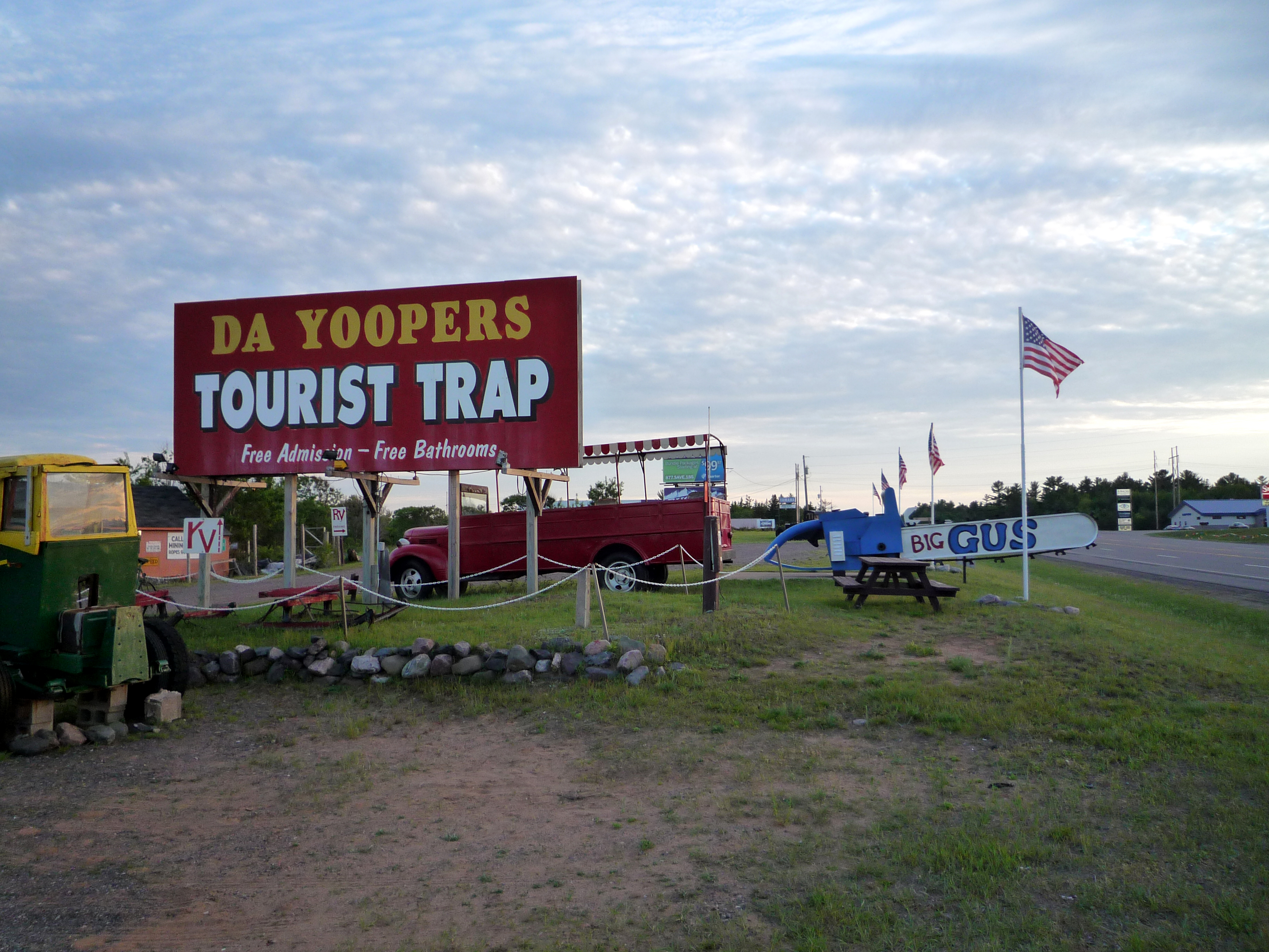
"Da Yoopers Tourist Trap", near Ishpeming, features a host of gaudy items in its museum and store that play up Yooper stereotypes
Early settlers included multiple waves of people from Nordic countries. There are still Swedish- and Finnish-speaking communities in many areas of the Upper Peninsula today. People of Finnish ancestry make up 16% of the peninsula's population. The U.P. is home to the highest concentration of Finns outside Europe and the only counties of the United States where a plurality of residents claim Finnish ancestry. The Finnish sauna and the concept of sisu have been adopted widely by residents of the Upper Peninsula. The television program Finland Calling, filmed at Marquette station WLUC-TV, is the only Finnish-language television broadcast in the United States; it has aired since March 25, 1962. Finlandia University, America's only college with Finnish roots, is located in Hancock.[42] Street signs in Hancock appear in English and Finnish to celebrate this heritage.
Other sizeable ethnic communities in the Upper Peninsula include French-Canadian, German, Cornish, Italian, and American Indian ancestry.
Upper Peninsula natives speak a dialect influenced by Scandinavian and French-Canadian speech. A popular bumper sticker, a parody of the "Say YES to Michigan" slogan promoted by state tourism officials, shows an outline of the Upper Peninsula and the slogan, "Say yah to da U.P., eh!" The dialect and culture are captured in many songs by Da Yoopers, a comedy music and skit troupe from Ishpeming, Michigan.
Throughout the Upper Peninsula there are newspapers, such as The Daily News of Iron Mountain, The Menominee County Journal, of Stephenson, The Daily Mining Gazette of Houghton, The Daily Press of Escanaba, and the Sault Ste. Marie Evening News that serve the rest of the U.P. The Mining Journal, based in Marquette, is the only daily newspaper that publishes a Sunday edition, which edition is distributed across the entire U.P. (the other six days are distributed in its local area only).
The Keweenaw peninsula is home to several ski areas. Mont Ripley, just outside of Houghton, is popular among students of Michigan Technological University (the university actually owns the mountain). Further up the peninsula in the small town of Lac La Belle is Mt. Bohemia. A skiing purist's resort, Bohemia is a self proclaimed "experts only" mountain, and it does not groom its heavily gladed slopes.[43] Other ski areas are Pine Mountain located in Iron Mountain, and Norway Mountain in the town of the same name.
Regional identity[]
Today, the Upper Peninsula is home to 299,184 people—only about 3% of the state's population— living in almost one-third of the state's land area. Residents are known as Yoopers, (from "U.P.ers") and many consider themselves Yoopers before they consider themselves Michiganders. (People living in the Lower Peninsula are commonly called "trolls" by Upper Peninsula residents, as they live "Under da Bridge".) This regionalism is not only a result of the physical separation of the two peninsulas, but also the history of the state.
Residents of the western Upper Peninsula take on some of the cultural identities of both Wisconsin and Michigan. In terms of sports fandom, residents may support Detroit professional teams or those of Wisconsin - particularly the Green Bay Packers. This is a result of both proximity and the broadcast and print media of the area. The four counties that border Wisconsin are also in the Central Time Zone, unlike the rest of Michigan, which is on Eastern time.
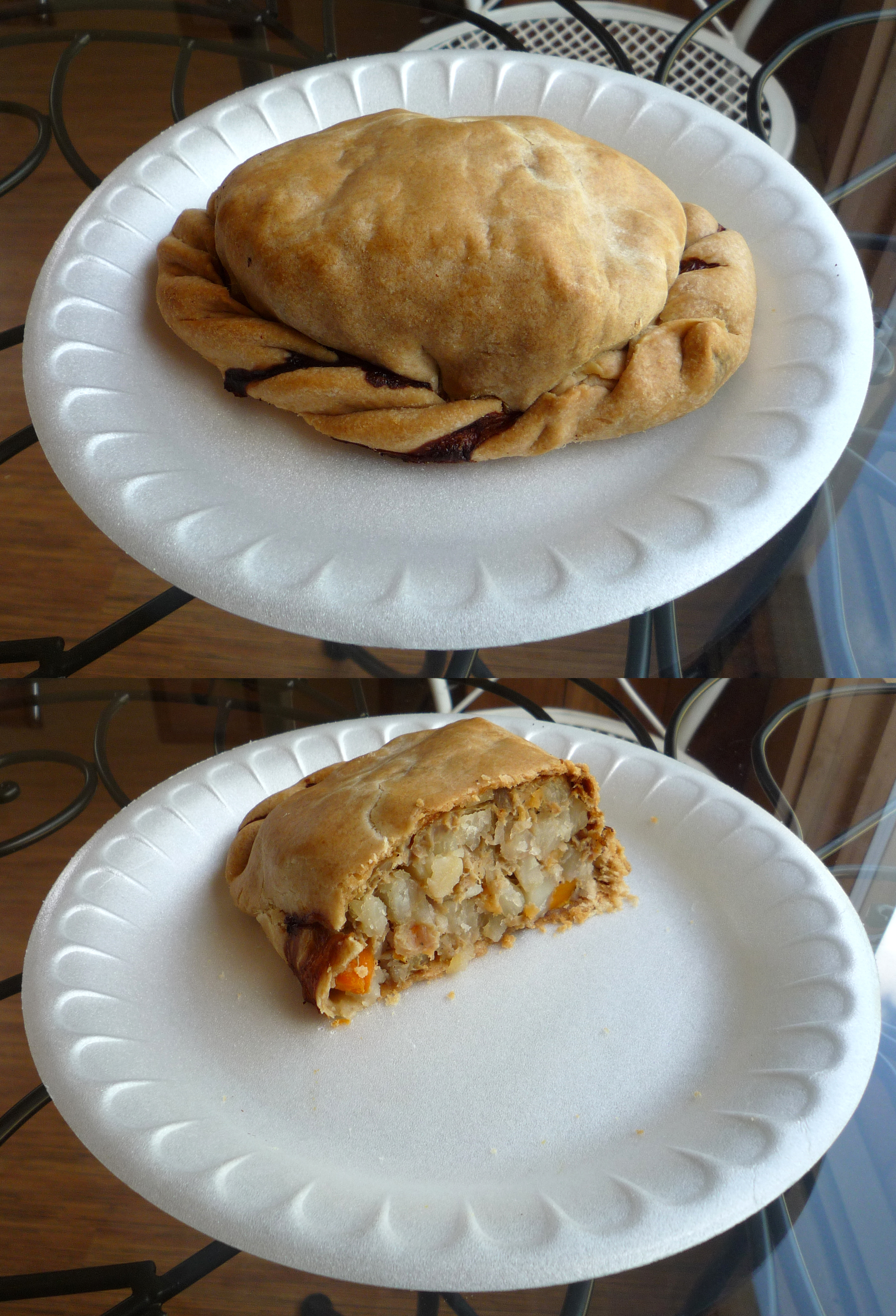

A Yooper pasty (beef)
A trip downstate is often rather difficult: a trip from Ironwood to Detroit is roughly 600 miles (960 km) long, more than twice the distance to Minneapolis and almost as long as a trip to St. Louis. Such a trip is made more difficult by the lack of freeways: a short section of I-75 is the only interstate in the U.P. Commonly, people of the western U.P. will go to Minneapolis or Wisconsin for trips. Residents of the northeastern part of the U.P. may cross the Sault Ste. Marie International Bridge to Canada more often than they cross the Mackinac Bridge to the Lower Peninsula, and they often associate more closely with Northern Ontario.
Cuisine[]
The Upper Peninsula has a distinctive local cuisine. The pasty (pronounced pass tee), a kind of meat turnover originally brought to the region by Cornish miners, is popular among locals and tourists alike. Pasty varieties include chicken, venison, pork, hamburger, and pizza. Many restaurants serve potato sausage and cudighi, a spicy Italian meat.
Finnish immigrants contributed nisu, a cardamom-flavored sweet bread; pannukakku, a variant on the pancake with a custard flavor; viili (sometimes spelled "fellia"), a stretchy, fermented Finnish milk; and korppu, hard slices of toasted cinnamon bread, traditionally dipped in coffee. Some Finnish foods such as juustoa (squeeky cheese) and sauna makkara (a ring-bologna sausage) have become so ubiquitous in Upper Peninsula cuisine that they are now commonly-found in most grocery stores and supermarkets.
Maple syrup is a highly prized local delicacy.[44] Fresh Great Lakes fish, such as the lake trout, whitefish, and (in the spring) smelt are widely eaten. There is minimal concern about contamination of fish from Lake Superior waters.[45] Smoked fish is also popular. Thimbleberry and Chokecherry jam is a treat.[46]
Notable residents[]
- Former University of Michigan football coach Lloyd Carr is an alumnus of Northern Michigan University; he was quarterback for the school's football team during an undefeated season in 1967. He graduated from NMU in 1968 with his B.S. in education and went on to earn his M.A. in education administration at NMU in 1970.
- James Tolkan, an American actor often cast as a strict, overbearing, bald-headed authority who played roles in Back to the Future and Top Gun was born in Calumet, Michigan.
- Robert J. Flaherty, a filmmaker who directed and produced the first commercially successful feature length documentary film Nanook of the North in 1922 is from Iron Mountain.
- George Gipp, the "Gipper"—immortalized in the film Knute Rockne, All American by Ronald Reagan—was born in Laurium.[47] He was the first All-American at the Notre Dame football program.
- Clarence L. "Kelly" Johnson, aircraft engineer and aeronautical innovator, was born in Ishpeming.
- John Lautner, a native of Marquette and alumnus of Northern Michigan University, was one of Frank Lloyd Wright's most successful Taliesin fellows. His Modernist residence, Chemosphere, is a Los Angeles landmark.
- Mitchell Leisen, film director, was born Menominee, Michigan in 1898. Directed the films Midnight (1939 film), Easy Living (1937 film), and other screwball comedies.
- Former San Francisco 49ers and Detroit Lions head coach Steve Mariucci and Michigan State basketball coach Tom Izzo are both natives of Iron Mountain. Both went to Northern Michigan University, where Mariucci was quarterback of the Wildcats' 1975 NCAA Division II national championship team.
- Terry O'Quinn, actor, was born in Sault Ste. Marie in 1952. O'Quinn most recently appeared with a recurring role as John Locke in the popular TV show, Lost.
- Chase Osborn was the only Governor of Michigan from the Upper Peninsula (1911–1913).
- Pam Reed is an ultrarunner who currently resides in Tucson, Arizona. She grew up in Palmer, Michigan, and graduated from Michigan Technological University.
- Mike Shaw, professional wrestler, was born in Skandia. He wrestled in the WWF as Bastion Booger and in the WCW as Norman the Lunatic.
- Howard Schultz, chairman of Starbucks Coffee Co., is a Northern Michigan University alumnus.
- Glenn T. Seaborg, a Nobel Prize-winning chemist and major contributor in the discovery of several of the transuranium elements, was born in Ishpeming.[48] Before his death in 1999, he was the only living person to have a chemical element named after him (seaborgium, abbreviated as Sg and with atomic number 106). This name caused controversy because Seaborg was still alive, but eventually it was accepted by international chemists. Though he lived most of his life in California, the Seaborg Center at Northern Michigan University is named in his honor.
- Matthew Songer, founder and CEO of Pioneer Surgical Technology, lives in Marquette.
- Mary Chase Perry Stratton founder of Pewabic Pottery, was born in Hancock, Michigan.[49]
- Art Van Damme, jazz accordionist, was born in Norway, Michigan.[50]
- Hon. John D. Voelker, Justice of the Michigan Supreme Court, wrote the best selling book Anatomy of a Murder under the pen name Robert Traver. The movie — filmed in Big Bay and Ishpeming (with some courtroom scenes in Marquette) — was directed by Otto Preminger.
- Steven Wiig, actor in the film Into the Wild and musician, was born and raised in Negaunee, Michigan, attended Northern Michigan University and works with the band Metallica.
See also[]
- List of counties in Michigan
- List of Michigan county name etymologies
- Heikki Lunta, mythological character
References[]
- ^ Simon, James; Finney, Patricia (August 10–14, 2008). "Publication, Access and Preservation of Scandinavian Immigrant Press in North America" (PDF). Quebec, Canada: Center for Research Libraries. http://www.ifla.org/IV/ifla74/papers/097-Simon_Finney-en.pdf. Retrieved October 27, 2010.
- ^ a b c d e Hunt, Mary; Hunt, Don (2007). Hunts' Guide to Michigan's Upper Peninsula. Albion, MI: Midwestern Guides. ISBN 0970909403. http://hunts-upguide.com/. Retrieved March 31, 2007.
- ^ a b [1]
- ^ Michigan's Upper Peninsula
- ^ "Michigan Geography". Netstate. September 24, 2009. http://www.netstate.com/states/geography/mi_geography.htm. Retrieved July 18, 2010.
- ^ [2]
- ^ Butz, Bob; Tischendof, Jay W (Foreword) (2005). Beast of Never, Cat of God: The Search for the Eastern Puma. Lyons Press. ISBN 1592284469. 2005 Winner Michigan Book Award from the Library of Michigan. Bob Butz biography.
- ^ Johnson, Kirk (March–April, 2002). "The mountain lions of Michigan Endangered Species Update" 19 (2): 27–31. list of sources.
- ^ Bolgiano, Chris; Roberts, Jerry (August 10, 2005). The Eastern Cougar: Historic Accounts, Scientific Investigations, And New Evidence. Mechanicsburg: Stackpole Books. pp. 67–78 pages=246. ISBN 0811732185. http://books.google.com/?id=G6P_LYhjOpYC&pg=PA67&lpg=PA67&dq=%22The+mountain+lions+of+Michigan%22#v=onepage&q=%22The%20mountain%20lions%20of%20Michigan%22&f=false.
- ^ "On the Cougar Trail: Team Investigates Sightings, Tracks Throughout U.P., State". Daily Press (Escanaba, MI). March 18, 2010. http://www.dailypress.net/page/content.detail/id/518136.html?nav=5003.
- ^ a b Donnelly, Francis X. (January 27, 2007). "Roar of Michigan Cougar Debate Grows Louder". Detroit News.
- ^ a b Aupperlee, Aaron (December 21, 2009). "Cougar Sightings Growing Common: DNR Says it Has No Proof Big Cats Are Lurking, But Many Folks Say Otherwise". Grand Rapids Press: p. A3.
- ^ (April 2006) "Detection and Classification of Cougars in Michigan Using Low Copy DNA Sources" (Subscription required). American Midland Naturalist 155 (2): 363–372. DOI:[363:DACOCI2.0.CO;2 10.1674/0003-0031(2006)155[363:DACOCI]2.0.CO;2]. ISSN 0003-0031. Retrieved on October 29, 2010.
- ^ (October 2007) "Does a Population of Cougars Exist in Michigan?" (Subscription required). American Midland Naturalist 158 (2): 467–71. DOI:[467:DAPOCE2.0.CO;2 10.1674/0003-0031(2007)158[467:DAPOCE]2.0.CO;2]. ISSN 0003-0031. Retrieved on November 4, 2010.
- ^ Michigan Citizens for Cougar Recognition (December 21, 2009). "Top 10 Counties for Cougar Sightings". Grand Rapids Press: p. A4.
- ^ "DNRE Confirms Cougar Sighting in Michigan". The Morning Sun (Mt. Pleasant, MI). June 21, 2010. http://www.themorningsun.com/articles/2010/06/21/sports/every_season/doc4c1f99fe334ad162964173.txt. Retrieved October 27, 2010.
- ^ "Invasive Species". Michigan Department of Natural Resources and Environment. 2010. http://www.michigan.gov/dnr/0,1607,7-153-10370_12146_12214---,00.html. Retrieved October 27, 2010.
- ^ "Invasive Phragmites Control and Management". Michigan Department of Natural Resources and Environment. December 19, 2007. http://www.michigan.gov/dnr/0,1607,7-153-10370_12146_12214-180794--,00.html. Retrieved November 5, 2010.
- ^ "A Guide to the Control and Management of Invasive Phragmites" (PDF). Michigan Department of Natural Resources and Environment. http://www.michigan.gov/documents/dnr/PhragBook_Email_216473_7.pdf. Retrieved November 5, 2010.
- ^ Ruhf, Robert J.. "Lake-Effect Precipitation in Michigan". http://www.x98ruhf.net/lake_effect.htm. Retrieved October 27, 2010.
- ^ "Mean Monthly and Annual Snowfall". Climate Source. http://www.climatesource.com/us/fact_sheets/fact_snowfall_us.html. Retrieved May 7, 2008.
- ^ Burt, Christopher C.; Stroud, Mark (2007). Extreme Weather: A Guide and Resource Book. New York: W. W. Norton & Company. p. 80. ISBN 0-393-33015-X. http://books.google.com/?id=SV229set7RIC&pg=PA80&lpg=PA80&dq=record+snowfall+keweenaw+peninsula#PPA80,M1.
- ^ (July 7, 1967) "State Constitutions: Referendum Row". Time. Retrieved on July 25, 2007.
- ^ Law, Gwillim (February 19, 2007). "United States Time Zones". Statoids. http://www.statoids.com/tus.html. Retrieved July 25, 2007.
- ^ "Election Results, General Election, November 4, 2008, Total Voters by County". Elections in Michigan. Michigan Department of State, Bureau Of Elections. December 30, 2008. http://miboecfr.nictusa.com/election/results/08GEN/COUNTYVT.html. Retrieved March 7, 2010.
- ^ "Election Results, General Election, November 4, 2008, President of the United States 4 Year Term (1) Position". Elections in Michigan. Michigan Department of State, Bureau Of Elections. December 30, 2008. http://miboecfr.nictusa.com/election/results/08GEN/COUNTYVT.html. Retrieved March 7, 2010.
- ^ Hart, John; Jamieson, Bob (August 8, 1975). "Headline: 51st State". NBC Evening News. http://tvnews.vanderbilt.edu/program.pl?ID=484742. Retrieved November 6, 2006.
- ^ "The Dominic J. Jacobetti Collection". Archived from the original on September 7, 2006. http://web.archive.org/web/20060907152648/http://www.nmu.edu/archives/collections/political/jacobetti.htm. Retrieved November 6, 2006.
- ^ "Historical Census Browser". University of Virginia, Geospatial and Statistical Data Center. University of Virginia Library. 2004. http://mapserver.lib.virginia.edu/index.html. Retrieved February 26, 2010.
- ^ Forstall, Richard (October 14, 1994). "Population of Counties by Decennial Census: 1900 to 1990". Population Division. US Bureau of the Census. http://www.census.gov/population/cencounts/1900-90.txt. Retrieved February 26, 2010.
- ^ Graham, Samuel A. (October 1941). "Climax Forests of the Upper Peninsula of Michigan". Ecology 22 (4): 355–362. DOI:10.2307/1930708.
- ^ "Top 10 Summer Destinations". ShermansTravel. http://www.shermanstravel.com/destinations/top_ten/Summer_Destinations. Retrieved May 7, 2008.
- ^ "Top 10 Summer Destinations". MSNBC. http://travel.msn.com/Guides/article.aspx?cp-documentid=345882. Retrieved 2007-06-24.
- ^ "Pine Mountain Ski Jump". http://www.exploringthenorth.com/jump/jump.html.
- ^ "Suicide Hill.". http://www.exploringthenorth.com/suicide/jump.html.
- ^ Hyde, Charles K. (1993). Historic Highway Bridges of Michigan. Detroit: Wayne State University Press. pp. 159–60. ISBN 0-8143-2448-7.
- ^ "Transportation in the Upper Peninsula". http://www.december.com/places/up/transit.html.
- ^ Michigan Department of Transportation (2010). Official Department of Transportation Map (Map). 1 in:15 mi/1 cm:9 km. Section A1–F12.
- ^ "Great Lakes Circle Tour". Great Lakes Commission. July 5, 2005. http://www.great-lakes.net/tourism/circletour/. Retrieved July 18, 2010.
- ^ Davis, R. Matt (May 1, 1986). "Signs to Mark Lake Circle Tour". Daily Mining Gazette (Houghton, MI).
- ^ "Sawyer Airport". Sawyer Airport. http://www.sawyerairport.com/. Retrieved July 18, 2010.
- ^ Hunt, Mary; Hunt, Don (2007). "Keweenaw Peninsula". Hunts' Guide to Michigan's Upper Peninsula. Albion, MI: Midwestern Guides. ISBN 0970909403. http://hunts-upguide.com/keweenaw_peninsula.html. Retrieved October 1, 2006.
- ^ "Warning". Mount Bohemia. Archived from the original on May 1, 2008. http://web.archive.org/web/20080501151912/http://www.mtbohemia.com/warning.html. Retrieved 2009-02-09.
- ^ Hunt, Mary; Hunt, Don (2007). "Specialty Foods". Hunts' Guide to Michigan's Upper Peninsula. Albion, MI: Midwestern Guides. ISBN 0970909403. http://hunts-upguide.com/specialty_foods.html. Retrieved March 31, 2007.
- ^ "Michigan Fish & Game Advisory". Michigan Department of Community Health. 2010. http://www.michigan.gov/documents/FishAdvisory03_67354_7.pdf. Retrieved 2011-02-05.
- ^ "Travel & Leisure, Driving Michigan's Upper Peninsula". Travelandleisure.com. http://www.travelandleisure.com/articles/driving-michigans-upper-peninsula/?page=2. Retrieved 2010-07-18.
- ^ Robinson, Ray (2002). Rockne of Notre Dame. New York: Oxford University Press. p. 70. ISBN 0-19-515792-3.
- ^ Bernstein, Jeremy (2007). Plutonium: A History of the World's Most Dangerous Element. Washington, DC: Joseph Henry Press. p. 74. ISBN 0-309-10296-0.
- ^ "Detroit News". http://info.detnews.com/history/story/index.cfm?id=23&category=life/.
- ^ Lee, William F. (2005). American Big Bands. Milwaukee: Hal Leonard Corporation. p. 298. ISBN 0-634-08054-7.
Further reading[]
- Burt, Williams A.; Hubbard, Bela (1846). Reports on the Mineral Region of Lake Superior. Buffalo: L. Danforth. ISBN 0665510098. http://books.google.com/?id=6c0QAAAAIAAJ&dq=Bela+Hubbard&printsec=frontcover. 113 pages.
- Lankton, Larry (2010). Hollowed Ground: Copper Mining and Community Building on Lake Superior, 1840s–1990s. Detroit: Wayne State University Press. 376 pages.
External links[]
- Clarke Historical Library, Central Michigan University, Bibliography on Michigan, arranged by counties and regions
- Beacons in the Night: Michigan Lighthouse Chronology Clarke Historical Library
- Michigan Geology, Clarke Historical Library
- Great Lakes Coast Watch
- Michigan Department of Natural Resources website, harbors, hunting, resources and more
- Michigan Historic Markers
- Michigan's Official Economic Development and Travel Site, including interactive map, information on attractions, museums, etc.
- Upper Peninsula of Michigan Nature Tourism | The Great Waters of Michigan
- Upper Peninsula of Michigan Travel
- Map of Upper Peninsula Counties and Minor Civil Divisions
- Michigan's Official Economic Development and Travel Site
- Finland Calling the WLUC TV-6 weekly Sunday morning show that has aired since 1962, hosted by Carl Pellonpaa.

|
Lake Superior |
| ||
| Lake Huron | ||||
 Upper Peninsula | ||||
| Lake Michigan |
Template:Colleges and Universities in Michigan's Upper Peninsula
| This page uses content from the English language Wikipedia. The original content was at Upper Peninsula of Michigan. The list of authors can be seen in the page history. As with this Familypedia wiki, the content of Wikipedia is available under the Creative Commons License. |