| Worth Matravers | |

|
|
Worth Matravers | |
| Population | 644 (parish) |
|---|---|
| OS grid reference | |
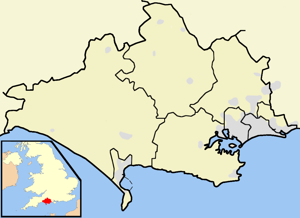
| Parish | Worth Matravers |
| District | Purbeck |
| Shire county | Dorset |
| Region | South West |
| Country | England |
| Sovereign state | United Kingdom |
| Police | Dorset |
| Fire | Dorset |
| Ambulance | South Western |
| EU Parliament | South West England |
| UK Parliament | South Dorset |
| List of places: UK • England • Dorset | |
Worth Matravers is a village and civil parish in the English county of Dorset. The village is situated on the cliffs west of Swanage. It comprises limestone cottages and farm houses and is built around a pond, which is a regular feature on postcards of the Isle of Purbeck.
The civil parish stretches from the coast northwards to, and just beyond, the A351 road from Corfe Castle to Swanage. The village of Worth Matravers is situated on side roads towards the south of the parish, which also includes the village of Harman's Cross on the main road to the north.[1]
Geography[]
To the south of Worth Matravers village are the limestone cliffs of the English Channel coast. These are situated on the South West Coast Path. The Jurassic Coast stretches over a distance of 153 kilometres (95 mi), from Orcombe Point near Exmouth, in the west, to Old Harry Rocks, in the east.[2] The coastal exposures along the coastline provide a continuous sequence of Triassic, Jurassic and Cretaceous rock formations spanning approximately 185 million years of the Earths history. The localities along the Jurassic Coast includes a large range of important fossil zones.
This coastline is popular with tourists in the Summer months, with the rocky beaches of Winspit, Seacombe and Chapman's Pool situated within walking distance of the village.
To the north of the village, but still within the parish, are the chalk Purbeck Hills. Many tourists pass through this area on the Swanage Railway, a steam locomotive operated heritage railway. Harman's Cross railway station on that railway is within the parish, but a significant distance from the village of Worth Matravers.
The parish has an area of 10.98 square kilometres. At the time of the 2001 census, the parish had a population of 644 living in 341 dwellings. The parish forms part of the Purbeck local government district. It is within the South Dorset constituency of the House of Commons and the South West England constituency of the European Parliament.[1][3][4]
Economy[]
Traditionally the village's economy was based on farming, quarrying and fishing. Today , two quarries - Swanworth and St. Aldhelm's - are still in operation, with Swanworth due to close within the next five years. Both arable and pasture farming are still central to the village's economy.
Places of interest[]
A monument on St Aldhelm's head, about a mile from the village, commemorates the development of radar by the Telecommunications Research Establishment at RAF Worth Matravers which was also one of the Chain Home radar stations during World War II, which proved decisive in the allied victory of that war. A Royal Observer Corps[1] monitoring post is situated in the lay-bye on the road to Worth Matravers.
On the bluff of the headland is a Norman Chapel dedicated to St Aldhelm, Bishop of Sherborne.
The village is also well known for its pub, the Square and Compass, which holds an annual week-long stone carving festival and accommodates a small museum exhibiting fossils and other local artefacts. The Square and Compass became a non smoking pub in early summer 2006. As of 2007, The Square and Compass was in the same family for 100 years.
Miscellaneous[]

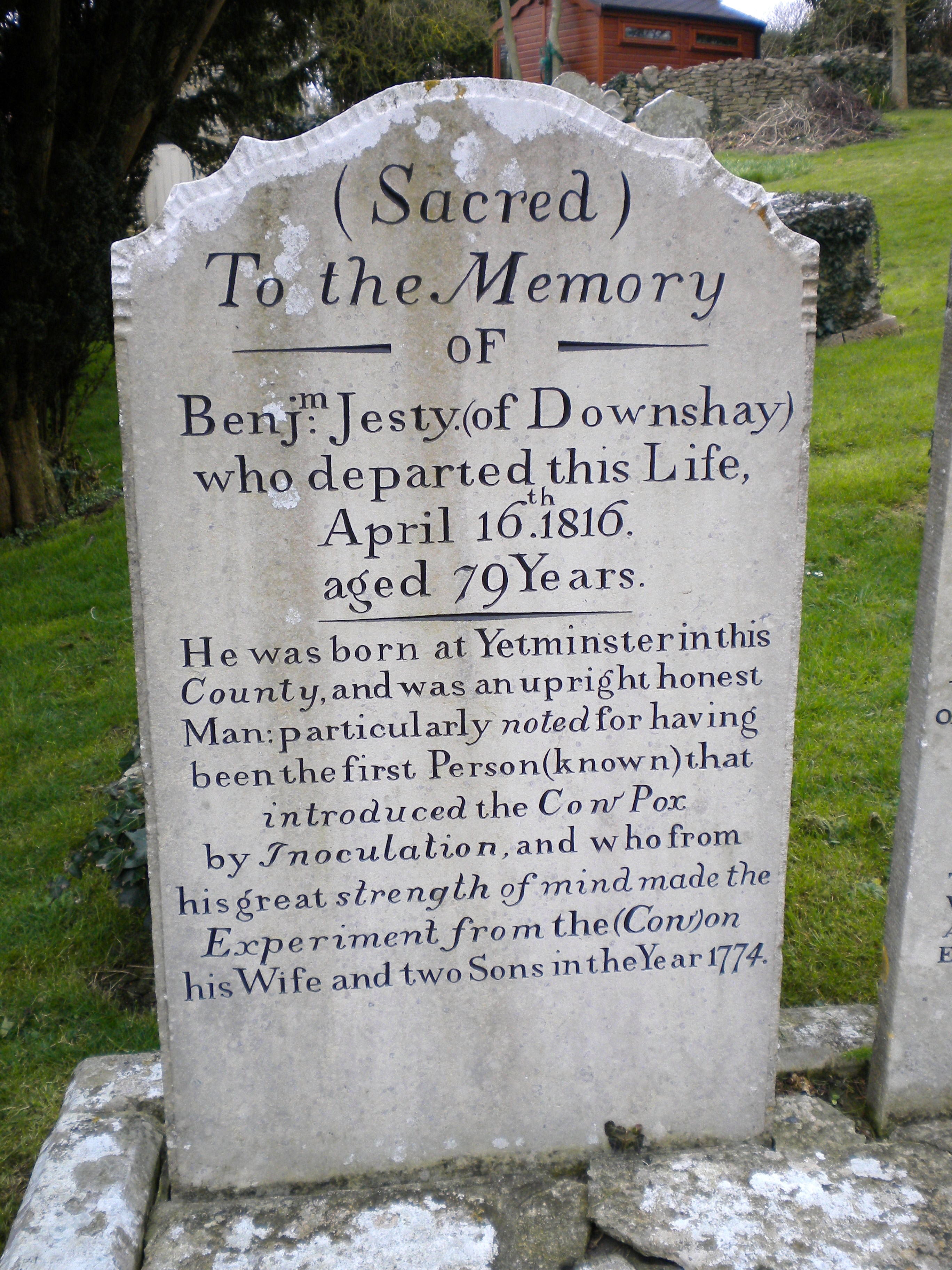
The tomb of Benjamin Jesty
- In 2004, local fishermen were targeted with a sabotage campaign by the so-called "Lobster Liberation Front", a fringe animal rights group operating in the area.
- The tombs of Benjamin Jesty, a farmer who is reported to have vaccinated his family against Smallpox having made the same observations as Edward Jenner and a while earlier, but kept quiet about it, and his wife are side by side in the churchyard. Jesty's family may be the first recorded deliberate attempt to induce immunity to Smallpox using Cowpox, or it may have been a more widespread activity prior to its systematisation.
- The current President of the Supreme Court of the United Kingdom Lord Phillips, took Worth Matravers as part of his title.
- The cliffs of Worth Matravers were the site of a Chain Home radar station during World War II, which was instrumental in the development of radar when a Telecommunications Research Establishment outstation was co-located with the radar station from 1940 to 1942.[5]
References[]
- ^ a b OS Explorer Map OL15 - Purbeck & South Dorset. Ordnance Survey. 2006. ISBN 978-0-319-23865-3.
- ^ "Dorset and East Devon Coast". UNESCO World Heritage Centre. 2001. http://whc.unesco.org/pg.cfm?cid=31&id_site=1029. Retrieved 2007-01-14.
- ^ "Worth Matravers - Dorset For You". Dorset For You Partnership. http://www.dorsetforyou.com/index.jsp?articleid=324171. Retrieved 2007-08-14.
- ^ "Parish Statistics". Purbeck District Council. 2007-01-11. Archived from the original on 2007-09-27. http://web.archive.org/web/20070927050126/http://www.purbeck.gov.uk/pdf/Parish+Statistics1.pdf. Retrieved 2007-08-12.
- ^ http://www.purbeckradar.org.uk/purbeck/index.htm
External links[]
- National Coastwatch Institution St Alban's Head Official Website
- Purbeck Radar Museum Trust website - Early radar development at Worth Matravers 1940-1942
- Worth Matravers Parish Council
- Worth Matravers area
- [2]
| This page uses content from the English language Wikipedia. The original content was at Worth Matravers. The list of authors can be seen in the page history. As with this Familypedia wiki, the content of Wikipedia is available under the Creative Commons License. |