- For other uses, see Yarmouth.
| Yarmouth | |
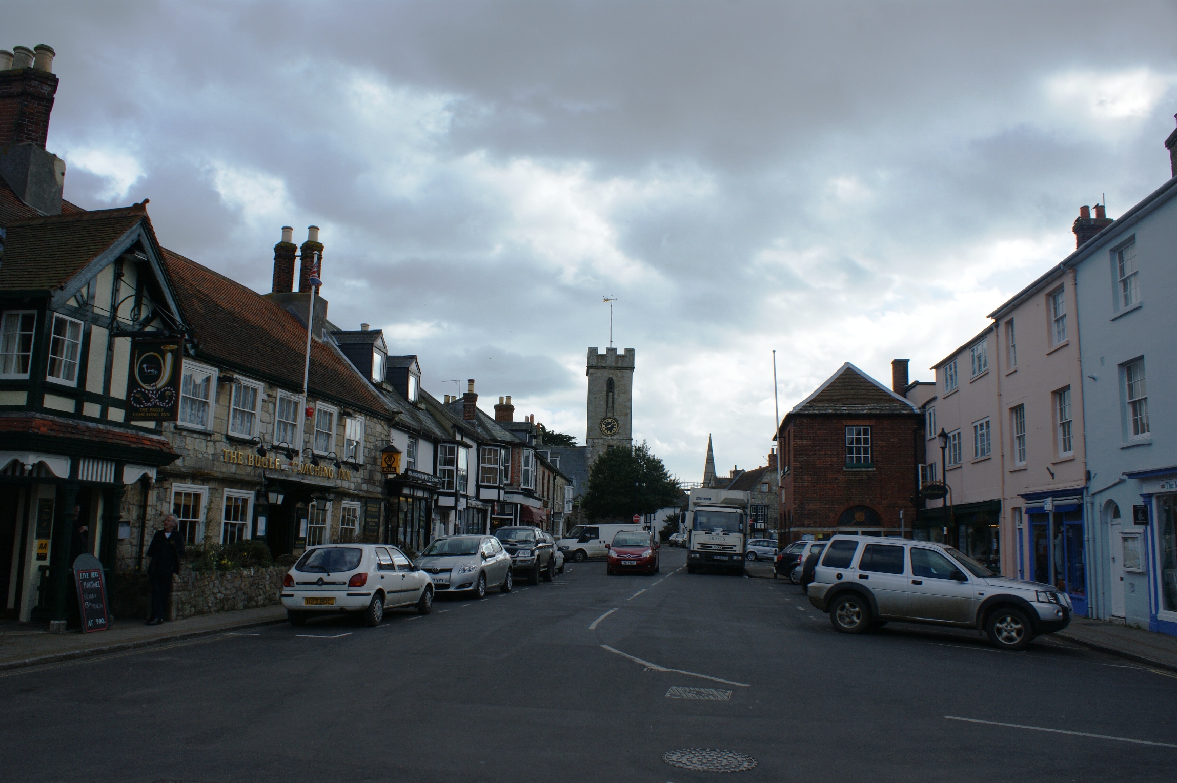 Yarmouth Town Centre. |
|

Yarmouth | |
| Population | 855 (1991 Census) |
|---|---|
| OS grid reference | |
| Unitary authority | Isle of Wight |
| Ceremonial county | Isle of Wight |
| Region | South East |
| Country | England |
| Sovereign state | United Kingdom |
| Post town | YARMOUTH |
| Postcode district | PO41 |
| Dialling code | 01983 |
| Police | Hampshire |
| Fire | Isle of Wight |
| Ambulance | Isle of Wight |
| EU Parliament | South East England |
| UK Parliament | Isle of Wight |
| List of places: UK • England • Isle of Wight | |
Yarmouth is a port and civil parish[1] in the western part of the Isle of Wight, off the southern coast of mainland England. The town is named for its location at the mouth of the small Western Yar river (there is also an Eastern Yar on the island). Yarmouth is a crossing point for the river, originally with a ferry, replaced with a road bridge in 1863.[2]
History[]
Yarmouth has been a settlement for over a thousand years, and is one of the very earliest on the Isle of Wight. The first record of a settlement here was in King Ethelred the Unready's record of the Danegeld tax of 991. It was originally called Eremue, meaning "muddy estuary". The Normans laid out the streets of Yarmouth on the grid system, a plan which can still be seen in the layout today. It grew rapidly, being given its first Charter as a town in 1135.[2] The town became a parliamentary borough in the Middle Ages, and the Yarmouth constituency was represented by two members of Parliament until 1832.[2]
Until the building of the castle, regular raids on the island by the French continued, and in 1544 the town of Yarmouth was reputed to have been burned down. Legend has it that the church bells were carried off to Cherbourg or Boulogne.[2]
Yarmouth Castle was built in 1547. It survives, and is now in the care of English Heritage.[3] It is effectively a gun platform built by Henry VIII to strengthen the Solent and protect the Isle of Wight, historically an important strategical foothold for any attempted invasion of England.
In St. James's Church there is a monument to the 17th-century admiral Sir Robert Holmes who based his operations at Yarmouth. He obtained it in a raid on a French ship, when he seized an unfinished statue of Louis XIV of France and forced the sculptor to finish it with his own head rather than the king's.[4]
Yarmouth Pier was built in 1876 and is the longest timber pier in England which is still open to the public.
Several Sites of Special Scientific Interest lie close to Yarmouth, including Yar Estuary SSSI & Bouldnor And Hamstead Cliffs SSSI.
Commerce[]

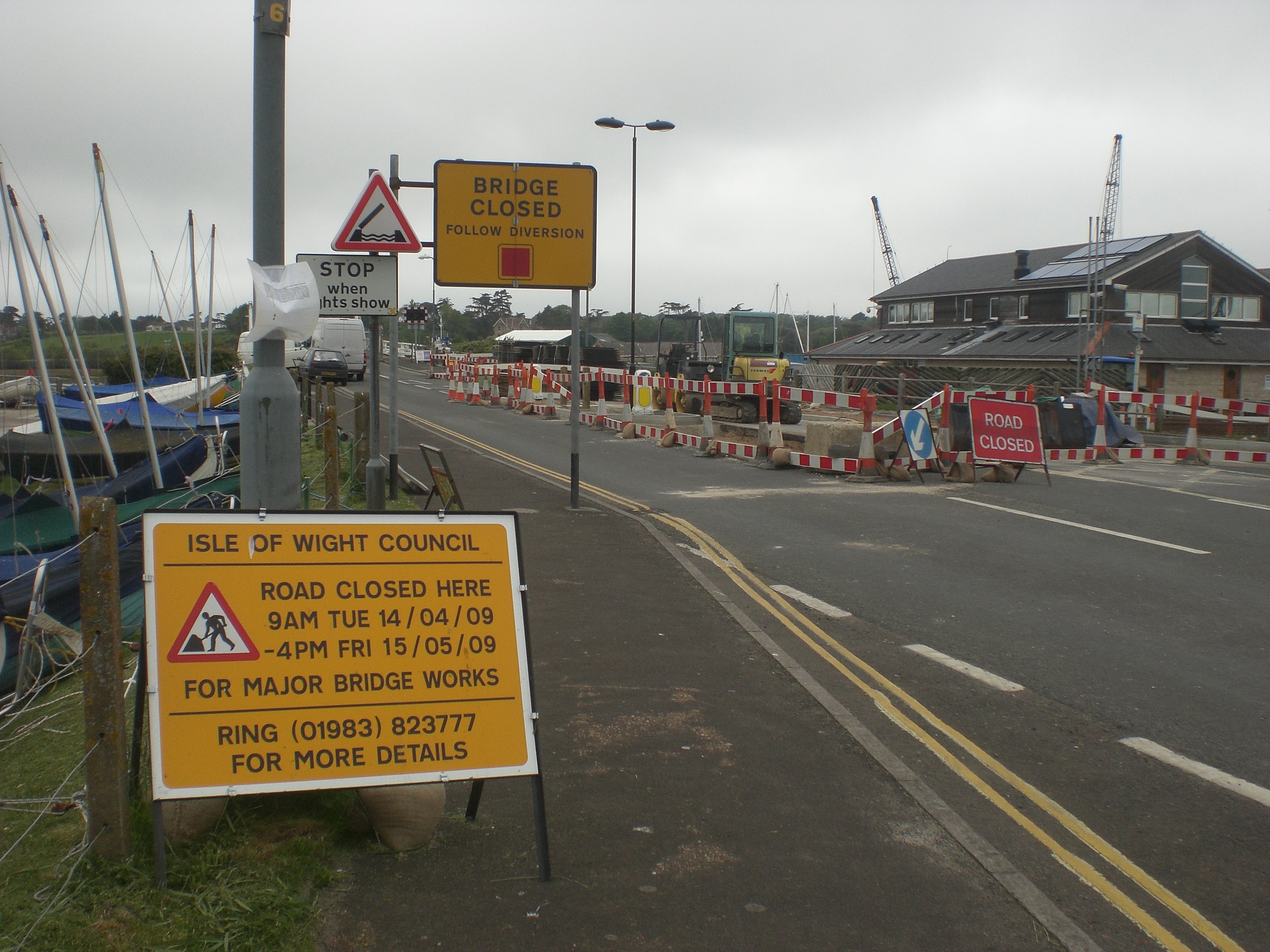
Ths closure of the Yar Bridge had a significant impact on trade.
As a port and market town Yarmouth has long had local commercial significance. It still has some boat yards and chandlery, and although relatively small in size it still supports a number of shops, hotels, pubs and restaurants, supported partly by passing trade from the ferry terminal and by visiting yacht-owners in the harbour.
In 2009 there were reports of the town suffering badly due to roadworks making access into the town near impossible. In addition to the Yar Bridge being closed for essential work repairs, other complicated diversions and trouble with Wightlink's Yarmouth to Lymington ferry service saw some businesses reporting a 30% drop in trade.[5] In an attempt to help the problem, the Isle of Wight Council announced plans to remove double yellow lines and increase the amount of free parking available in the town for the duration of the bridge closure.[6]
Transport[]


Yarmouth Bus Station & Ferry Terminal.
The Wightlink car ferry sails from Yarmouth to Lymington in Hampshire.
Southern Vectis operate bus services from Yarmouth bus station, the main one being circular route route 7 serving Totland, Alum Bay, Freshwater, Brighstone, Newport and either Shalfleet or Calbourne and back to Yarmouth. The route runs in both directions.[7] To reach Yarmouth, route 7 uses Pixley Hill, which has caused some controversy amongst local residents who do not believe the road is large enough to send buses down.[8] The controversy was initially started by former route 11 being extended to serve Yarmouth and using the lane in September 2008.[9]
In the spring and summer, Southern Vectis also operate an open top bus route called "The Needles Tour" which runs through Freshwater Bay to Alum Bay and onto The Needles Battery down a bus only road along the cliff edge; returning to Yarmouth via Totland and Colwell.[10] For the more athletic, Yarmouth is on the Isle of Wight Coastal Path.
The parish was once served by Yarmouth railway station, with services to Newport. Passenger services ended in 1953, and the track has long since been removed; the trackbed between Yarmouth and Freshwater has been converted into a bridleway.
Size and population[]
Yarmouth is the smallest town in the United Kingdom. It has a population of just 1,000 (compared with about 600 at the beginning of the 19th century).
Gallery[]
")
")
")
")
")
")
References[]
- ^ English Parishes & Welsh Communities N&C 2004
- ^ a b c d A Timeline History of Yarmouth compiled by Ian Dallison on behalf of The Yarmouth Society
- ^ English Heritage
- ^ BBC DNA page about Robert Holmes
- ^ "Trouble over bridged water in quiet town". Isle of Wight County Press. http://www.iwcp.co.uk/news/the-view-from-here/trouble-over-bridged-water-in-quiet-town-25979.aspx. Retrieved 2009-05-01.
- ^ "Free parking boost to Yarmouth trade". Isle of Wight County Press. http://www.iwcp.co.uk/news/news/free-parking-boost-to-yarmouth-trade-25990.aspx. Retrieved 2009-05-01.
- ^ "Southern Vectis route list". Southern Vectis. http://www.islandbuses.info/routelist.shtml. Retrieved 2009-12-22.
- ^ "Road row rumbles on". Isle of Wight County Press. http://www.iwcp.co.uk/news/news/road-row-rumbles-on-30176.aspx. Retrieved 2009-12-20.
- ^ "We could be in line for a wonderful hoo-ha". Isle of Wight County Press. 2009-01-23. http://www.iwcp.co.uk/news/we-could-be-in-line-for-a-wonderful-hooha-24267.aspx. Retrieved 2009-08-11.
- ^ "Southern Vectis Needles Tour". Southern Vectis. http://www.islandbuses.info/otneedles.shtml. Retrieved 2009-12-22.
External links[]
| |||||||||||||||||
| ||||||||||||||
| This page uses content from the English language Wikipedia. The original content was at Yarmouth, Isle of Wight. The list of authors can be seen in the page history. As with this Familypedia wiki, the content of Wikipedia is available under the Creative Commons License. |